


UPDATE: Bighorn Fire passes 7,000 acres, only 10% contained
The Bighorn Fire continued to grow Thursday, threatening approximately 850 homes around Oro Valley and the Catalina Foothills — a level of destruction that would constitute a major disaster, the federal government said.
The blaze, which has burned more than 4,700 acres, forced local authorities to issue mandatory evacuations for about 200 residences, sending Pima County Sheriff's deputies door to door in a Catalina Foothills neighborhood.
The Pima County Office of Emergency Management and the Pima County Sheriff's Department issued the evacuation order shortly after 10 a.m. Thursday for the northern-most homes in the area between Alvernon Way and First Avenue, north of Ina Road.
Deputy James Allerton, spokesman for the sheriff's office, said the people in that area are being told to leave immediately, as fire crews set back-burns to clear away vegetation between them and the advancing blaze.
Authorities also expanded the so-called "set" area, where residents are urged to voluntarily leave or be prepared to evacuate if conditions change. That area now extends north of Ina from First to Alvernon and north of the Skyline Road alignment from Alvernon east to Sabino Canyon Road.
Parts of Oro Valley, including all areas east of Oracle Road from north of Magee to Catalina State Park, were previously placed in the "set" stage.
FEMA has authorized federal funds to help the state battle the Bighorn Fire.
Arizona requested the federal assistance Thursday and received approval for a Fire Management Assistance Grant promptly.
The grant provides federal funding for up to 75% of eligible firefighting costs, including expenses for field camps, equipment use, materials, supplies and mobilization, and demobilization activities.
The Bighorn Fire was sparked by lightning on Friday, June 5. Since then, crews have managed to contain about 10% of the blaze, mostly along its southwestern flank, closest to the ignition point near Pusch Ridge, said Adam Jarrold, spokesman for the multi-agency team fighting the fire.
No structures had been lost as of noon Thursday, but the fire continued to burn out of control in Pima and Finger Rock Canyons and along the ridgeline above a growing swath of the Catalina Foothills.
Jarrold said the terrain is too steep to safely send in ground crews, so the fire was largely being attacked from above.
Large air tankers dumped bright red fire retardant on the ridges below Finger Rock as Jarrold and Allerton briefed reporters at the corner of Swan Road and Skyline Drive late Thursday morning.
The air attack includes at least five fixed-wing aircraft and seven helicopters of various sizes, Jarrold said.
With a forecasted high well above 100 degrees and low humidity, conditions are not expected to immediately improve.
"In this particular situation, weather and topography are not our friend," Jarrold said.
Evacuation zone
Allerton didn't know how many homes had been evacuated or when or whether more people might get the "go" order.
Evacuation Message https://t.co/RbUKgdQn61 pic.twitter.com/TGoqZAbHJ6
— Pima County Sheriff's Department (@PimaSheriff) June 11, 2020
A cooling shelter for evacuees was set up at Canyon del Oro High School, 25 W. Calle Concordia, in Oro Valley.
For anyone worried about leaving their property unattended, Allerton said, deputies would continue to patrol the evacuation zone.
"We will be maintaining a presence in the area as much as we can," he said.
Not everyone was heeding the evacuation order.
A man who refused to give his name said his home near Finger Rock Canyon is just inside the evacuation zone announced late Thursday morning, but he wasn't about to let the government tell him what to do.
The man said he thought fire crews missed a chance to keep the fire from spreading to the north side of the range.
"With the stuff they're doing now," he said, motioning to the air tankers circling overhead, "they could have stopped it four days ago."
For more information, residents can call 351-3473. Sign up for Pima County's emergency alerts here.

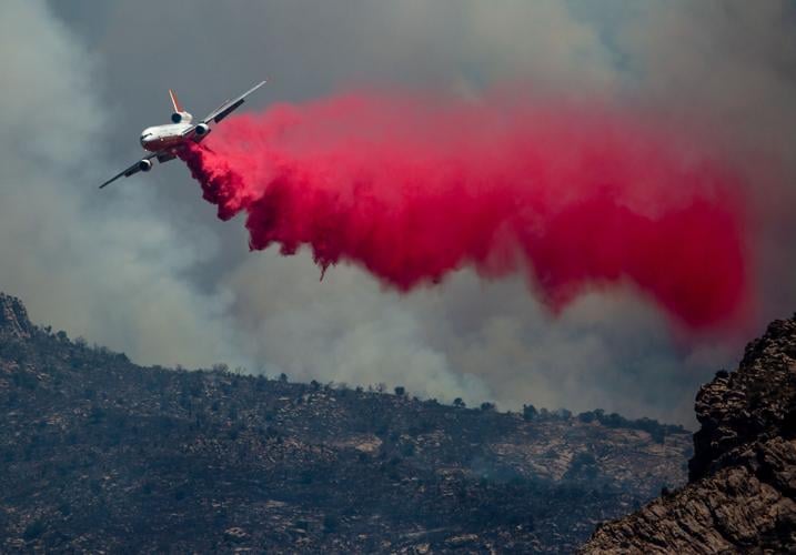
The Bighorn Fire breaks onto the southern slopes of the Santa Catalina Mountains and burns above a pair of homes in the foothills just west of the Finger Rock Trailhead, Tucson, Ariz., June 10, 2020.
Extra forces
More than 200 people were fighting the fire as of Thursday morning, and additional personnel were slated to arrive later in the day.
A Type 1 management team has assumed command of firefighting efforts. The team has more resources available to it and is typically assigned to complex firefighting situations, according to officials.
The extra forces are expected to include more elite Hotshot crews, fire engines and support workers, Jarrold said.
Fire crews from outside the Southwest may soon be arriving to help battle the fire.
On Thursday morning, Golder Ranch Fire said it was sending two trucks and eight wildland firefighters.
A Chinook helicopter drops water on a ridge above Pima Canyon in Coronado National Forest during the Bighorn Fire on June 10, 2020. Video by Rick Wiley / Arizona Daily Star
The federal wildfire control system has designated the Arizona-New Mexico area, including the Bighorn Fire, as one of the nation’s top two firefighting priorities and has issued a call for firefighters from other states to join the efforts.
“As of today, the Southwest is one of the nation’s top two priorities for allocating firefighting resources,” Cindy Wolfe, a spokeswoman for the Bighorn Fire, said Wednesday. The other high priority area is in Alaska, she said.
The Tucson area fire has been “competing for resources,” with more than a dozen other wildfires in Arizona and New Mexico, Wolfe said.

A letter writer deems the hotshot crews, firefighting units and pilots dropping water and retardant “heroic” for their work in trying to tame the Bighorn Fire in the Catalina Mountains.
Closed trails
Catalina State Park is closed and trails in the area can be closed without notice because of the fire activity, officials said.
The following trails are affected by the fire: Romero Canyon, Pusch Peak, Pima Canyon, Finger Rock, Pontatoc, Pontatoc Ridge and Linda Vista.
Meanwhile, Pima County Department of Environmental Quality officials issued an air pollution health watch after monitoring stations detected increased levels of ozone and particulates due to wildfire smoke.
Children, older people and those with heart or lung issues are urged to stay indoors if they smell smoke.
Meanwhile, the bighorn sheep for whom the fire is named seem to be taking it in stride so far, said Mark Hart, a spokesman for Arizona Game and Fish Department. The sheep were reintroduced by the department to the Pusch Ridge area several years ago.
Hart said the sheep are excellent climbers, well-equipped to escape quickly if threatened. No sheep deaths have been reported, he said.
Photos: The Bighorn Fire in Coronado National Forest near Tucson
Bighorn Fire
Updated
Smoke from the Bighorn Fire colors the skies over the eastern slopes of the Santa Catalina and Rincon mountains, Cascabel, Ariz., June 30, 2020.
Bighorn Fire
Updated
Smoke from the Bighorn Fire puffs above the cottonwood-willow forest running along the San Pedro River valley, Cascabel, Ariz., June 30, 2020.
Bighorn Fire
Updated
Smoke from the Bighorn fire blows Northeast over the Catalina mountains on June 30, 2020 in Tucson, Ariz. Photo taken from E. Speedway Blvd.
Bighorn Fire
Updated
Bighorn Fire burn area on Samaniego Ridge in the Santa Catalina Mountains looking west toward Biosphere II on June 27, 2020.
Bighorn Fire
Updated
Bulldozer clearing vegetation on the Northeast corner of the Bighorn Fire burning in and around the Santa Catalina Mountains on June 27, 2020.
Bighorn Fire
Updated
Crews working the Bighorn Fire near Summerhaven, Ariz., in the Santa Catalina Mountains on June 23, 2020.
Bighorn Fire
Updated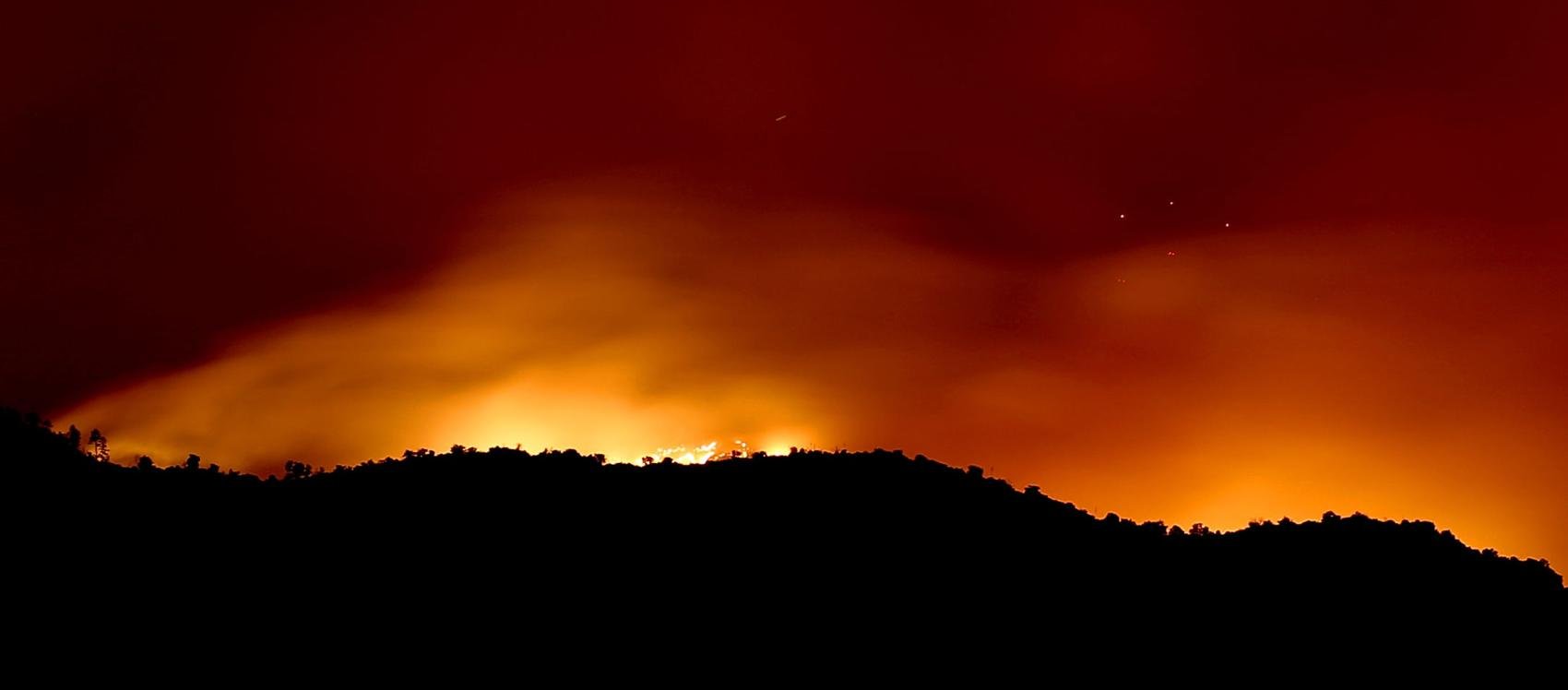
West winds push the smoke of the Bighorn Fire as it burns on the southeastern slopes of the Santa Catalina Mountains, Tucson, Ariz., June 26, 2020. The lights on the antennas of Mount Bigelow are just visible at right through the smoke.
Bighorn Fire
Updated
Flames from the Bighorn Fire climb over a ridge near Esperero Canyon lighting up a stand of saguaro as the blaze continues relentlessly to the east on the southern slopes of the Santa Catalina Mountains, Tucson, Ariz., June 23, 2020. Engine crews were monitoring the fire, which was largely beneficial and no threat to homes.
Bighorn Fire
Updated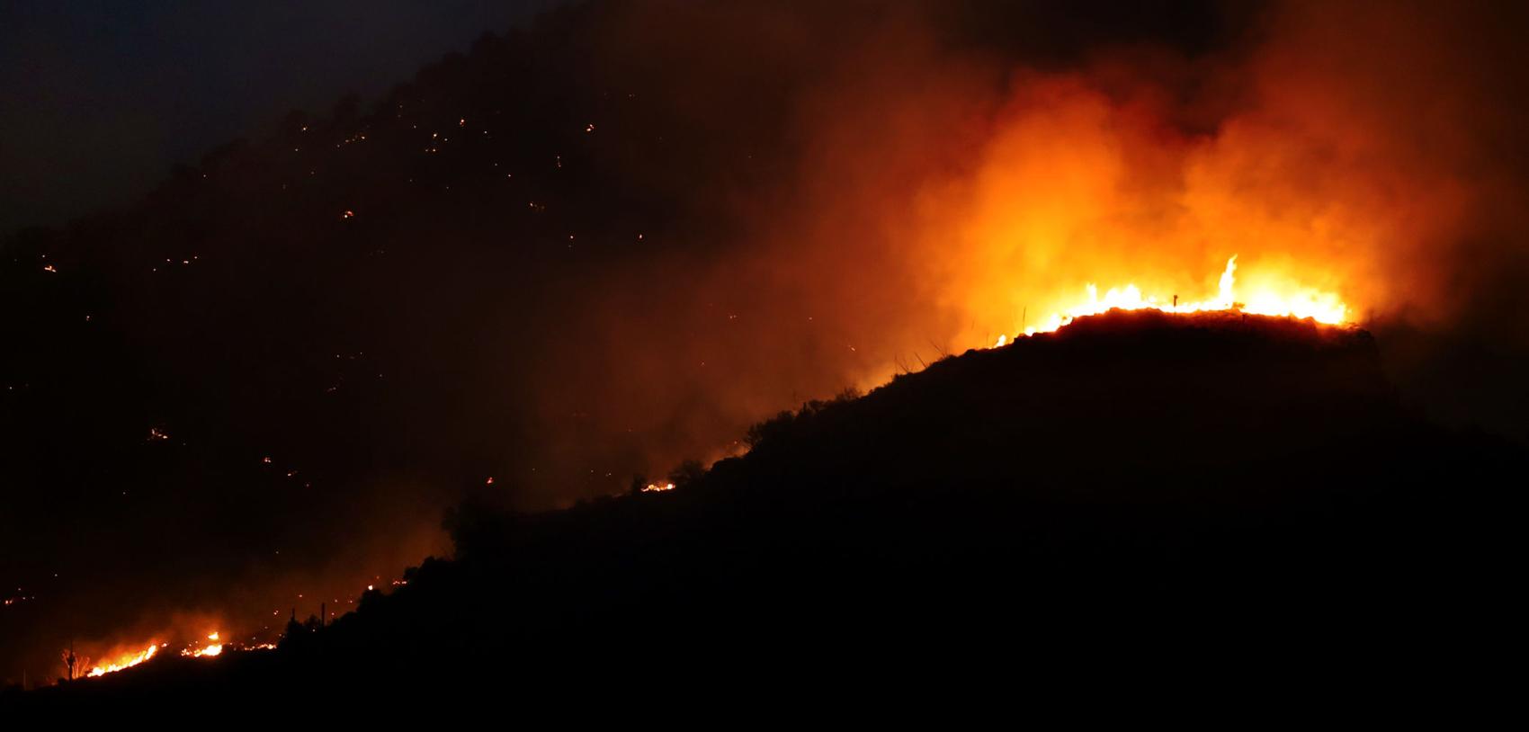
Flames from the Bighorn Fire rise over a ridge near Esperero Canyon as the blaze moves east on the southern slopes of the Santa Catalina Mountains, Tucson, Ariz., June 23, 2020.
Bighorn Fire
Updated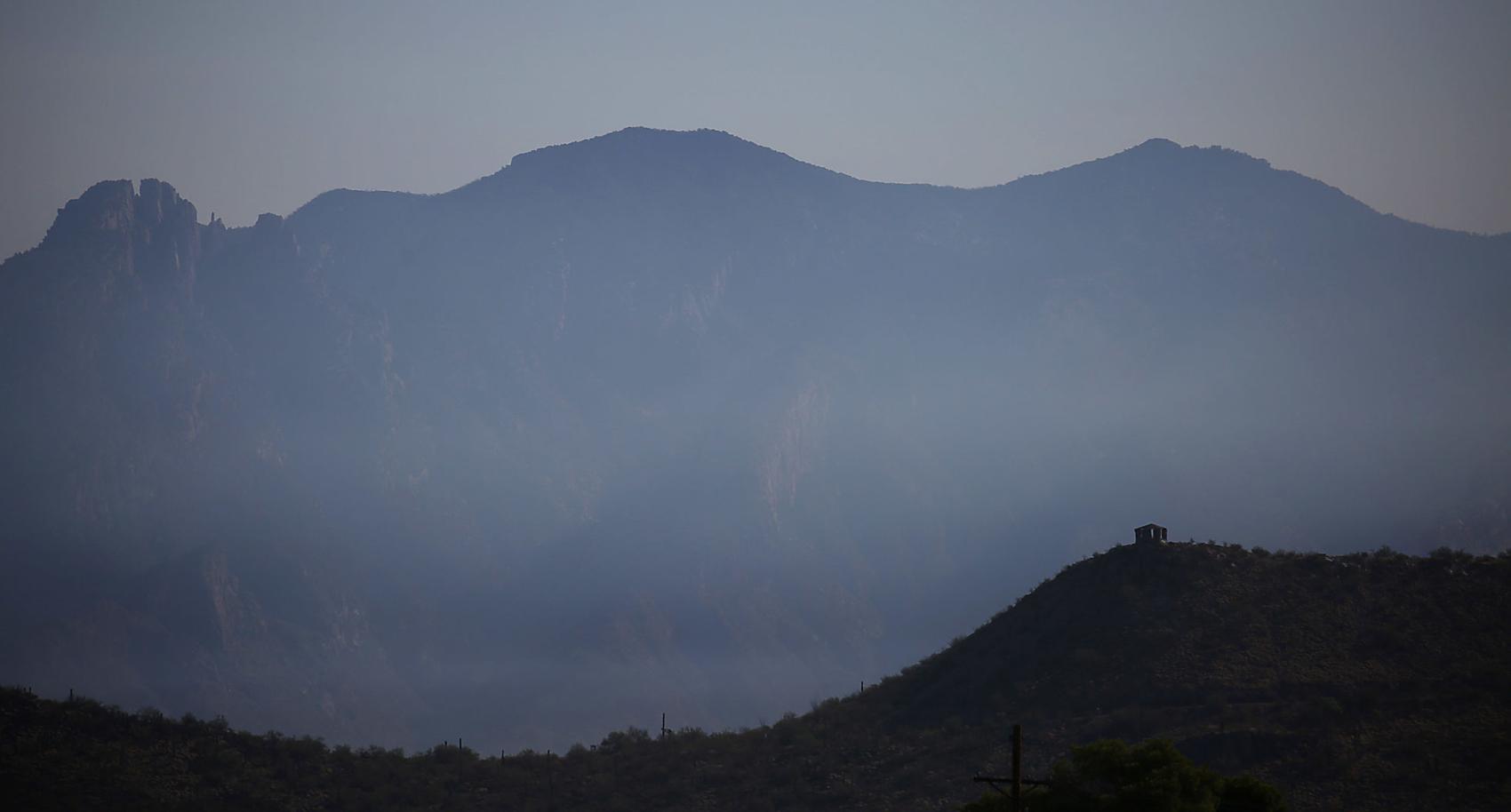
Smoke from the Bighorn Fire covers the Santa Catalina Mountains with Sentinel Peak seen in the foreground Tuesday morning on June 23, 2020.
Bighorn Fire
Updated
From Ventana Canyon, at left, to just north of the end of Houghton Road, the Bighorn Fire stretches along the southern slopes of the Santa Catalina Mountains, Tucson, Ariz., June 20, 2020.
Bighorn Fire
Updated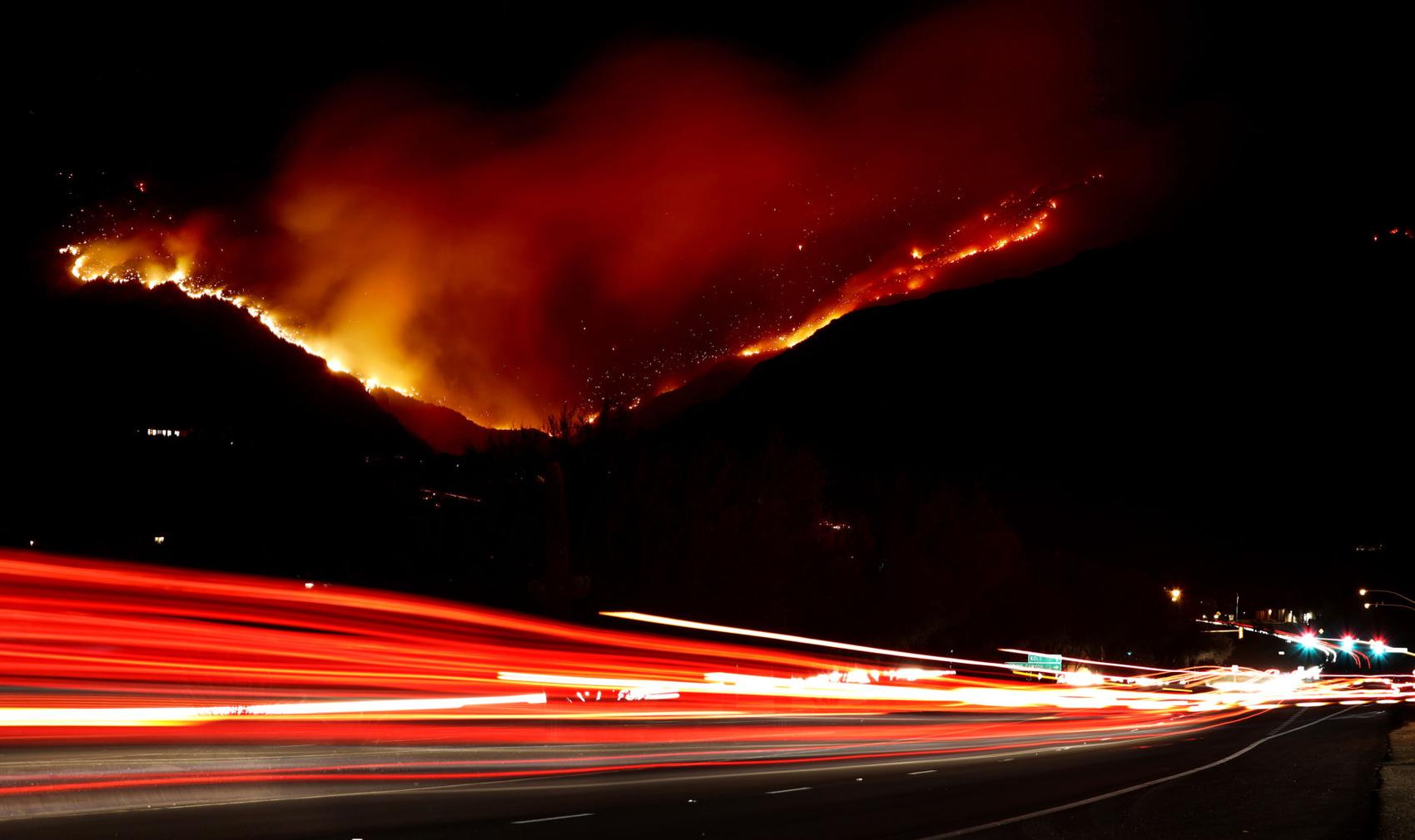
Traffic on Sabino Canyon Road drives under the glow of he Bighorn Fire as it claims Ventana Canyon on the south slopes of the Santa Catalina Mountains, Tucson, Ariz., June 19, 2020.
Bighorn Fire
Updated
The Bighorn Fire burning in Ventana Canyon in the Santa Catalina Mountains behind downtown Tucson on June 18, 2020.
Bighorn Fire
Updated
Flames return to the southern slopes as the Bighorn Fire continues to burn through the heart of the Santa Catalina Mountains, Tucson, Ariz., June 18, 2020.
Bighorn Fire
Updated
Radio Ridge, near the top of the Santa Catalinas, is silhouetted by flames from the Bighorn Fire on the southern seen from near, Oracle, Ariz., June 18, 2020.
Bighorn Fire
Updated
Passersby use a wildlife exit along Oracle Road to get an elevated view the smoke billowing out of the northwestern portion of the Bighorn Fire, Oro Valley, Ariz., June 17, 2020.
Bighorn Fire
Updated
The Bighorn Fire lights up the ridge overlooking Saddlebrooke in the northwestern foothills of the Santa Catalina Mountains, Tucson, Ariz., June 17, 2020.
Bighorn Fire
Updated
Smoke billows from the Santa Catalinas as the Bighorn Fire continues to burn as seen from Honey Bee Canyon Park in Oro Valley, on June 17, 2020.
Bighorn Fire
Updated
The same wind whipping the flags outside the Fairfield Inns & Suites on Oracle Road is whipping up the flames and smoke of the Bighorn Fire, Oro Valley, Ariz., June 17, 2020.
Bighorn Fire
Updated
Flames break through the smoke as a finger of the Bighorn Fire scorches its way through a canyon on the west side of the Santa Catalina Mountains, Tucson, Ariz., June 17, 2020.
Bighorn Fire
Updated
A stand of pines go up in flames as the Bighorn Fire pushes its way down a slope on the northern side of the Santa Catalina Mountains, Tucson, Ariz., June 16, 2020.
Bighorn Fire
Updated
A DC-10 VLAT makes a slurry drop near the observatory site and along the burnout of the 17 year-old Aspen Fire as crew fight to keep the Bighorn Fire being advancing on Mount Lemmon, Tucson, Ariz., June 16, 2020.
Bighorn Fire
Updated
The Bighorn Fire crest a ridge on the north side of the Santa Catalina Mountains as the day's steady winds push the flames closer to Mount Lemmon, Tucson, Ariz., June 16, 2020.
Bighorn Fire
Updated
A Sikorsky firefighting helicopter drops water along a ridge top as the flames from the Bighorn Fire work their way onto the northern slopes of the Santa Catalina Mountains, Tucson, Ariz., June 16, 2020.
Bighorn Fire- Arizona
Updated
A DC-10 VLAT climbs out of the range after making a slurry drop between The Bighorn Fire and Mount Lemmon, Tucson, Ariz., June 16, 2020.
Bighorn Fire
Updated
A fire engine from Three Points Fire District west of Tucson passes a Pima County Sheriff Auxiliary Volunteer on its way up the Catalina Highway to Mount Lemmon on June 15, 2020. Several local fire districts supply equipment and firefighters to fight the Bighorn Fire.
Bighorn Fire- Arizona
Updated
Sierra National Forest hotshot crew members talk about wind patterns while preparing for a possible change in direction from the Bighorn Fire on Mount Lemmon in the Santa Catalina Mountains in Ariz. on June 14, 2020.
Bighorn Fire- Arizona
Updated
A Sierra National Forest hotshot crew member measures the wind while preparing for a possible change in direction from the Bighorn Fire on Mount Lemmon in the Santa Catalina Mountains in Ariz. on June 14, 2020.
Bighorn Fire- Arizona
Updated
Smoke flows out of canyons in the Santa Catalina Mountains from the Bighorn Fire north of Tucson, Ariz. on June 14, 2020, as seen from Mount Lemmon Trail #5.
Bighorn Fire- Arizona
Updated
Smoke from the Bighorn Fire burning in canyons in the Santa Catalina Mountains to the west, looms over homes in Summerhaven, Ariz. on June 14, 2020.
Bighorn Fire
Updated
A family of four horned owls perch on a utility pole near Tanque Verde and Houghton with the glow from the Bighorn Fire burning in the Santa Catalina Mountains behind them to north, Tucson, Ariz., June 14, 2020.
Bighorn Fire
Updated
The Bighorn Fire's northwestern front looms over homes as it burns into the central Santa Catalina Mountains, Oro Valley, Ariz., June 13, 2020.
Bighorn Fire
Updated
A stiff wind out of the southwest pushes the Bighorn Fire into the central Santa Catalina Mountains and toward homes, Oro Valley, Ariz., June 13, 2020.
Bighorn Fire
Updated
A Chinook helicopter carrying a water bucket flies north along the Pusch Ridge Wilderness as the Bighorn Fire pushes north-northeast into Romero Canyon east of Catalina State Park in Santa Catalina Mountains on Saturday, June 13, 2020.
Bighorn Fire - Arizona
Updated
A air tanker flies above the the Bighorn Fire as smoke billows up near the mouth of Romero Canyon, on June 13, 2020.
Bighorn Fire
Updated
A DC-10 VLAT drops below the ridge line in his path to make a slurry drop as the battle moves to the northwest and crews work to keep the Bighorn Fire from spreading through Catalina State Park, Oro Valley, Ariz., June 11, 2020.
Bighorn Fire
Updated
Two firefighting helicopters maneuver around one another while recharging at a dip site as the battle moves to the north to keep the Bighorn Fire from spreading, Oro Valley, Ariz., June 11, 2020.
Bighorn Fire
Updated
An aerial tanker banks out of a smoky gully after making a slurry drop as the battle moves to the northwestern reaches of the Santa Catalina Mountains, Oro Valley, Ariz., June 11, 2020.
Bighorn Fire
Updated
A Chinook helicopter drops water on the line of flames advancing through grasslands at the northwestern foot of the Santa Catalinas as crews work to keep the Bighorn Fire from spreading through Catalina State Park, Oro Valley, Ariz., June 11, 2020.
Bighorn Fire
Updated
A firefighting Sikorsky helicopter calls it a night and flies for base as sun sets on the the battle to keep the Bighorn Fire from spreading, Oro Valley, Ariz., June 11, 2020.
Bighorn Fire
Updated
A McDonnell Douglas MD-80 firefighting air tanker emerges from heavy smoke from the Bighorn Fire burning near Catalina State Park in Oro Valley on June 12, 2020.
Bighorn Fire
Updated
People stand along Oracle Road just north of the entrance to Catalina State Park as the Bighorn Fire continues to burn in the Pusch Ridge Wilderness near the park, on June 12, 2020.
Bighorn Fire
Updated
People stand along Oracle Road just north of the entrance to Catalina State Park as the Bighorn Fire continues to burn at the base of Pusch Ridge near the park, on June 12, 2020.
Bighorn Fire
Updated
A Chinook helicopter drops water on the Bighorn Fire burning in Pusch Ridge, on June 12, 2020.
Bighorn Fire
Updated
A line of fire retardant draped along the Santa Catalina Mountains from Sunrise Drive above Cimarron Foothills Estates neighborhood as the Bighorn Fire burns for its seventh day in the western Santa Catalina mountain range, on June 12, 2020.
Bighorn Fire
Updated
A Chinook helicopter dumps water on the Bighorn Fire in the front range of the Santa Catalina Mountains in between granite faces already painted with pink fire retardant on Thursday, June 11, 2020.
Bighorn Fire
Updated
People stand along Oracle Road just north of the entrance to Catalina State Park as the Bighorn Fire continues to burn in the Pusch Ridge near the park, on June 12, 2020.
Bighorn Fire
Updated
People watch from Oracle Road just north of the entrance to Catalina State Park as Chinook helicopters drop water on the Bighorn Fire burning for its seventh day in Pusch Ridge very close to Catalina State Park on June 12, 2020.
Bighorn Fire
Updated
The Bighorn Fire inches over a ridge above several homes north of Coronado Drive west of Swan as night falls on the neighborhoods under evacuation and prepare to leave warnings in the Santa Catalina Mountain foothills, Tucson, Ariz., June 11, 2020.
Bighorn Fire
Updated
A DC-10 VLAT makes a last drop in the dying light over the homes in the area between Swan and Alvernon during the daylong struggle to keep the Bighorn Fire out of the neighborhoods of the Santa Catalina Mountain foothills, Tucson, Ariz., June 11, 2020.
Bighorn Fire
Updated
A Sikorsky firefighting helicopter heads back to the dip tank, overflying several homes under a smoking ridge in the upper reaches of the Santa Catalina foothills as crews fight to keep the Bighorn Fire out of several neighborhoods, Tucson, Ariz., June 11, 2020.
Bighorn Fire
Updated
A tanker skims over a ridge while dropping slurry just west of Craycroft during the struggle to keep the Bighorn Fire out of the neighborhoods of the Santa Catalina Mountain foothills, Tucson, Ariz., June 11, 2020.
Bighorn Fire - Arizona
Updated
Residents in the Catalina Foothills neighborhood north of Tucson watch an air tanker drop fire retardant on the Bighorn Fire near Finger Rock Canyon the Santa Catalina Mountains on June 11, 2020. Photo by Rebecca Sasnett / Arizona Daily Star
Bighorn Fire - Arizona
Updated
A hot shot fire crew fighting the Bighorn Fire hikes on ridge near Finger Rock Canyon in the foothills of the Santa Catalina Mountains north of Tucson, Ariz. on June 11, 2020. Photo by Rebecca Sasnett / Arizona Daily Star
Bighorn Fire - Arizona
Updated
Pink fire retardant settles over a ridge near Finger Rock Canyon in the Santa Catalina Mountains north of Tucson, Ariz. on June 11, 2020.
Bighorn Fire
Updated
A helicopter dumps water along an area to combat the Bighorn Fire in the Santa Catalina Mountains on June 11, 2020.
Bighorn Fire
Updated
Qin Chen talks with Tom Lemmons, of the Pima County Sheriff's Office Auxiliary, about "Go" orders given to evacuate her home in the Cobblestone Estates neighborhood due to the Bighorn Fire in the Santa Catalina Mountains on June 11, 2020. Lemmons asked residents if they planned to evacuate or stay in their home.
Bighorn Fire
Updated
Keith Lencke of the Blue Ridge Hotshots watches the air attack on the Bighorn Fire in the Cobblestone Estates neighborhood near the Santa Catalina Mountains on June 11, 2020.
Bighorn Fire
Updated
People watch the Bighorn Fire from La Encantada at Campbell and Skyline on June 11, 2020.
Bighorn Fire - Arizona
Updated
A UH-60 firefighting helicopter picks up a bucket of water at Immaculate Heart High School as another helicopter drops water on the Bighorn Fire burning in Pima Canyon in the Santa Catalina Mountains north of Tucson on June 11, 2020.
Bighorn Fire - Arizona
Updated
A Chinook helicopter refills with water at Imaculate Heart High School near Magee and Oracle while fighting the Bighorn Fire burning in Pima Canyon in the Santa Catalina Mountains north of Tucson on June 11, 2020.
Bighorn Fire
Updated
A jet tanker drops retardant as it flies through Pontatoc Canyon as wildfire crews continue to fight the Bighorn Fire which has spread along the western side of the Santa Catalinas, on June 11, 2020.
Bighorn Fire
Updated
An air tanker drops fire retardant as wildfire crews continue to fight the Bighorn Fire which has spread along the western side of the Santa Catalinas, on June 11, 2020.
Bighorn Fire
Updated
A helicopter carries water over an area of the Bighorn Fire in the Santa Catalina Mountains in the Coronado National Forest north of Tucson on June 10, 2020. The fire has now burned 3,277 acres since it started on Friday, June 5, from a lightning strike in the Pusch Ridge area of the Catalina Mountains.
Bighorn Fire
Updated
From alongside Campbell Avenue, a couple gets photos of the Bighorn Fire breaking onto the southern slopes of the Santa Catalina Mountains, Tucson, Ariz., June 10, 2020.
Bighorn Fire
Updated
In the last of the day's light a helicopter makes a last minute water drop on a line of flames from the Bighorn Fire moving down the southern slopes of the Santa Catalina Mountains, Tucson, Ariz., June 10, 2020.
Bighorn Fire
Updated
The Bighorn Fire breaks onto the southern slopes of the Santa Catalina Mountains and burns above a pair of homes in the foothills just west of the Finger Rock Trailhead, Tucson, Ariz., June 10, 2020.
Bighorn Fire - Arizona
Updated
A chinook helicopter drops a load of water on the Bighorn Fire as is moves into the top of Finger Rock Canyon and up Mount Kimball, on June 10, 2020.
Bighorn Fire - Arizona
Updated
A Smokey Bear Hotshot walks along Finger Rock Canyon trail as smoke billows from the Bighorn Fire further up the canyon, on June 10, 2020.
Bighorn Fire - Arizona
Updated
Adam Hutton with the Smokey Bear Hotshots of Ruidoso, New Mexico tosses away brush being cut near the mouth of Finger Rock Canyon as a precaution against the growing Bighorn Fire being fought in the Santa Catalina Mountain Range, on June 10, 2020.
Bighorn Fire - Arizona
Updated
Hotshots with Smokey Bear and Blue Ridge talk near the Finger Rock Canyon trailhead as smoke billows from the Bighorn Fire billows in the distance, on June 10, 2020.
Bighorn Fire - Arizona
Updated
Crew members with the Smokey Bear Hotshots from Ruidoso, New Mexico cut line near the mouth of Finger Rock Canyon as a precaution against the growing Bighorn Fire being fought in the Santa Catalina Mountain Range, on June 10, 2020.
Bighorn Fire - Arizona
Updated
A driver heads south on Campbell Ave. as smoke billows from the Bighorn Fire in the Santa Catalina Mountains in the Coronado National Forest north of Tucson on June 10, 2020.
Bighorn Fire - Arizona
Updated
The Bighorn Fire burning in Pima Canyon and Finger Rock Canyon in the Santa Catalina Mountains, Coronado National Forest north of Tucson, Ariz., June 10, 2020.
Bighorn Fire - Arizona
Updated
Heavy fuels burning above Finger Rock Canyon produce think black smoke during the Bighorn Fire within the Santa Catalina Mountains in Coronado National Forest north of Tucson on June 10, 2020.
Bighorn Fire - Arizona
Updated
Tinder-dry vegetation bursts into flames above during the Bighorn Fire burning above Finger Rock Canyon within the Santa Catalina Mountains in Coronado National Forest north of Tucson on June 10, 2020.
Bighorn Fire - Arizona
Updated
The hazy remnants of the Bighorn Fire hang low in Pima Canyon within the Santa Catalina Mountains in Coronado National Forest north of Tucson on the morning of June 10, 2020.
Bighorn Fire - Arizona
Updated
The Bighorn Fire burns on the East side of beloved hiking area Pima Canyon within the Santa Catalina Mountains in Coronado National Forest north of Tucson, late on June 9, 2020. The lightning-caused fire increased slightly, to 2,556 acres, but is still but still only 10% contained.
Bighorn fire
Updated
A helicopter flies along the Catalinas on its way to Rose Canyon Lake while fighting the Bighorn fire in Pima Canyon, on June 9, 2020.
Bighorn Fire - Arizona
Updated
Dark smoke from heavy fuels in the upper elevations of Pima Canyon obscure the rising sun during the Bighorn Fire in the Santa Catalina Mountains in Coronado National Forest north of Tucson on June 9, 2020.
Bighorn Fire
Updated
The Bighorn Fire glows as it burns into Pima Canyon in the western reaches of the Santa Catalina Mountains above Tucson, Ariz., just after sunset June 8, 2020. During its third day, the lightning sparked wildfire chewed a wind driven path east and higher into the range.
Bighorn Fire - Arizona
Updated
A helicopter drops a bucket of water on the Bighorn Fire burning into Pima Canyon inside the Coronado National Forest north of Tucson, Ariz. on June 8, 2020. The lighting-caused Bighorn Fire, as of Monday June 8, has spread to over 2,300 acres and is 10% contained, according to Oro Valley Police department via Twitter.
Bighorn Fire - Arizona
Updated
A long nighttime exposure of fire burning in Pusch Ridge accentuates the flames of the Bighorn Fire burning in the Santa Catalina Mountains in Coronado National Forest north of Tucson on June 7, 2020.
Bighorn Fire - Arizona
Updated
A Chinook heavy-lift helicopter with water bucket trailing behind speeds back to the dip tank during the Bighorn Fire burning along Pusch Ridge of the Santa Catalina Mountains in Coronado National Forest north of Tucson on June 7, 2020.
Bighorn Fire - Arizona
Updated
Smoke envelops a granite spire during the Bighorn Fire burning along Pusch Ridge of the Santa Catalina Mountains in Coronado National Forest north of Tucson on June 7, 2020.
Bighorn Fire - Arizona
Updated
A large air tanker drops fire retardant on the top of Pusch Ridge during the Bighorn Fire burning in the Santa Catalina Mountains in Coronado National Forest north of Tucson on June 7, 2020.
Bighorn Fire - Arizona
Updated
At the Bighorn Fire burning along Pusch Ridge of the Santa Catalina Mountains in Coronado National Forest north of Tucson on June 7, 2020. Photo by Rick Wiley / Arizona Daily Star
Bighorn Fire - Arizona
Updated
People watch the aerial ballet of helicopters and air tankers on the Bighorn Fire from the safety of Oro Valley Marketplace on June 7, 2020. The Bighorn Fire is burning along Pusch Ridge of the Santa Catalina Mountains in Coronado National Forest north of Tucson on June 7, 2020. Photo by Rick Wiley / Arizona Daily Star
Bighorn Fire - Arizona
Updated
A Chinook heavy-lift helicopter trailing a water bucket flies past canyons choked with smoke during the Bighorn Fire burning along Pusch Ridge of the Santa Catalina Mountains in Coronado National Forest north of Tucson on June 7, 2020. Photo by Rick Wiley / Arizona Daily Star
Bighorn Fire - Arizona
Updated
A heavy-lift Chinook helicopter takes off from the Bighorn Fire heli-base on Oracle Road during the Bighorn Fire burning along Pusch Ridge of the Santa Catalina Mountains in Coronado National Forest north of Tucson on June 7, 2020. Photo by Rick Wiley / Arizona Daily Star
Bighorn Fire - Arizona
Updated
An air tanker drops retardant the Bighorn Fire burning along Pusch Ridge of the Santa Catalina Mountains in Coronado National Forest north of Tucson on June 7, 2020. Photo by Rick Wiley / Arizona Daily Star
Bighorn Fire - Arizona
Updated
A lead plane, lower left, guides a large air tanker during a retardant drop at the Bighorn Fire burning along Pusch Ridge of the Santa Catalina Mountains in Coronado National Forest north of Tucson on June 7, 2020. Photo by Rick Wiley / Arizona Daily Star
Bighorn Fire
Updated
A huge DC-10 VLAT (Very Large Air Tanker) pulls up after dropping a load of fire retardant in a neighborhood just south of Catalina State Park during the Bighorn Fire burning along Pusch Ridge in Coronado National Forest north of Tucson on June 6, 2020.
Bighorn Fire
Updated
Smoke from the Bighorn Fire shrouds granite formations of Pusch Ridge in Coronado National Forest north of Tucson on June 6, 2020.
Bighorn Fire
Updated
A heavy-lift helicopter drops water on the line of the Bighorn Fire burning along Pusch Ridge in Coronado National Forest north of Tucson on June 6, 2020.
Bighorn Fire
Updated
A Sikorsky heavy-lift helicopter finishes a drop at dusk on the Bighorn Fire burning along Pusch Ridge in Coronado National Forest north of Tucson on June 6, 2020.
Bighorn Fire
Updated
The Huey helicopter passes along a ridge on the Bighorn Fire burning along Pusch Ridge in Coronado National Forest north of Tucson on June 6, 2020.
Bighorn Fire
Updated
Flames fanned by canyon winds emerge from the smoke during the Bighorn Fire burning along Pusch Ridge in Coronado National Forest north of Tucson on June 6, 2020.
Bighorn Fire
Updated
Smoke shrouds granite formations the Bighorn Fire burning along Pusch Ridge in Coronado National Forest north of Tucson on June 6, 2020.
Bighorn Fire
Updated
The Bighorn Fire burning about La Reserve along Pusch Ridge in Coronado National Forest north of Tucson on June 6, 2020.
Bighorn Fire
Updated
A DC-10 Very Large Air Tanker drops on the Bighorn Fire burning along Pusch Ridge in Coronado National Forest north of Tucson on June 6, 2020.
Bighorn Fire
Updated
A heavy lift helicopter passes through the Bighorn Fire burning along Pusch Ridge in Coronado National Forest north of Tucson on June 6, 2020.
Bighorn Fire
Updated
A DC-10 Very Large Air Tanker drops thousands of gallons of retardant at the base of the Bighorn Fire burning above La Reseve along Pusch Ridge in Coronado National Forest north of Tucson on June 6, 2020.
Bighorn Fire
Updated
The Bighorn Fire burning along Pusch Ridge in Coronado National Forest north of Tucson on June 6, 2020.
Bighorn Fire
Updated
An air tanker drops fire retardant to create a fire line behind homes (bottom center) in Or Valley during the Bighorn Fire burning along Pusch Ridge in Coronado National Forest north of Tucson on June 6, 2020.
Bighorn Fire
Updated
Helicopters drop water on the Bighorn Fire burning along Pusch Ridge in Coronado National Forest north of Tucson on June 6, 2020.
Bighorn Fire
Updated
Helicopters drop water on the Bighorn Fire burning along Pusch Ridge in Coronado National Forest north of Tucson on June 6, 2020.
Bighorn Fire
Updated
Helicopters drop water on the Bighorn Fire burning along Pusch Ridge in Coronado National Forest north of Tucson on June 6, 2020.
Bighorn Fire
Updated
The Bighorn Fire burning along Pusch Ridge in Coronado National Forest north of Tucson on June 6, 2020.
Bighorn Fire near Oro Valley
Updated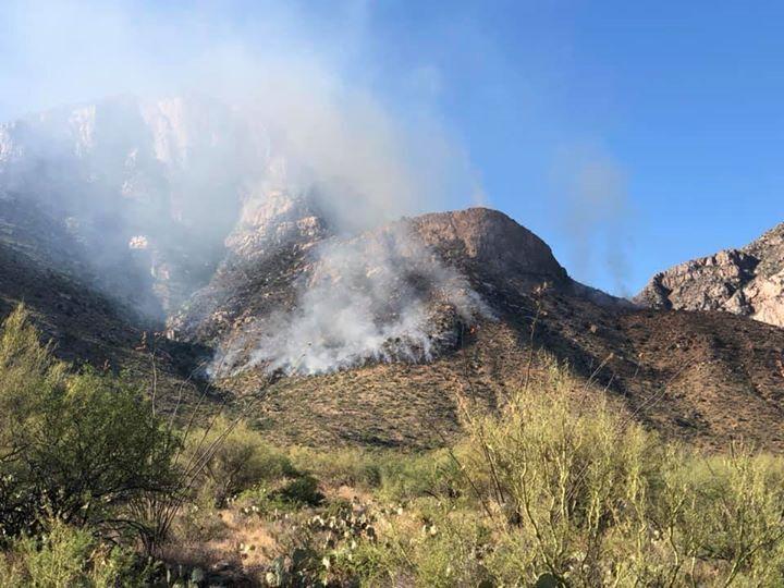
A fire is burning in the Pusch Ridge area east of Oro Valley on Saturday. The fire was started by lightning for storms that moved through Friday night. Ground crews and helicopters are fighting the blaze, which is not spreading rapidly.