

Photos: Las Cienegas National Conservation Area
Water brings the Las Cienegas National Conservation Area south of Tucson to life.

Joe Cicero looks over some of the insects attracted to a blue-light sheet trap under a nearly full moon in the Las Cienegas National Conservation Area.
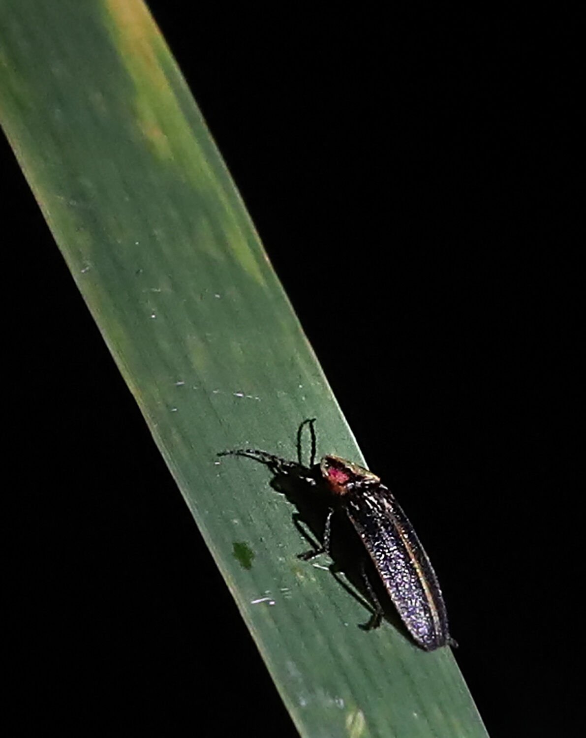
A male firefly rests on a reed leaf, one of a colony in the Las Cienegas National Conservation Area.

Trees shade the still water of Cienega Creek at Las Cienegas National Conservation Area on June 12, 2019.

A Pronghorn Antelope grazes near the old Empire Ranch headquarters outside Sonoita, Ariz. The Bureau of Land Management now oversees Las Cienegas National Conservation Area where the ranch is located. When the ranch was first established in the 1870s, it took a whole day to ride by horseback from the ranch headquarters to Tucson.

Several Pronghorn Antelope graze near the old Empire Ranch headquarters outside Sonoita, Ariz. The Bureau of Land Management now oversees Las Cienegas National Conservation Area where the ranch is located. When the ranch was first established in the 1870s, it took a whole day to ride by horseback from the ranch headquarters to Tucson.

Damage from the Sawmill Fire in the riparian area near Empire Ranch in the Las Cienegas National Conservation Area on May 2, 2017, north of Sonoita, Ariz. The majority of mature foliage, including cottonwoods, but further evaluation is needed to determine the trees' fate.

Mike Trubman, with the Black Mesa Interagency Hotshot Crew, radioes his fellow firefighters as he conducts mop-op work along Cienega Creek in the Las Cienegas National Conservation Area about three miles northeast of Empire Ranch while the Sawmill Fire burns on April 27, 2017 in Southeastern Arizona between Green Valley and J-6.

Locals watch from Las Cienegas Conservation Area as the the Sawmill fire spreads east approaching AZ State Rd 83, 8 miles north of Sonoita, Ariz. on April 24, 2017.

Fire damage to the Empire Ranch riparian area within the Las Cienegas Conservation Area north of Sonoita, Ariz. on May 2, 2017.

Bob Kerry submitted this photo of a storm over the Santa Rita Mountains taken from Las Cienegas National Conservation Area.

A recently stabilized and resurfaced road winds through Las Cienegas National Conservation Area southeast of Tucson, with the first 3 miles paved and the remaining 8 miles getting a fresh gravel grade to eliminate the washboard effect.

Ash trees bask in the sunlight near the headwaters of Cienega Creek, southeast of Empire Ranch in the Las Cienegas National Conservation Area.

A group of Gila top minnows swim in the Bureau of Land Management's Cieneguita Wetland east of Empire Ranch near Cienega Creek in the Las Cienegas National Conservation Area.

Light seeps across the vegetation, including duckweed seen here, in the Empire Gulch near Empire Ranch in the Las Cienegas National Conservation Area.

Pretty for an invasive species - a patch of vinca flowers in the Empire Gulch near Empire Ranch in the Las Cienegas National Conservation Area.

Vegetation surrounding the headwaters of Cienega Creek, southeast of Empire Ranch in the Las Cienegas National Conservation Area.

Biologist Dennis Caldwell uses a tree branch to measure the depth of the headwaters of Cienega Creek, southeast of Empire Ranch in the Las Cienegas National Conservation Area.

One of the pools comprising the Bureau of Land Management's Cieneguita Wetland east of Empire Ranch near Cienega Creek in the Las Cienegas National Conservation Area.

Biologist Dennis Caldwell walks through a nearly-dry cattle tank near the Bureau of Land Management's Cieneguita Wetland east of Empire Ranch near Cienega Creek in the Las Cienegas National Conservation Area.

The headwaters of Cienega Creek, southeast of Empire Ranch in the Las Cienegas National Conservation Area.

A view of vegetation along Cienega Creek east of Empire Ranch about 10 miles north of Sonoita, Ariz. in the Las Cienegas National Conservation Area.

A view looking up at the canopy of cottonwood trees in Empire Gulch near Empire Ranch in the Las Cienegas National Conservation Area.

Underneath the canopy of cottonwood trees, biologist Dennis Caldwell talks about the water aquifer that feeds the Empire Gulch near Empire Ranch in the Las Cienegas National Conservation Area.

Biologist Dennis Caldwell uses a tree branch to measure the depth of the headwaters of Cienega Creek, southeast of Empire Ranch in the Las Cienegas National Conservation Area.

Biologist Dennis Caldwell pulls at the root of a giant rush plant in the Bureau of Land Management's Cieneguita Wetland east of Empire Ranch near Cienega Creek in the Las Cienegas National Conservation Area.

A vermillion flycatcher adds some color to a mesquite tree near Empire Ranch about 10 miles north of Sonoita, Ariz. in the Las Cienegas National Conservation Area.

Biologist Dennis Caldwell uses a tree branch to measure the depth of the headwaters of Cienega Creek, southeast of Empire Ranch in the Las Cienegas National Conservation Area.

Biologist Dennis Caldwell uses a pair of binoculars to spot leopard frogs in the Empire Gulch near Empire Ranch in the Las Cienegas National Conservation Area.
Most Popular

The 32nd Dillinger Days took over Hotel Congress with antique autos, tours, exhibits, lectures and the reenactments of the 1934 fire and the a…

The Wildcats and Sun Devils tangle in a back-and-forth, down-to-the-wire battle in Arizona's 89-82 win, Jan. 14, 2026, in Tucson.

More than 7,000 cases, some 86,000 boxes of Girl Scout cookies, were distributed at the GSSOAZ Cookie Drop, January 16, 2026, to 67 troops in …
Thursday's news: What you missed while you were at work.

Our weekly round-up of letters published in the Arizona Daily Star.

Get a quick digest of today's top local news stories from Arizona Daily Star.

The Wildcats fell behind by three in the first quarter, a deficit they couldn't ever erase in 58-53 loss to the Knights, January 10, 2026, Tuc…

The Wildcats had to play catch-up for much of the night, couldn't quite close the deal late in losing to the Jayhawks 80-69 in the Big 12, Jan…

Don't miss Wednesday's most popular stories from Arizona Daily Star.

Former DEA agent Joseph Bongiovanni, 61, was convicted on Oct. 10, 2024, on seven of 11 charges in his retrial, making him the first DEA agent…