


Avid hikers — seeking to get in top shape for challenging treks — experiment with all manner of training techniques.
We tread the treadmill, run the roads, pedal the bike, paddle laps in the pool — and ultimately arrive at this ought-to-be obvious nugget of wisdom: The best way to get in overall shape for hiking is, yep, hiking.
Trekking a challenging trail, after all, exposes us to rugged terrain, steep grades, changing weather, the weight of a backpack, bugs and perhaps the occasional snake — elements you won’t learn to deal with on an air-conditioned treadmill jog.
Happily for Tucson-area hikers, our home turf is surrounded by terrific training terrain that can get us in shape for trekking challenges near and far.
From steep trails in canyons of the Catalina Mountains to summits in the nearby Rincon and Santa Rita ranges, you’ll find good conditioning hikes for any season — with splendid scenery along the way.
Today, we’ll describe three trails in the Catalinas that can provide a wondrous workout in a matter of hours — because many of us don’t have all day for training sessions.
Two of the trails are at altitudes well above the desert — because, as you might have noticed, it’s the hot time of year. One of the trails is not well above the desert, but many experienced hikers use it for training in the summer by starting by 5 a.m. and being finished before the searing heat sets in.
We’ll also include brief descriptions of two great training trails in nearby ranges — but those hikes will take up most of a day.
Lace ‘em up. Let’s go.
BUG SPRING TRAIL
You’ve got options when it comes to a training hike on the Bug Spring Trail.
The 4.6-mile route connects two trailheads along the Catalina Highway — a lower one between mile markers 7 and 8 and an upper one between markers 11 and 12.
An out-and-back trek from the lower trailhead totals 9.2 miles and entails about 1,300 feet of elevation gain — passing over a high point of well over 6,000 feet along the way. Scenery includes grassy, high-desert landscapes in the lower reaches and juniper-and-pine woodlands in the upper elevations.
If you have limited time and still want to get in some solid trail training, consider this option: Begin from the upper trailhead and do one, two or more “laps” up and down the first impressively steep stretch of trail.
The trail segment — which climbs less than a mile to a high ridge where the trail begins its descent toward the lower trailhead — favors a straight-up approach with a minimal number of switchbacks. Zip up it. Descend. Repeat. Your legs and lungs will know you’re getting a good workout.
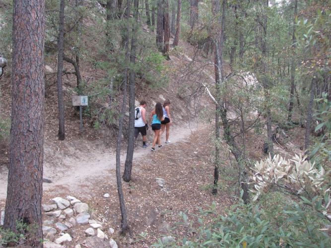
ASPEN DRAW TRAIL
This route is only about two miles long, but it climbs slopes at altitudes between 8,000 and 9,000 feet — making it an excellent place to prepare for high-altitude hikes elsewhere.
It provides a good up-and-back training trek with options for adding mileage.
Some of us have hiked the trail up and down twice in succession to build fitness. Other possibilities include linking with the similarly named Aspen Trail near the top of the route and following that trail for a mile or more before reversing your course.
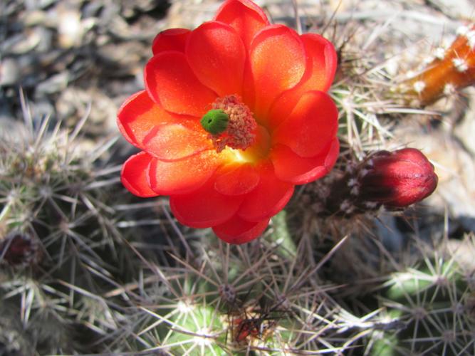
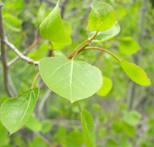
An added benefit: The Aspen Draw Trail ascends through beautiful woodlands of pine, fir and aspen with ferns, wildflowers and mushrooms flanking the path in the late spring and summer.
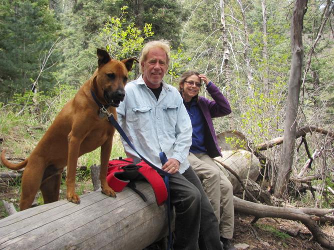
“It was a good workout going up there,” said Tucson musician John Coinman as he and his wife, Jo Andersen, descended the trail with their dog named Bill Brown. “We’re not used to the (altitude). We’re used to desert hiking.”
Said Andersen: “It’s a great trail. Beautiful.”
To reach the trail, take Tanque Verde Road to the Catalina Highway and follow the highway past Milepost 24 to a turnoff for Mount Lemmon Ski Valley. Continue to Ski Valley and park. Then walk about 20 yards down the south side of the highway from the ski area parking lot and watch for a trail leading downhill. Follow it for 0.2 of a mile down the side of the hill and across a small watercourse to the signed start of the Aspen Draw Trail.
BLACKETT’S RIDGE TRAIL
One of the best trails for a quick, steep, fitness-building hike in the Tucson area is Blackett’s Ridge in Sabino Canyon northeast of the city.
It has one daunting — but manageable — challenge at this time of year: It’s in the desert, which gets hot, very hot, in June and beyond.
The key, say hikers who love Blackett’s, is to start very early in the morning so as to finish the hike before the day begins to heat up.
A round-trip trek up and down the trail totals only 6.2 miles, but that “up” part involves nearly 1,700 vertical feet of steep climbing.
After a fairly flat and easygoing start, the trail turns into what a casual walker might call “the little hike from hell.”
The terrain is rocky and rugged, and a series of steep switchbacks midway up the route will hammer home the point that you’re getting a full-on cardio workout if you move at a brisk pace.
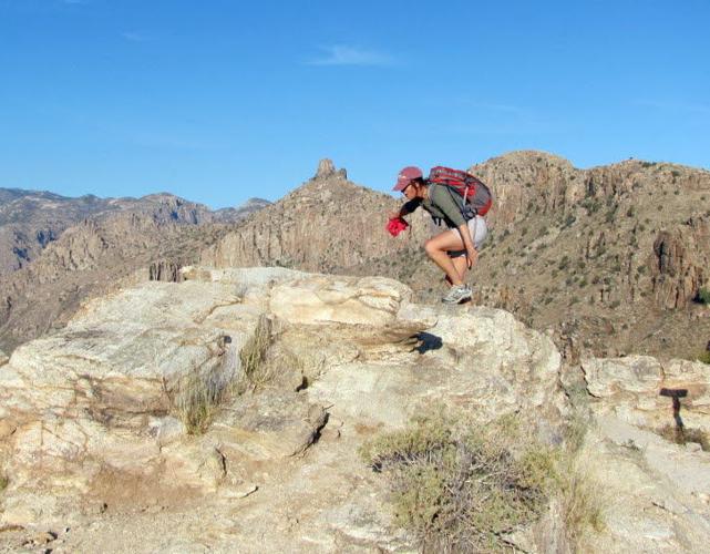
Robin Sims, an extremely fit hiker, was still able to exclaim, “Beautiful country!” after ascending the switchbacks.
This is a route on which it’s critically important to carry plenty of water, wear sunscreen and a hat, and be prepared to turn around immediately if the heat becomes a problem.
To reach the trail, take Sabino Canyon Road north to the canyon visitor center and parking lot at 5700 N. Sabino Canyon Road. You’ll pay a $5-per-vehicle fee at the canyon.
Start at the east end of the parking lot and follow a broad, flat path 0.4 of a mile to a road. Turn right on the road and follow it 0.4 of a mile, across a bridge, to the signed start of the Phoneline Trail. Hike 0.6 of a mile on the Phoneline Trail to a junction with the Blackett’s Ridge Trail. From there, it’s 1.7 miles to trail’s end at the top of the ridge. The one-way hike totals 3.1 miles.
CHALLENGING SUMMITS
Trails to the summits of higher mountains in ranges around Tucson have helped many hikers get in top trekking shape. Some of the trails involve a lengthy drive to the trailhead and sustained uphill hiking — so plan on spending an entire day.
Two of the most challenging summit treks:
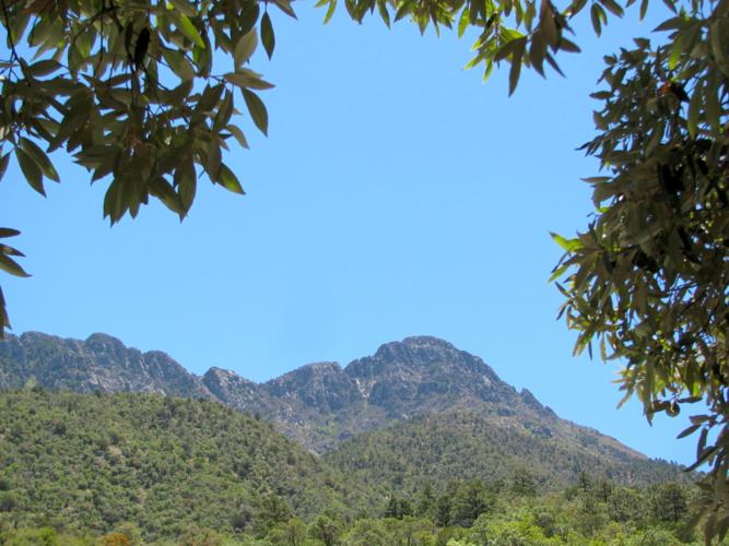
- Mount Wrightson in the Santa Rita Mountains south of Tucson. The 10.8-mile round-trip hike involves more than 4,000 feet of elevation gain on the way to the 9,453-foot summit of Wrightson.
- Rincon Peak in the Rincon Mountains east of Tucson. Hikers ascend more than 4,000 vertical feet on the 16-mile round-trip trek to the 8,482-foot summit.

