


Popular Sabino Canyon northeast of Tucson typically has three types of weather in June: hot, very hot and let’s-not-even-talk-about-it hot.
This could be an ideal time, then, to skip out on the swelter and instead visit Upper Sabino Canyon — a cool, fir-forested, lesser-known hikers’ haven perched a vertical mile above its alter ego in the desert below.
Upper Sabino lies at an elevation of about 8,000 feet in the Catalina Mountains between the village of Summerhaven and Mount Lemmon Ski Valley.
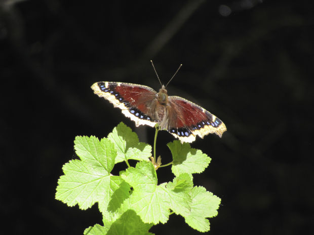
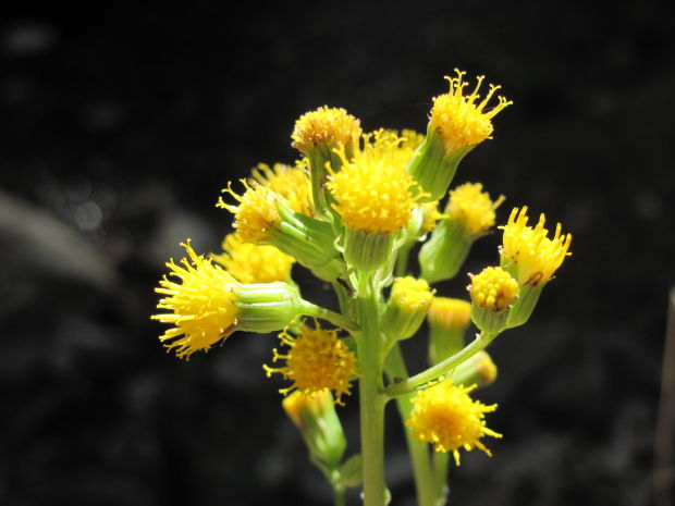
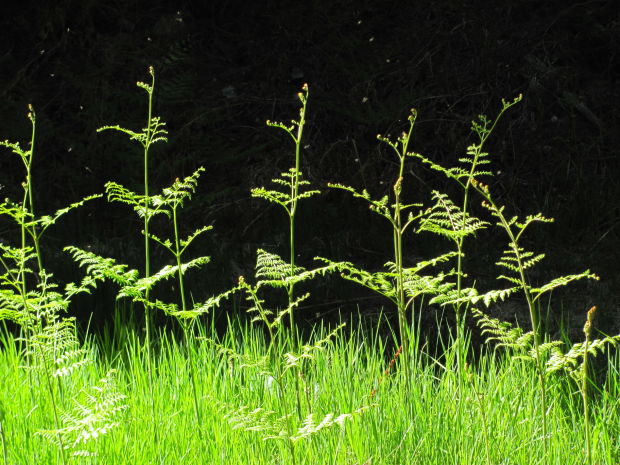
It boasts bountiful wildflowers, green fields of ferns, a trickling stream and wildlife ranging from black bears to birds and butterflies.
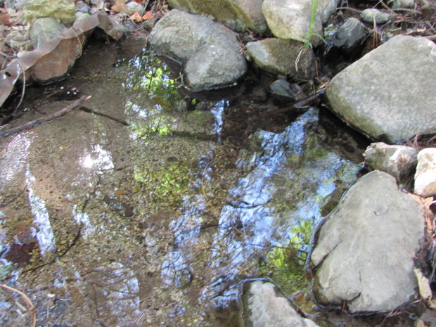
“It’s so pretty up there right now,” said Michael Stanley, whose work as manager of the Mount Lemmon Water District takes him frequently into Upper Sabino Canyon. Spring water from the canyon is collected in large tanks there and provides water for Summerhaven and fighting fires in the Catalinas.
“We try to keep a little water flowing in the creek in the canyon” with releases from one of the tanks, Stanley said. “That little bit of flow really helps with the aesthetics of the area and shows the health of the watershed.”
RAMBLING THE CANYON
Upper Sabino can be reached easily from either of two starting points — one on Turkey Run Road in Summerhaven and the other at Ski Valley. See the “Get to the trailheads” section for directions.
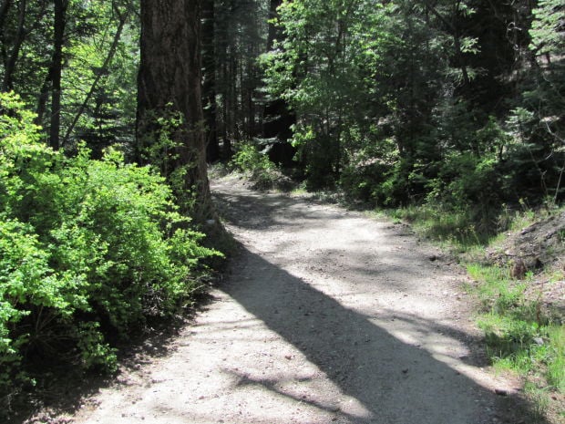
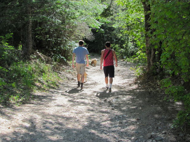
A walk in the canyon isn’t an endurance challenge. The terrain is mostly gentle, and the route follows an old road bed that’s closed to private vehicles.
You’ll cover a mile or so of hiking if you walk up and down the canyon. But the stream, forest glades surrounded by towering firs, and groves of spring-green maple trees invite little side trips along the way.
Many visitors depart the old road bed near the midpoint of the canyon and follow a trail that roughly parallels the road. This trail lies at the foot of some of the canyon’s springs, making it a good place to see yellow columbines and other colorful summer wildflowers.
Those in search of a more challenging trek can pick up the Aspen Draw Trail at the upper end of the canyon near Ski Valley. The somewhat steep 1.7-mile trail winds through groves of aspen trees toward a high point near the top of the main Ski Valley lift.
SIGHTS ALONG THE WAY
Hikers in the canyon will see a few signs of civilization, including some large tanks used to store water collected from the springs.
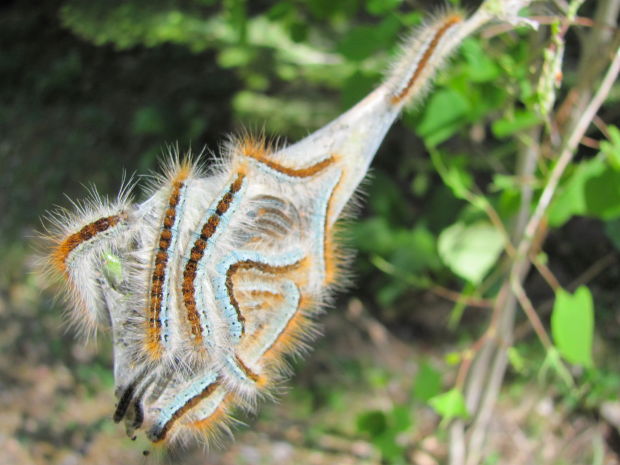
But much of the scenery is of the natural variety — birds, squirrels, perhaps a deer, caterpillars emerging from cocoons on tree branches, and beautiful butterflies.
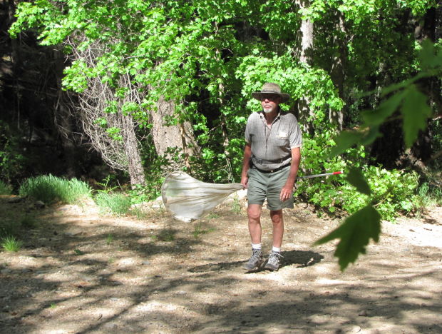
Hiker Doug Mullins, carrying a large butterfly net on a recent visit to the canyon, said he sometimes collects butterflies and keeps them alive for breeding.
“I’m looking for black checkerspot and thicket hairstreak butterflies,” Mullins said. “We’ll see what I find.”
GET TO THE TRAILHEADS
Take Tanque Verde Road to the Catalina Highway and follow the highway past Milepost 24.
To start at the lower end of the canyon, drive into Summerhaven and turn right on Turkey Run Road. The turnoff is near the Mount Lemmon Community Center. Follow the road until you reach a closed gate. Park there and walk up the road into the canyon.
To begin at the upper end, take the turnoff for Mount Lemmon Ski Valley instead of driving into Summerhaven. Park in the Ski Valley lot, walk about 20 yards down the south side of the road from the lot and watch for a trail leading downhill. Follow it for 0.2 of a mile down the side of the hill and across a small watercourse to the canyon.

