

Soaring behind Tucson to the north is the crest of the Santa Catalina Mountains — a rugged set of stair steps climbing northeast from Pusch Peak to Mount Lemmon.
A trail system follows or contours that crest from the top of Pima Canyon all the way to Summerhaven and Mount Lemmon. Segments have different names — Pima Canyon, Finger Rock, Ventana, Cathedral Rock, Mount Lemmon — but some hikers call it “the crest trail.”
This backcountry trail system within Pusch Ridge wilderness is the steepest, roughest, most remote and least-visited part of the Catalinas. It’s also hardest to fix up and maintain.
Forest Service staff often mention the challenges of trail work on the crest. It’s more than 5 miles one way up any of the canyon trails (Pima, Finger Rock, Ventana, Esperero, Romero) to the crest. There’s no water to support a trail crew (the closest seasonal water is Pima Spring and sometimes pools in Pima Canyon).
So how bad are the trails? In early May, a reconnaissance trip across the Catalinas yielded a pleasant surprise.
Trails were passable all the way to West Fork Sabino Creek where a northeast route joined the well-marked and cleared Arizona Trail. The hike out — on a trail initially proposed for abandonment — was also reasonable.
Experienced backpackers attracted by the Catalina skyline will find both solitude and improved trails for their trek. But wait until fall after a good monsoon or spring after a good snowpack when temperatures cool and pools return to Pima and West Fork Sabino creeks and drainages in Wilderness of Rocks. A summer trek would be unsafe with the heat and lack of water.
Here’s the report.

Good trail work was found on upper Pima Canyon Trail.
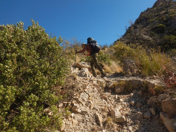
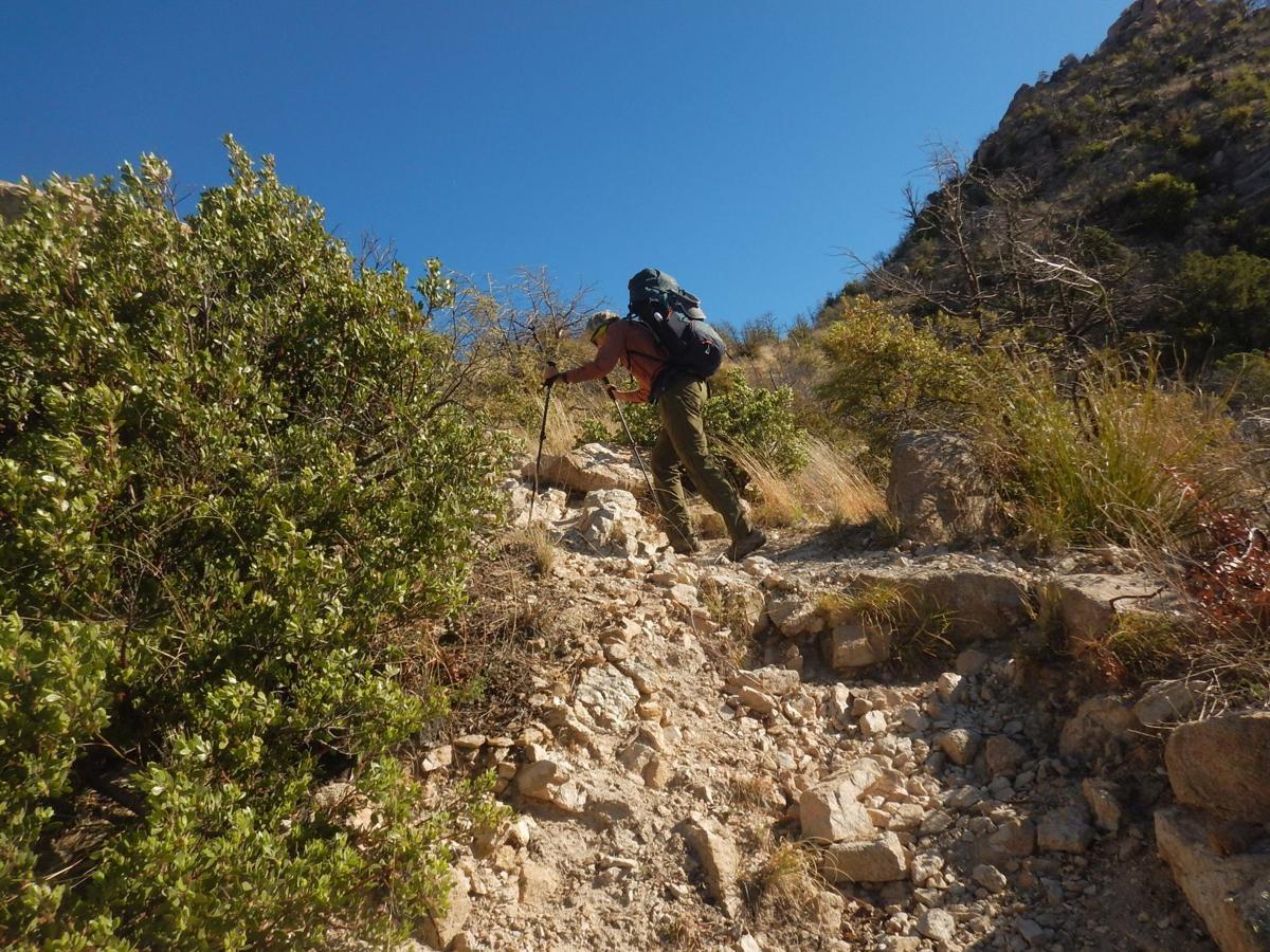
The first three mellow miles of trail up Pima Canyon were well-maintained by Friends of Pima Canyon. The big surprise occurred on the steep climb above.
Back in 2016, before the Bighorn Fire, this trail, which mostly contours up north side of canyon, was only inches wide and scary where exposed. After the 2020 fire, Pima trail conditions were reported to be even worse.
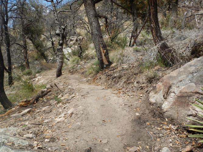
Now a real trail had emerged — clambering up rocks in sections but a normal trail width one could hike with backpacks. Above Pima Spring the trail was steep but doable. Upper Pima to Kimball Peak was a nice contour trail with beautiful views. Other than a nasty slide down the far side of Kimball, the trail was good to the Finger Rock junction and another half mile beyond.
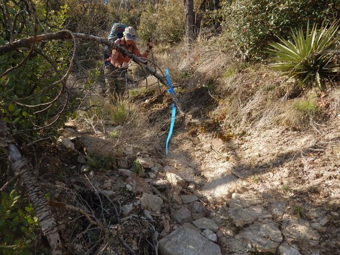
The worst section was the descent and contour to a junction with Ventana Trail — flagged and brushed but a thin fluctuating trail unpleasant for backpacking. The well-used trail on up to the Window was wicked steep but wide and well-marked. After steep drop to a saddle and on to a junction with Esperero Trail (coming up from Sabino Canyon), the Cathedral Trail from Esperero to a ridge (and route to Cathedral Rock) with switchbacks into West Fork Sabino Creek was good.

Brushy trail was encountered soon after the Finger Rock junction.
‘Trail building on hard mode’
Much of the new trail work was done by Tucson-based Outslope Trails Solutions. Funded through the National Forest Foundation (which has raised funds specifically for restoration work for the 2020 Bighorn Fire in the Catalinas), the Outslope crew rebuilt the tread in Upper Pima.
“The design is not perfect,” said Eric Ruljancich, Outslope owner. “There are some nasty sections. Our goal was to go out and get it open so they average user could go up there and not have to call search and rescue.” Retread work stopped when it got too hot but Ruljancich flagged and brushed the rough section to Ventana junction. Ventana Trail is heavily used by day-hikers and was cleared by the Forest Service.
“My ulterior motive is that if I flag it, people will walk the grass in where it should be,” Ruljancich said. “That section to Ventana is the absolute worst.”
The good news is, Outslope Solutions will finish that section in the fall. Ruljancich also has a proposal to reroute what he calls the drop off “ditch” on east side of Kimball Peak with a couple more switchbacks. Earlier this year, his crew reworked the section from Esperero to West Fork Sabino called Cathedral Trail.
“Southern Arizona is trail building on hard mode,” said Ruljancich, who lives in Tucson and works throughout the Southwest. In the Catalinas, the combination of two fires in past 20 years, loss of vegetation, rain events and a soil type that easily goes to “rocky shale ball bearings, these things have compounded to make areas which are really bad.”
The recon hike hit another such area after meeting the Arizona National Scenic Trail (AZT) at West Fork Sabino. The AZT wilderness route in the Catalinas is mellow from Molino Canyon along Sabino Creek, and gently contours above West Fork to Romero Pass (with one big switchback).
The bad part was up from Romero: a mile section of the Mount Lemmon Trail that switchbacks steeply with washed out steep rock up to three feet high — which is no fun to crawl over with a backpack. The barren area was burned in both the Bighorn and Aspen (2003) fires.
Arizona Trail Association (ATA) officials are “well aware of the problem section,” said Zach MacDonald, trail director. “What I proposed maybe five years ago was a series of reroutes. But a zig zag around would not be easy; there is a reason the trail is where it is. It’s all rock and cliffs.”
ATA’s main concern is that neither the wilderness route with the tough Mount Lemmon section nor the wilderness bypass used by mountain bikes on the east side of Catalinas from Bug Spring to Butterfly Trail is safe for equestrian users. ATA supports the Forest Service’s proposed multi-use Vista Trail west of the Catalina Highway as a preferred Arizona Trail route for equestrian and moderate cyclists. (Check out the major trail expansion plan for the Santa Catalinas at tucne.ws/1nq6).
Improving the Mount Lemmon wilderness route for hikers is still proposed but just “a concept on a topo map,” MacDonald said. He cited the usual problems for fielding a trail crew: remote and far from water. “Building switchbacks is slow and expensive.”
Back on the trails
Once the Arizona Trail nears the first ridge on Mount Lemmon in ponderosa pine, the trail is reasonable most of the way to Summerhaven with a few burned areas and washouts from the two fires. This particular route followed popular day hike areas: Wilderness of Rocks and Mint Springs trails.
After resupply and overnight stop in Summerhaven, the “backcountry recon” was non-wilderness on road to Marshall Gulch trailhead, the poorly signed Sunset Trail, “social (hiker-made) trail” along Bear Wallow and brief section on the Catalina Highway. (The Catalina Trail Plan proposes to improve Sunset and adopt/improve the “unauthorized” Bear Wallow route).
The recon hike reentered wilderness and descended to East Fork Sabino Creek on Box Camp Trail. The Forest Service had proposed dropping this trail from maintenance but agreed to keep it based on public feedback. The trail was good through lightly burned ponderosa.
“Box Camp,” 2 miles down, apparently got its name from bear boxes nailed to trees from outfitters who used to camp here. The area had heavily burned pines and lush new post-fire fern growth but still offered a nice campsite with a view of Tucson below. The quarter-mile trail to Box Spring was cloaked in Mexican locust and nearly impassable.
Box Camp was likely used by Indians to access the high country, said Coronado National Forest recreation staff officer Adam Milnor. Rancher/outfitter use was described in a Desert Leaf article (tucne.ws/1nq7).
The well-designed trail followed the ridge most of its 4,000-foot descent, crossing Ash Springs drainage (with large pools in May) then descending to East Fork in more than 20 switchbacks.
The final section along part of the Arizona Trail (East Fork Sabino) and Bear Canyon was a popular thru- or day-hiking route and good except for washout with giant boulders where the trail crossed upper Bear Creek. Horse tracks and manure on the trail above begged the question of how the horses managed.
No hikers were encountered until dropping down to popular Seven Falls on a Saturday, where at least 100 day hikers were met on the way out. This experience dovetails with Forest Service’s findings that the main use of the Catalinas is day hiking. Other than Arizona Trail thru-hikers, few backpack on backcountry trails in Pusch Ridge wilderness.
Other newly-improved wilderness trails include Upper Romero Canyon and Palisades trails. Esperero Trail from Sabino Canyon was brushed by volunteers and Forest Service seasonals.
With Mt. Lemmon once again painted white from recent snow showers, here is a look at Tucson's popular winter destination in past decades.

