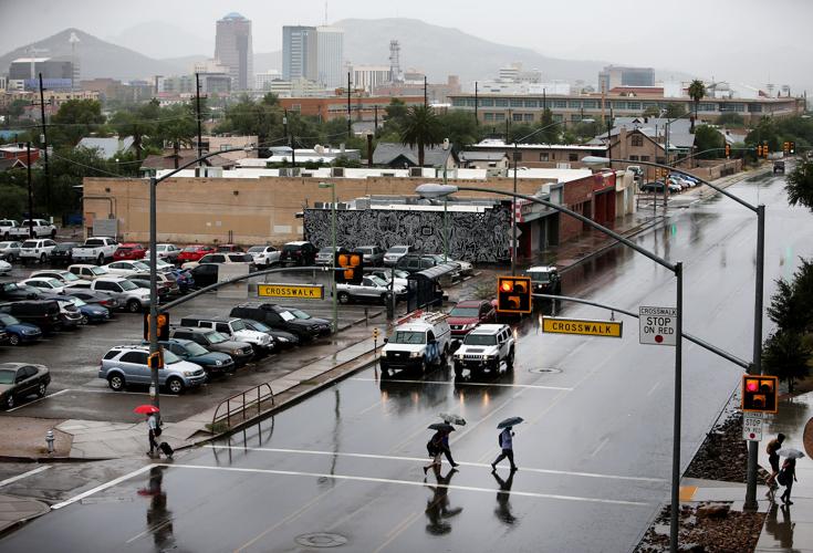
The rain associated with a weakening tropical storm will gradually taper off Wednesday afternoon after a morning of drenching showers in Southeastern Arizona.
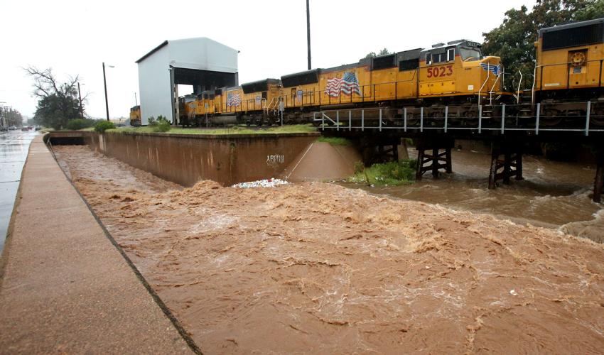
The National Weather Service said a flash-flood watch will remain in effect until 8 p.m. for the region; a flood warning is also in effect until 2:45 p.m. for south-central Santa Cruz County because of heavy storm runoff. The Nogales Wash is running at an elevated level causing some concern, the NWS said. Nogales has seen more than an 1 inch of rain today.
The NWS said Newton was not a tropical storm as it crossed into Arizona. It moved into the state as a remnant low, according to the latest public notice from the National Hurricane Center.
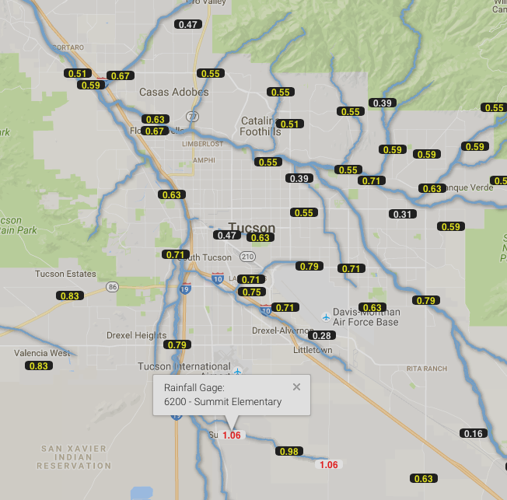
Rain totals in the Tucson metro area show between a half-an-inch to about 1½ inches. The mountains around Tucson saw higher totals with Mount Lemmon recording about 2.5 inches of rain today, according to a rain gauge with the Pima County Regional Flood Control District. Some higher elevation gauges east of Tucson recorded more than 3 inches of rain today.
Green Valley has recorded about 1.3 inches of rain, according to flood control gauges. More than 3 inches of rain has been recorded today at Madera Canyon, south of Tucson.
The widespread rain should begin tapering off this afternoon, but some isolated storms with heavy rain are still possible this afternoon in the Tucson area.
Some reports of minor flooding have been reported, according to the NWS.
The rain has had another benefit, keeping Tucson temperatures in the 70s. The NWS said the high today so far was 77 degrees shortly after midnight and the storms have dropped the temperature the low 70s by mid-day.
The lowest maximum daytime temperature for this date is 77 degrees set in 1919. That means if the high today doesn't go beyond this morning's 77 degrees, it will break a 97-year-old record for the date, the NWS said.
The rain has affected some services and events today:
The Reid Park Zoo is closed today because of the inclement weather.


