The Pima Association of Governments is working to better understand travel demands for motorists in the region.
The taxpayer-funded organization overseeing regional planning hopes use of the new model will help “predict how, when and where people travel in the greater Tucson region,” PAG said. It will lead to better plans for long-term transportation in the growing region of more than 1 million residents.
A major focus of the new model is collecting household activity data to ensure it correlates with the data officials are observing. Household surveys will be a key part in gathering this information.
A trio of B-52′s completed the first non-stop, round-the-world flight by jet planes, landing at March Air Force Base in California after more than 45 hours aloft, and more events that happened on this day in history.
This modeling, unlike past methods, could show how an entire household moves throughout a given region during a day.
“The activity-based model can represent 24-hour, daily activities of a family or household in ways that previous modeling methods cannot,” PAG said.
“Consider a family of four household members. The model can create activities and travel where, for example, one parent drops off and picks up two kids at schools on the way to work and coming back home, and the other parent leaves home for shopping and recreation activity at specific time and location. Then both come back home and then the family goes out to eat together.”
The organization will examine geographical data to help assess traffic congestion not only about the local jurisdictions, but also on Interstates 10 and 19.
“Information on how roadways are configured, such as the roadway network having 80% of arterial roads, is input to help assess traffic congestion,” PAG said.
Another goal is to use the model to better represent residents’ changing travel options and behaviors to ensure better regional transportation planning efforts.
The activity-based model can better forecast new mobility impacts, such as autonomous vehicles, ride-sharing and home delivery services, which have grown through online shopping. Some of these providers are companies such as TuSimple, Lyft, Uber or Amazon, PAG said.
“Autonomous vehicles might be a major transportation mode in 2045. The behavior of a family with autonomous vehicles would be different from another family without autonomous vehicles,” PAG said.
“A family could change the ownership of vehicles from two normal cars to one autonomous vehicle. This change would impact the daily activities of the family. This will affect the transportation demand on the network.”
An influx of these vehicles could be addressed by examining not only the daily activity changes but an impact to other transportation modes in the region.
The activity-based model will also be used to expand out of the region, said Paul Casertano, PAG’s transportation planning director in a statement.
The model “will support alignment with the greater Phoenix region and activity-based modeling done by Maricopa Association of Governments,” said Casertano. “This will allow us to improve how we prepare for and manage future growth and expanding transportation needs through the Sun Corridor mega region.”
Down the Road
Pima County road work extension: Shoulder repair work on North Hacienda del Sol Road between East River Road and East Sunrise Drive has been extended until Thursday, Jan. 21.
Crews will work between 6 a.m. and 4 p.m. each day.
Motorists should use caution and adhere to the reduced speeds and temporary closures as crews place materials starting at the south end of the project and work north to Sunrise Drive.
A look back at Tucson-area streets:
Photos: A look back at Tucson-area streets
Broadway Road, Williams Addition, 1958

Recently paved and improved Broadway Road in Tucson looking east to Craycroft Road (just beyond the Union 76 gas station at left), where the Broadway pavement ended in 1958. At right, is the natural desert of the Williams Addition, an innovative 160-acre development with only 22 homes on large lots. Developer Lew McGinnis bought all but two of the homes by 1980. It is now Williams Centre.
Interstate 10, 1960

Interstate 10 under construction at St Mary's Road in Tucson, ca. 1960.
Cherry Avenue, 1972

Arizona Stadium is off in the distance looking south along North Cherry Avenue on February 9, 1972. At the time the UA was proposing an addition to its football stadium adding another 10,600 seats to the east side of the structure that would involve permanently closing Cherry Avenue. It was also considering a 3,600-unit parking lot, all of which could cost around $11 million.
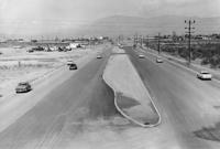
Speedway Blvd., 1950

Speedway Blvd. looking east from County Club Road, Tucson, in 1950. The controversial "hump" down the middle of the road separated opposing lanes of traffic. It was removed in 1957.
Court Street, 1900

Court Street in Tucson, c. 1900. City Hall is on the left (with flagpole) and San Augustin church is the peaked roof in distance at the end of the street. The building in the left foreground was used for the first mixed school taught by Miss Wakefield( later Mrs. Fish) and Miss Bolton.
Congress Street, 1933

Congress Street, looking west from 4th Avenue, Tucson, ca. 1933. Hotel Congress is at left. Today, Caffe Luce and One North Fifth Lofts have replaced the shops just beyond the Hotel Congress sign on the corner of 5th Ave. and Congress.
Broadway Road, 1900s

Undated photo looking west on Broadway Road from the Santa Rita Hotel in Tucson. The cross street with man on horseback is Stone Ave. Photo likely from the early 1900s, since the Santa Rita was finished in 1904.
Congress St., 1920

Congress Street in Tucson, looking west from 6th Avenue in 1920.
Park Avenue, 1952

Definitely not a safe place to walk: Park Avenue at the Southern Pacific RR tracks in 1952, looking north into the Lost Barrio in Tucson. Park now crosses under the railroad tracks and links with Euclid Ave.
Electric street cars

Electric street cars replaced horse-drawn street cars in Tucson, 1906.
Toole Ave., 1958

City Laundry Co. of Tucson occupied the historic building at right, at 79 E. Toole Ave., since 1915. Prior to 1915, it was a brewery. It was one the oldest buildings in downtown Tucson. The building at left fronting Council Street was built by City Laundry in 1928 and ultimately became the main plant. Both buildings were demolished in 1958 to make way for a parking lot.
Stone Ave., 1971
Updated
The lights of businesses on Stone Avenue in downtown Tucson, looking south from Ventura Street in July, 1971.
22nd Street, 1962

Traffic tie-ups like this one in June, 1962, happened several times a day on 22nd Street at the Southern Pacific Railroad tracks in Tucson. Most of the motorists in this picture had to wait 10 minutes for the two-train switching operation. An overpass solved the problem in 1965.
Benson Highway, 1972

This stretch of the Benson highway near South Palo Verde Road was bypassed after Interstate 10 was opened in 1969. It was just another string of businesses along the road that struggled to survive on August 14, 1972. The four-mile stretch was once a vital thoroughfare before the interstate system was created.
Church Ave, 1966

Greyhound bus depot, left, was located on the northwest corner of Broadway Boulevard and Church Avenue around February 1966.
Campbell Ave., 1960

Gridlocked traffic on Glenn Street, east of Campbell Avenue as thousands of people attended the opening of the new $2 million Campbell Plaza Shopping Center on April 7, 1960. Originally, the parking facilities was designed to handle 850 vehicles but it was overflowing for the event. The plaza is situated on 18 acres and has 18 tenants.
Interstate 19, 1964

Looking south on the Nogales Interstate Highway (now I-19) at the Ajo Way overpass on July 20, 1964.
Meyer Avenue, 1966

Street scene of South Meyer Avenue looking south from West Congress Street on June 26, 1966. All the buildings were demolished as part of the city's urban renewal project in the 1960s and 70s.
Cortaro Road, 1978

Cortaro General Store on the northwest corner of Cortaro Road and I-10 in December, 1978.
Congress St., 1967

A man crosses East Congress Street at Arizona Avenue as this portion up to Fifth Avenue was falling on hard times with only one small shop still in business on May 3, 1967.
Stone Avenue, 1955

The Stone Avenue widening project between Drachman and Lester streets in April, 1955. A Pioneer Constructors pneumatic roller is used to compact the gravel base for an 80-foot roadway. The four-block project cost $37,500.
US 84A in Tucson, 1954

Westbound SR84A (now I-10) at Congress Street in 1954. In 1948, the Arizona State Highway Department approved the Tucson Controlled Access Highway, a bypass around downtown Tucson. It was named State Route 84A, and connected Benson Highway (US 80) with the Casa Grande Highway (US 84). By 1961, it was reconstructed as Interstate 10.
Grant Road, 1962

The new Grant Road underpass at the Southern Pacific RR in December, 1962, as seen looking west on Grant Road east of the tracks and Interstate 10. The Tucson Gas and Electric generating station (no longer there) is at right.
Grant Road, 1966

Grant Road, looking west at Campbell Ave. in 1966.
Old Nogales Highway, 1966

Old Nogales Highway near Ruby Road in July, 1956.
Oracle Road, 1925

This is a 1925 photo of the All Auto Camp on 2650 N Oracle Rd at Jacinto which featured casitas with the names of a state on the buildings. T
Oracle Road, 1950

This is a 1950 photo of the North Oracle Road bridge where it originally crossed over the Rillito River, west of the current bridge.
Oracle Road, 1979

Area in 1979 along North Oracle Road near the entrance of the Oracle Road Self Storage at 4700 N Oracle Rd near the Rillito River which would now be north of the Tucson Mall. There is no apparent record of the Superior Automatic and Self Service Car Wash.
Oracle Road, 1975

Oracle Road, looking south from Suffolk Drive, in March, 1975. Then, it was a four-lane state highway on Pima County land. It was annexed by Oro Valley more than 30 years later.
36th St., 1956

The Palo Verde Overpass south of Tucson (Southern Pacific RR tracks), looking East on 36th Street, in 1956.
Interstate 10, 1966

Large billboards used to line the area along Interstate 10 (South Freeway) between West 22nd and West Congress Streets on May 5, 1966.
Catalina Highway, 1967

Snow clogs the Catalina Highway to Mt. Lemmon at 5,400 feet elevation on Feb. 18, 1967. Rock slides up ahead kept motorists from going further.
Speedway Blvd., 1968

The new Gil's Chevron Service Station at 203 E Speedway on the northeast corner at North Sixth Avenue was open for business in March 1968. The photo is looking toward the southeast.
Catalina Highway, 1955

The Mt. Lemmon Highway on May 18, 1955.
Tanque Verde Road, 1950s

In this undated photo taken in the late 1950s, the Tanque Verde Bridge over the Pantano Wash was allowing traffic to make its way toward the northeast side of town.
Craycroft and I-10, 1966

The TTT Truck Terminal at Craycroft Road and Benson Highway in Tucson in June, 1966. It's a mile east of the original, built in 1954.
Congress St., 1980

Congress Street in Tucson, looking east from the Chase Bank building at Stone Ave. in August, 1980.
Silverbell Road, 1975

Silverbell Road and Scenic Drive in Marana, looking south-southwest in 1975.
Interstate 10, 1962

Interstate 10 (referred to as the "Tucson freeway" in newspapers at the time) under construction at Speedway Blvd. in the early 1960s. By Summer 1962, completed freeway sections allowed travelers to go from Prince Road to 6th Ave. The non-stop trip to Phoenix as still a few years away.
Alvernon Way, 1982

This is a July 2, 1982 photo of flooding along a Tucson street. Might be North Alvernon Way near Glenn Street.
6th Ave, 1960s

The Tucson Fire Department's Station No. 1 was once on the 100 block of South Sixth Avenue, across the street from the Pueblo Hotel and Apartments in the late 1960s. The fire station had been on the site from as early as 1909 and was next door to the Tucson Stables, which had a livery and sold feed for horses. The historic Santa Rita Hotel rises up behind the fire station. The entire block is now the Tucson Electric Power headquarters.
Ruthrauff Road, 1975

Shown in 1975, owboys drive 250 cattle down a frontage road near Ruthrauff Road in Tucson toward the finish line of "The Last Cattle Drive," a 350-mile journey that began in Willcox. The drive ended at the Nelson Livestock Aucions yard, 455 N. Highway Drive. The cattle was sold with proceeds going to the Muscular Dystrophy Assosciation.
Main Ave., 1969

The newly aligned South Main Ave swerved its way along a barren stretch of landscape on May 9, 1969. Note the Redondo Towers in the background.
Congress St., 1970

Traffic along West Congress Street near the Santa Cruz River moves along on July 24, 1970. City authorities had decided to replace the bridge starting in the fall.


