A major step was taken toward completing the $129 million Interstate 10-Ruthrauff Road interchange Thursday night, the Arizona Department of Transportation said.
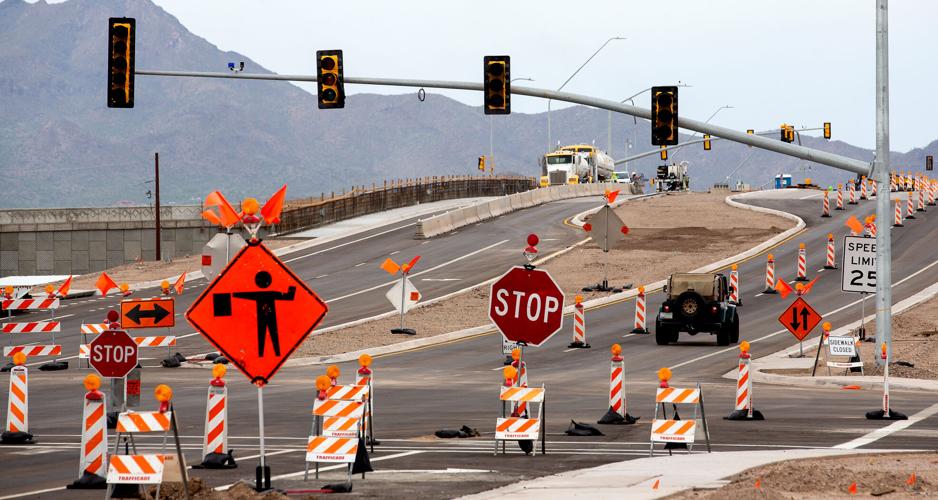
Crews opened the new bridge that carries vehicles on Ruthrauff/El Camino Del Cerro over I-10 and the Union Pacific Railroad tracks, eliminating the need for vehicles to stop for trains frequenting the area.
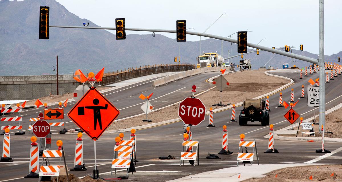
Temporary lane restrictions remain on Ruthrauff as crews continue their work to widen the road to two lanes in each direction.

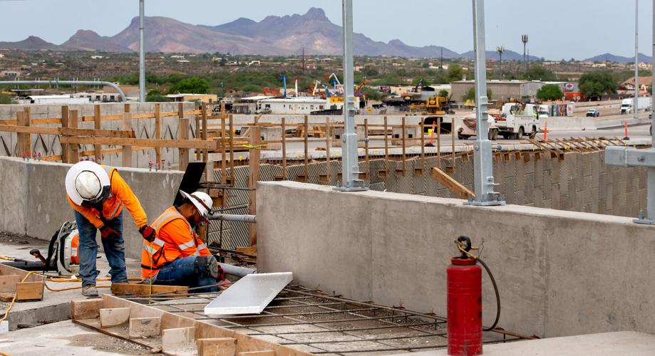
Workers place rebar for pedestrian sidewalks on the Ruthrauff Road bridge at Interstate 10 on Friday.
The I-10 ramps connecting drivers to the interchange remain closed and should open in the next several months, ADOT said. Crews still need to reconstruct the ramps and frontage roads to carry all traffic over the railroad tracks.
By late fall, ADOT said, motorists will use the expanded I-10 with four lanes in each direction, a widened Ruthrauff Road, and an underpass that will carry motorists using Davis Avenue and Highway Drive under Ruthrauff.
Traffic will then use local roads and Maryvale Avenue to connect with Ruthrauff.
Todd Martin caught this Northern Cardinal feasting on some Zinfandel grapes at his Tucson home.
Photos: Interstate 10/US 80 in Pima County
Interstate 10 / US 80 in Pima County
Updated
US 80 (now Interstate 10) and the Casa Grande Highway (now Miracle Mile), Tucson, in 1956. The overpass passes over the Southern Pacific RR mainline.
Interstate 10 / US 80 in Pima County
Updated
New traffic lanes of Interstate 10 pass over Grant Road underpass, Tucson, looking west, in August, 1962.
Interstate 10 / US 80 in Pima County
Updated
Congress Street looking east towards downtown Tucson in 1956. US 80 (now Interstate 10) crosses in the middle of the photo. Vehicles on US 80 had to stop at the traffic light.
Interstate 10 / US 80 in Pima County
Updated
Benson Highway (US 80) looking southeast from just east of 6th Ave. in 1956. The famous Sage and Sand Motel is now the Lazy 8 Motel, just east of the Silver Saddle Restaurant. The Desert Lodge, at left, is no longer. Most-likely it was sacrificed for Interstate 10.
Interstate 10 / US 80 in Pima County
Updated
Pilars for billboards dot a new section of Interstate 10 near Park Ave. in 1968. The section from 10th Ave. to Valencia Road to four years to finish at about $1 million a mile. The roadway was designated a "scenic route" by the Tucson City Council in 1966, though the planned billboards stood in defiance. That land is now The Bridges development, which includes Walmart and Costco.
Interstate 10 / US 80 in Pima County
Updated
A new section of Interstate 10 from 10th Ave. to Valencia Road, Tucson, including bridge over Ajo Way, opened to traffic in 1968. The project began in 1964 and cost just about $1 million per mile.
Interstate 10 / US 80 in Pima County
Updated
Interstate 10 (formerly U.S. 80) under construction at Speedway Blvd. in October, 1958.
Interstate 10 / US 80 in Pima County
Updated
The new Gilpin Air Field 4,500 foot runway that was just completed at the Freeway Airport can be seen as it extends from the dark strip in the left center of the photograph in July 1958. Individual T hangars, a new administration building and a machine shop were being built. The old Gilpin hangars are on the right and to the left is the railroad and the Casa Grande Highway, now Interstate 10. Prince Road runs down beside the airport on the left and Romero Road cuts across on the right.
Interstate 10 / US 80 in Pima County
Updated
A semi tractor-trailer narrowly clears the original 6th Ave. overpass on Interstate 10 in 1982. As evidenced by the photo, several predecessors weren't so fortunate. The overpass was replaced in 1990.
Interstate 10 / US 80 in Pima County
Updated
Aerial of Interstate 10 under construction at West Sixth Street and St Mary's Road in Tucson.
Interstate 10 / US 80 in Pima County
Updated
Undated aerial photo of Interstate 10, prior to Interstate 19, with South Sixth Avenue in the middle of the photo. The South Gate Shopping Center is at the bottom of the photo.
Interstate 10 / US 80 in Pima County
Updated
Aerial view of the Santa Cruz River as it winds its way through Pima County north of Cortaro Road in 1953. The county was considering a bridge at several locations, but had to contend with the ever-changing course of the river. US 80 is at right.
Interstate 10 / US 80 in Pima County
Updated
Expansion of U.S. Highway 80, middle of photo, underway north of Congress St. in September, 1951. Arizona Daily Star
Interstate 10 / US 80 in Pima County
Updated
Desolate stretch of Interstate 10 near Toltec in Pinal County in 1982.
Interstate 10 / US 80 in Pima County
Updated
Desolate stretch of Interstate 10 near Toltec in Pinal County in 1982.
Interstate 10 / US 80 in Pima County
Updated
The I-19, I-10 interchange in Tucson under construction on June 20, 2003.
Interstate 10 / US 80 in Pima County
Updated
Westbound traffic weaves its way along Interstate 10 near downtown Tucson in Sept, 2008. The Arizona Department of Transportation has a contract with Kiewit/Sundt Joint Venture for the widening project that will extend the interstate from three lanes to four between 29th Street and West Prince Road. The project was completed in 2010.
Interstate 10 / US 80 in Pima County
Updated
Demolition of the eastbound Interstate 10 bridge over Ina Road on Feb. 23, 2017.


