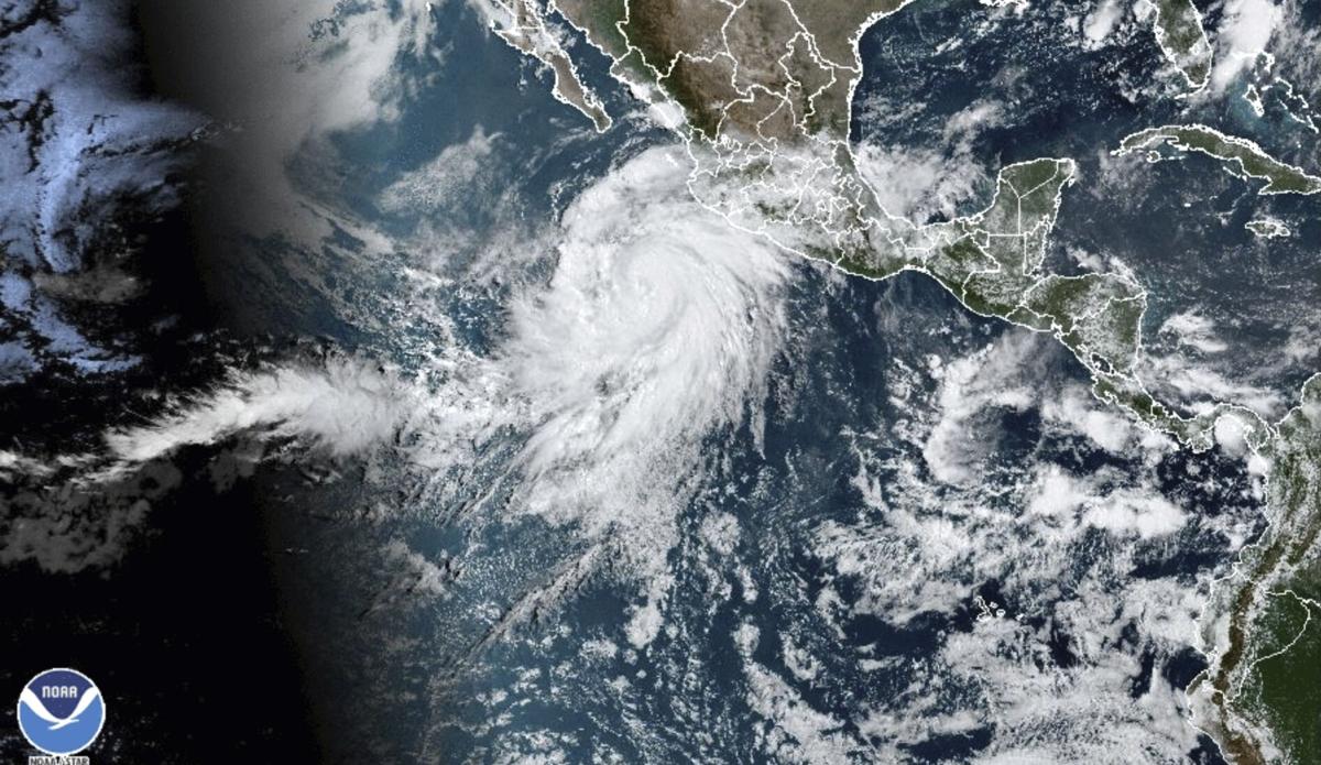
Hilary strengthened into a Category 2 hurricane off Mexico’s Pacific coast Thursday, and it could bring heavy rain to the U.S. southwest by the weekend.
The area affected by heavy rainfall may include the stretch between San Diego, California and Yuma. A wider area between Bakersfield, California and Tucson could also see rain, the Associated Press reported Thursday afternoon.
An increase in storm activity this weekend, especially Saturday, could be indirectly associated with the hurricane’s possible landfall in Southern California, said Carl Cerniglia, a lead meteorologist for the National Weather Service in Tucson.
Southern Arizona could see an inch of rain Saturday, though it likely will very widely, he said.
Some localized areas have the potential to reach up to three inches of rain, but that depends on what Hilary does over the next day or two, Cerniglia said.
The U.S. National Hurricane Center said Thursday that Hilary had maximum winds of 105 mph and could perhaps skim the coast of the Baja California peninsula by the weekend.
Hilary was located about 500 miles south-southeast of Los Cabos, on the southern tip of the Baja peninsula. While it was still far from land, the hurricane was moving west-northwest at 14 mph and was expected to take a more northward turn, toward the U.S. border.
It was expected to become a major hurricane by Friday and perhaps skim the sparsely populated western edge of the Baja coast. The hurricane center said it could possibly survive briefly as a tropical storm and cross the U.S. border.
No tropical storm has made landfall in Southern California since Sept. 25, 1939, according to the National Weather Service.
“Rainfall impacts from Hilary within the Southwestern United States are expected to peak this weekend into Monday,” the hurricane center wrote in a report. “Flash, urban, and arroyo flooding is possible with the potential for significant impacts.”
Meanwhile, an unrelated storm Wednesday night hit portions of Oro Valley, dropping nearly an inch of rain in some parts of the area and toppling trees. Gusting wind of 43 m.p.h. was recorded at a weather station near North First Avenue and East Tangerine Road, the weather service said, but residents took to social media to share video that showed more powerful wind and rainfall.
A severe localized storm in Oro Valley Wednesday evening brought high wind that shattered sliding glass doors and multiple windows at the home of one resident who captured the damage on camera. Video courtesy of Angela G.


