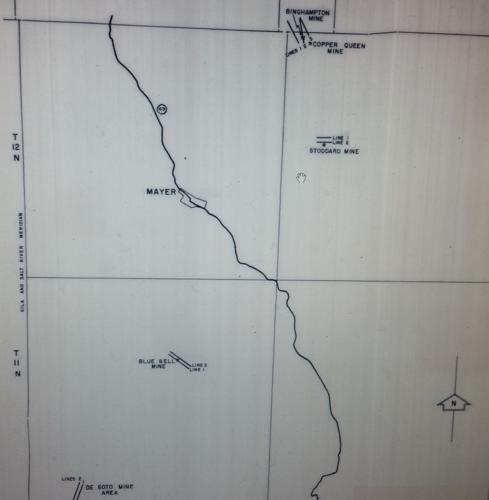
One of the greatest producing mines in Central Arizona’s Bradshaw Mountains was the Blue Bell Mine, located nine miles south of Humboldt on 180 acres of land in the Big Bug Mining district.
A replacement deposit in Yavapai schist, the ore consists of chalcopyrite and iron pyrites.
Discovered in the 1870s, the Blue Bell Mine later became a well-known producer of copper along with gold and silver. Average grades included 2.8 percent copper, 1.2 ounces of silver and .04 ounces of gold per ton.
The metals were found in lenses and shoots as replacements in schist over a 1,600 foot long mineral zone. Some of these lenses reached a size of 20 feet. Lacking evident rich surface deposits, serious mining did not occur until 1896 when the mine shipped its first ore for production. Varying copper prices throughout its history necessitated the mine be worked intermittently.
A 4,500 feet in elevation, the mine was conveniently located one mile west of the Prescott-Crown King Railroad. An aerial tramway connected the mine to the railroad at Blue Bell siding.
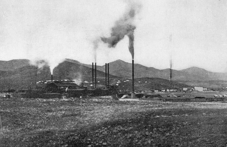
The ore was then shipped by rail to the Humboldt smelter, rebuilt in 1906 to accommodate the volume of ore from the Blue Bell Mine.
The 800-ton capacity smelter and mill (replete with gravity concentration and later flotation) were also a destination for treatment of siliceous ores from the neighboring De Soto Mine.
The Blue Bell Mine operated under multiple ownerships throughout its prime production years involving a large quantity of low-grade pyritic copper ore.
Between 1896 and 1927 its production rivaled that of all other mines in the Bradshaw Mountains with a product valued at $14 million.
The Consolidated Arizona Smelting Co., later reorganized as the Southwest Metals Co., developed the property in 1905, mining the stopes by the shrinkage system and later the cut-and-fill method. That method was abandoned in 1914 because it was not economical despite offering higher purity of ore in contrast to the shrinkage system.
The entry of the United States into World War I in 1917 saw the mine’s greatest production figure the following year, with 131,000 tons of ore shipped by a 3.3 mile aerial tramway with a capacity of 20 tons of ore movement per hour.
Its primary shaft was sunk 1,400 feet in depth, replete with over 30,000 feet of workings north and south and five smaller shafts. Rising water levels proved challenging necessitating the daily pumping of 150,000 gallons to ensure unimpeded mining operations.
During its later years of production its owners implemented diamond drilling to seek out the faulted extensions of ore lenses.
The mine was forced to close because of the closing of the Humboldt smelter in 1927 and a drop in copper prices to 5 cents a pound.
The tram line and railroad were removed in 1931.
The mine was leased by Lloyd Farnham during World War II.
Farnham, a mining engineer, successfully operated the mine from 1944 through 1948, shipping 7,159 tons of copper ore valued at $150,000. Mayer, four miles to the north, served as a housing base with a dirt road connecting to the mine for truck haulage.
Sherwood and Kate Owens purchased the mine in 1958. They leased it to the Mine Management Group in Phoenix from 1969 to 1973.
An idea of producing cement copper from the mine waters mixed with a copper sulfate solution on iron never materialized.
Amoco Minerals acquired an option at the mine in 1974, conducting several electromagnetic surveys while initiating several drilling operations. Pronto Exploration Limited of Toronto, Canada optioned the mine in 1981, employing surface geochemical testing later reported the potential for a bulk tonnage gold deposit on the property.
Dick Mieritz, a consulting mining engineer from Phoenix, visited the mine site and reported in 1988 that the potential of undertaking in-situ leaching on the property based upon his conclusion the mine contained 30 million gallons of copper-bearing solution. He deduced that the massive sulfide deposit contained active bacteria.
The Halquist Stone Co. Inc later operated the Blue Bell Schist Quarry on the mine property in the 1990s for production of building and dimension stone.


