


Springtime in Tucson — especially during a pandemic — is the perfect time to explore the great Sonoran Desert outdoors.
But for many people, the thought of hiking along a dusty trail or tackling the paved path up Tumamoc Hill is just not their thing.
We’ve got you covered.
What about an urban hike, one that requires less energy, can be done in an hour or two and offers a retail/dining/adult beverage pitstop along the route?
We thought so.
Here are three urban trails that you can bike or walk that fit that bill. We’re kind of cheating a bit; two of the trails — the Rillito River and Santa Cruz River park trails — are part of the larger Chuck Huckelberry Loop, more than 136 miles of paved paths stretching from the east side, South Tucson, Oro Valley and Marana. But since the trails are separated by Interstate 10, we figure we can get away with it.

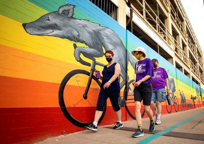
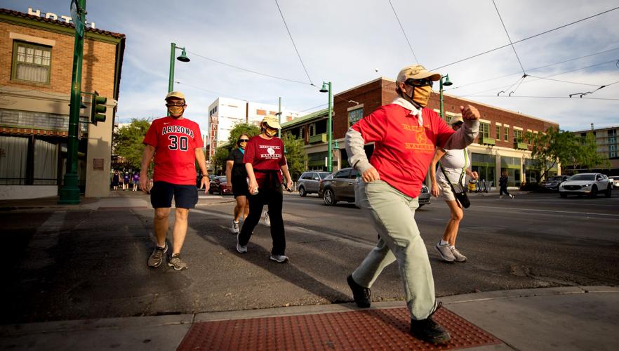
Friends Rebecca Werner, left, Annbell DeVinney and Bill DeVinney walk past a mural in downtown Tucson during “Meet Me at Maynards” on April 5. “Meet Me at Maynards” has found a new home with the Beyond Foundation, a nonprofit dedicated to improving the health and well-being of the Tucson community.
Meet Me At Maynards
When and where: Meets at 5:30 p.m. Mondays at Maynards Market & Kitchen, 400 E. Toole Ave.
Cost: Free; registration is required at meetmeatmaynards.com
The hike: This is a family-friendly affair that also can double as date night, if your idea of date night includes walking more than 4 miles throughout downtown. You can opt for a shorter route of 2 and 3 miles, as well, and you can also choose to run or jog the route. Along the way, you’ll pass historic sites, city landmarks and a whole slew of beautiful homes and businesses including restaurants.
The longer route takes you from Hotel Congress across Toole from Maynards west to Fifth Avenue toward East Congress Street before you make it to Church past Pennington and north onto North Court Avenue, near the original El Charro Café. Among the highlights of the journey: Crossing through El Presidio Park and the pedestrian bridge at Congress and Broadway, crossing the Rattlesnake Bridge and strolling along North Fourth Avenue before winding back to Hotel Congress.
The shorter route skips the Rattlesnake Bridge and Fourth Avenue. For detailed routes visit meetmeatmaynards.com/route, and no matter which you choose, masks are required and social distancing is encouraged.
New leadership: Beyond Tucson, the nonprofit organization that promotes healthy lifestyles through physical activity, took over the weekly downtown events when Meet Me At Maynards relaunched on April 5.
“It’s bigger than anything we’ve done before, but it’s everything we want to do in this community,” said Beyond board member Damion Alexander.
Alexander, a local realtor and lifelong cyclist and outdoor enthusiast, said the weekly event falls into Beyond’s mission of bringing the community together to focus on physical and mental well-being.
By the numbers: Since it was launched in August 2009, 253,953 people have participated in Meet Me At Maynards’ weekly walks. The event was on hiatus for most of 2020 due to the COVID-19 pandemic. When it relaunched on April 5 — the 632nd event since it started — 340 people participated including five kids, according to the Meet Me At Maynards website.

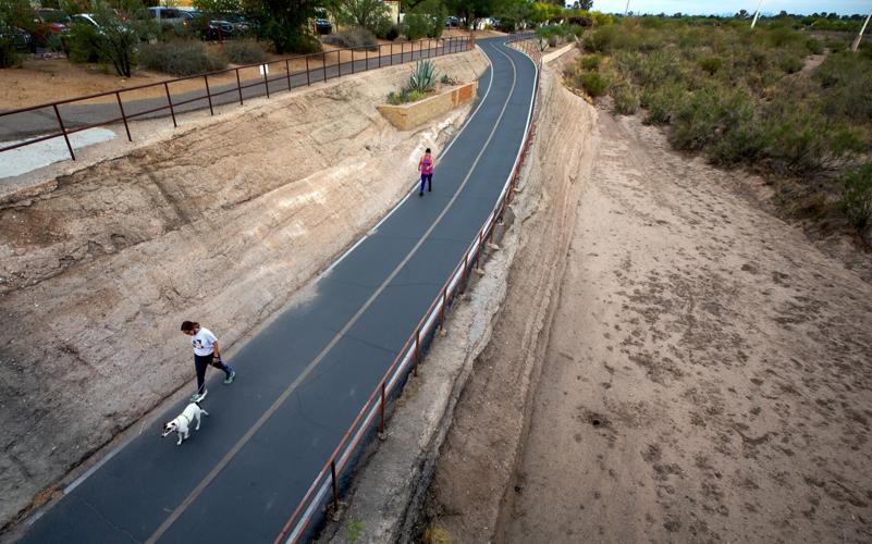
The Rillito River Walk, near North Campbell Avenue and East River Road in Tucson, Ariz., is a 21-mile trail which runs along the Rillito River from North Craycroft Road to I-10 near West Orange Grove Road.
Rillito River Park Trail
Where: The 12-mile trail runs along the Rillito River from North Craycroft Road and East Glenn Street, off East Grant Road, to West River Road not far from West Orange Grove Road and Interstate 10. You can park at either end.
The route: This is the trail you take when you crave some me-time and want to hear yourself think above the din of life. As you plod along the path, let your mind wander to the summer monsoons when all of Tucson waits to see the sun-worn cracks and seams get muddy as the river fills up with rain. Your thoughts will occasionally get interrupted by passing cars whizzing along the busy thoroughfares, especially at afternoon rush, but once you get in the groove and find your mind space, it’s easy to tune out the world and focus on the journey.
“I joke about it because it’s called the river walk and there’s no water,” said Judith Jacobskind, a New Yorker who retired to Tucson with her husband more than 20 years ago. “It’s really just fine because it’s quite level and it’s more manageable for us.”
The couple, who are both in their mid-80s, have been walking the Rillito River trail since the pandemic led to the closure of their usual walking trail in Sabino Canyon. The couple walk about a mile at a time every other day.

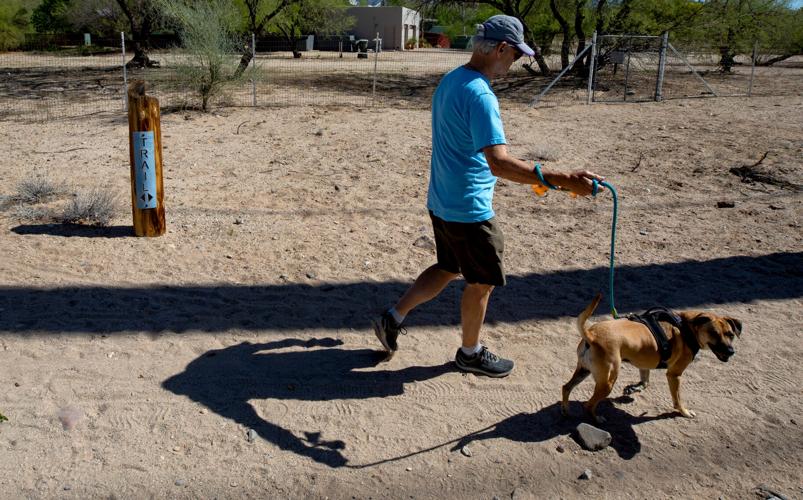
Bill Pattinson walks his dog Kona along the Rillito River Walk Trail near North Craycroft Road and East River Road in Tucson, Ariz., on April 13. The path is used for cycling, horseback riding, running, walking, dog walking and wildlife viewing.
“It’s important to exercise,” she said. “I see lots of people on the walk who are not so able, but they want to be as able as they can be. That’s what older people do. It’s a case of use it or lose it.”
Cyclists, skateboarders and walkers share the Rillito trail, which at times could be a recipe for disaster if users aren’t mindful of one another, Damion Alexander cautioned.
“It comes down to being courteous” to other users, said Alexander, who usually takes to the trail daily on his bike, clocking 250 miles a week.
Alexander suggested that people who want a more challenging workout should consider using the less busy Santa Cruz River Trail.
By the numbers: County officials estimate that nearly a million people use the Loop every year, making it one of the most used parks in the state.

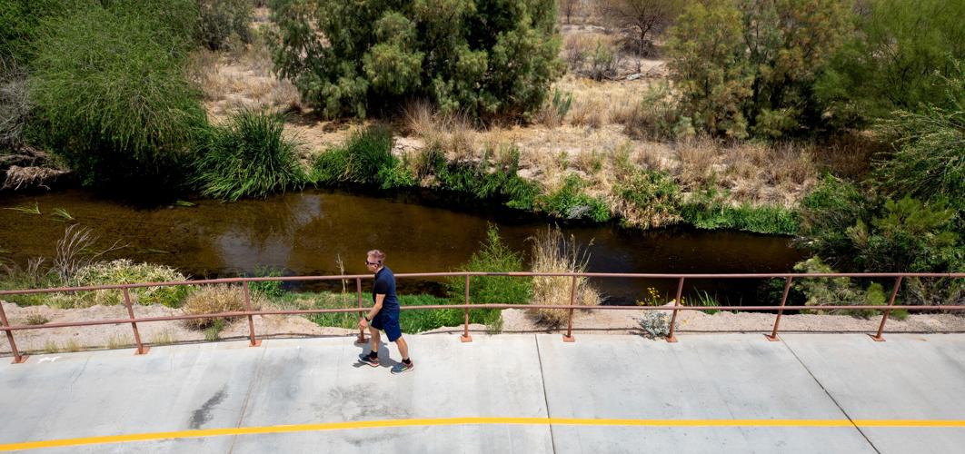
A walker gets in some exercise along the Santa Cruz River Walk near Cortaro Road in Marana on April 15.
Santa Cruz River Park Trail
Where: The 40-mile paved trail runs the length of the Santa Cruz on both sides of the historically dry riverbed, stretching from North Saunders Road in Marana to West Valencia Road on Tucson’s south side.
You can hop on the trail at any point along the way that intersects with the river, but your best bet for park-and-walk is to park near the ballfields off El Camino del Cerro west of the river, or at West Silverbell Road’s Christopher Columbus Park. Other parking opportunities include off North Riverview Boulevard, just north of where it meets North Apache Drive and at the end of West Ontario Street at North Riverside Road.
The route: There are pockets of the Santa Cruz River Park Trail that are hugely popular with walkers, including on the far northwest side a couple miles from where it starts — or ends depending on the direction you are heading — in Marana.
You will often see couples walking while their young children circle them on bicycles. The further east you go, the more likely you are to see cyclists pushing themselves to their physical limits as the trail becomes less populated.
In the mid sections of the trail, especially in areas where there is little to no residential pockets, you will see more cyclists and runners.
“The Rillito is a really great place to go slow. If you are going out for a workout and you’re going for speed, take the Santa Cruz trail,” said Alexander, who regularly rides his bike on both trails.
Photos: Santa Cruz River through Tucson
Santa Cruz River
Updated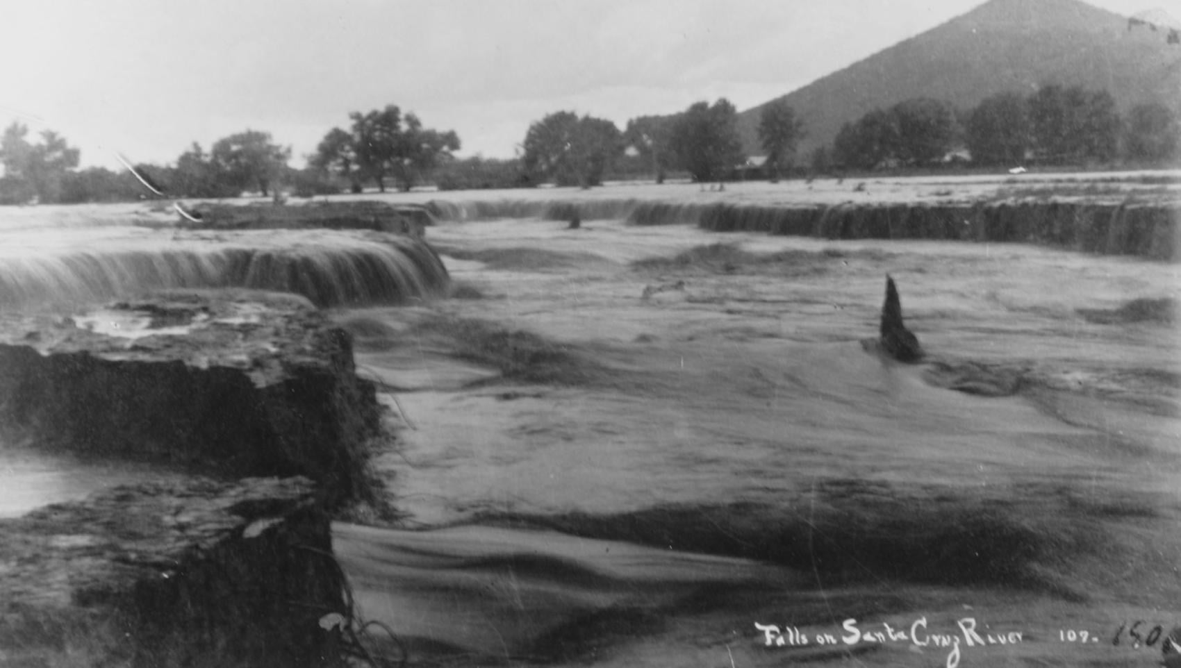
Waterfalls on the Santa Cruz River in 1889 near Sentinel Peak in Tucson.
Santa Cruz River
Updated
Girls in Santa Cruz River,1889-1890.
Santa Cruz River
Updated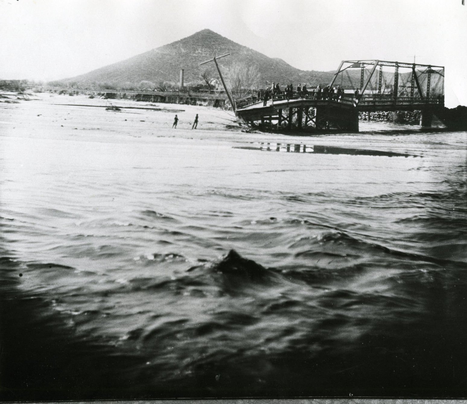
A bridge over the Santa Cruz River near Sentinel Peak in Tucson washed out during flooding in 1915.
Santa Cruz River
Updated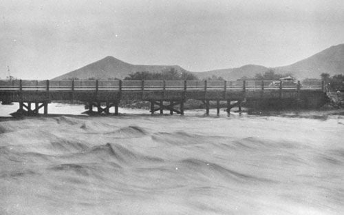
Santa Cruz River at St. Mary's Road bridge in 1931.
Santa Cruz River
Updated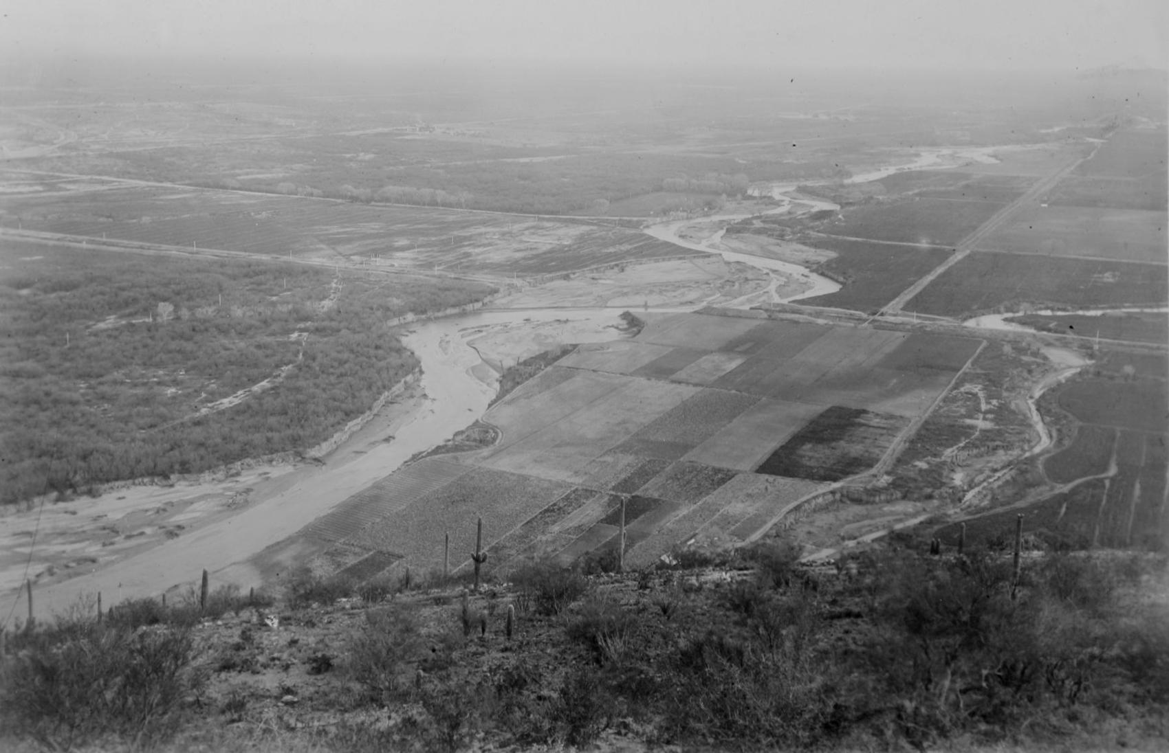
The Santa Cruz River flows north as seen from Sentinel Peak in Tucson in the early 1900's.
Santa Cruz River
Updated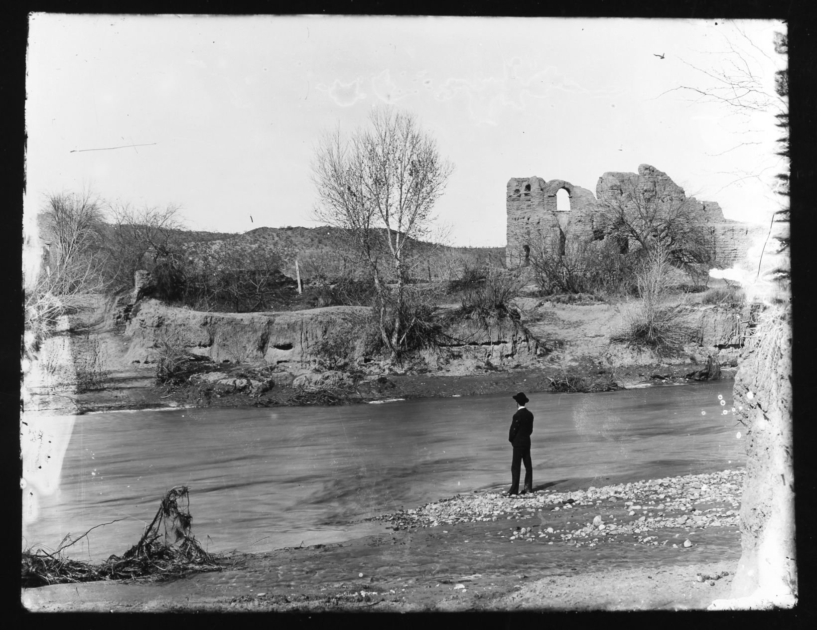
El Convento along the Santa Cruz River, ca. 1910.
Santa Cruz River
Updated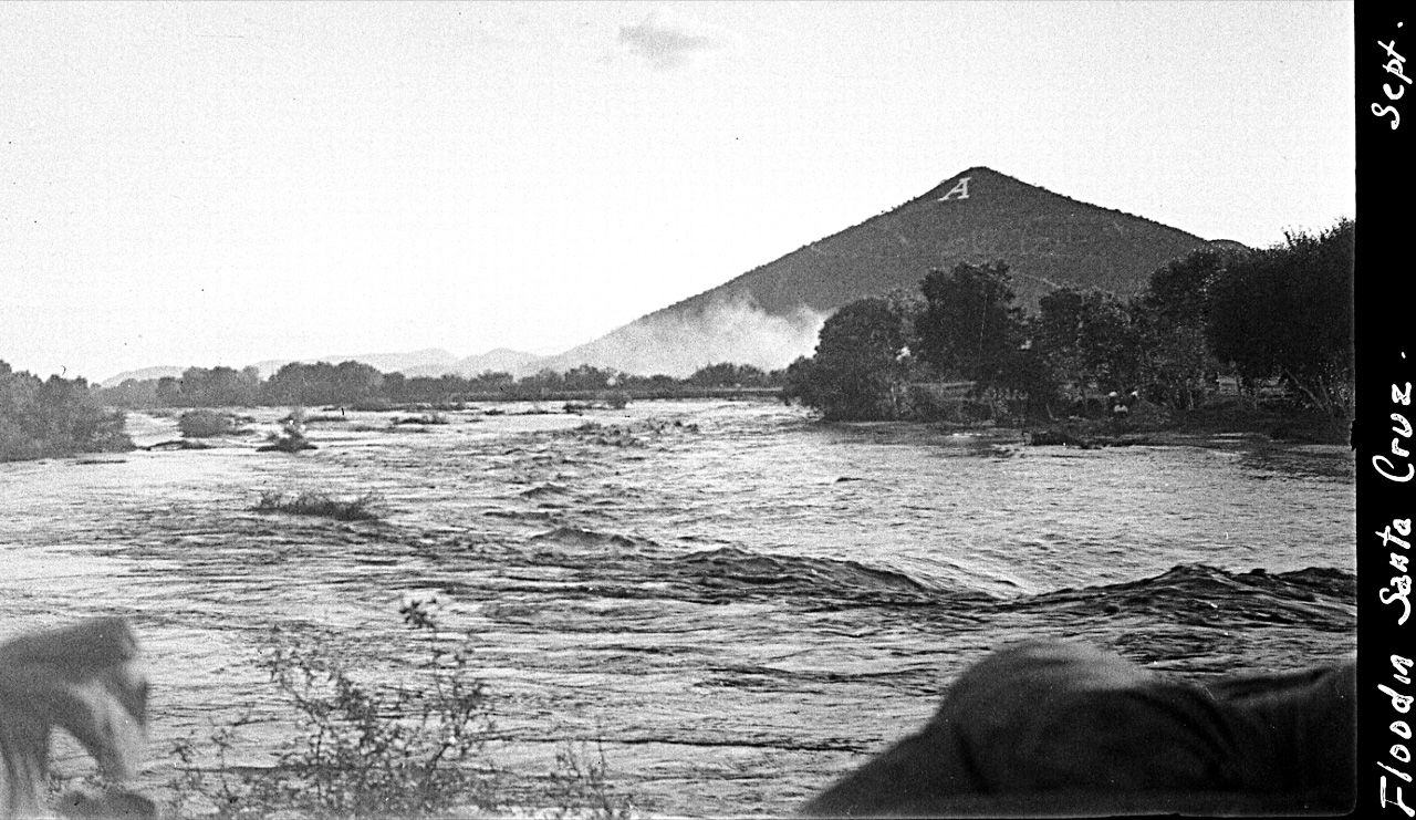
Flooding of the Santa Cruz River, Tucson, in September, 1926, from “Letters from Tucson, 1925-1927” by Ethel Stiffler.
Santa Cruz River
Updated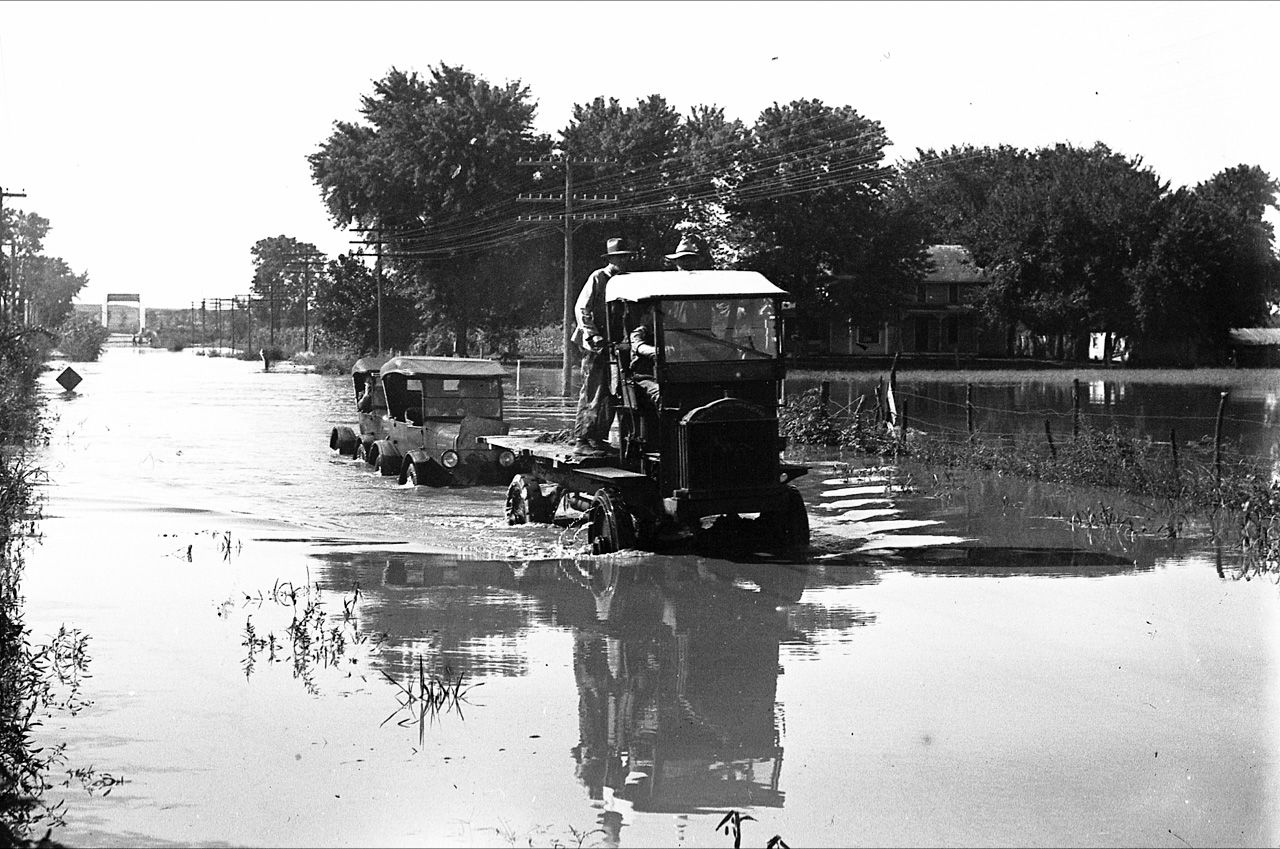
Flooding of the Santa Cruz River, Tucson, in September, 1926, from “Letters from Tucson, 1925-1927” by Ethel Stiffler.
Santa Cruz River in Tucson
Updated
Aerial view of the Santa Cruz River as it winds its way through Pima County north of Cortaro Road in 1953. The county was considering a bridge at several locations, but had to contend with the ever-changing course of the river.
Santa Cruz River in Tucson
Updated
The Tucson Citizen wrote in 1970, "The Santa Cruz River is a garbage dump" and "even marijuana grows in it." City leaders were pushing to upgrade and beautify the channel. The U.S. Army Corps of Engineers was studying the possibility.
Santa Cruz River in Tucson
Updated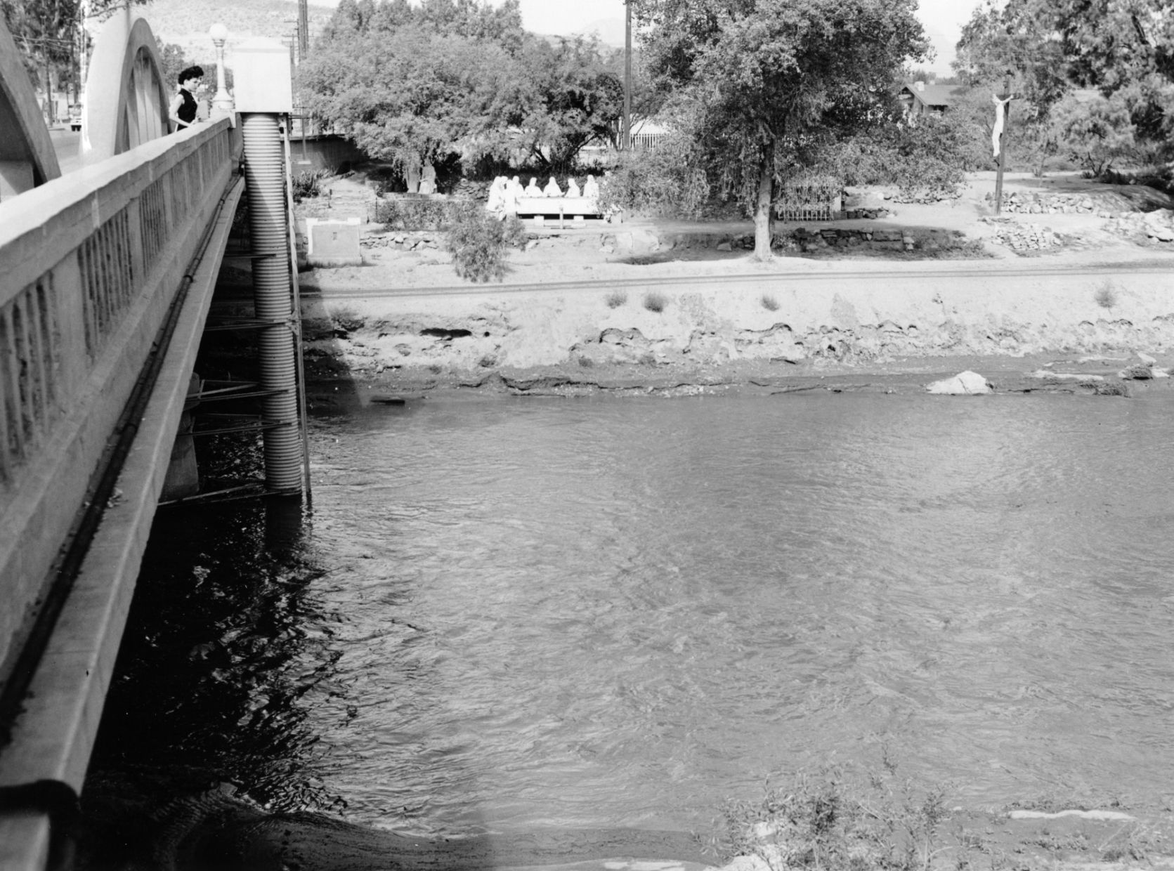
The Santa Cruz River flowing under the Congress Street bridge in August, 1952. The Garden of Gesthemane is in the background.
Santa Cruz River in Tucson
Updated
Drought in June, 1974, turned the Santa Cruz riverbed into crunchy chunks of dried mud.
Santa Cruz River in Tucson
Updated
The Santa Cruz River flowing under Silverlake Road in August, 1970.
Santa Cruz River in Tucson
Updated
Children play in the Santa Cruz River near Speedway Blvd in August, 1970.
Santa Cruz River in Tucson
Updated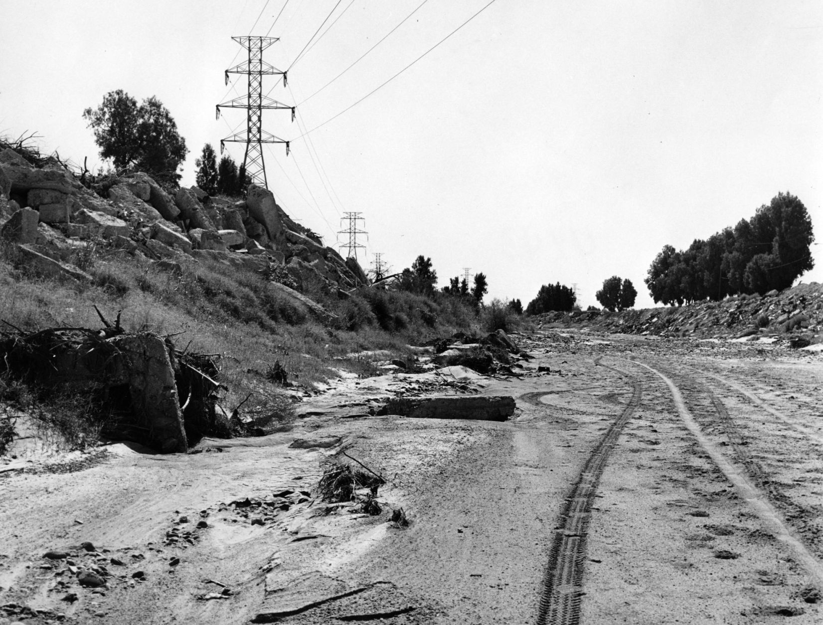
The Santa Cruz riverbed at Congress Street in November, 1967.
Santa Cruz River in Tucson
Updated
After years of waiting, crews began clearing debris and channeling the Santa Cruz River in November, 1977, and constructing what would become a 14-mile river park. The Speedway Blvd. bridge is in the background.
Santa Cruz River in Tucson
Updated
After years of waiting, crews began clearing debris and channeling the Santa Cruz River in November, 1977, and constructing what would become a 14-mile river park.
Santa Cruz River in Tucson
Updated
The Santa Cruz River looks peaceful flowing underneath Speedway Road after days of flooding in October, 1977.
Santa Cruz River in Tucson
Updated
Adalberto Ballesteros rides along the Santa Cruz River west of downtown Tucson in 1980.
Santa Cruz River
Updated
Junked cars and trash spill into the Santa Cruz River, looking south, just south of Grant Road in July, 1974.
Santa Cruz River in Tucson
Updated
Road graders scrape the Santa Cruz River channel between Speedway and Grant roads during bank stabilization construction in May, 1991.
Santa Cruz River
Updated
Flooding in Marana after the Santa Cruz River overflowed its banks in Oct. 1983.
Santa Cruz River
Updated
A bridge on the Santa Cruz River northwest of Tucson washed out during flooding in October 1983.
Santa Cruz River
Updated
Residents watch the surging Santa Cruz River rush past West St. Mary's Road on January 19, 1993.
Santa Cruz River
Updated
Tucson firefighters are standing by and waiting for two kids floating in the Santa Cruz River on some type of object during flooding in July, 1996.
Santa Cruz River
Updated
Runner, cyclists and motorists alike pass over and under the Silverlake Road bridge at the Santa Cruz River west of Interstate 10 on Sept. 7, 2017, in Tucson, Ariz.
Santa Cruz River
Updated
A cyclist bikes the Santa Cruz River Park path at the Silverlake Road bridge west of Interstate 10 on Sept. 7, 2017, in Tucson, Ariz.
Santa Cruz River
Updated
A makeshift memorial on the banks of the Santa Cruz River near Congress Street west of Interstate 10 on Sept. 7, 2017, at in Tucson, Ariz.
Santa Cruz River
Updated
The Santa Cruz River flows Friday morning July 23, 2021 after an overnight monsoon storm passed over in Tucson, Ariz.
Santa Cruz River
Updated
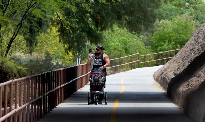
Andres Franco-Gomez walks with his 4 month old daughter Annilici‡ Franco-Gomez along the Santa Cruz River Walk near N. Cortaro Rd. in Marana, Ariz., April 15, 2021.
Santa Cruz River
Updated
Under the evening sun, a biker uses the paths along the Santa Cruz River Park on the first day of 90+ degree temperatures in the area, April 23, 2020, Tucson, Ariz.
Santa Cruz River
Updated
A crowd of people stand at an area where reclaimed water starts to fill the Santa Cruz River at 29th Street as part of the Santa Cruz River Heritage Project on June 24, 2019. The release of effluent is the cityÕs first effort to restore a fraction of the river's flow since groundwater pumping dried it up in the 1940s.
Santa Cruz River
Updated
A westbound street car cruises over the Cushing St. Bridge and a wide pool of the reclaimed water in the river channel as part of the Santa Cruz River Heritage Project, Tuesday, June 25, 2019, Tucson, Ariz.
Santa Cruz River
Updated
Amy Novelli tries to coax her horse over a water feature where reclaimed water flows in the Santa Cruz River, on June 26, 2020.
Santa Cruz River
Updated
Monsoon clouds are reflected in the effluent discharge water from the Agua Nueva and Tres Rios wastewater treatment plants running in the Santa Cruz River at Ina Rd. In Marana on July 5, 2022.
Santa Cruz River
Updated
A Great Blue Heron wades through the treated effluent water running in the Santa Cruz River at Ina Rd. Herons are just one of the species that have returned to the area.
Santa Cruz River
Updated
Cottonwood Shoots sprout up from the ground of a channel leading to the Santa Cruz River on the Tohono O'odham Nation on Sept. 18, 2019. After receiving CAP water the channel has started seeing the effects of the water table being pushed to the surface, creating a half-mile or so if not longer of lush, riparian and even marshy environment including cottonwood shoots and willows.
Santa Cruz River
Updated
Water in a channel leading to the Santa Cruz River on the Tohono O'odham Nation Wednesday, Sept. 18, 2019.
Santa Cruz River
Updated
A a caterpillar on a small stick protruding from out of a shallow bit of water in a channel leading to the Santa Cruz River on the Tohono O'odham Nation on Sept. 18, 2019.
Santa Cruz River
Updated
A sunflower grows in a channel leading to the Santa Cruz River on the Tohono O'odham Nation on Sept. 18, 2019.
Santa Cruz River
Updated
Caterpillar Inc. employee Urvashi Dosha reaches into brush to grab debris out of the Santa Cruz Riverbed during a cleanup event between Congress and Cushing Streets, on Oct. 23, 2020. About 30 people took part in the pickup organized by Caterpillar Inc. in partnership with Tucson Clean and Beautiful and the Sonoran Institute.
Santa Cruz River
Updated
Tucson Water discharges water treated at the Tucson Airport Remediation Project treatment plant into the Santa Cruz River north of Irvington Road, as shown in this photo from Nov. 5, 2021.
Santa Cruz River
Updated
Water flows in the Santa Cruz River near the Crossroads at Silverbell District Park, in Marana, Ariz. on November 18, 2020.
Santa Cruz River
Updated
Water flows in the Santa Cruz River south of downtown Tucson, Ariz. on November 16, 2020.
Santa Cruz River
Updated
A Vermillion flycatcher rests on a branch along the Santa Cruz River south of downtown Tucson, Ariz. on November 16, 2020. The addition of water to the Santa Cruz River has brough back wildlife to the area.
Santa Cruz River
Updated
Water flows in the Santa Cruz River south of downtown Tucson, Ariz. on November 16, 2020.
Santa Cruz River
Updated
Water flows in the Santa Cruz River south of downtown Tucson, Ariz. on November 16, 2020. The addition of water to the Santa Cruz River has brought wildlife back to the area.
Santa Cruz River
Updated
Construction crews work to remove access sediment and invasive vegetation from the Santa Cruz River at Silverbell Tree Drive loop in Tucson, Ariz. on February 3, 2020. Crews removed approximately 140,000 cubic yards of sediment from the Santa Cruz River channel.

