


A group of volunteers is creating a nonprofit to recruit, coordinate and possibly help fund trail restoration efforts in the Santa Catalina Mountains north of Tucson.
Friends of the Santa Catalina Trails hope to help the Forest Service implement a comprehensive plan to manage, re-purpose and possibly extend a 250-mile trail system.
“The Forest Service has not had funds for a regular trail crew in decades,” said Piers Ingram, a Friends board member.
By contrast, neighboring Saguaro National Park has a seasonal trail crew of 25-26 people.
Ingram said the Forest Service depends on “sporadic grants, service days by organizations and the work of individual volunteers. Getting more help from the community is central to the plan.”
Many parts of the Catalinas trails system, originally designed and maintained for access on horseback (stock), now has steep drop offs instead of mellow switchbacks, overgrowth of Mexican locust and other post-fire vegetation, along with dangerous eroded sections.
The 2003 Aspen Fire impacted the trail following the rugged ridgeline from Pima Canyon to Mount Lemmon as well as trails on the mountain. The Bighorn Fire, which burned almost 120,000 acres in the summer of 2020, damaged more than 200 miles of trails which were temporarily closed by the Forest Service.

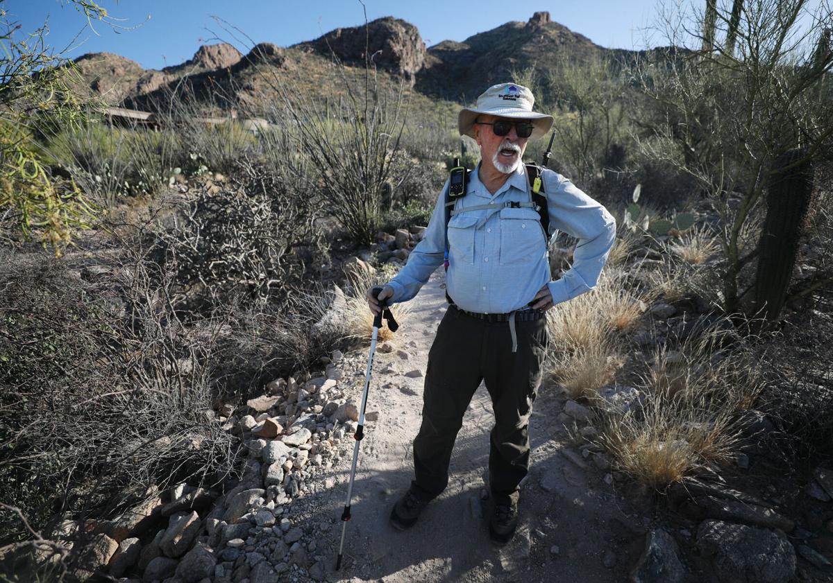
Tim Hawthorne hikes along the Pima Canyon Trail in Tucson. Hawthorne says he hikes the trail three times a week.
Many trails have been reopened, but two years later, some trails on the northwest end of the mountains are damaged beyond reasonable repair without major trail reconstruction.
Heavily used front range trails also have dangerous sections.
Board member Mark Flint said a hiker fell just above Pima Springs in Pima Canyon last year, broke her leg and had to be med-evacuated out of the canyon. The upper trail section is closed by the Forest Service because of hazardous slopes “and because people get lost.”
On a recent hike up Pima Canyon, Flint pointed out work done by the group. On a steep climb before the trail descends into the canyon, volunteers have removed major rocks and built walkways around steep drop-offs. Flint has built “pans,” trenches that remove run-off to prevent the trail from washing out when it rains.
Flint, a trail design contractor and former trail designer for Pima County, volunteers time to work on Pima and Finger Rock Trail.
He hopes to design a “Friends” portal like one used by the Arizona Trail Association where people can sign up for given trail projects.
Flint added, “Every time we are out here working, we get asked by hikers, ‘how can I help?’” He said he refers volunteers to Gregg Sasek, Santa Catalina Ranger District dispersed recreation manager. But Sasek is often in the field “and in no position to coordinate massive volunteer efforts.”
Front range trails are heavily used, especially from winter through spring by locals and snowbirds, Ingram said. A counter installed by Pima County on the Coronado National Forest-county border, about half a mile up Pima Canyon Trail, recorded 8,000 visits for one month — nearly 270 hikers a day.

A counter installed by Pima County about a half-mile up Pima Canyon Trail recorded 8,000 visits for one month — nearly 270 hikers a day.
What is the Forest Service’s reaction to the offer? Charles Woodard, District Ranger, said the “Friends” proposal is in its infancy. He said he will have an official reaction once the group has met with the Forest Service to discuss how they best can work together to serve the public.
Thus far, the group has a five-member board of directors — all who work on trails to aid the underfunded and understaffed Santa Catalina Ranger District, which administers lands in the Catalinas. They are writing bylaws and articles of incorporation, Ingram said.
Room to grow
The Coronado National Forest, parent to the ranger district, recently released a Public Engagement Report based on feedback and comments on the Catalinas trail system. From November 2021 to April 2022 an interactive “story map” allowed citizens to give feedback on specific areas. The project elicited 861 comments and engaged 73 organizations.
The most frequent comment was a call for more trails (39%) while others wanted more connecting trails (23%), loop trails (14%), beginner trails (10%) a bike park (7%) and more downhill trails (6%). The largest number of comments came from mountain bikers. With increasing recreation uses, “the public wants us to grow the system but is concerned about our ability to maintain it,” said Adam Milnor, Coronado recreation staff officer who has led the trails planning effort.
Some commenters suggested the Forest Service adopt other trails not in the system such as Milagrosa Canyon, a mountain bike trail in the Redington Pass area that begins in a private neighborhood. Another concern is the 50-Year Trail, which originates in Catalina State Park (and other access points on state lands), and crosses state trust and private lands with 20 miles on national forest. No one public entity controls the trail, and access could easily by blocked by new private development.
The Forest Service is also evaluating specific needs like trailhead parking on the Mount Lemmon highway, connections between trails and options for more beginner trails — for mountain bikers and hikers — on top of Mount Lemmon or other flatter spots. Most of the Catalinas are very steep.
The Forest Service secured a $100,000 grant from the National Forest Foundation to rebuild the damaged Romero Canyon Trail from the pools to Romero Pass, Milnor said. Anther $250,000 in post-fire recovery funds will help restore damaged trails in Pusch Ridge Wilderness.

Looking into Pima Canyon from the trail north of Tucson.
Trail priorities include Cathedral Rock/crest Trail, upper Finger Rock and upper Pima Canyon and the upper end of Esperero Trail (which links Sabino Canyon to Cathedral Rock Trail.) Milnor said some closures on upper trails will be lifted once trails are safe to use. The Santa Catalina Ranger District also hired two seasonal trail people, the first time in 15 years, Milnor said. He said the Outdoor Recreation Act of 2021 and more post-fire money will also help fund trail work.
Volunteers provide an estimated $3.2 million of work a year forest-wide and work together well, Milnor said. He said “Friends” members have worked on Catalina trails for years. Observing the booming recreation demand, he said, “they are willing to step up and do more.”
A possible model for Friends of the Santa Catalina Trails could be Friends of Sabino Canyon, a nonprofit established in 1993 to focus on Sabino Canyon recreation and public education. It has raised more than a $1 million to fund trail maintenance and repairs, facilities enhancements, water wells, interpretive exhibits, restoration, educational activities, and invasive species management, according to its website, sabinocanyon.org.
To learn more about the Friends of Santa Catalina Trails, email Mark Flint at markflint@dakotacom.net.
Photos: Pima Canyon trail in the Santa Catalina Mountains
Pima Canyon Trail
Updated
Patrick Knoth, of Green Vally, enjoys the hike along the Pima Canyon Trail on March 13, 2018, in Tucson, Ariz. The trailhead is at 1610 E. Magee Road.
Pima Canyon Trail
Updated
Views along the Pima Canyon Trail on March 13, 2018, in Tucson, Ariz. The trailhead is at 1610 E. Magee Road.
Pima Canyon Trail
Updated
A marker for the Pima Canyon Trail on March 13, 2018, in Tucson, Ariz. The trailhead is at 1610 E. Magee Road.
Pima Canyon Trail
Updated
A stoic saguaro cactus along the Pima Canyon Trail on March 13, 2018, in Tucson, Ariz. The trailhead is at 1610 E. Magee Road.
Pima Canyon Trail
Updated
Hikers created this rock cairn along the Pima Canyon Trail on March 13, 2018, in Tucson, Ariz. The trailhead is at 1610 E. Magee Road.
Pima Canyon Trail
Updated
Views along the Pima Canyon Trail on March 13, 2018, in Tucson, Ariz. The trailhead is at 1610 E. Magee Road.
Pima Canyon Trail
Updated
Views along the Pima Canyon Trail on March 13, 2018, in Tucson, Ariz. The trailhead is at 1610 E. Magee Road.
Pima Canyon Trail
Updated
Views from the Pima Canyon Trail looking southwest on March 13, 2018, in Tucson, Ariz. The trailhead is at 1610 E. Magee Road.
Pima Canyon Trail
Updated
Views along the Pima Canyon Trail looking south on March 13, 2018, in Tucson, Ariz. The trailhead is at 1610 E. Magee Road.
Pima Canyon Trail
Updated
Stacks of saguaros along the Pima Canyon Trail on March 13, 2018, in Tucson, Ariz. The trailhead is at 1610 E. Magee Road.
Pima Canyon Trail
Updated
The Tucson Mormon Temple as viewed from the Pima Canyon Trail on March 13, 2018, in Tucson, Ariz. The trailhead is at 1610 E. Magee Road.
Pima Canyon Trail in Santa Catalina Mountains
Updated
Pima Canyon Trail in 2012.
Pima Canyon Trail in Santa Catalina Mountains
Updated
One of the nearly completed luxury homes that caught fire and burned late Monday night in an aerial photo Tuesday, June 12th, 2001 burned to the foundation. Four homes in Pima Canyon Estates were set ablaze. Damage was at least $2 million. The initials CSP, which stand for Coalition to Save the Preserves, were found painted at the fire scenes and similar fires in the Phoenix area from 1998-2001..
Pima Canyon Trail in Santa Catalina Mountains
Updated
These two under-construction luxury homes that were set afire are near the Pima Canyon trailhead on June 11, 2001. Four homes in Pima Canyon Estates were set ablaze. Damage was at least $2 million. The initials CSP, which stand for Coalition to Save the Preserves, were found painted at the fire scenes and similar fires in the Phoenix area from 1998-2001..
Pima Canyon Trail in Santa Catalina Mountains
Updated
The Catalina Mountains provide a backdrop for the foothills where up to five luxury homes caught fire and burned late on June 11, 2001. Four homes in Pima Canyon Estates were set ablaze. Damage was at least $2 million. The initials CSP, which stand for Coalition to Save the Preserves, were found painted at the fire scenes and similar fires in the Phoenix area from 1998-2001..
Pima Canyon Trail in Santa Catalina Mountains
Updated
Light snow tops the Santa Catalina Mountains near the Pima Canyon trailhead in February, 2012.
Pima Canyon Trail in Santa Catalina Mountains
Updated
Snow blankets the upper reaches of Pima Canyon in the Santa Catalina Mountains. Photo taken from Village Ave. near Magee Road on Saturday, Jan. 23, 2010.
Pima Canyon Trail in Santa Catalina Mountains
Updated
As Jack Hanna releases the hatch at right, three of the 14 bighorn sheep dart into the desert as they're released into the Santa Catalina mountains on Thursday, Nov. 20, 2014, near Pima Canyon in Tucson, Ariz. Three rams and 11 ewes were released just after dawn.
Pima Canyon
Updated
The Bighorn Fire consumes thick vegetation in crags above Pima Canyon within the Santa Catalina Mountains in Coronado National Forest north of Tucson on June 9, 2020.
Pima Canyon Trail
Updated
A sign at the entrance to the Pima Canyon Trail warns hikers of dangers after the Bighorn Fire damages hiking areas on September 30, 2020.
Pima Canyon Trail
Updated
Clouds clearing above Pima Canyon in the Santa Catalina Mountains reveal snow on March 13, 2021.

