


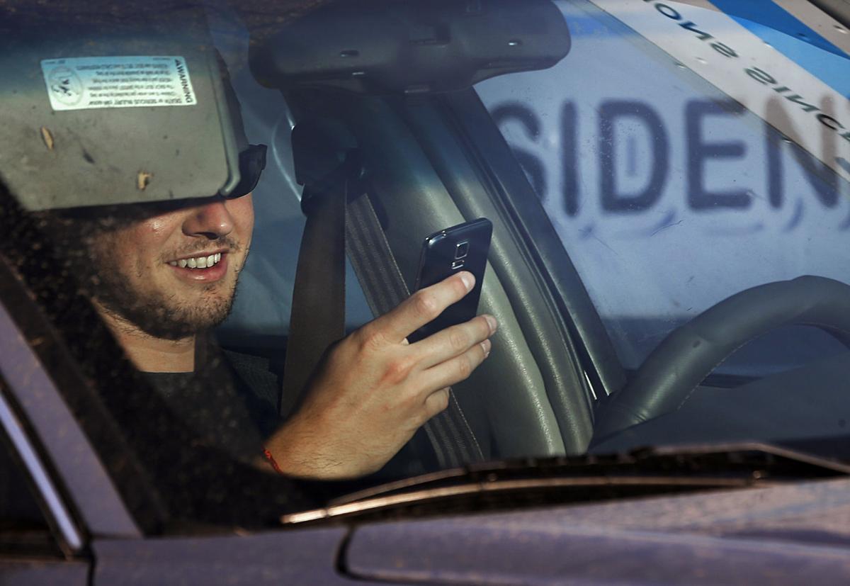
PHOENIX — A 2019 state law about driving while texting becomes real in a few days.
It technically has been illegal since April 2019 for drivers in Arizona to use a hand-held cell phone.
But until now, the law allowed police to issue only a warning, though some communities, including Tucson, have had their own bans. All that changes Friday when the state law gets real teeth.
How real?
A first-time offense would result in a fine of up to $149, though it could be no less than $75. Subsequent violations could lead to fines up to $250.
Local laws will be repealed when the state law takes effect.
The statewide ban almost did not happen.
Many Republicans favored a different measure that was aimed at distracted driving.
Proponents of that version argued that the problem with simply focusing on texting and cell phone use is that it fails to address other things that people do.
“I’ve seen people going down the road brushing their teeth, which I don’t really understand,” Rep. Travis Grantham, R-Gilbert, argued during the 2019 debate.
“There’s people eating burritos who are swerving because they’re trying to put sauce on their food,” Grantham said. “Anything can cause a distraction.”
Mo was found wandering the streets of Phoenix alone, and now gets plenty of love from his owners - despite his 'barking.'
But that version contained what some advocates of a hard ban on texting while driving considered a poison pill: Police could stop and cite a motorist only if the vehicle was being driven “in a manner that is an immediate hazard to person or property” or the driver does not “exercise reasonable control” to avoid hitting someone or something.
This law, however, says an officer is free to stop someone who is seen operating a vehicle while holding an electronic device, regardless of how well — or poorly — that person is driving.
Rep. Noel Campbell, R-Prescott, one of the champions of that version, told colleagues the strict enforcement is appropriate — and long overdue.
“We are only one of three states in the entire nation that does not ban text messaging and driving even though we know the frightening statistics,” he said.
Grantham, however, argued the language is overly broad. He pointed out that, as approved, it does more than make it illegal for a motorist to have a cell phone in hand. It would also be a violation if someone “supports (a cell phone) with any part of the person’s body” unless the motorist is also using a hands-free device.
“That could be sitting in your lap,” he said. “That’s way too restrictive.”
House Majority Leader Warren Petersen, R-Gilbert, said it would be one thing if the legislation was limited to things like texting or checking social media. But he said there’s nothing inherently dangerous with talking on a cell phone, even without a hands-free device.
“There have been people who have driven their whole lives holding their phone up, talking on their phone, that have not had an accident, myself included,” he said. “We’re going to make an awful lot of people lawbreakers with this bill.”
That argument that some people can talk and drive did not impress Rep. Randy Friese, D-Tucson.
“That doesn’t mean it’s safe,” he said.
But Rep. David Cook, R-Globe, said HB 2318 actually can lead to less safety.
He pointed out that people get Amber alerts about missing children, and silver alerts on missing seniors, on their cell phones, information that includes a description of the vehicle being sought.
“That life is just as important,” Cook said, with this law barring people from checking out these messages while driving.
The final House vote on the matter occurred with family members of those killed by texting motorists watching in the gallery. House Minority Leader Charlene Fernandez, D-Yuma, specifically addressed the survivors of Clayton Townsend, an officer with the Salt River Police Department who was killed in January 2019 when he was struck by a texting motorist while conducting a traffic stop.
“We’re going to get it done today,” she told them.
“I understand the pain of what happened, of losing these officers,” said Rep. Anthony Kern, R-Glendale. But he voted against the measure, saying “it goes a little bit too far.”
Gov. Doug Ducey, in signing the legislation, gave credit to Toni Townsend, Clayton’s mother.
“I think everyone just saw this as such an avoidable death,” the governor said. “And when somebody comes down (to the Legislature) and speaks with the power and passion of a mom on behalf of her fallen son, how could they not deliver this to the governor’s desk?”
Toni Townsend said she and the family actually celebrated approval of the bill the day before Ducey’s signing ceremony, on Easter Sunday, with the family going to the cemetery and sharing pictures.
“So it’s been a joyous couple of days,” she said, even if it came “out of some horrible tragedy.”
“No good can ever come from that,” Townsend said. “But we can have a positive, and we can at least have a legacy for Clayton.”
Among those who were unaware of — or ignored — the hazards was the governor himself.
Ducey, who is now driven almost all the time by his security detail, confessed to his own practices before he took office in 2015.
“I’m sorry to say that I did,” he said, though it never resulted in an accident. Still, the governor said, that’s not the point.
“Now I know it’s not about being good about working your phone and driving, it’s that you shouldn’t be on your phone while driving,” Ducey said. “So my behavior will change as well.”
A look back at Tucson streets:
Photos: A look back at Tucson-area streets
Broadway Road, Williams Addition, 1958
Recently paved and improved Broadway Road in Tucson looking east to Craycroft Road (just beyond the Union 76 gas station at left), where the Broadway pavement ended in 1958. At right, is the natural desert of the Williams Addition, an innovative 160-acre development with only 22 homes on large lots. Developer Lew McGinnis bought all but two of the homes by 1980. It is now Williams Centre.
Interstate 10, 1960
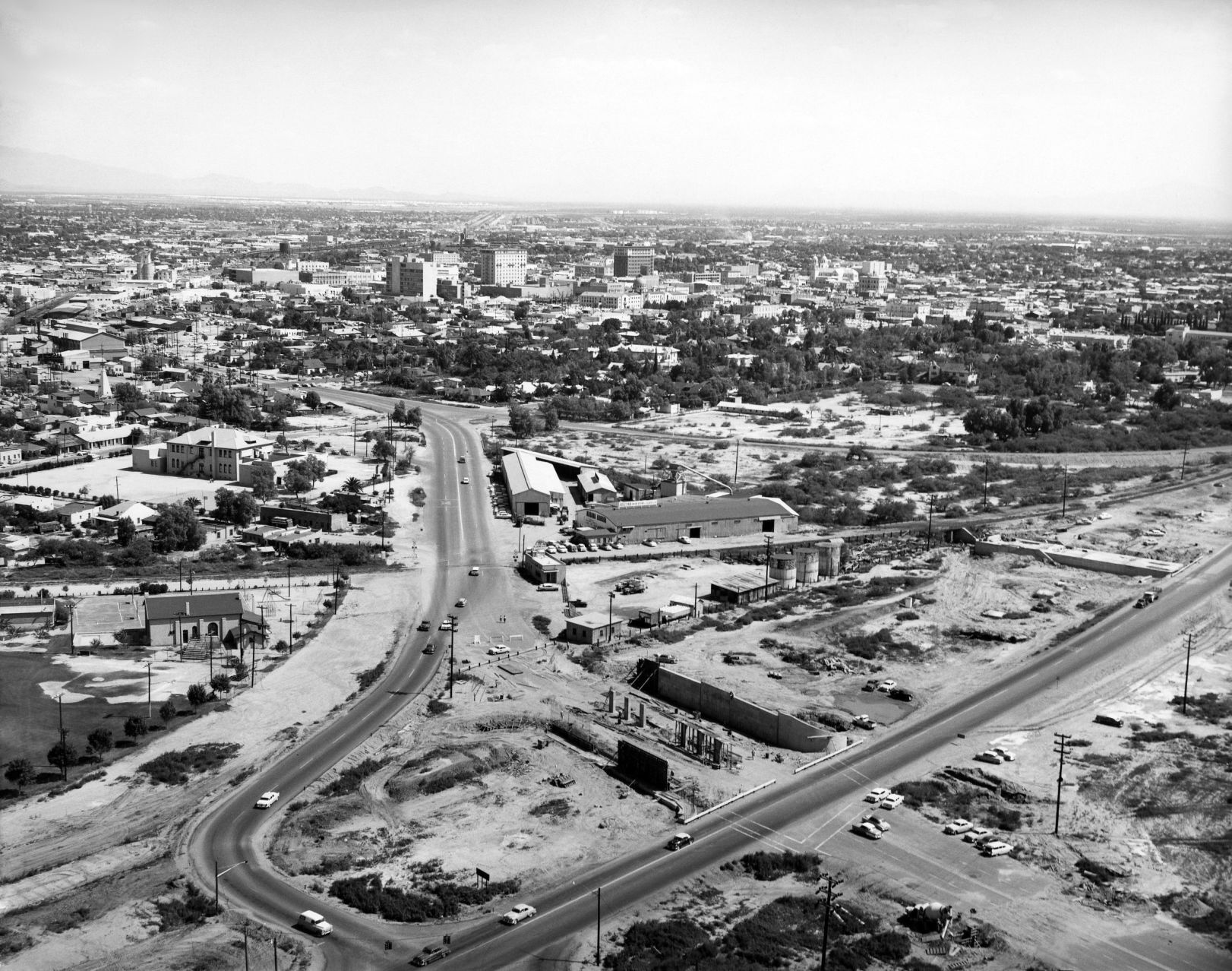
Interstate 10 under construction at St Mary's Road in Tucson, ca. 1960.
Cherry Avenue, 1972

Arizona Stadium is off in the distance looking south along North Cherry Avenue on February 9, 1972. At the time the UA was proposing an addition to its football stadium adding another 10,600 seats to the east side of the structure that would involve permanently closing Cherry Avenue. It was also considering a 3,600-unit parking lot, all of which could cost around $11 million.
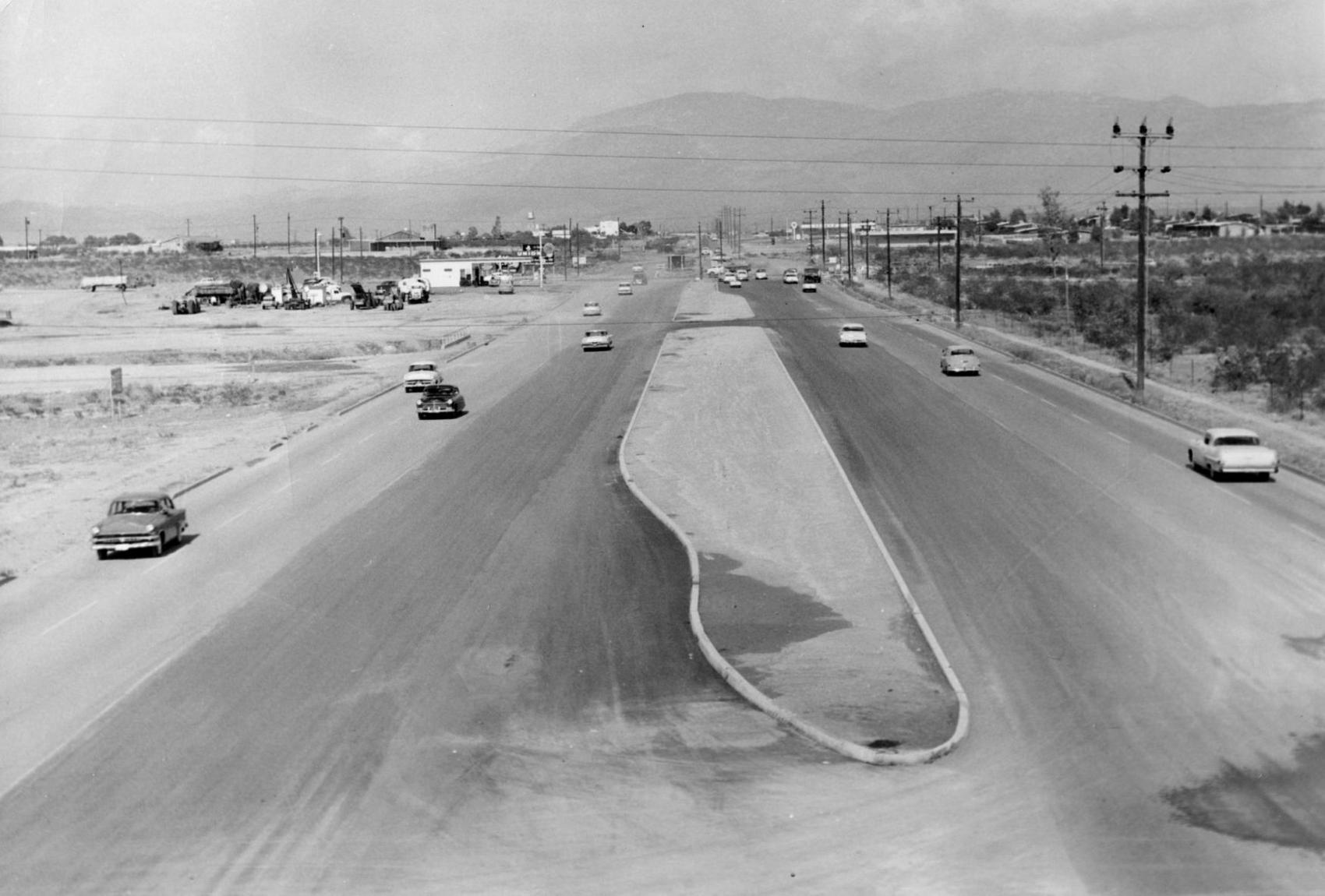
Speedway Blvd., 1950

Speedway Blvd. looking east from County Club Road, Tucson, in 1950. The controversial "hump" down the middle of the road separated opposing lanes of traffic. It was removed in 1957.
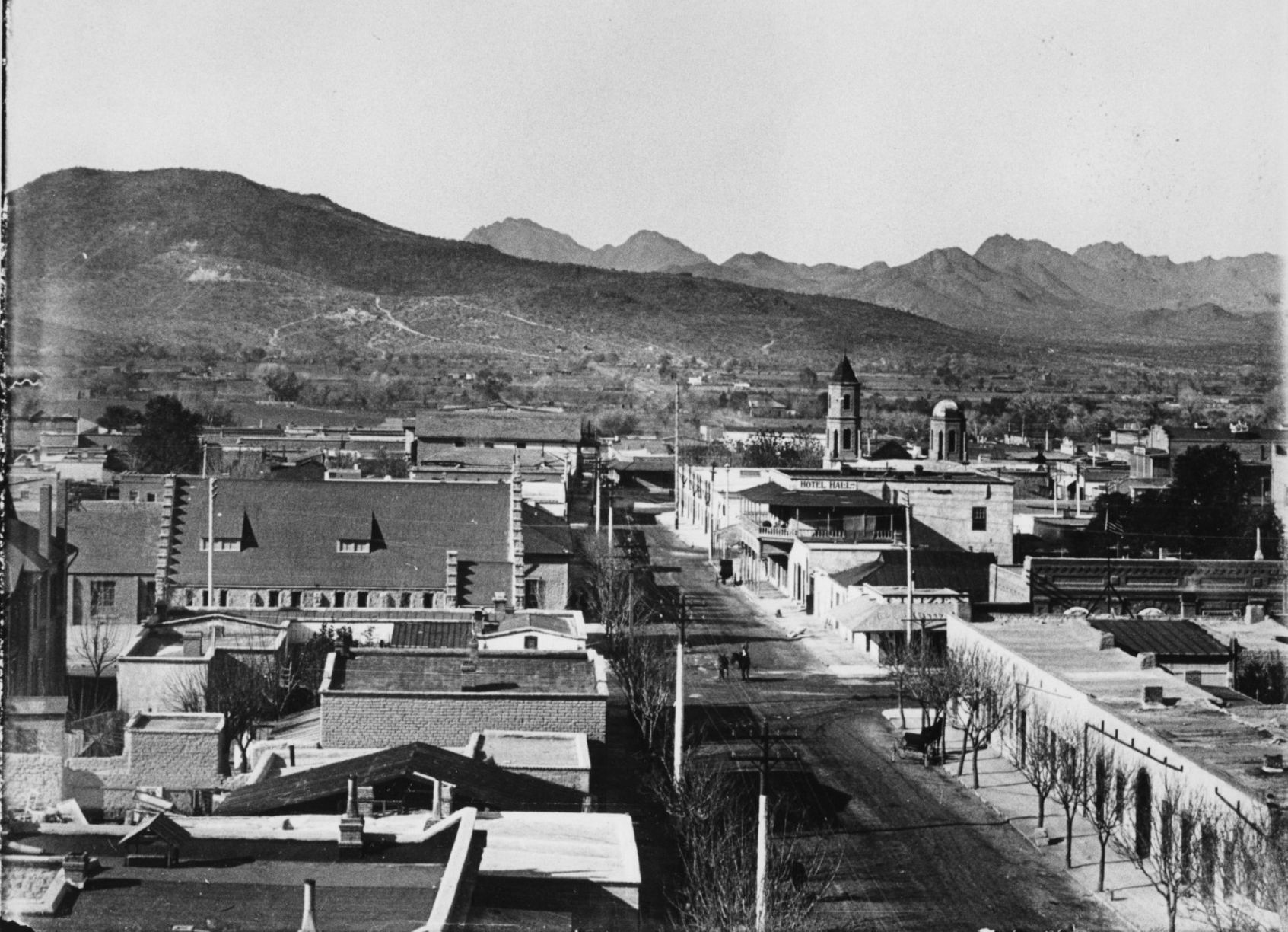
Court Street, 1900

Court Street in Tucson, c. 1900. City Hall is on the left (with flagpole) and San Augustin church is the peaked roof in distance at the end of the street. The building in the left foreground was used for the first mixed school taught by Miss Wakefield( later Mrs. Fish) and Miss Bolton.
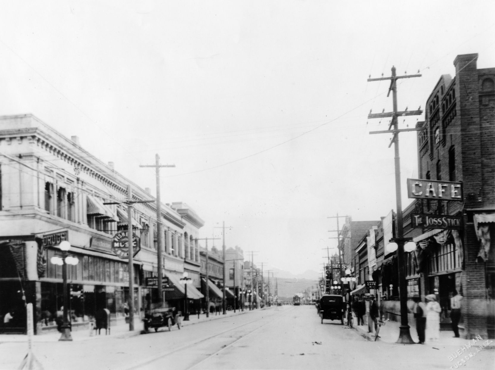
Congress Street, 1933
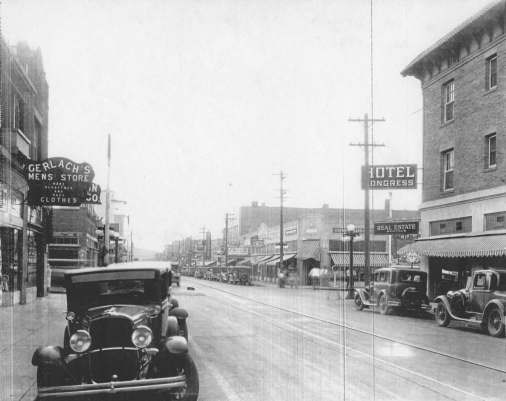
Congress Street, looking west from 4th Avenue, Tucson, ca. 1933. Hotel Congress is at left. Today, Caffe Luce and One North Fifth Lofts have replaced the shops just beyond the Hotel Congress sign on the corner of 5th Ave. and Congress.
Broadway Road, 1900s
Undated photo looking west on Broadway Road from the Santa Rita Hotel in Tucson. The cross street with man on horseback is Stone Ave. Photo likely from the early 1900s, since the Santa Rita was finished in 1904.
Congress St., 1920
Congress Street in Tucson, looking west from 6th Avenue in 1920.
Park Avenue, 1952
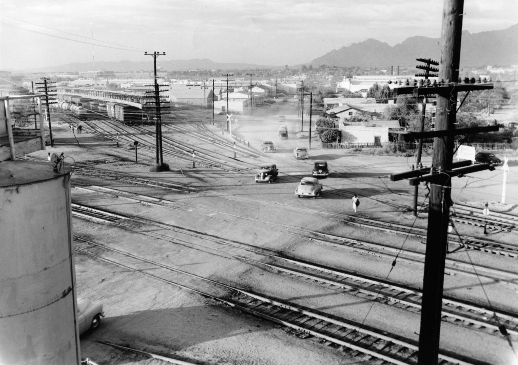
Definitely not a safe place to walk: Park Avenue at the Southern Pacific RR tracks in 1952, looking north into the Lost Barrio in Tucson. Park now crosses under the railroad tracks and links with Euclid Ave.
Electric street cars
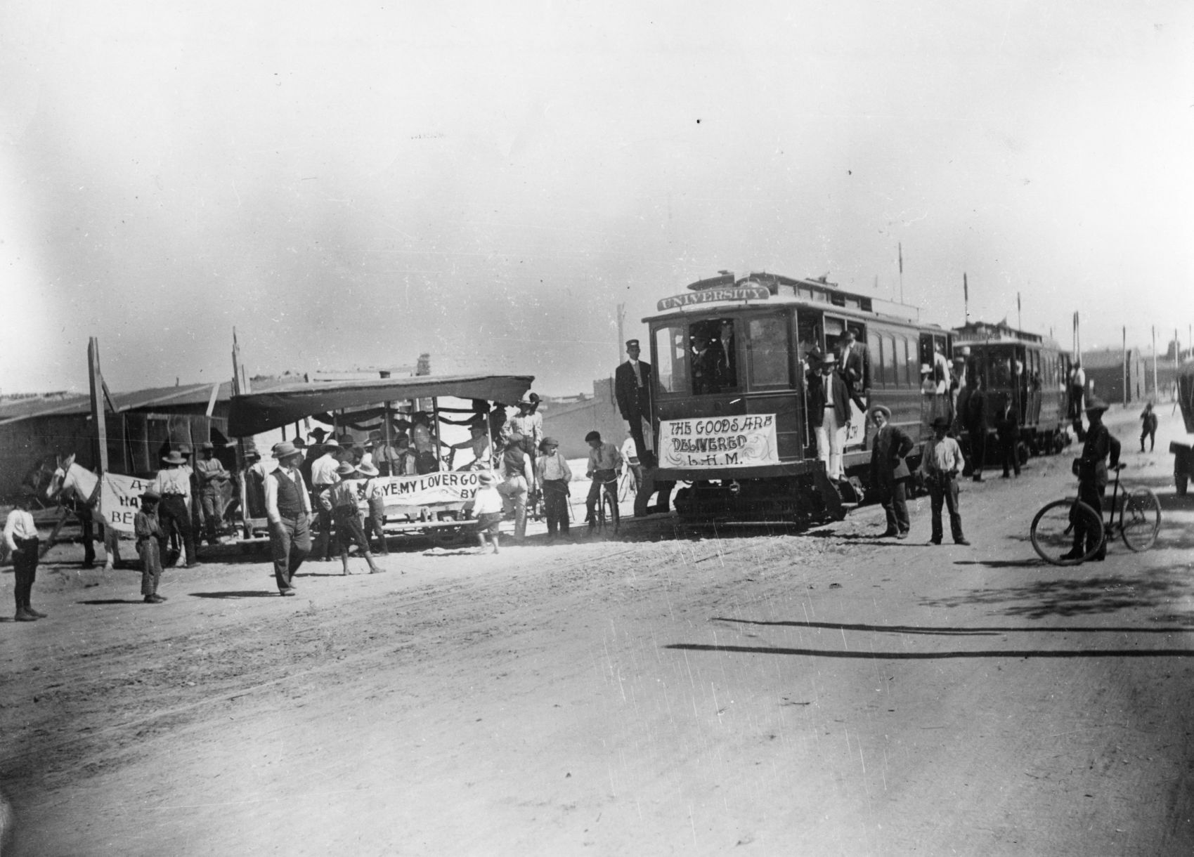
Electric street cars replaced horse-drawn street cars in Tucson, 1906.
Toole Ave., 1958
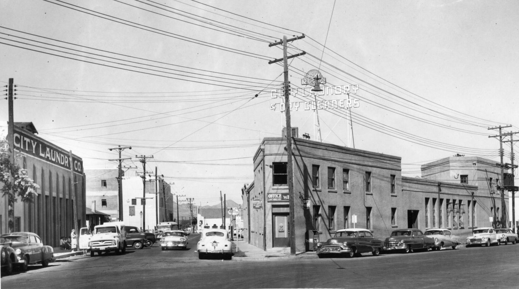
City Laundry Co. of Tucson occupied the historic building at right, at 79 E. Toole Ave., since 1915. Prior to 1915, it was a brewery. It was one the oldest buildings in downtown Tucson. The building at left fronting Council Street was built by City Laundry in 1928 and ultimately became the main plant. Both buildings were demolished in 1958 to make way for a parking lot.
Stone Ave., 1971
Updated
The lights of businesses on Stone Avenue in downtown Tucson, looking south from Ventura Street in July, 1971.
22nd Street, 1962

Traffic tie-ups like this one in June, 1962, happened several times a day on 22nd Street at the Southern Pacific Railroad tracks in Tucson. Most of the motorists in this picture had to wait 10 minutes for the two-train switching operation. An overpass solved the problem in 1965.
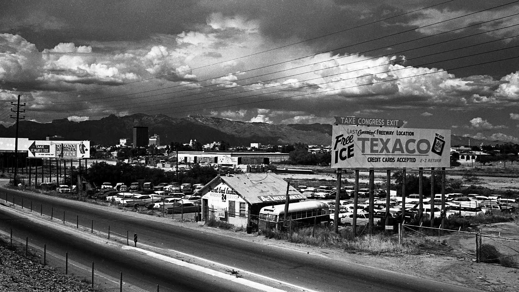
Benson Highway, 1972
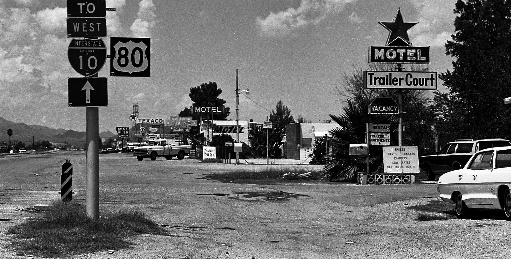
This stretch of the Benson highway near South Palo Verde Road was bypassed after Interstate 10 was opened in 1969. It was just another string of businesses along the road that struggled to survive on August 14, 1972. The four-mile stretch was once a vital thoroughfare before the interstate system was created.
Church Ave, 1966

Greyhound bus depot, left, was located on the northwest corner of Broadway Boulevard and Church Avenue around February 1966.
Campbell Ave., 1960

Gridlocked traffic on Glenn Street, east of Campbell Avenue as thousands of people attended the opening of the new $2 million Campbell Plaza Shopping Center on April 7, 1960. Originally, the parking facilities was designed to handle 850 vehicles but it was overflowing for the event. The plaza is situated on 18 acres and has 18 tenants.
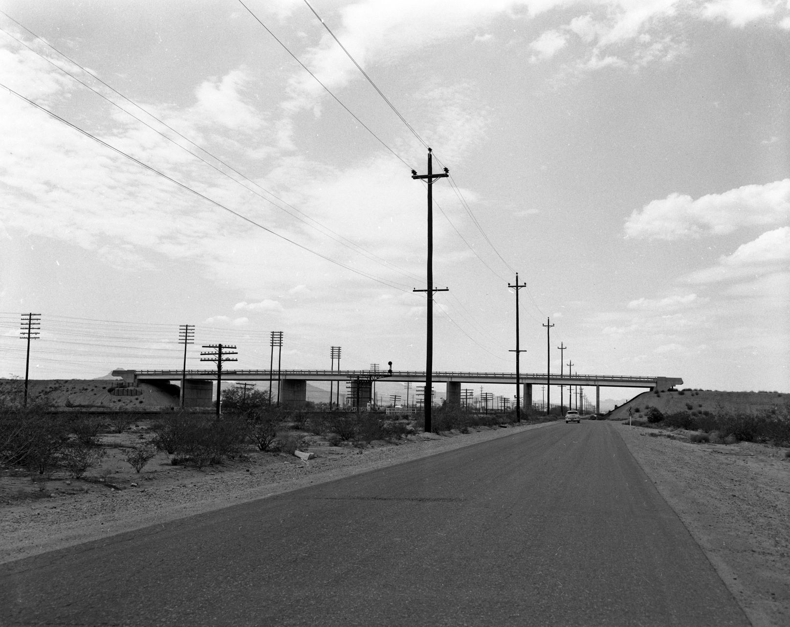
Interstate 19, 1964

Looking south on the Nogales Interstate Highway (now I-19) at the Ajo Way overpass on July 20, 1964.
Meyer Avenue, 1966

Street scene of South Meyer Avenue looking south from West Congress Street on June 26, 1966. All the buildings were demolished as part of the city's urban renewal project in the 1960s and 70s.
Cortaro Road, 1978

Cortaro General Store on the northwest corner of Cortaro Road and I-10 in December, 1978.
Congress St., 1967

A man crosses East Congress Street at Arizona Avenue as this portion up to Fifth Avenue was falling on hard times with only one small shop still in business on May 3, 1967.
Stone Avenue, 1955
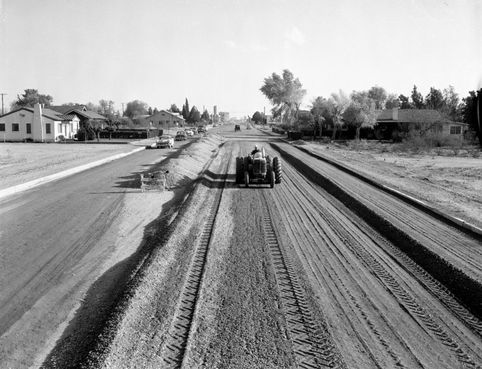
The Stone Avenue widening project between Drachman and Lester streets in April, 1955. A Pioneer Constructors pneumatic roller is used to compact the gravel base for an 80-foot roadway. The four-block project cost $37,500.
US 84A in Tucson, 1954

Westbound SR84A (now I-10) at Congress Street in 1954. In 1948, the Arizona State Highway Department approved the Tucson Controlled Access Highway, a bypass around downtown Tucson. It was named State Route 84A, and connected Benson Highway (US 80) with the Casa Grande Highway (US 84). By 1961, it was reconstructed as Interstate 10.
Grant Road, 1962
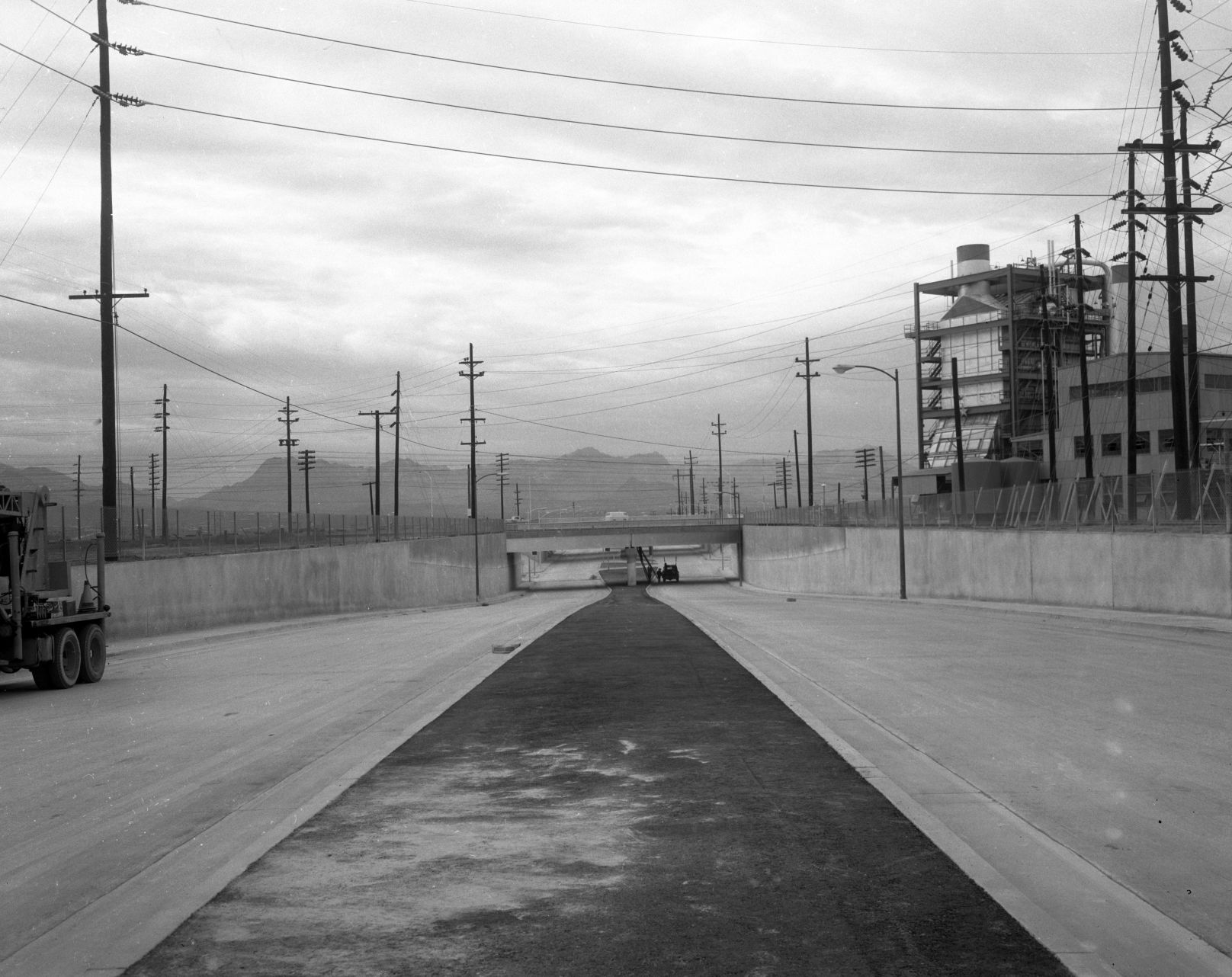
The new Grant Road underpass at the Southern Pacific RR in December, 1962, as seen looking west on Grant Road east of the tracks and Interstate 10. The Tucson Gas and Electric generating station (no longer there) is at right.
Grant Road, 1966

Grant Road, looking west at Campbell Ave. in 1966.
Old Nogales Highway, 1966
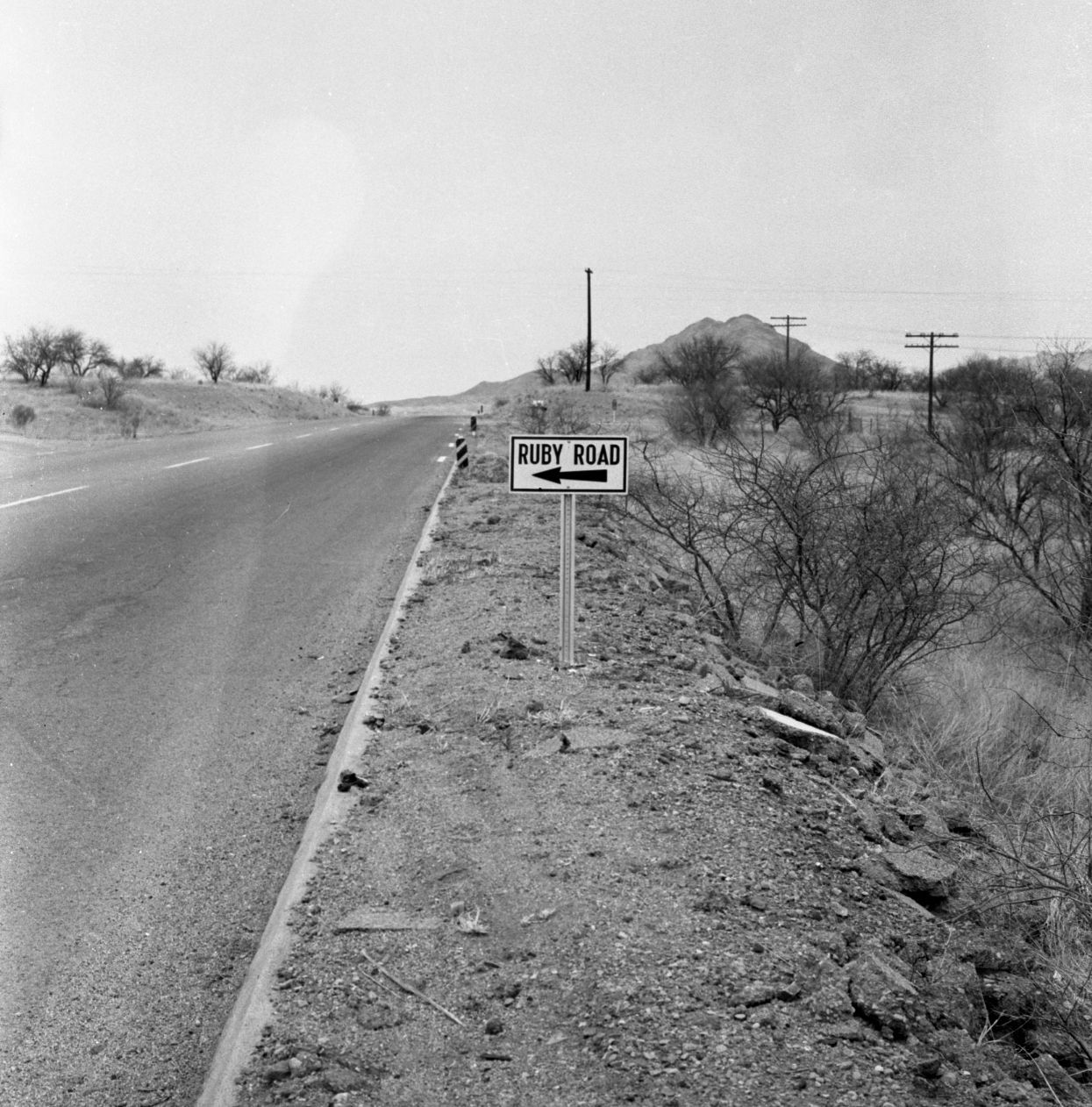
Old Nogales Highway near Ruby Road in July, 1956.
Oracle Road, 1925

This is a 1925 photo of the All Auto Camp on 2650 N Oracle Rd at Jacinto which featured casitas with the names of a state on the buildings. T
Oracle Road, 1950

This is a 1950 photo of the North Oracle Road bridge where it originally crossed over the Rillito River, west of the current bridge.
Oracle Road, 1979

Area in 1979 along North Oracle Road near the entrance of the Oracle Road Self Storage at 4700 N Oracle Rd near the Rillito River which would now be north of the Tucson Mall. There is no apparent record of the Superior Automatic and Self Service Car Wash.
Oracle Road, 1975

Oracle Road, looking south from Suffolk Drive, in March, 1975. Then, it was a four-lane state highway on Pima County land. It was annexed by Oro Valley more than 30 years later.
36th St., 1956
The Palo Verde Overpass south of Tucson (Southern Pacific RR tracks), looking East on 36th Street, in 1956.
Interstate 10, 1966
Large billboards used to line the area along Interstate 10 (South Freeway) between West 22nd and West Congress Streets on May 5, 1966.
Catalina Highway, 1967

Snow clogs the Catalina Highway to Mt. Lemmon at 5,400 feet elevation on Feb. 18, 1967. Rock slides up ahead kept motorists from going further.
Speedway Blvd., 1968

The new Gil's Chevron Service Station at 203 E Speedway on the northeast corner at North Sixth Avenue was open for business in March 1968. The photo is looking toward the southeast.
Catalina Highway, 1955
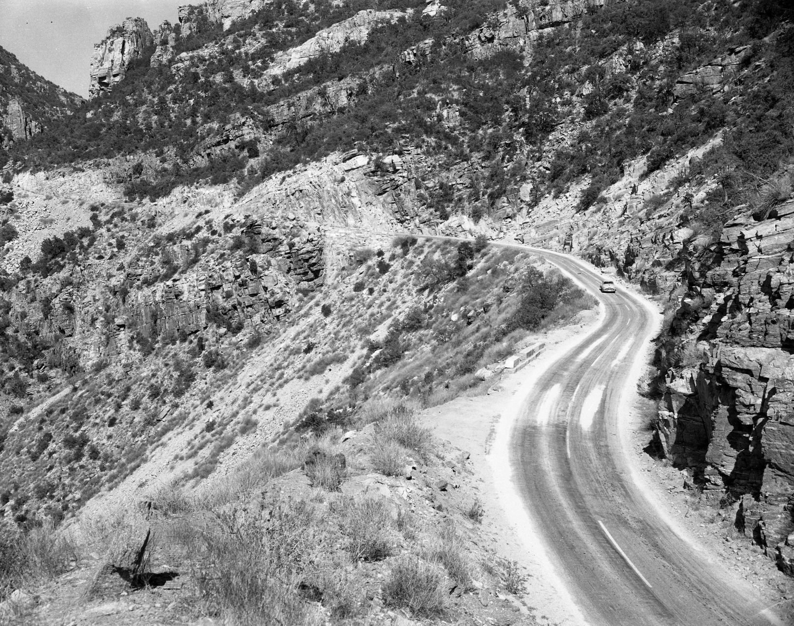
The Mt. Lemmon Highway on May 18, 1955.
Tanque Verde Road, 1950s

In this undated photo taken in the late 1950s, the Tanque Verde Bridge over the Pantano Wash was allowing traffic to make its way toward the northeast side of town.
Craycroft and I-10, 1966

The TTT Truck Terminal at Craycroft Road and Benson Highway in Tucson in June, 1966. It's a mile east of the original, built in 1954.
Congress St., 1980

Congress Street in Tucson, looking east from the Chase Bank building at Stone Ave. in August, 1980.
Silverbell Road, 1975

Silverbell Road and Scenic Drive in Marana, looking south-southwest in 1975.
Interstate 10, 1962

Interstate 10 (referred to as the "Tucson freeway" in newspapers at the time) under construction at Speedway Blvd. in the early 1960s. By Summer 1962, completed freeway sections allowed travelers to go from Prince Road to 6th Ave. The non-stop trip to Phoenix as still a few years away.
Alvernon Way, 1982

This is a July 2, 1982 photo of flooding along a Tucson street. Might be North Alvernon Way near Glenn Street.
6th Ave, 1960s

The Tucson Fire Department's Station No. 1 was once on the 100 block of South Sixth Avenue, across the street from the Pueblo Hotel and Apartments in the late 1960s. The fire station had been on the site from as early as 1909 and was next door to the Tucson Stables, which had a livery and sold feed for horses. The historic Santa Rita Hotel rises up behind the fire station. The entire block is now the Tucson Electric Power headquarters.
Ruthrauff Road, 1975

Shown in 1975, owboys drive 250 cattle down a frontage road near Ruthrauff Road in Tucson toward the finish line of "The Last Cattle Drive," a 350-mile journey that began in Willcox. The drive ended at the Nelson Livestock Aucions yard, 455 N. Highway Drive. The cattle was sold with proceeds going to the Muscular Dystrophy Assosciation.
Main Ave., 1969
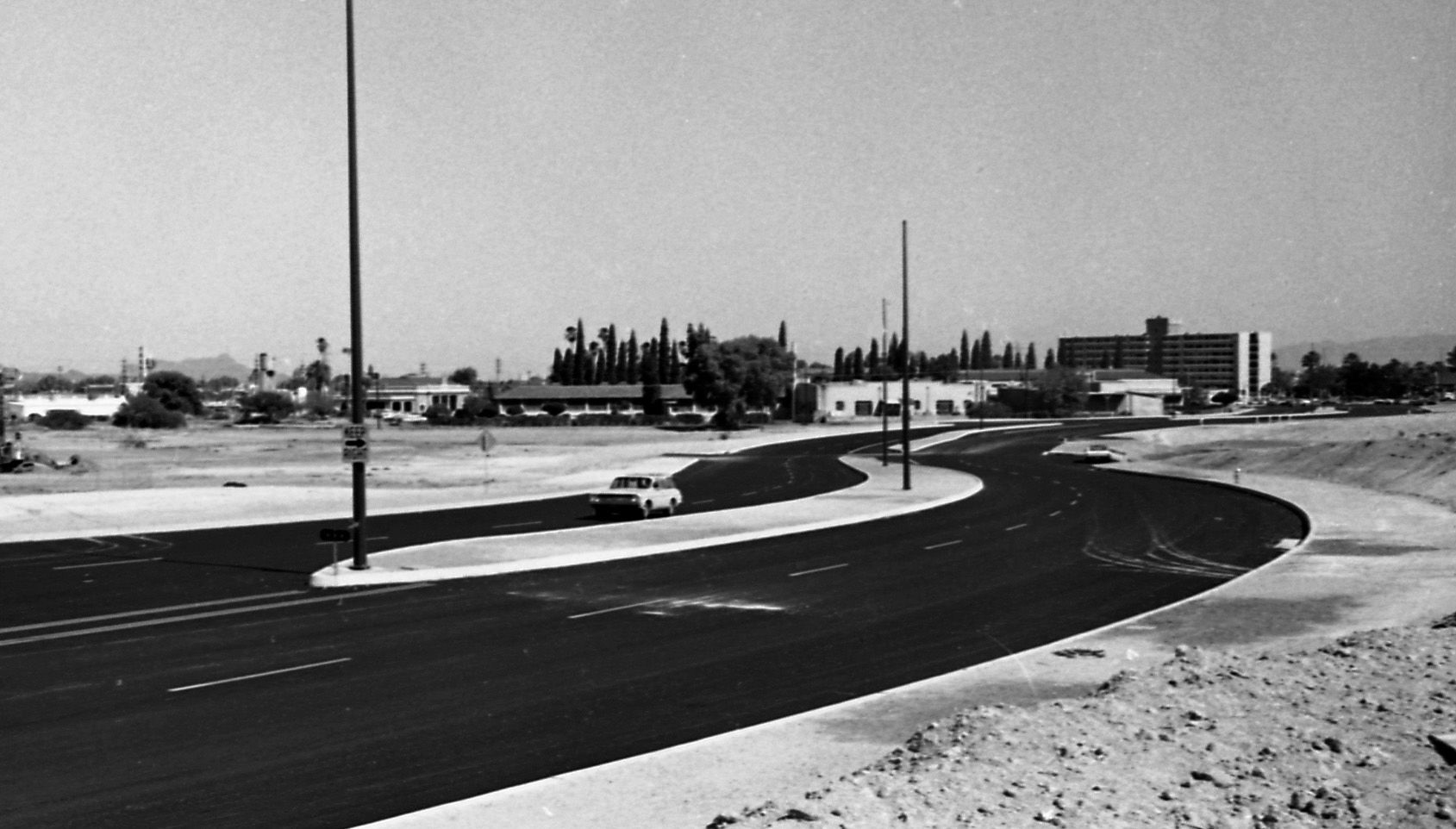
The newly aligned South Main Ave swerved its way along a barren stretch of landscape on May 9, 1969. Note the Redondo Towers in the background.
Congress St., 1970

Traffic along West Congress Street near the Santa Cruz River moves along on July 24, 1970. City authorities had decided to replace the bridge starting in the fall.

