


Tucson can expect a blast of winter weather with wind, rain and temperatures near freezing in the forecast by week’s end, the National Weather Service says.
A large storm system moving across the western United States is expected to bring lower temperatures to the area, said Carl Cerniglia, forecaster at NWS Tucson. He said Tucson should start to see increased cloud coverage by Thursday afternoon, with wind and rain not far behind.
“There are increasing chances that showers will be fairly widespread ... at least during that 24-hour period from Thursday evening into Friday evening, or at least Friday afternoon,” he said.
After that, Tucsonans should prepare for a weekend of temps likely ranging from near freezing into the low 60s through Sunday. The expected low for Saturday is 36 degrees. Water freezes when air temperatures reach 32 degrees.
Cerniglia suggested bringing pets inside and covering outdoor plants susceptible to cold snaps. Low-lying areas can record much lower temperatures, he noted, than the city’s official temperature taken at Tucson International Airport.
“Even in the Tucson metro area, we’ll get down to or slightly below freezing from the way it looks at this point,” he said. “There’s a really good chance of that, so people should be prepared for that potential.”
The leaves along E. Mount Lemmon Hwy, trails in the Santa Catalina Mountains and Summerhaven have started to change their colors during the fall season. Places you can see the leaves changing are at Gordon Hirabayashi Campground, Palisades Visitor Center, Bear Wallow Trail, Summerhaven and Mint Spring Trailhead. Video by Rebecca Sasnett, Arizona Daily Star.
Fans of cooler temps shouldn’t get used to them, however. Cerniglia said the warmer weather the region has experienced due to La Niña should return as early as Monday afternoon, Dec. 13.
“We’ll be back into the 70s again,” he said.
La Niña, the meteorological phenomenon caused by colder-than-normal waters in the equatorial Pacific Ocean off the coast of South America, is expected to bring a drier and warmer winter than normal in Tucson.
Photos: Snow in the high Santa Catalinas and Rincon Mountains
Snow
Updated
Snow covers the tops of the Pusch Ridge mountain range in Tucson, Ariz., on March 16, 2021.
Snow
Updated
Snow covers the tops of the Pusch Ridge mountain range in Tucson, Ariz., on March 16, 2021.
Snow
Updated
Snow covers the tops of the Pusch Ridge mountain range in Tucson, Ariz., on March 16, 2021.
Snow
Updated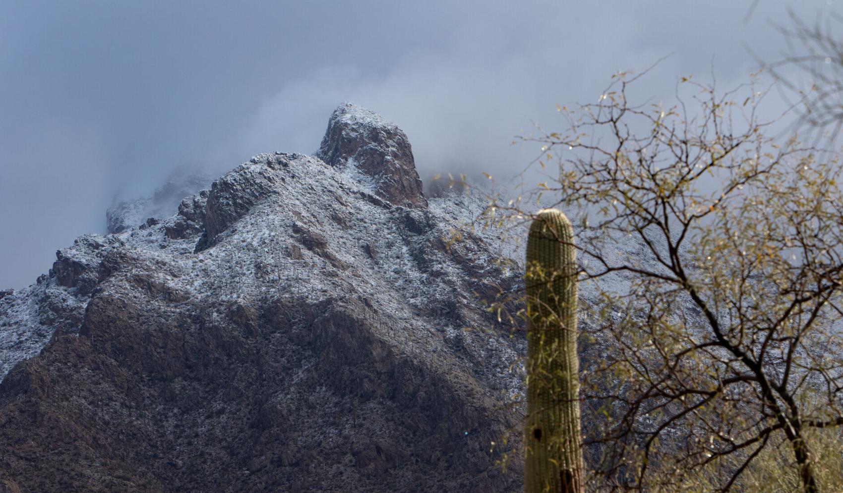
Clearing cloud cover reveals snow on Pusch Peak in the Santa Catalina Mountains north of Tucson on March 13, 2021.
Snow
Updated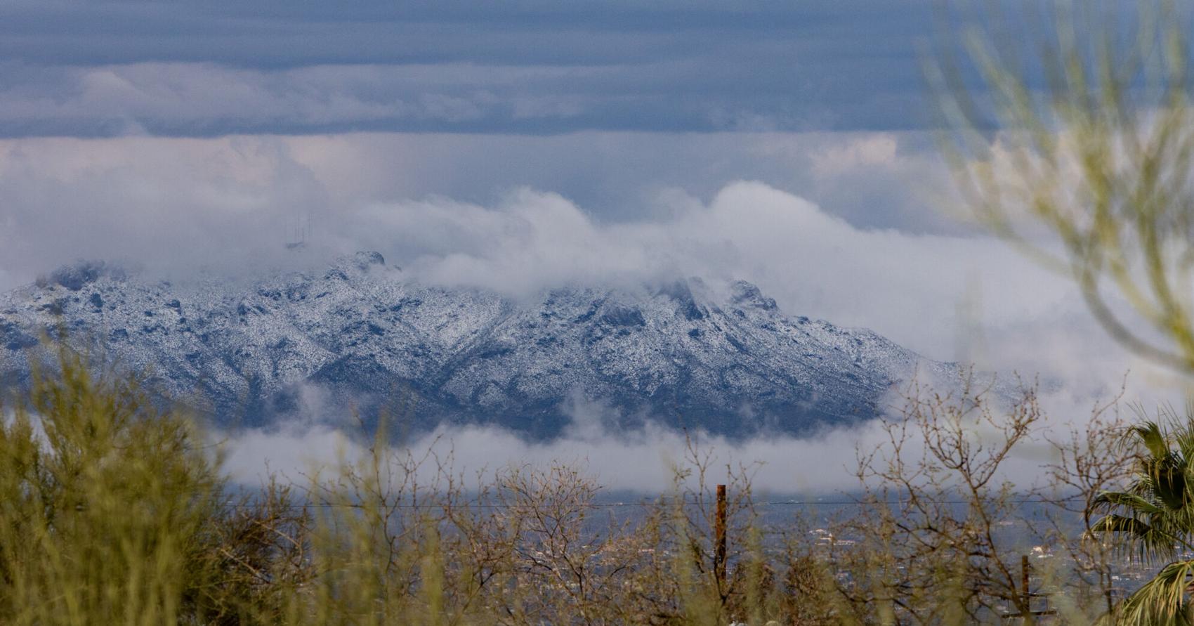
Snow on the Safford Peak and the Tucson Mountains west of Tucson on March 13, 2021.
Snow
Updated
Clouds clearing above Pima Canyon in the Santa Catalina Mountains reveal snow on March 13, 2021.
Snow
Updated
Snow on Pusch Peak and the Santa Catalina Mountains on March 13, 2021.
Snow
Updated
Snow on Thompson Peak and the Tucson Mountains on March 13, 2021.
Snow
Updated
A raven finds a perch near the Douglas Spring Trailhead with the snow in the higher reaches of the Rincon Mountains, Tucson, Ariz., March 13, 2021.
Snow
Updated
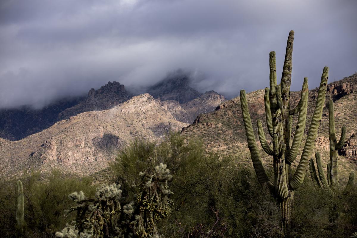
The clouds break and the sun hits the snow covered peaks in the higher reaches of the Santa Catalinas, Tucson, Ariz., March 13, 2021.
Snow
Updated
A sliver of sunlight stripes a snow covered peak in the higher reaches of the Santa Catalinas, Tucson, Ariz., March 13, 2021.
Snow
Updated
A cactus in the Saguaro National Park East stands in front f the snow in the higher reaches of the Santa Catalinas, Tucson, Ariz., March 13, 2021.

