


A new section of the Mount Lemmon area, including Willow Canyon, has been given evacuation orders amid the Bighorn Fire, which has nearly doubled in size since Tuesday.
The area includes lower Catalina Highway and lower Mount Lemmon communities from Organization Ridge Road to South Willow Canyon. Find a full map here.
Officials urge people in the area to move south on Catalina Highway and leave the mountain.
Deputies with the Pima County Sheriff's Department will be going door to door to contact residents. An evacuation center is open at Sahuaro High School, 545 N. Camino Seco.
The Pinal County Sheriff's Office also issued an evacuation notice for residents in the area of Peppersauce Canyon to Highjinks Road and Campo Bonito. The northern flank of the fire is heading toward the town of Oracle, which as been placed in the "set" category.
The Southern Arizona Chapter of the American Red Cross has re-opened an evacuation center at Canyon del Oro High School, 25 W. Calle Concordia.
A separate evacuation order was issued Tuesday for areas including Summerhaven and Mount Bigelow. That evacuation order remained in place Thursday.
More than 800 people are fighting the Bighorn Fire, which has grown to 31,208 acres and is at 40% containment as of Thursday morning. Upwards of 400 firefighters were in the Mount Lemmon area on Wednesday.
As of Thursday morning, no structures in the Summerhaven community have been lost as efforts to keep the fire from the Mount Lemmon Sky Center Observatory and the western side of the village were successful.
According to Coronado National Forest officials, fire managers expect the fire to move north toward Charouleau Gap today.
Crews on Thursday will be working to tie together the two containment lines north of the fire perimeter to protect the communities of Oracle and San Manuel, offficials said.
Evacuation alerts for the Oro Valley area from Catalina State Park south to West Magee Road and the Tucson Foothills area from North First Avenue east to North Alvernon Way, which were formerly on “set,” were downgraded to “ready” Wednesday. This is part of the state's "Ready, Set, Go" evacuation system.
Photos: The Bighorn Fire in Coronado National Forest near Tucson
Bighorn Fire
Updated
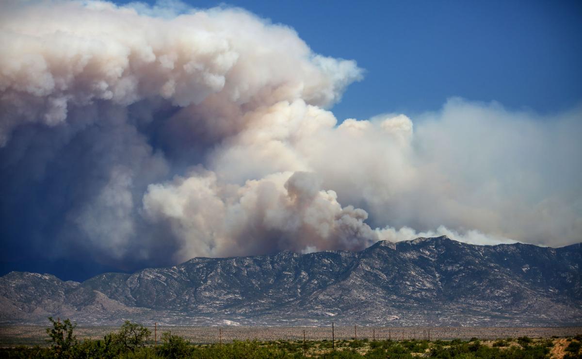
Smoke from the Bighorn Fire colors the skies over the eastern slopes of the Santa Catalina and Rincon mountains, Cascabel, Ariz., June 30, 2020.
Bighorn Fire
Updated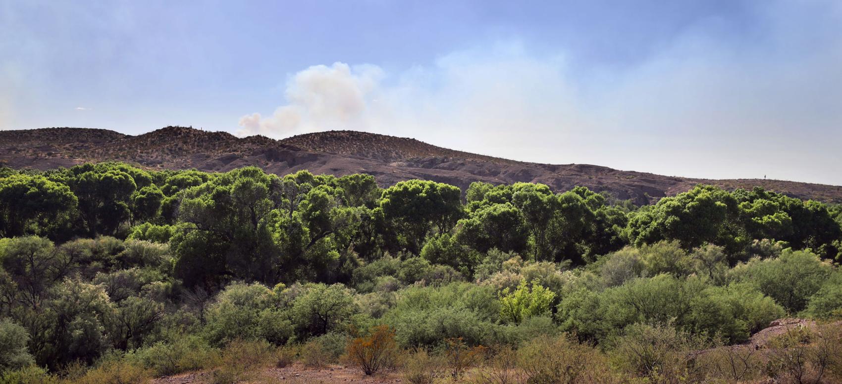
Smoke from the Bighorn Fire puffs above the cottonwood-willow forest running along the San Pedro River valley, Cascabel, Ariz., June 30, 2020.
Bighorn Fire
Updated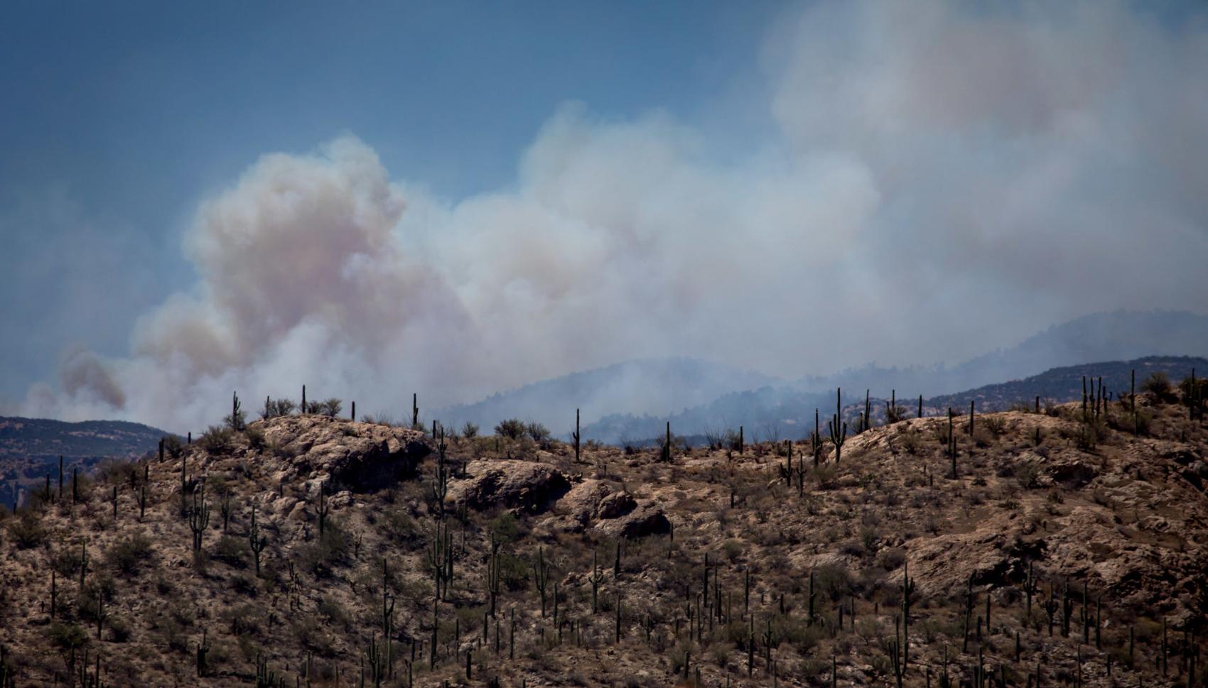
Smoke from the Bighorn fire blows Northeast over the Catalina mountains on June 30, 2020 in Tucson, Ariz. Photo taken from E. Speedway Blvd.
Bighorn Fire
Updated
Bighorn Fire burn area on Samaniego Ridge in the Santa Catalina Mountains looking west toward Biosphere II on June 27, 2020.
Bighorn Fire
Updated
Bulldozer clearing vegetation on the Northeast corner of the Bighorn Fire burning in and around the Santa Catalina Mountains on June 27, 2020.
Bighorn Fire
Updated
Crews working the Bighorn Fire near Summerhaven, Ariz., in the Santa Catalina Mountains on June 23, 2020.
Bighorn Fire
Updated
West winds push the smoke of the Bighorn Fire as it burns on the southeastern slopes of the Santa Catalina Mountains, Tucson, Ariz., June 26, 2020. The lights on the antennas of Mount Bigelow are just visible at right through the smoke.
Bighorn Fire
Updated
Flames from the Bighorn Fire climb over a ridge near Esperero Canyon lighting up a stand of saguaro as the blaze continues relentlessly to the east on the southern slopes of the Santa Catalina Mountains, Tucson, Ariz., June 23, 2020. Engine crews were monitoring the fire, which was largely beneficial and no threat to homes.
Bighorn Fire
Updated
Flames from the Bighorn Fire rise over a ridge near Esperero Canyon as the blaze moves east on the southern slopes of the Santa Catalina Mountains, Tucson, Ariz., June 23, 2020.
Bighorn Fire
Updated
Smoke from the Bighorn Fire covers the Santa Catalina Mountains with Sentinel Peak seen in the foreground Tuesday morning on June 23, 2020.
Bighorn Fire
Updated
From Ventana Canyon, at left, to just north of the end of Houghton Road, the Bighorn Fire stretches along the southern slopes of the Santa Catalina Mountains, Tucson, Ariz., June 20, 2020.
Bighorn Fire
Updated
Traffic on Sabino Canyon Road drives under the glow of he Bighorn Fire as it claims Ventana Canyon on the south slopes of the Santa Catalina Mountains, Tucson, Ariz., June 19, 2020.
Bighorn Fire
Updated
The Bighorn Fire burning in Ventana Canyon in the Santa Catalina Mountains behind downtown Tucson on June 18, 2020.
Bighorn Fire
Updated
Flames return to the southern slopes as the Bighorn Fire continues to burn through the heart of the Santa Catalina Mountains, Tucson, Ariz., June 18, 2020.
Bighorn Fire
Updated
Radio Ridge, near the top of the Santa Catalinas, is silhouetted by flames from the Bighorn Fire on the southern seen from near, Oracle, Ariz., June 18, 2020.
Bighorn Fire
Updated
Passersby use a wildlife exit along Oracle Road to get an elevated view the smoke billowing out of the northwestern portion of the Bighorn Fire, Oro Valley, Ariz., June 17, 2020.
Bighorn Fire
Updated
The Bighorn Fire lights up the ridge overlooking Saddlebrooke in the northwestern foothills of the Santa Catalina Mountains, Tucson, Ariz., June 17, 2020.
Bighorn Fire
Updated
Smoke billows from the Santa Catalinas as the Bighorn Fire continues to burn as seen from Honey Bee Canyon Park in Oro Valley, on June 17, 2020.
Bighorn Fire
Updated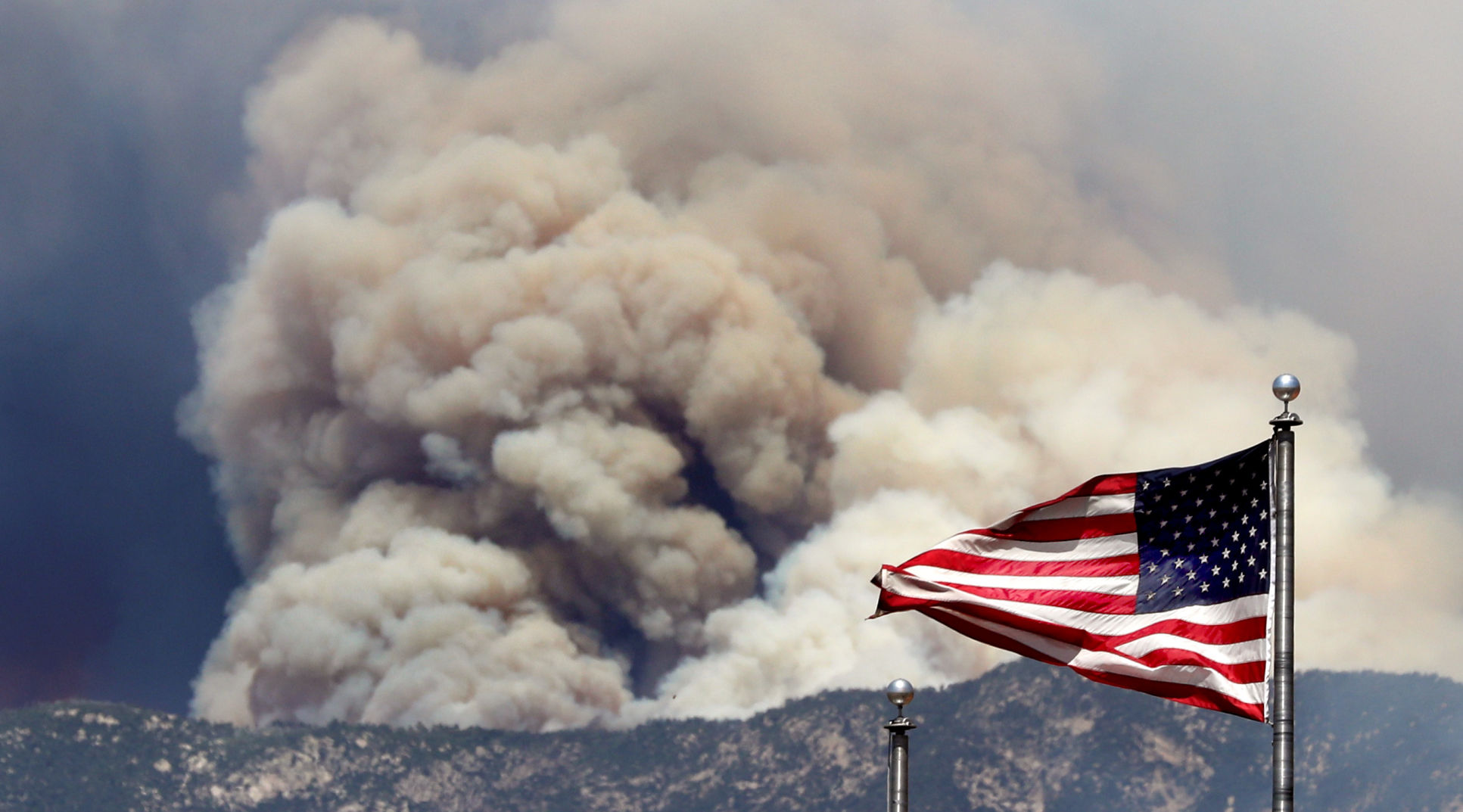
The same wind whipping the flags outside the Fairfield Inns & Suites on Oracle Road is whipping up the flames and smoke of the Bighorn Fire, Oro Valley, Ariz., June 17, 2020.
Bighorn Fire
Updated
Flames break through the smoke as a finger of the Bighorn Fire scorches its way through a canyon on the west side of the Santa Catalina Mountains, Tucson, Ariz., June 17, 2020.
Bighorn Fire
Updated
A stand of pines go up in flames as the Bighorn Fire pushes its way down a slope on the northern side of the Santa Catalina Mountains, Tucson, Ariz., June 16, 2020.
Bighorn Fire
Updated
A DC-10 VLAT makes a slurry drop near the observatory site and along the burnout of the 17 year-old Aspen Fire as crew fight to keep the Bighorn Fire being advancing on Mount Lemmon, Tucson, Ariz., June 16, 2020.
Bighorn Fire
Updated
The Bighorn Fire crest a ridge on the north side of the Santa Catalina Mountains as the day's steady winds push the flames closer to Mount Lemmon, Tucson, Ariz., June 16, 2020.
Bighorn Fire
Updated
A Sikorsky firefighting helicopter drops water along a ridge top as the flames from the Bighorn Fire work their way onto the northern slopes of the Santa Catalina Mountains, Tucson, Ariz., June 16, 2020.
Bighorn Fire- Arizona
Updated
A DC-10 VLAT climbs out of the range after making a slurry drop between The Bighorn Fire and Mount Lemmon, Tucson, Ariz., June 16, 2020.
Bighorn Fire
Updated
A fire engine from Three Points Fire District west of Tucson passes a Pima County Sheriff Auxiliary Volunteer on its way up the Catalina Highway to Mount Lemmon on June 15, 2020. Several local fire districts supply equipment and firefighters to fight the Bighorn Fire.
Bighorn Fire- Arizona
Updated
Sierra National Forest hotshot crew members talk about wind patterns while preparing for a possible change in direction from the Bighorn Fire on Mount Lemmon in the Santa Catalina Mountains in Ariz. on June 14, 2020.
Bighorn Fire- Arizona
Updated
A Sierra National Forest hotshot crew member measures the wind while preparing for a possible change in direction from the Bighorn Fire on Mount Lemmon in the Santa Catalina Mountains in Ariz. on June 14, 2020.
Bighorn Fire- Arizona
Updated
Smoke flows out of canyons in the Santa Catalina Mountains from the Bighorn Fire north of Tucson, Ariz. on June 14, 2020, as seen from Mount Lemmon Trail #5.
Bighorn Fire- Arizona
Updated
Smoke from the Bighorn Fire burning in canyons in the Santa Catalina Mountains to the west, looms over homes in Summerhaven, Ariz. on June 14, 2020.
Bighorn Fire
Updated
A family of four horned owls perch on a utility pole near Tanque Verde and Houghton with the glow from the Bighorn Fire burning in the Santa Catalina Mountains behind them to north, Tucson, Ariz., June 14, 2020.
Bighorn Fire
Updated
The Bighorn Fire's northwestern front looms over homes as it burns into the central Santa Catalina Mountains, Oro Valley, Ariz., June 13, 2020.
Bighorn Fire
Updated
A stiff wind out of the southwest pushes the Bighorn Fire into the central Santa Catalina Mountains and toward homes, Oro Valley, Ariz., June 13, 2020.
Bighorn Fire
Updated
A Chinook helicopter carrying a water bucket flies north along the Pusch Ridge Wilderness as the Bighorn Fire pushes north-northeast into Romero Canyon east of Catalina State Park in Santa Catalina Mountains on Saturday, June 13, 2020.
Bighorn Fire - Arizona
Updated
A air tanker flies above the the Bighorn Fire as smoke billows up near the mouth of Romero Canyon, on June 13, 2020.
Bighorn Fire
Updated
A DC-10 VLAT drops below the ridge line in his path to make a slurry drop as the battle moves to the northwest and crews work to keep the Bighorn Fire from spreading through Catalina State Park, Oro Valley, Ariz., June 11, 2020.
Bighorn Fire
Updated
Two firefighting helicopters maneuver around one another while recharging at a dip site as the battle moves to the north to keep the Bighorn Fire from spreading, Oro Valley, Ariz., June 11, 2020.
Bighorn Fire
Updated
An aerial tanker banks out of a smoky gully after making a slurry drop as the battle moves to the northwestern reaches of the Santa Catalina Mountains, Oro Valley, Ariz., June 11, 2020.
Bighorn Fire
Updated
A Chinook helicopter drops water on the line of flames advancing through grasslands at the northwestern foot of the Santa Catalinas as crews work to keep the Bighorn Fire from spreading through Catalina State Park, Oro Valley, Ariz., June 11, 2020.
Bighorn Fire
Updated
A firefighting Sikorsky helicopter calls it a night and flies for base as sun sets on the the battle to keep the Bighorn Fire from spreading, Oro Valley, Ariz., June 11, 2020.
Bighorn Fire
Updated
A McDonnell Douglas MD-80 firefighting air tanker emerges from heavy smoke from the Bighorn Fire burning near Catalina State Park in Oro Valley on June 12, 2020.
Bighorn Fire
Updated
People stand along Oracle Road just north of the entrance to Catalina State Park as the Bighorn Fire continues to burn in the Pusch Ridge Wilderness near the park, on June 12, 2020.
Bighorn Fire
Updated
People stand along Oracle Road just north of the entrance to Catalina State Park as the Bighorn Fire continues to burn at the base of Pusch Ridge near the park, on June 12, 2020.
Bighorn Fire
Updated
A Chinook helicopter drops water on the Bighorn Fire burning in Pusch Ridge, on June 12, 2020.
Bighorn Fire
Updated
A line of fire retardant draped along the Santa Catalina Mountains from Sunrise Drive above Cimarron Foothills Estates neighborhood as the Bighorn Fire burns for its seventh day in the western Santa Catalina mountain range, on June 12, 2020.
Bighorn Fire
Updated
A Chinook helicopter dumps water on the Bighorn Fire in the front range of the Santa Catalina Mountains in between granite faces already painted with pink fire retardant on Thursday, June 11, 2020.
Bighorn Fire
Updated
People stand along Oracle Road just north of the entrance to Catalina State Park as the Bighorn Fire continues to burn in the Pusch Ridge near the park, on June 12, 2020.
Bighorn Fire
Updated
People watch from Oracle Road just north of the entrance to Catalina State Park as Chinook helicopters drop water on the Bighorn Fire burning for its seventh day in Pusch Ridge very close to Catalina State Park on June 12, 2020.
Bighorn Fire
Updated
The Bighorn Fire inches over a ridge above several homes north of Coronado Drive west of Swan as night falls on the neighborhoods under evacuation and prepare to leave warnings in the Santa Catalina Mountain foothills, Tucson, Ariz., June 11, 2020.
Bighorn Fire
Updated
A DC-10 VLAT makes a last drop in the dying light over the homes in the area between Swan and Alvernon during the daylong struggle to keep the Bighorn Fire out of the neighborhoods of the Santa Catalina Mountain foothills, Tucson, Ariz., June 11, 2020.
Bighorn Fire
Updated
A Sikorsky firefighting helicopter heads back to the dip tank, overflying several homes under a smoking ridge in the upper reaches of the Santa Catalina foothills as crews fight to keep the Bighorn Fire out of several neighborhoods, Tucson, Ariz., June 11, 2020.
Bighorn Fire
Updated
A tanker skims over a ridge while dropping slurry just west of Craycroft during the struggle to keep the Bighorn Fire out of the neighborhoods of the Santa Catalina Mountain foothills, Tucson, Ariz., June 11, 2020.
Bighorn Fire - Arizona
Updated
Residents in the Catalina Foothills neighborhood north of Tucson watch an air tanker drop fire retardant on the Bighorn Fire near Finger Rock Canyon the Santa Catalina Mountains on June 11, 2020. Photo by Rebecca Sasnett / Arizona Daily Star
Bighorn Fire - Arizona
Updated
A hot shot fire crew fighting the Bighorn Fire hikes on ridge near Finger Rock Canyon in the foothills of the Santa Catalina Mountains north of Tucson, Ariz. on June 11, 2020. Photo by Rebecca Sasnett / Arizona Daily Star
Bighorn Fire - Arizona
Updated
Pink fire retardant settles over a ridge near Finger Rock Canyon in the Santa Catalina Mountains north of Tucson, Ariz. on June 11, 2020.
Bighorn Fire
Updated
A helicopter dumps water along an area to combat the Bighorn Fire in the Santa Catalina Mountains on June 11, 2020.
Bighorn Fire
Updated
Qin Chen talks with Tom Lemmons, of the Pima County Sheriff's Office Auxiliary, about "Go" orders given to evacuate her home in the Cobblestone Estates neighborhood due to the Bighorn Fire in the Santa Catalina Mountains on June 11, 2020. Lemmons asked residents if they planned to evacuate or stay in their home.
Bighorn Fire
Updated
Keith Lencke of the Blue Ridge Hotshots watches the air attack on the Bighorn Fire in the Cobblestone Estates neighborhood near the Santa Catalina Mountains on June 11, 2020.
Bighorn Fire
Updated
People watch the Bighorn Fire from La Encantada at Campbell and Skyline on June 11, 2020.
Bighorn Fire - Arizona
Updated
A UH-60 firefighting helicopter picks up a bucket of water at Immaculate Heart High School as another helicopter drops water on the Bighorn Fire burning in Pima Canyon in the Santa Catalina Mountains north of Tucson on June 11, 2020.
Bighorn Fire - Arizona
Updated
A Chinook helicopter refills with water at Imaculate Heart High School near Magee and Oracle while fighting the Bighorn Fire burning in Pima Canyon in the Santa Catalina Mountains north of Tucson on June 11, 2020.
Bighorn Fire
Updated
A jet tanker drops retardant as it flies through Pontatoc Canyon as wildfire crews continue to fight the Bighorn Fire which has spread along the western side of the Santa Catalinas, on June 11, 2020.
Bighorn Fire
Updated
An air tanker drops fire retardant as wildfire crews continue to fight the Bighorn Fire which has spread along the western side of the Santa Catalinas, on June 11, 2020.
Bighorn Fire
Updated
A helicopter carries water over an area of the Bighorn Fire in the Santa Catalina Mountains in the Coronado National Forest north of Tucson on June 10, 2020. The fire has now burned 3,277 acres since it started on Friday, June 5, from a lightning strike in the Pusch Ridge area of the Catalina Mountains.
Bighorn Fire
Updated
From alongside Campbell Avenue, a couple gets photos of the Bighorn Fire breaking onto the southern slopes of the Santa Catalina Mountains, Tucson, Ariz., June 10, 2020.
Bighorn Fire
Updated
In the last of the day's light a helicopter makes a last minute water drop on a line of flames from the Bighorn Fire moving down the southern slopes of the Santa Catalina Mountains, Tucson, Ariz., June 10, 2020.
Bighorn Fire
Updated
The Bighorn Fire breaks onto the southern slopes of the Santa Catalina Mountains and burns above a pair of homes in the foothills just west of the Finger Rock Trailhead, Tucson, Ariz., June 10, 2020.
Bighorn Fire - Arizona
Updated
A chinook helicopter drops a load of water on the Bighorn Fire as is moves into the top of Finger Rock Canyon and up Mount Kimball, on June 10, 2020.
Bighorn Fire - Arizona
Updated
A Smokey Bear Hotshot walks along Finger Rock Canyon trail as smoke billows from the Bighorn Fire further up the canyon, on June 10, 2020.
Bighorn Fire - Arizona
Updated
Adam Hutton with the Smokey Bear Hotshots of Ruidoso, New Mexico tosses away brush being cut near the mouth of Finger Rock Canyon as a precaution against the growing Bighorn Fire being fought in the Santa Catalina Mountain Range, on June 10, 2020.
Bighorn Fire - Arizona
Updated
Hotshots with Smokey Bear and Blue Ridge talk near the Finger Rock Canyon trailhead as smoke billows from the Bighorn Fire billows in the distance, on June 10, 2020.
Bighorn Fire - Arizona
Updated
Crew members with the Smokey Bear Hotshots from Ruidoso, New Mexico cut line near the mouth of Finger Rock Canyon as a precaution against the growing Bighorn Fire being fought in the Santa Catalina Mountain Range, on June 10, 2020.
Bighorn Fire - Arizona
Updated
A driver heads south on Campbell Ave. as smoke billows from the Bighorn Fire in the Santa Catalina Mountains in the Coronado National Forest north of Tucson on June 10, 2020.
Bighorn Fire - Arizona
Updated
The Bighorn Fire burning in Pima Canyon and Finger Rock Canyon in the Santa Catalina Mountains, Coronado National Forest north of Tucson, Ariz., June 10, 2020.
Bighorn Fire - Arizona
Updated
Heavy fuels burning above Finger Rock Canyon produce think black smoke during the Bighorn Fire within the Santa Catalina Mountains in Coronado National Forest north of Tucson on June 10, 2020.
Bighorn Fire - Arizona
Updated
Tinder-dry vegetation bursts into flames above during the Bighorn Fire burning above Finger Rock Canyon within the Santa Catalina Mountains in Coronado National Forest north of Tucson on June 10, 2020.
Bighorn Fire - Arizona
Updated
The hazy remnants of the Bighorn Fire hang low in Pima Canyon within the Santa Catalina Mountains in Coronado National Forest north of Tucson on the morning of June 10, 2020.
Bighorn Fire - Arizona
Updated
The Bighorn Fire burns on the East side of beloved hiking area Pima Canyon within the Santa Catalina Mountains in Coronado National Forest north of Tucson, late on June 9, 2020. The lightning-caused fire increased slightly, to 2,556 acres, but is still but still only 10% contained.
Bighorn fire
Updated
A helicopter flies along the Catalinas on its way to Rose Canyon Lake while fighting the Bighorn fire in Pima Canyon, on June 9, 2020.
Bighorn Fire - Arizona
Updated
Dark smoke from heavy fuels in the upper elevations of Pima Canyon obscure the rising sun during the Bighorn Fire in the Santa Catalina Mountains in Coronado National Forest north of Tucson on June 9, 2020.
Bighorn Fire
Updated
The Bighorn Fire glows as it burns into Pima Canyon in the western reaches of the Santa Catalina Mountains above Tucson, Ariz., just after sunset June 8, 2020. During its third day, the lightning sparked wildfire chewed a wind driven path east and higher into the range.
Bighorn Fire - Arizona
Updated
A helicopter drops a bucket of water on the Bighorn Fire burning into Pima Canyon inside the Coronado National Forest north of Tucson, Ariz. on June 8, 2020. The lighting-caused Bighorn Fire, as of Monday June 8, has spread to over 2,300 acres and is 10% contained, according to Oro Valley Police department via Twitter.
Bighorn Fire - Arizona
Updated
A long nighttime exposure of fire burning in Pusch Ridge accentuates the flames of the Bighorn Fire burning in the Santa Catalina Mountains in Coronado National Forest north of Tucson on June 7, 2020.
Bighorn Fire - Arizona
Updated
A Chinook heavy-lift helicopter with water bucket trailing behind speeds back to the dip tank during the Bighorn Fire burning along Pusch Ridge of the Santa Catalina Mountains in Coronado National Forest north of Tucson on June 7, 2020.
Bighorn Fire - Arizona
Updated
Smoke envelops a granite spire during the Bighorn Fire burning along Pusch Ridge of the Santa Catalina Mountains in Coronado National Forest north of Tucson on June 7, 2020.
Bighorn Fire - Arizona
Updated
A large air tanker drops fire retardant on the top of Pusch Ridge during the Bighorn Fire burning in the Santa Catalina Mountains in Coronado National Forest north of Tucson on June 7, 2020.
Bighorn Fire - Arizona
Updated
At the Bighorn Fire burning along Pusch Ridge of the Santa Catalina Mountains in Coronado National Forest north of Tucson on June 7, 2020. Photo by Rick Wiley / Arizona Daily Star
Bighorn Fire - Arizona
Updated
People watch the aerial ballet of helicopters and air tankers on the Bighorn Fire from the safety of Oro Valley Marketplace on June 7, 2020. The Bighorn Fire is burning along Pusch Ridge of the Santa Catalina Mountains in Coronado National Forest north of Tucson on June 7, 2020. Photo by Rick Wiley / Arizona Daily Star
Bighorn Fire - Arizona
Updated
A Chinook heavy-lift helicopter trailing a water bucket flies past canyons choked with smoke during the Bighorn Fire burning along Pusch Ridge of the Santa Catalina Mountains in Coronado National Forest north of Tucson on June 7, 2020. Photo by Rick Wiley / Arizona Daily Star
Bighorn Fire - Arizona
Updated
A heavy-lift Chinook helicopter takes off from the Bighorn Fire heli-base on Oracle Road during the Bighorn Fire burning along Pusch Ridge of the Santa Catalina Mountains in Coronado National Forest north of Tucson on June 7, 2020. Photo by Rick Wiley / Arizona Daily Star
Bighorn Fire - Arizona
Updated
An air tanker drops retardant the Bighorn Fire burning along Pusch Ridge of the Santa Catalina Mountains in Coronado National Forest north of Tucson on June 7, 2020. Photo by Rick Wiley / Arizona Daily Star
Bighorn Fire - Arizona
Updated
A lead plane, lower left, guides a large air tanker during a retardant drop at the Bighorn Fire burning along Pusch Ridge of the Santa Catalina Mountains in Coronado National Forest north of Tucson on June 7, 2020. Photo by Rick Wiley / Arizona Daily Star
Bighorn Fire
Updated
A huge DC-10 VLAT (Very Large Air Tanker) pulls up after dropping a load of fire retardant in a neighborhood just south of Catalina State Park during the Bighorn Fire burning along Pusch Ridge in Coronado National Forest north of Tucson on June 6, 2020.
Bighorn Fire
Updated
Smoke from the Bighorn Fire shrouds granite formations of Pusch Ridge in Coronado National Forest north of Tucson on June 6, 2020.
Bighorn Fire
Updated
A heavy-lift helicopter drops water on the line of the Bighorn Fire burning along Pusch Ridge in Coronado National Forest north of Tucson on June 6, 2020.
Bighorn Fire
Updated
A Sikorsky heavy-lift helicopter finishes a drop at dusk on the Bighorn Fire burning along Pusch Ridge in Coronado National Forest north of Tucson on June 6, 2020.
Bighorn Fire
Updated
The Huey helicopter passes along a ridge on the Bighorn Fire burning along Pusch Ridge in Coronado National Forest north of Tucson on June 6, 2020.
Bighorn Fire
Updated
Flames fanned by canyon winds emerge from the smoke during the Bighorn Fire burning along Pusch Ridge in Coronado National Forest north of Tucson on June 6, 2020.
Bighorn Fire
Updated
Smoke shrouds granite formations the Bighorn Fire burning along Pusch Ridge in Coronado National Forest north of Tucson on June 6, 2020.
Bighorn Fire
Updated
The Bighorn Fire burning about La Reserve along Pusch Ridge in Coronado National Forest north of Tucson on June 6, 2020.
Bighorn Fire
Updated
A DC-10 Very Large Air Tanker drops on the Bighorn Fire burning along Pusch Ridge in Coronado National Forest north of Tucson on June 6, 2020.
Bighorn Fire
Updated
A heavy lift helicopter passes through the Bighorn Fire burning along Pusch Ridge in Coronado National Forest north of Tucson on June 6, 2020.
Bighorn Fire
Updated
A DC-10 Very Large Air Tanker drops thousands of gallons of retardant at the base of the Bighorn Fire burning above La Reseve along Pusch Ridge in Coronado National Forest north of Tucson on June 6, 2020.
Bighorn Fire
Updated
The Bighorn Fire burning along Pusch Ridge in Coronado National Forest north of Tucson on June 6, 2020.
Bighorn Fire
Updated
An air tanker drops fire retardant to create a fire line behind homes (bottom center) in Or Valley during the Bighorn Fire burning along Pusch Ridge in Coronado National Forest north of Tucson on June 6, 2020.
Bighorn Fire
Updated
Helicopters drop water on the Bighorn Fire burning along Pusch Ridge in Coronado National Forest north of Tucson on June 6, 2020.
Bighorn Fire
Updated
Helicopters drop water on the Bighorn Fire burning along Pusch Ridge in Coronado National Forest north of Tucson on June 6, 2020.
Bighorn Fire
Updated
Helicopters drop water on the Bighorn Fire burning along Pusch Ridge in Coronado National Forest north of Tucson on June 6, 2020.
Bighorn Fire
Updated
The Bighorn Fire burning along Pusch Ridge in Coronado National Forest north of Tucson on June 6, 2020.
Bighorn Fire near Oro Valley
Updated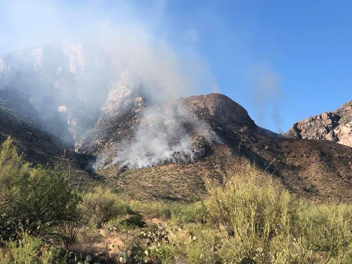
A fire is burning in the Pusch Ridge area east of Oro Valley on Saturday. The fire was started by lightning for storms that moved through Friday night. Ground crews and helicopters are fighting the blaze, which is not spreading rapidly.

