


For many decades, the Colorado River was managed with the attitude that its water levels would remain roughly stable over time, punctuated by alternating wet and dry periods.
But in the face of possibly the river’s driest period in 1,200 years, a new approach is now needed to managing the river’s reservoirs — one that can account for “deep uncertainty” about future climate and runoff conditions, says the U.S. Bureau of Reclamation. And for the next two months, the bureau wants to hear from the public about how it should go about operating reservoirs including Lake Mead, Lake Powell and other parts of the river system under such conditions.
The bureau announced last Friday in the Federal Register that it wants written, public comment on what issues should be covered for revising operating guidelines for the reservoirs that date back to 2007 and expire at the end of 2026. It’s also looking for public guidance on how the feds can best insure that the process used to conduct the revisions is “inclusive, transparent, and encourages meaningful engagement.” The entire effort will be carried out under the strictures of the National Environmental Policy Act, with a formal environmental impact statement expected in the future.
Publication of the bureau’s announcement kicks off what’s expected to be a prolonged, difficult and contentious effort to develop new guidelines, in which the seven river basin states including the numerous interest groups operating in each state pursue an elusive consensus for future river management.
The 2007 guidelines were developed after the river had experienced a five-year period of extreme drought that drove the reservoirs to what were seen at the time as extremely low levels from 2000 through 2004. But the guidelines, while allowing for cuts in deliveries of water to the Lower River Basin states when Lake Mead fell below specified levels, were based primarily on the assumption of a “stationary” climate, the bureau said in its Federal Register notice last week.
While a formal, federal review found the 2007 guidelines were effective at meeting their overall purpose, the drought’s increasing severity since then showed the guidelines weren’t “robust” enough to protect reservoir levels, the bureau said.
A new set of agreements, developed in 2019, were aimed at shoring up the management of the reservoirs to adapt to their continued declines. They were approved as separate drought contingency plans for the river’s Upper and Lower Basin states. Arizona, Nevada and California comprise the Lower Basin. Utah, New Mexico, Colorado and Wyoming make up the Upper Basin.
But those measures have also proven “demonstrably insufficient to address the ongoing drought and low runoff conditions,” the bureau said.
As a result, the federal agency was forced, starting in 2021, to take a series of emergency measures to protect reservoir levels. They culminated with this month’s announcement that it wants Arizona and the other river basin states to cut their river water used by 2 million to 4 million acre-feet starting next year. The bureau says if the states don’t approve their own plans for such cuts by mid-August, the agency will impose its own cuts on the system.
In half of all years since 2000, the river has carried less than 11 million acre-feet annually at Lee’s Ferry, just downstream of Lake Powell, compared to a 20th century average of around 15 million acre-feet, the bureau noted. The river has had less than 8 million acre-feet at Lee’s Ferry in 13% of those years, said the bureau.
Overall, the river has been 20% drier in the 21st century than in the 20th century, and 5-year average river flows have dropped by 33% in 23 years.
“Future strategies should consider these conditions and the likelihood of continued declines in supply,” the bureau said.
In its notice last Friday, the bureau added, “With increasing temperatures across the basin, predictions of commensurate decreases in reliable supply, and uncertainty in future demands, Reclamation believes that future policies must be tested across a wide range of potential future conditions, including drought sequences that are longer and more severe than those that have been observed.”
The latest projections of future climate change agree that temperatures will continue warming, but a wide range of potential futures are possible for both precipitation and overall impacts on river flows, said the bureau.
Experts can’t say with a high degree of confidence or specificity what’s most likely to happen, meaning “the question ‘what will future runoff be?’ cannot be answered, the bureau said. That, combined with uncertainty about future growth patterns and water use, mean “it is impossible to assign probabilities to any given future and the basin is experiencing conditions of deep uncertainty,” the bureau said.
Without an approach that takes such uncertainties into account, future policies “are likely to be insufficiently robust, adaptable, and successful,” the bureau said.
Photos: Glen Canyon Dam dedicated in 1966 after years of construction
Glen Canyon Dam
Updated
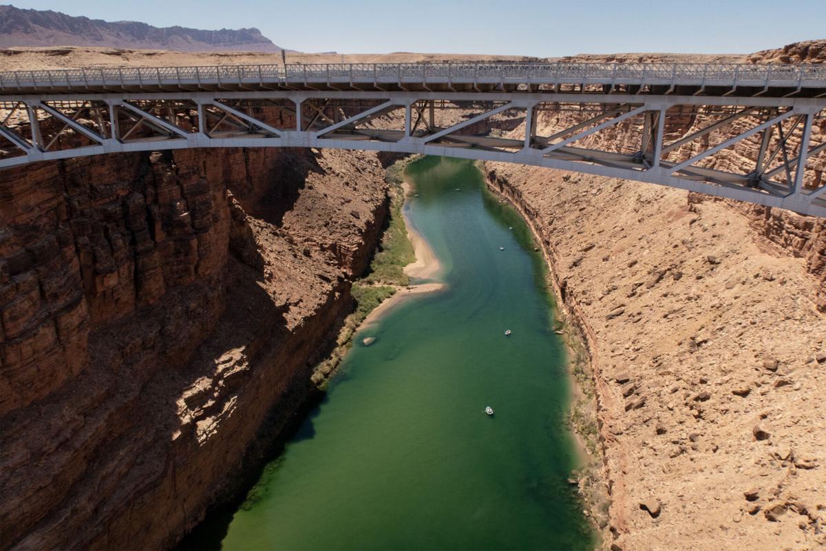
Glen Canyon Bridge and Glen Canyon Dam during the official dedication of Glen Canyon Dam near Page, Ariz. on Sept. 22, 1966.
Glen Canyon Dam
Updated
Interior Secretary Stewart Udall, right, with Ladybird Johnson during the official dedication of Glen Canyon Dam near Page, Ariz. on Sept. 22, 1966. The Glen Canyon Bridge is in the background.
Glen Canyon Dam
Updated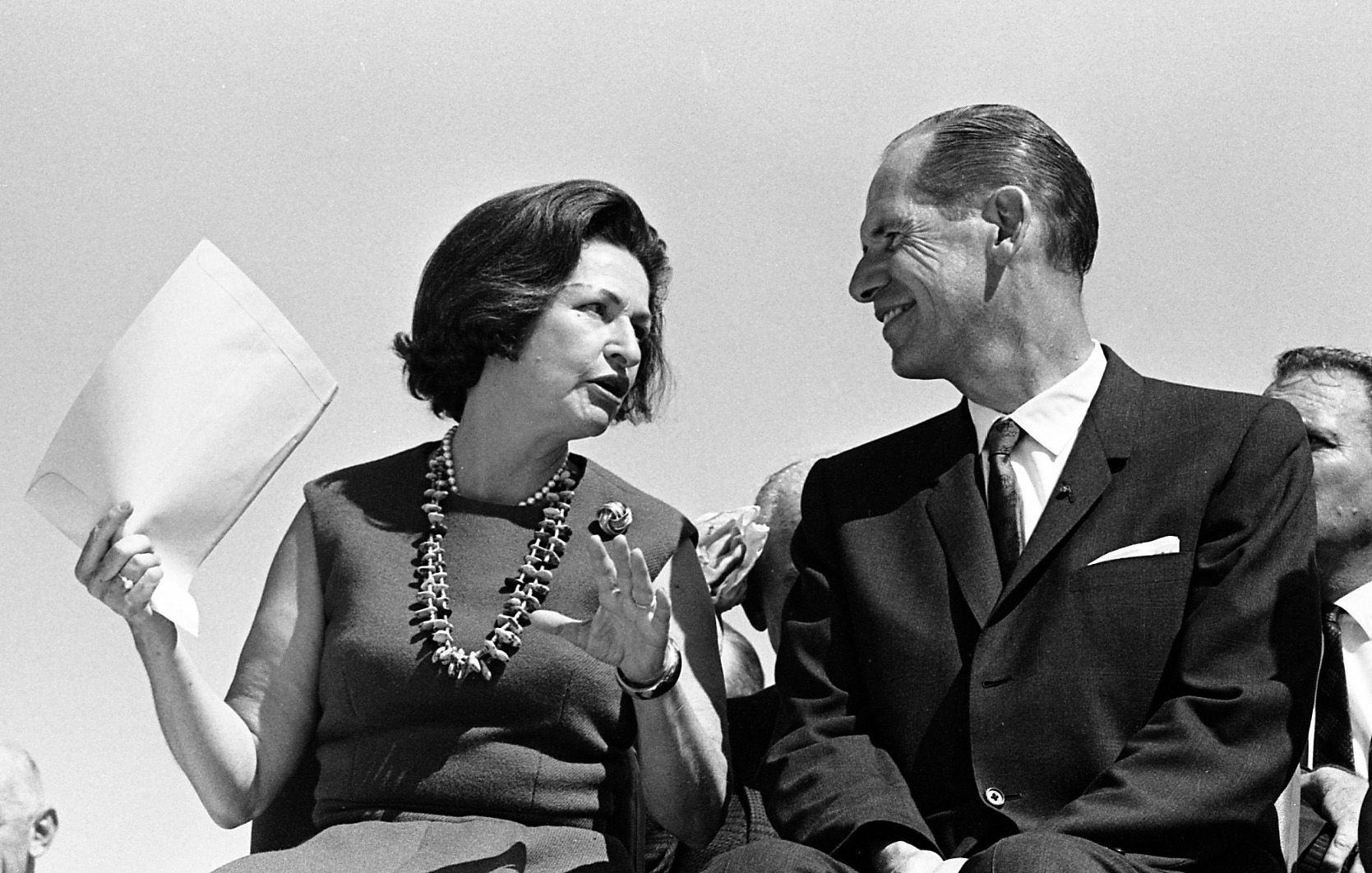
First Lady Ladybird Johnson with Arizona Gov. Sam Goddard during the official dedication of Glen Canyon Dam near Page, Ariz. on Sept. 22, 1966.
Glen Canyon Dam
Updated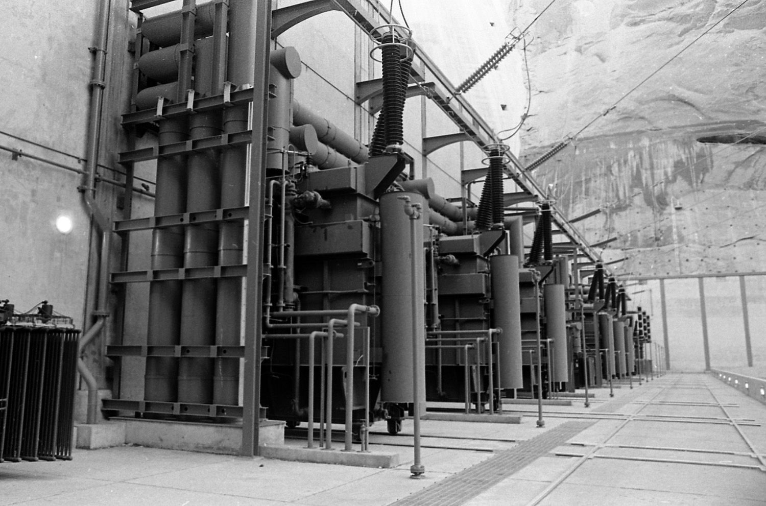
The transformer complex during the official dedication of Glen Canyon Dam near Page, Ariz. on Sept. 22, 1966.
Glen Canyon Dam
Updated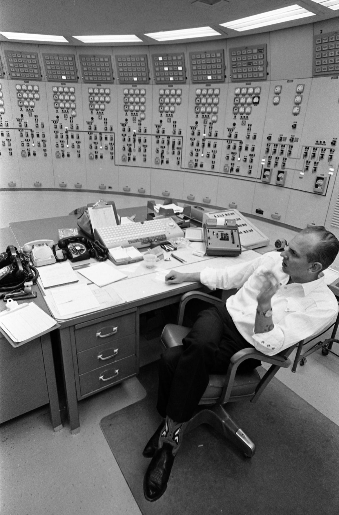
The control room during the official dedication of Glen Canyon Dam near Page, Ariz. on Sept. 22, 1966.
Glen Canyon Dam
Updated
Deep underneath Glen Canyon Dam during the official dedication of Glen Canyon Dam near Page, Ariz. on Sept. 22, 1966.
Glen Canyon Dam
Updated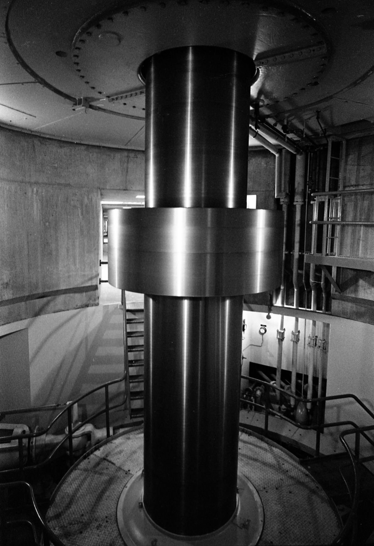
A giant steel turbine shaft spinning during the official dedication of Glen Canyon Dam near Page, Ariz. on Sept. 22, 1966.
Glen Canyon Dam
Updated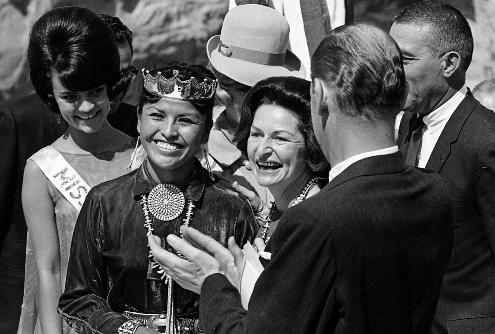
First Lady Ladybird Johnson, center, during the official dedication of Glen Canyon Dam near Page, Ariz. on Sept. 22, 1966.
Glen Canyon Dam
Updated
First Lady Ladybird Johnson during the official dedication of Glen Canyon Dam near Page, Ariz. on Sept. 22, 1966.
Glen Canyon Dam
Updated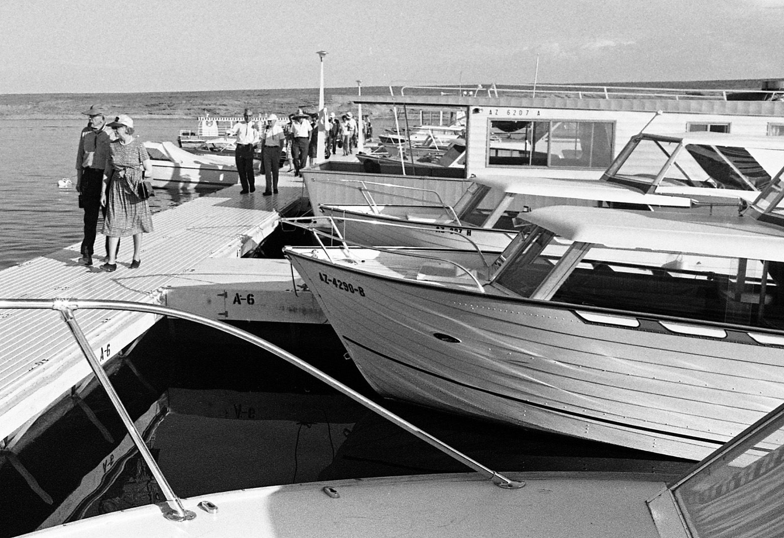
Wahweap Marina on Lake Powell during the official dedication of Glen Canyon Dam near Page, Ariz. on Sept. 22, 1966.
Glen Canyon Dam
Updated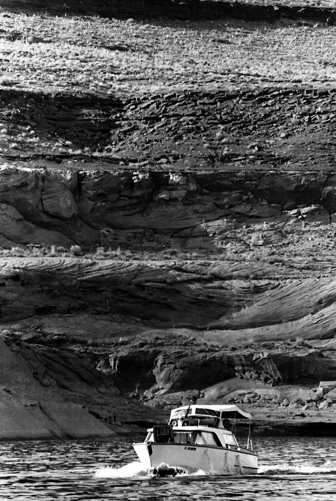
Boaters on the new Lake Powell during the official dedication of Glen Canyon Dam near Page, Ariz. on Sept. 22, 1966.
Glen Canyon Dam
Updated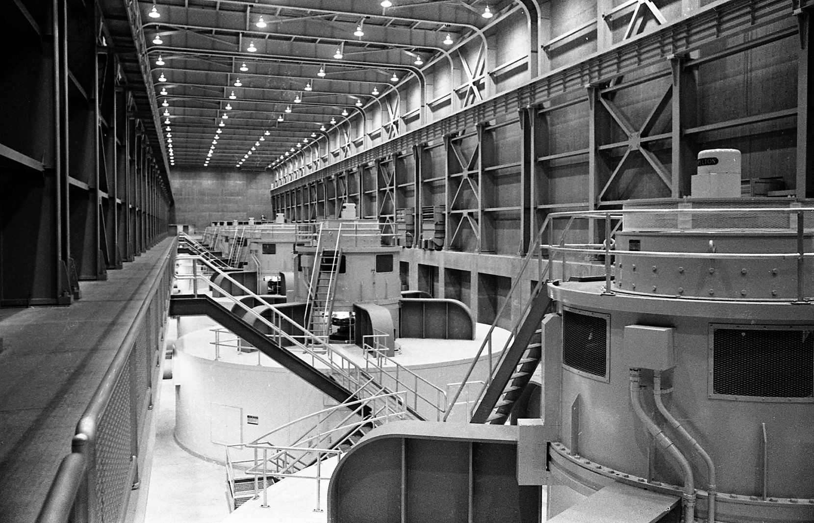
The turbine hall during the official dedication of Glen Canyon Dam near Page, Ariz. on Sept. 22, 1966. The first electricity was generated on September 4, 1964, with the power sent into the regional electric grid through a pair of long-distance transmission lines as far as Phoenix, Arizona and Farmington, New Mexico.[
Glen Canyon Dam
Updated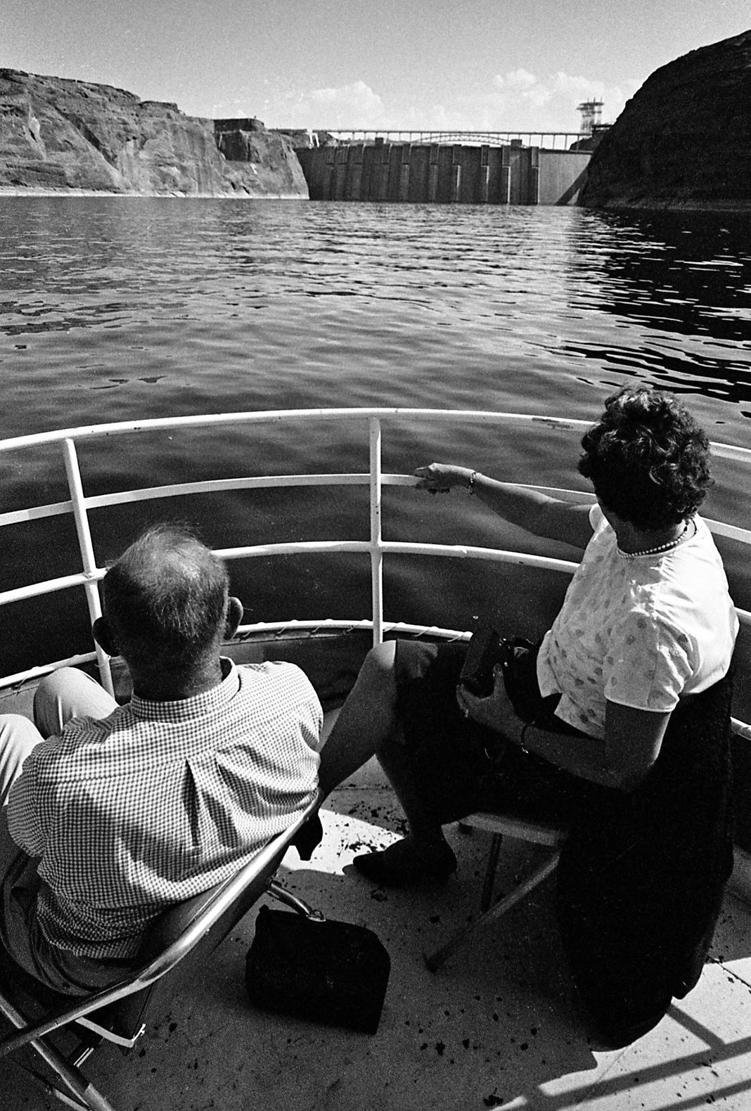
The eight penstocks that provide water for generation of electricity are revealed on the back of Glen Canyon Dam during the official dedication of Glen Canyon Dam near Page, Ariz. on Sept. 22, 1966.
Glen Canyon Dam
Updated
A man catches some sun during the official dedication of Glen Canyon Dam near Page, Ariz. on Sept. 22, 1966.
Glen Canyon Dam
Updated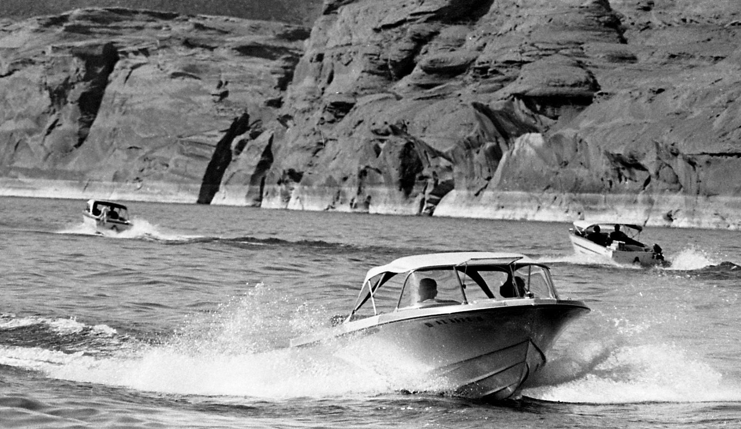
Boaters on Lake Powell during the official dedication of Glen Canyon Dam near Page, Ariz. on Sept. 22, 1966.
Glen Canyon Dam
Updated
Boaters on Lake Powell during the official dedication of Glen Canyon Dam near Page, Ariz. on Sept. 22, 1966.
Glen Canyon Dam
Updated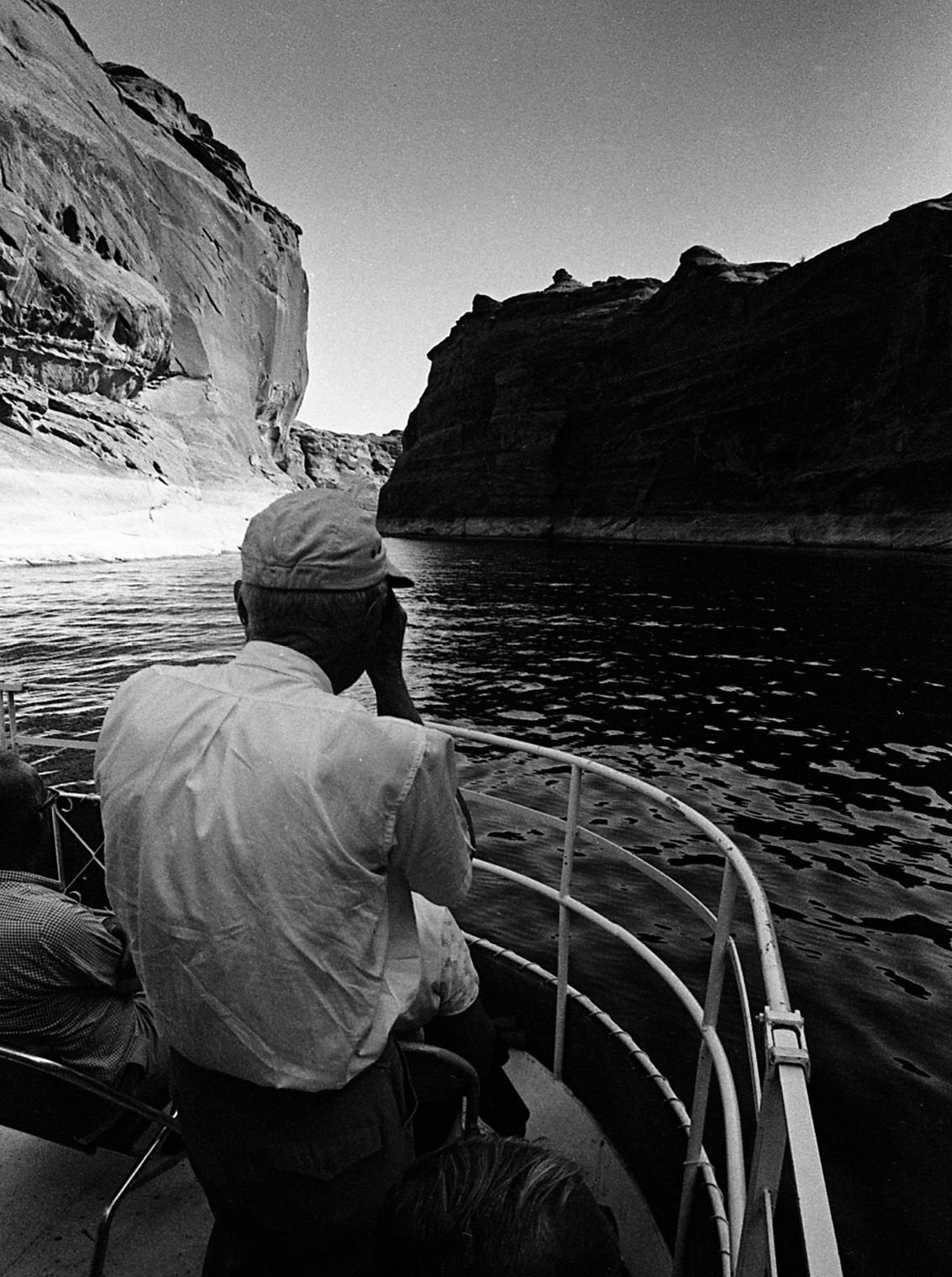
A guest photographs Arizona's newest lake during the official dedication of Glen Canyon Dam near Page, Ariz. on Sept. 22, 1966.
Glen Canyon Dam
Updated
Spectators watch the dignitaries from a distance during the official dedication of Glen Canyon Dam near Page, Ariz. on Sept. 22, 1966.
Glen Canyon Dam
Updated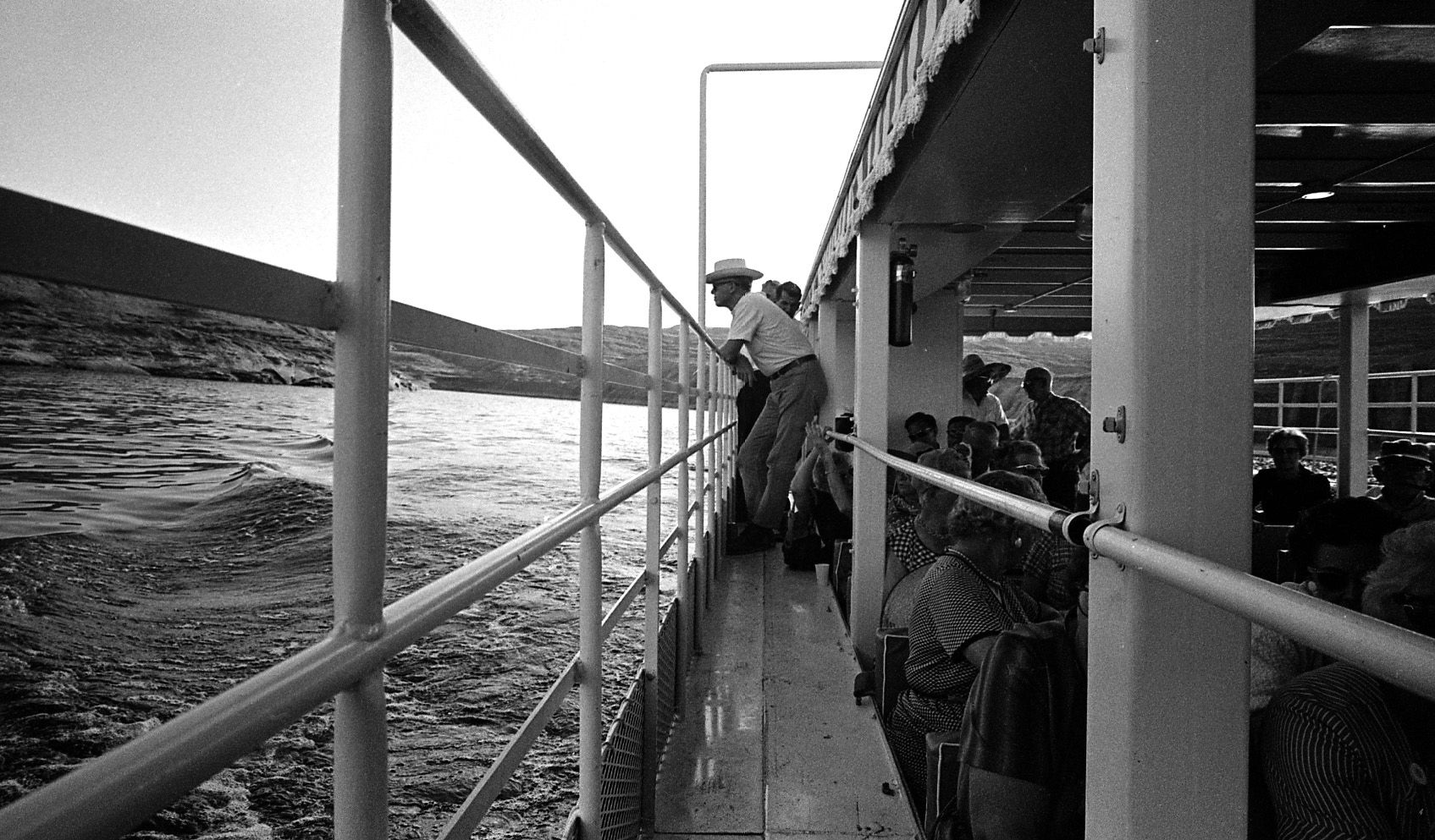
A boat ride on Lake Powell during the official dedication of Glen Canyon Dam near Page, Ariz. on Sept. 22, 1966.
Glen Canyon Dam
Updated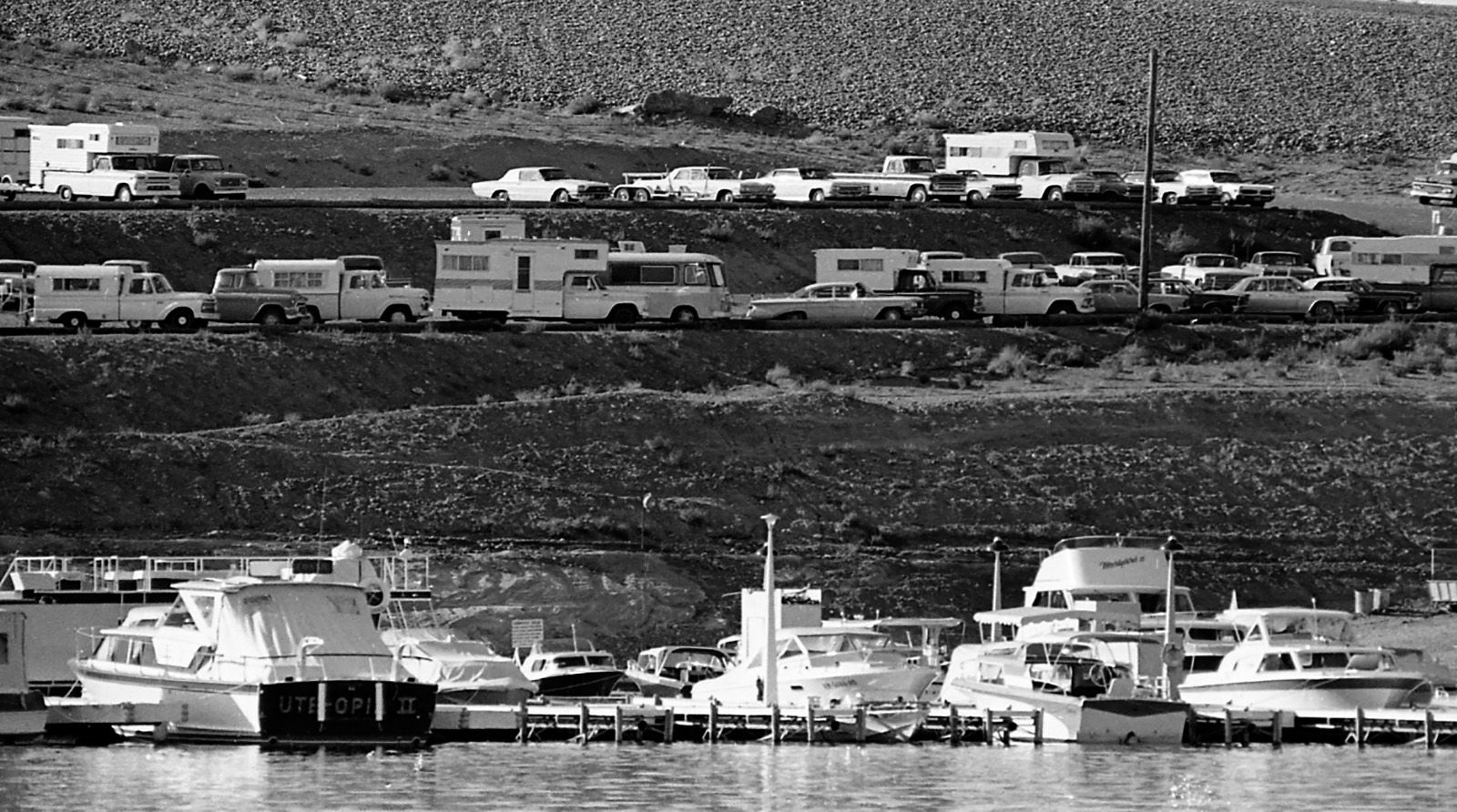
Wahweap Marina on Lake Powell during the official dedication of Glen Canyon Dam near Page, Ariz. on Sept. 22, 1966.
Glen Canyon Dam
Updated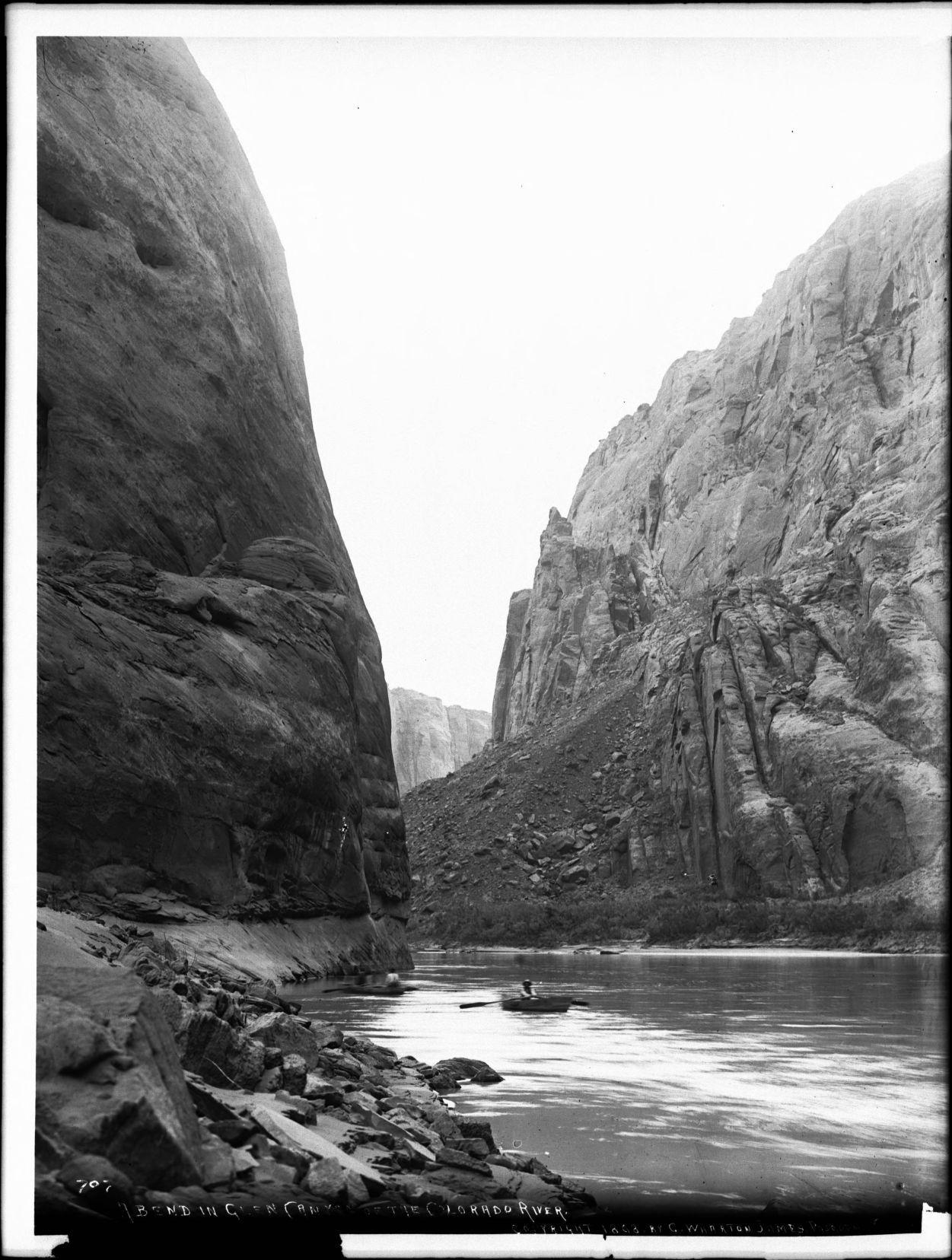
Photograph of a bend in Glen Canyon of the Colorado River, Grand Canyon, ca.1898. The towering nearly-vertical rocky canyon walls loom over the placid river. The canyon rim is visible in the distance. A rocky embankment forms the shore on one side of the river. Two men row small boats on the river.
Glen Canyon Dam
Updated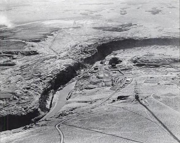
Glen Canyon damsite from the air in November 1957, prior to construction of the Glen Canyon Bridge
Glen Canyon Dam
Updated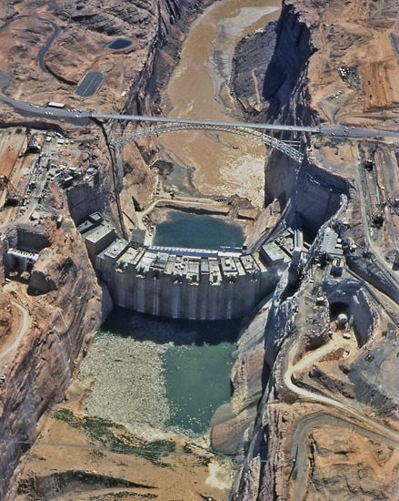
Aerial view of Glen Canyon Dam during construction - 1962
Glen Canyon Dam
Updated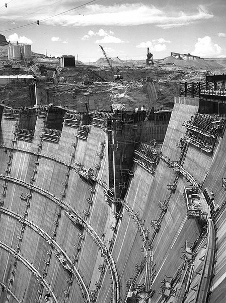
Construction of Glen Canyon Dam in 1963.
Glen Canyon Dam
Updated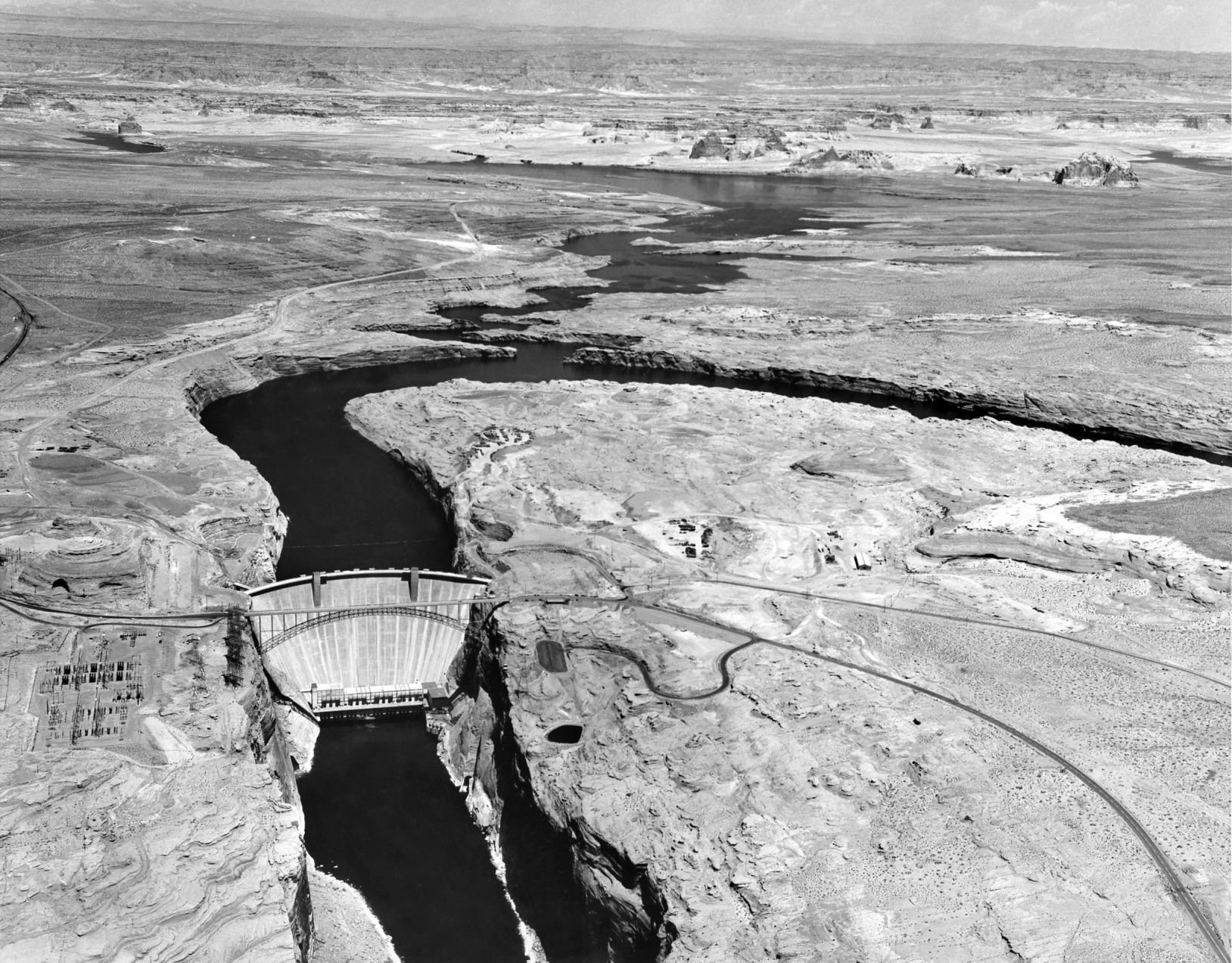
Lake Powell filling underway, 1965
Glen Canyon Dam, bridge, construction
Updated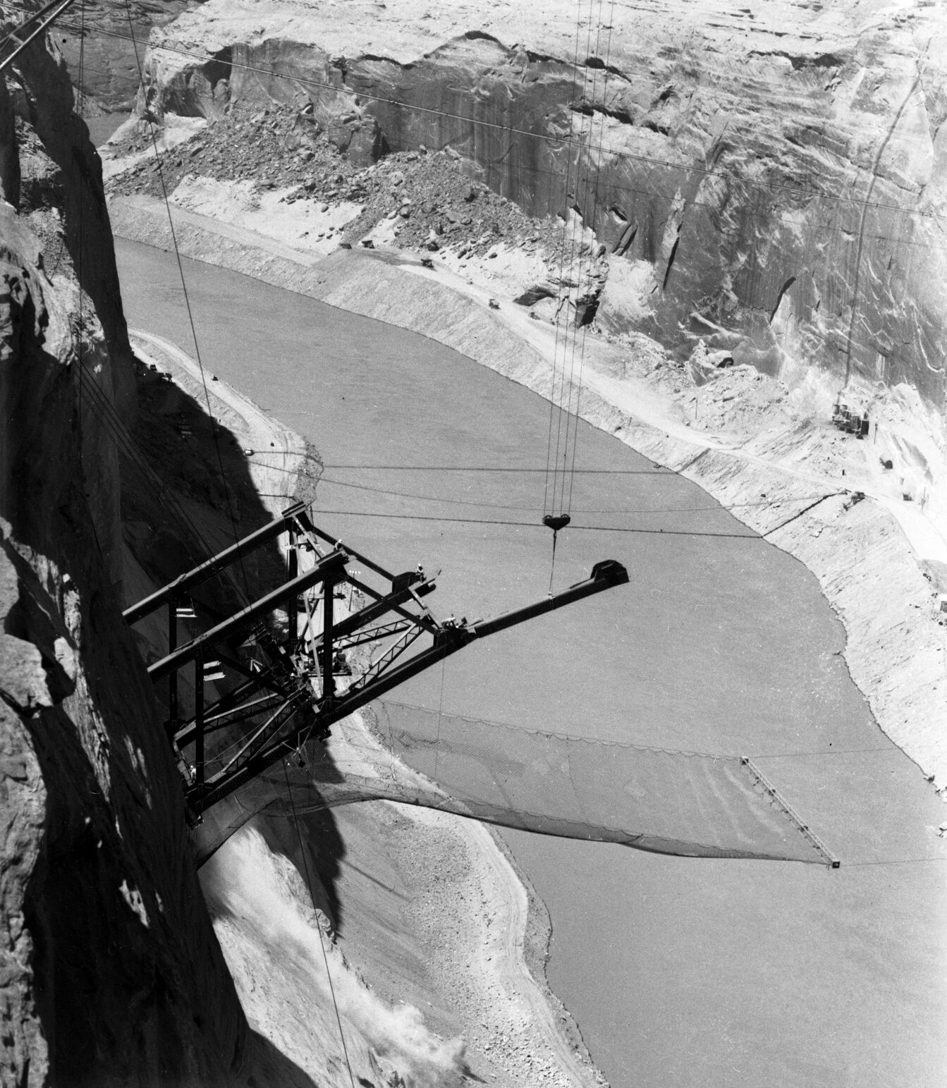
Steelworkers sit on the steel span for Glen Canyon bridge under construction high above the Colorado River in the late 1950s.
Glen Canyon Dam, bridge, construction
Updated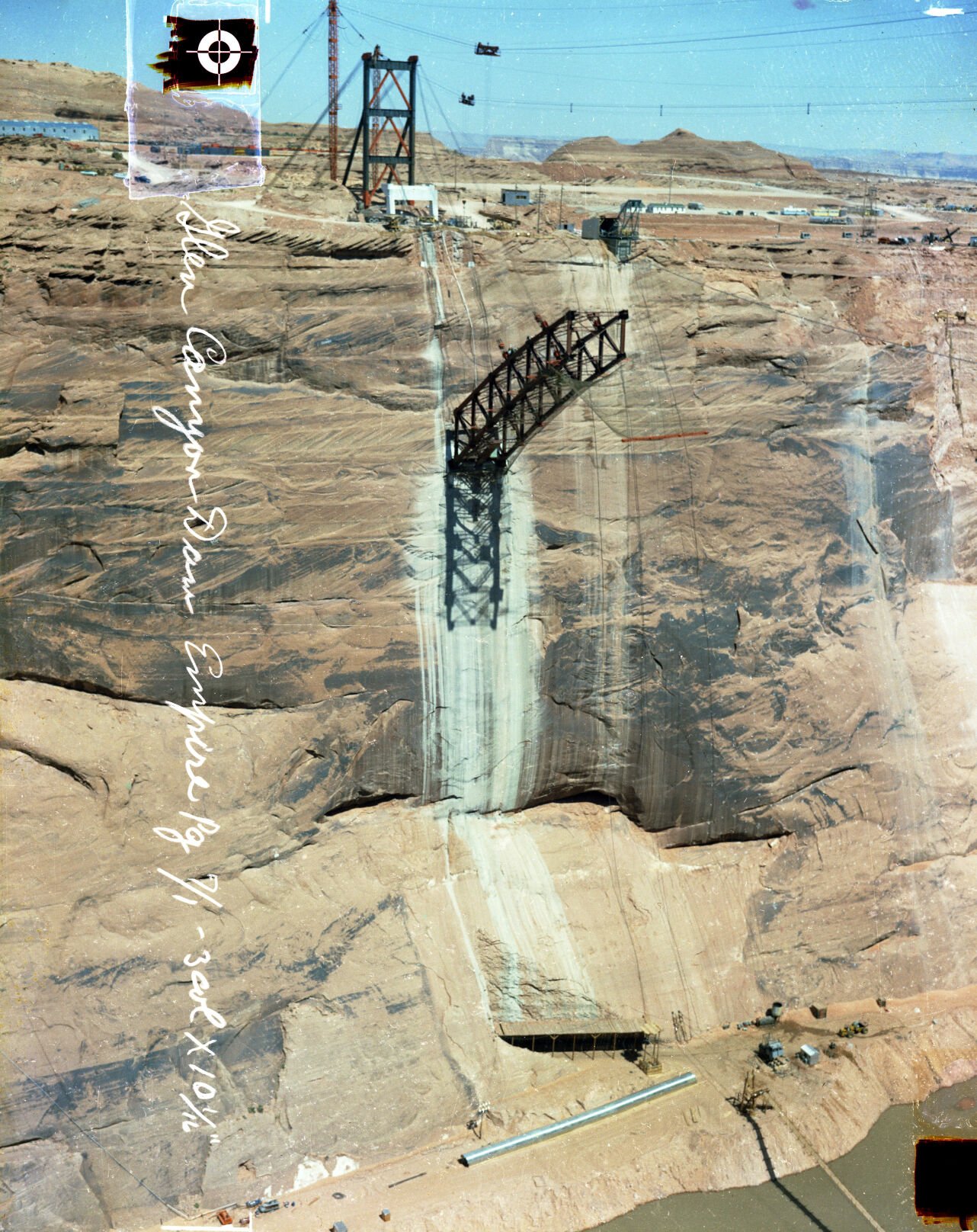
The bridge span emerges from the anchorage in the wall of Glen Canyon just west of the dam site under construction, late 1950s.
Glen Canyon Dam, bridge, construction
Updated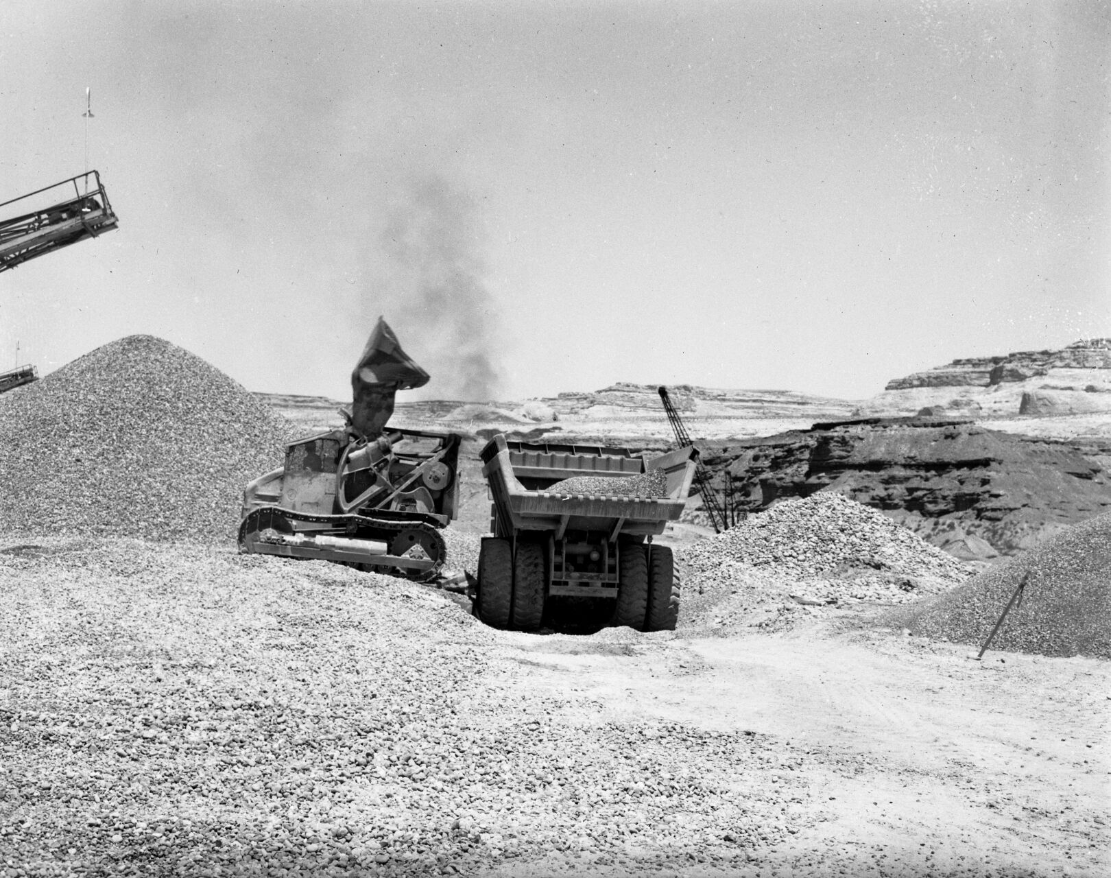
Heavy equipment moving rock at Glen Canyon Dam site, late 1950s.
Glen Canyon Dam, bridge, construction
Updated
Dozens of survey marks dot the wall of Glen Canyon at the site of the dam in the late 1950s.
Glen Canyon
Updated
Bend in Glen Canyon of the Colorado River, Grand Canyon, ca.1898. Photographer: George Wharton James

