


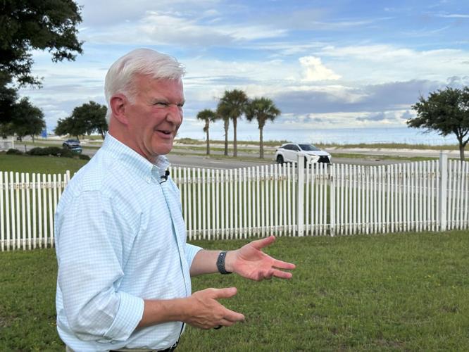
GULFPORT, Miss. — Rocking on his front porch overlooking the Mississippi Sound, former Gulfport Mayor Billy Hewes questions how anyone wouldn't want to live there.
"People are always going to gravitate to the water," he said. "And we have a beautiful waterfront."
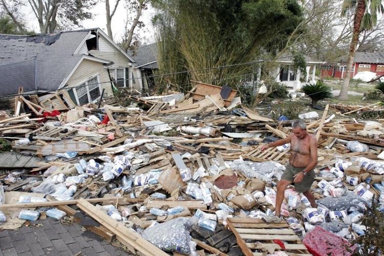
But it was far from certain that people would return after 2005's Hurricane Katrina, which killed 238 people in Mississippi and left only concrete slabs in many areas. With beachfront rebuilding crawling along a decade later, Gulfport began offering property tax breaks to those who built near the water. Hewes said the goal was for people to "build back better, quicker, help kick-start the economy."
Where to encourage building is a thorny decision for local governments in areas exposed to floods or wildfires. Despite risks including rising sea levels, places need residents and taxpayers. Like other Gulf Coast cities after Katrina, Gulfport required residents to build at higher elevations and enforced a stronger building code. But most residents near the water are in at least a moderate-risk flood zone. Nationwide, many more homes are being built in flood zones than are being removed.
"The local government was not necessarily thinking we need people to build in this flood-prone place," Miyuki Hino, a professor at the University of North Carolina at Chapel Hill who researches flooding, said of such decisions. "They were thinking we have this land that's underutilized and we can increase our property tax revenue."
Storm left a 'postapocalyptic' wasteland
Allen Baker lived through 1969's Hurricane Camille in neighboring Long Beach and thought he knew what to expect. But the 2005 storm was far worse. His historic beachfront home was blown to bits by what witnesses said was a tornado spun off by the hurricane.
"Coming back, there was no home," Baker said.
All along the coast, neighborhoods between the beach and a railroad track just to the north were shredded by a battering storm tide and winds. Recovery was slow for years.
"It was kind of spooky down here," Baker said. "I mean, it looked like one of your postapocalyptic movies."
Baker and his wife waited. They didn't move into a new home until 2016, after Gulfport began waiving city property taxes for seven years when owners invested certain amounts in building south of the railroad tracks. Property owners still had to pay county and school taxes.
Sixty properties received Gulfport's tax break before the city stopped approving new applicants in 2021, tax records show. The savings weren't huge, typically $500 to $1,000 a year, depending on property value. But Baker and others said it was a sign to stop hesitating and start building.
"In simple terms, it was a green light," Baker said.
Steel rods and thick foundations
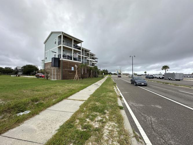
Not every area has recovered equally. In a lower-lying area on the west side of Gulfport, where rotting chicken and giant paper bales washed up from the port, many lots are still vacant. But one block inland on the east side, attractive new houses mix with structures that survived.
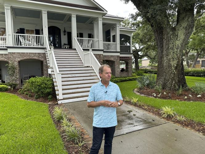
Hewes also benefited from the tax break, building a new home on a beachfront site owned by his family since 1904 — the second-most valuable house built under the program, according to tax records. Hewes said he and his wife used their tax savings to build stronger.
"We put a lot more money into actually hardening this home to a much higher standard," Hewes said.
Baker's current house also exceeds Gulfport's building code, with steel rods inside walls that tie into a 3-foot-thick concrete foundation and fasten down the roof. That qualified the home for an insurance industry standard called "fortified," which provides savings on expensive wind insurance. But only 1,500 homes in Mississippi have fortified status, according to the Insurance Institute for Business & Home Safety. That compares with 9,000 in Louisiana and 50,000 in nation-leading Alabama.
Baker, who became a civil engineer after flying airliners, argues beachfront areas need an extra-strict building code.
"Everything about this house is built to be punished," he said. "If you seriously want to live in this environment, you have to plan for that."
Some progress, but not enough?
Katherine Egland, a Gulfport resident who chairs the NAACP's national Environmental and Climate Justice Committee, fears the community may not be prepared for the next big storm.
"I'm not saying we didn't make some progress," Egland said. "What I'm saying is we didn't make nearly the amount of progress that we should have made."
She still rejects how Mississippi prioritized business recovery and says some development farther inland has worsened rainwater flooding in historically Black neighborhoods. Areas targeted by the tax break are whiter and more affluent than the city overall.
"You're giving incentives to residents south of the tracks, but at the same time, you are imperiling residents that live north of the tracks," Egland said.
Most of the first block facing the beach in Gulfport is rated as having a 1% yearly chance of flooding, although what's called the 100-year flood zone sometimes stretches farther back. The Federal Emergency Management Agency considers almost all of the rest of the area south of the railroad track to have between a 1% and a 0.2% risk of flooding annually. Flood insurance generally isn't required in that moderate risk area.
Hino said it's "absolutely true" that elevating a building reduces risk but said risk grows over time with rising sea levels, which could require someone to elevate a house multiple times over decades. And while a 1% yearly risk of flooding sounds low, those odds add up over time.
"Over the course of your 30-year mortgage, you have a 40% chance of flooding," Hino said.
It's not unusual that houses were built in a flood zone in Gulfport. From 2001 to 2019, more than 840,000 homes were built in flood plains nationwide, according to a 2024 University of Miami study. That's in part because the federally subsidized National Flood Insurance Program will repeatedly pay to rebuild, no matter how high the risk
"The incentive for local governments is to build, and in some ways the incentive for people is to stay where they are," Hino said.
The buyout that didn't happen
There was a plan to get more people out of Mississippi flood zones. Federal officials considered buying out 2,000 properties at highest risk of being damaged by hurricane storm tides. The U.S. Army Corps of Engineers projected that a $408 million buyout, in 2008 dollars, would lower potential yearly storm damage by $22 million to $33 million. But Congress never appropriated the money.
Hino said buyouts can create parkland that serves both as an environmental buffer and an amenity. But Hewes said he thinks Gulfport's choices "may have done more for our recovery than any sort of federal buyout." He said it took years for Gulfport to productively reuse land from a pre-Katrina buyout along a flood-prone bayou.
"Do you create an area that is blighted, that is abandoned, that is neglected after the fact?" Hewes asked.
Even without the tax break, construction is continuing in beachfront areas. But it may not be clear how successful recovery has been until those new buildings are tested by the next major hurricane.
"Some people have built out of concrete," Baker said. "Some people have built out of better materials. Some people have not. And those people are going to be in for a shock."

