

Glen Canyon is revealing itself.
David Brower, the first executive director of the Sierra Club and a three-time Nobel Peace Prize nominee, once said flooding Glen Canyon would be “America’s most regretted environmental mistake.” But almost 60 years after the fact, the full extent of that “mistake” remains mysterious.
Archaeologists and naturalists hastened to detail the canyon’s contents even as the Glen Canyon Dam was under construction. By the time the waters of Lake Powell began to rise in 1963, their photos and notebooks salvaged accounts of petroglyphs, natural bridges and extensive, pristine ecosystems in the Glen Canyon area. But their work was far from complete.
They documented just enough to guess at the grand total of what would be drowned under Lake Powell. William Lipe, one of the leading archaeologists of this effort, reflected that “there was an awareness that a lot was being lost.”
Now, long-term drought has brought water levels in Lake Powell to historic lows. As the shores recede, they unveil Glen Canyon’s lost wonders, allowing the consequences to resurface.
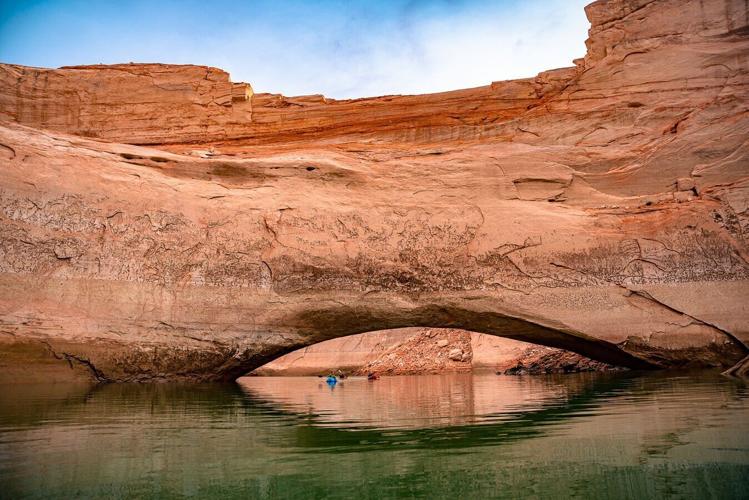
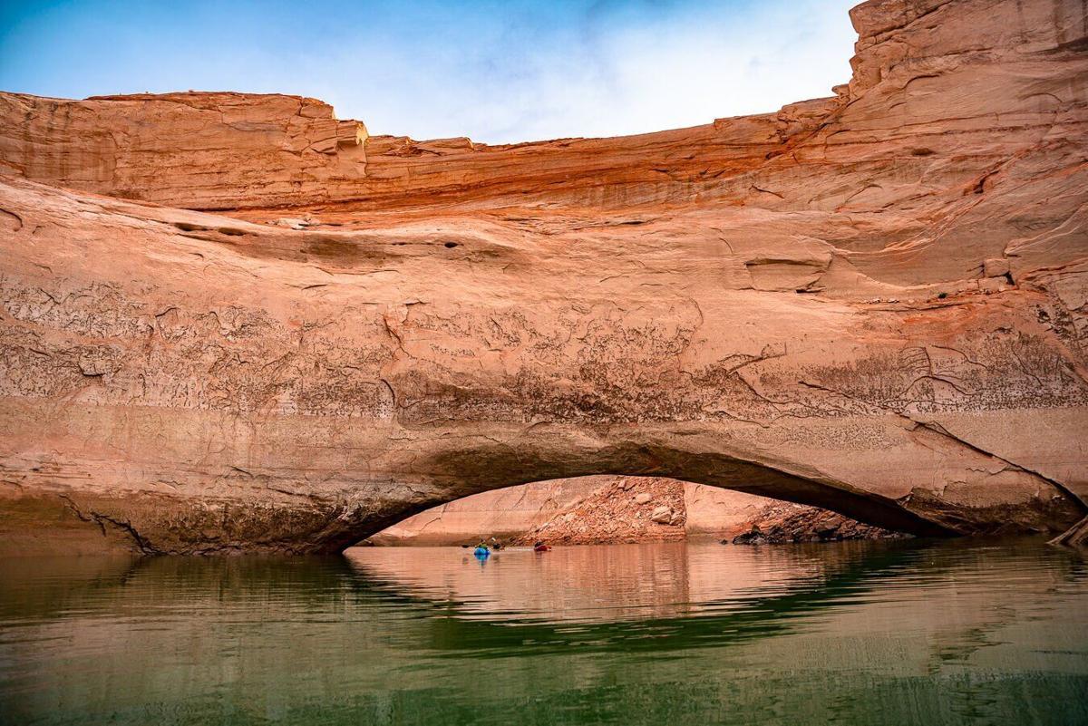
Gregory Natural Bridge is one such wonder. The 137-foot arch of Navajo sandstone spans Fiftymile Canyon and was fully submerged under Lake Powell when the reservoir filled in 1969. Last summer there were rumors that the lowering waters would soon reveal the arch, making it visible for the first time since the river trips of Katie Lee.
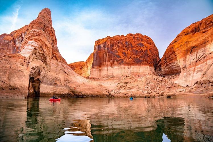
In January, Flagstaff photographer and outdoor guide Eric Retterbush set out to investigate these rumors. He and fellow photographer Eric Hanson recruited two other friends to join them. They mapped a round-trip canyoneering route that would take them down one canyon and out another, past the location of Gregory Natural Bridge.
They began their expedition camped on the ridge above their point of entry.
“Our first night was absolutely miserable,” Retterbush said. The forecast for the overnight temperature was 27 degrees Fahrenheit, but he estimated that the mercury dipped lower than expected.
“When we got up, our 5-gallon water carrier was frozen,” he said. “We were absolutely just struggling through the whole night. And knowing that we were going to be in a wet canyon the next day, we were pretty scared at that point.”
In the morning, they descended into Willow Gulch and soon were met with a deep water slot canyon. The team inflated their rafts and began to ferry through the water, canyon walls too narrow for the use of oars.
“We were just grabbing the walls to scoot through,” Retterbush said.
On the other side of this deep water, the entered an area they had not expected, a no-man’s land undescribed in any of the research they had conducted.
“We didn’t see any other footprints of anybody back there whatsoever,” Retterbush said. “There weren’t even ravens around. There was no life, no bugs. No nothing.”
In this unvisited corridor, Retterbush and the crew found a natural amphitheater where they wanted to make camp, but it was almost too peaceful to get comfortable.
“This place was absolutely pristine,” Retterbush said. “It was just perfect sand up there. We felt bad putting our stuff down.”
They examined the ground closely, looking for signs of algae, cyanobacteria and fungi that make up cryptobiotic soil crust. Finding none, they decided their presence would do no harm and set up camp. But before they did, they traced out parcels for their tents, desiring to leave the ground mostly untouched, feeling it deserved the reverence of a sand painting made in meditation, a work of art.
The feeling that these canyons had been wholly untouched is something of a modern illusion, Retterbush said. Divots in the sandstone called Moki steps tell of the Ancestral Puebloans and other Indigenous peoples of the Southwest that frequented the canyon. They carved Moki steps to act as hand and foot holds so they could climb in and out of the steep canyon walls.
“They’re kind of these ancient climbing routes,” he said, routes that continue to provide passage for those who navigate the canyons in modernity.
Still, even the Moki steps were not enough to shake the feeling that remote nature had embraced them only a day into their travel. Inaccessible to cattle and a difficult reach for bighorn sheep, the canyon fluoresced green with native grasses that terraced the sandy banks in warm microclimates. The temperatures swayed wildly over small losses and gains of elevation. Down by the water, it was a full 15 degrees cooler than their camp, Retterbush said. Frost and snow stayed frozen in the shadows.
Discovering artifacts
The next morning, the team rose early to make use of the cold. The miles ahead were laden with sediment — and consequently, quicksand.
“And I wanted that stuff to be frozen,” Retterbush said.
Normally, the sticky clay of quicksand can suck the boots off a hiker and hold them waist deep if they’re not careful. But in gelid climes, quicksand freezes and becomes like crème brûlée, Retterbush said.

Boaters drift in the calm waters near Gregory Natural Bridge.
“It’s got a crusty layer,” he said. “And if you scurry, you can get across.”
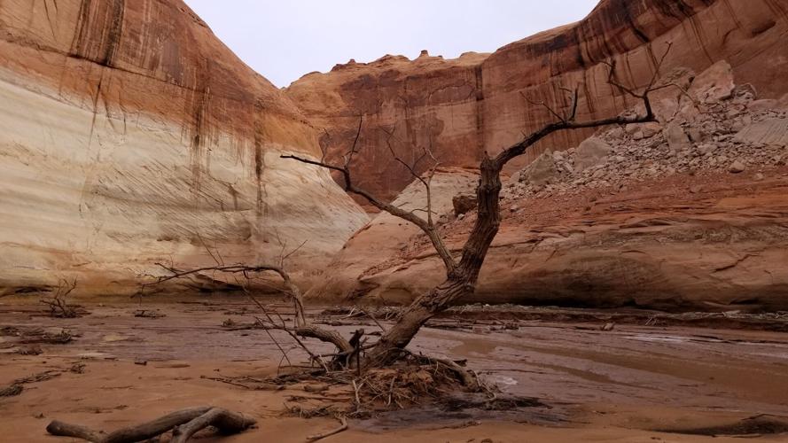
As they continued to descend into the canyon, the team soon came across artifacts left from the receding water — skeletal cottonwoods that would have been underwater only a few years prior, now left standing dead, frozen in the moment that the lake rose to meet them. Eventually they met the lake edge. A bathtub ring from the high water marked the canyon high above their head.
Again they inflated their rafts and paddled through the widening canyon to the place where Gregory Natural Bridge was said to be rising above the water. The closer they got, the more Retterbush felt anxious, concerned that their travel would be for naught, that snowmelt would have inched the water up, kept the arch below the lake.
“We came around a corner, and it was more magnificent than I could have imagined,” Retterbush said. “It was honestly one of the most beautiful parts of canyon country I’ve ever seen.”
A 60-foot section of sandstone bridge had risen from the water, high enough to paddle under. Retterbush and his team piloted their rafts beneath the arch and marveled at its curving underbelly 20 feet overhead.
“I’ve seen tons and tons of arches over the years guiding in the southwest,” Retterbush said. “But I’ve never been that close, underneath this monstrosity. It was almost like flying through.”
Water awe
Awash in awe, the team laid back in their boats and drifted through the placid water. Water and sky reflected each other, made one blue body separated by a jagged rotunda of red sandstone. In the calm, Retterbush heard something he had never heard before. He was unable to identify the sound and pointed it out to his companions.
“We thought it was animals,” he said. “It almost sounded like little creatures in the rocks. Little squeaks and pops.” But whenever they would investigate the source of the sound, they found nothing but bare rock and canyon walls.
Eventually they put it together: They were hearing water leak from the exposed rock itself.
“Sandstone soaks up water like a sponge,” Retterbush said. “It was so saturated that the water was just finding its way out, air bubble by air bubble.”
This porosity of sandstone is well documented. It’s become one of the leading arguments for “Fill Mead First,” initiatives that claim water could be spared in the current era of drought if Lake Mead was prioritized as the primary reservoir on the Colorado River.
In 2013, the Glen Canyon Institute commissioned a study to analyze water lost to ground seepage through the sandstone of Glen Canyon. The conducting hydrologist estimated that 300,000 acre-feet of water, an amount equivalent to entire water allotment for the state of Nevada, could be spared if water was stored in Lake Mead rather than in the porous sandstone of Glen Canyon. Subsequent studies have re-estimated these measurements to be closer to 50,000 acres, and while the exact number remains elusive, hydrologists agree that water from Lake Powell soaks into the surrounding sandstone and remains locked away for decades or longer.
For Retterbush, the opportunity to experience this phenomenon with his own senses was a humbling stroke of good fortune, one that could have easily been undone if the conditions had been anything less than perfect. “If there was wind, we wouldn’t have heard it,” he said.
It was also served as a dire reminder. The wonders of Glen Canyon, places like the Gregory Natural Bridge, will not wait forever under the waters of Lake Powell.
“When they become waterlogged these arches become very brittle,” Retterbush said. “Being underwater for so long will ruin the integrity of one of these arches, these nice natural areas. It’s going to accelerate erosion.”
From the Gregory Natural Bridge, Retterbush and his team spent another day meandering up through more waterways, slot canyons and Moki steps to reconnect with the ridge where their journey began. It was an adventure, Retterbush reflected, but it’s more than that.
“I like to teach respect rather than conquer,” he said.

A cottonwood drowned by the waters of Lake Powell.
There was another arch Retterbush found during the trip — a small, delicate iron band about 3 feet across.
“It took hundreds of years for this rusty little thing to erode away,” he said. “And it could all be gone with one step.”
Or one misstep, one mistake, like the flooding of a canyon. The paradox of our natural wonders is that no matter how grand they seem, how impossibly small they make us feel, even sandstone is sensitive to human action.
In all likelihood, Lake Powell will continue to recede. The water will continue to fall and reveal the wonders that were drowned by previous generations. The full extent of our “mistake” will come into clearer focus, and as people like Retterbush rediscover what was lost, we will have to decide what might be gained by a different route forward.
Photos: Glen Canyon Dam dedicated in 1966 after years of construction
Glen Canyon Dam
Updated
Glen Canyon Bridge and Glen Canyon Dam during the official dedication of Glen Canyon Dam near Page, Ariz. on Sept. 22, 1966.
Glen Canyon Dam
Updated
Interior Secretary Stewart Udall, right, with Ladybird Johnson during the official dedication of Glen Canyon Dam near Page, Ariz. on Sept. 22, 1966. The Glen Canyon Bridge is in the background.
Glen Canyon Dam
Updated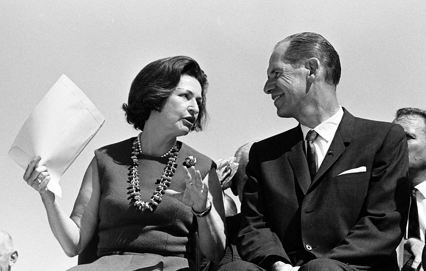
First Lady Ladybird Johnson with Arizona Gov. Sam Goddard during the official dedication of Glen Canyon Dam near Page, Ariz. on Sept. 22, 1966.
Glen Canyon Dam
Updated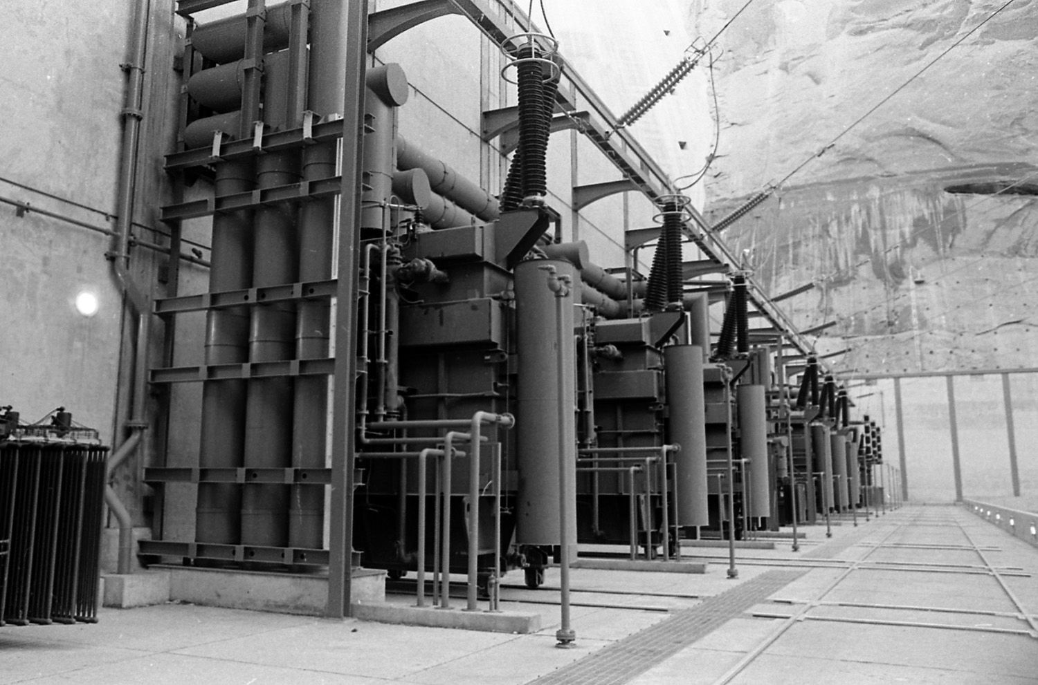
The transformer complex during the official dedication of Glen Canyon Dam near Page, Ariz. on Sept. 22, 1966.
Glen Canyon Dam
Updated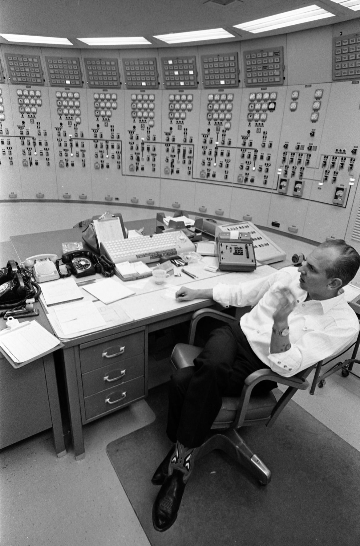
The control room during the official dedication of Glen Canyon Dam near Page, Ariz. on Sept. 22, 1966.
Glen Canyon Dam
Updated
Deep underneath Glen Canyon Dam during the official dedication of Glen Canyon Dam near Page, Ariz. on Sept. 22, 1966.
Glen Canyon Dam
Updated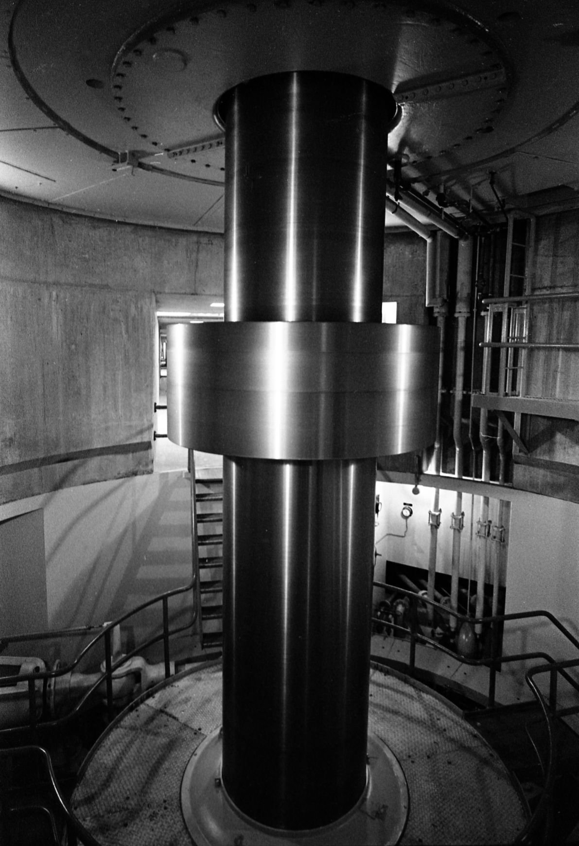
A giant steel turbine shaft spinning during the official dedication of Glen Canyon Dam near Page, Ariz. on Sept. 22, 1966.
Glen Canyon Dam
Updated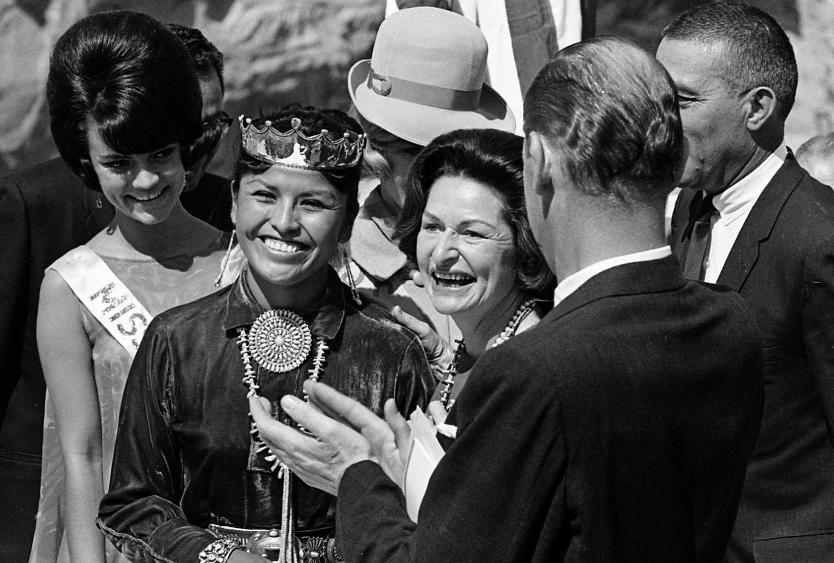
First Lady Ladybird Johnson, center, during the official dedication of Glen Canyon Dam near Page, Ariz. on Sept. 22, 1966.
Glen Canyon Dam
Updated
First Lady Ladybird Johnson during the official dedication of Glen Canyon Dam near Page, Ariz. on Sept. 22, 1966.
Glen Canyon Dam
Updated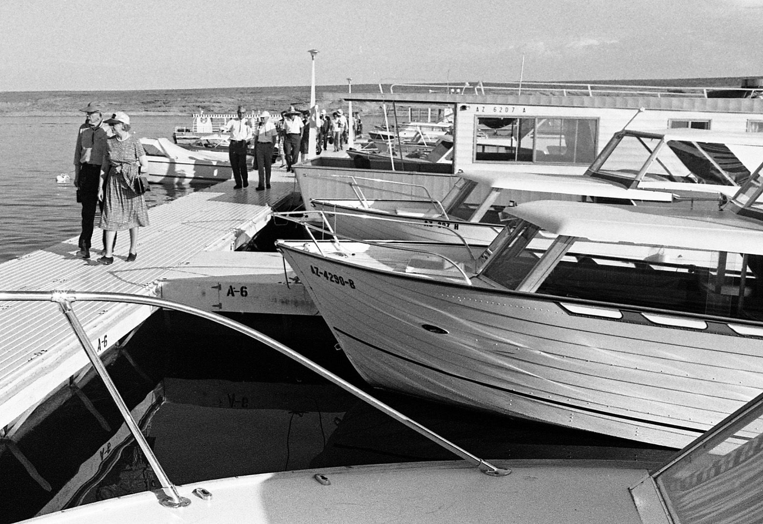
Wahweap Marina on Lake Powell during the official dedication of Glen Canyon Dam near Page, Ariz. on Sept. 22, 1966.
Glen Canyon Dam
Updated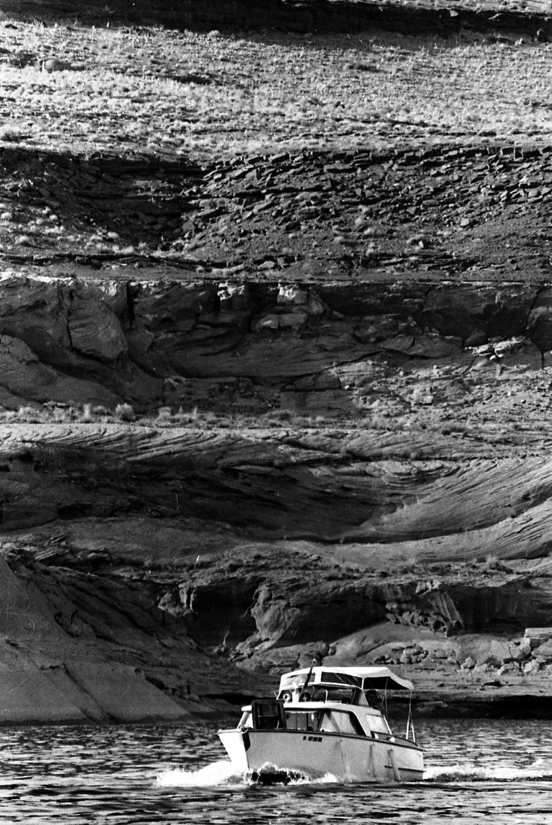
Boaters on the new Lake Powell during the official dedication of Glen Canyon Dam near Page, Ariz. on Sept. 22, 1966.
Glen Canyon Dam
Updated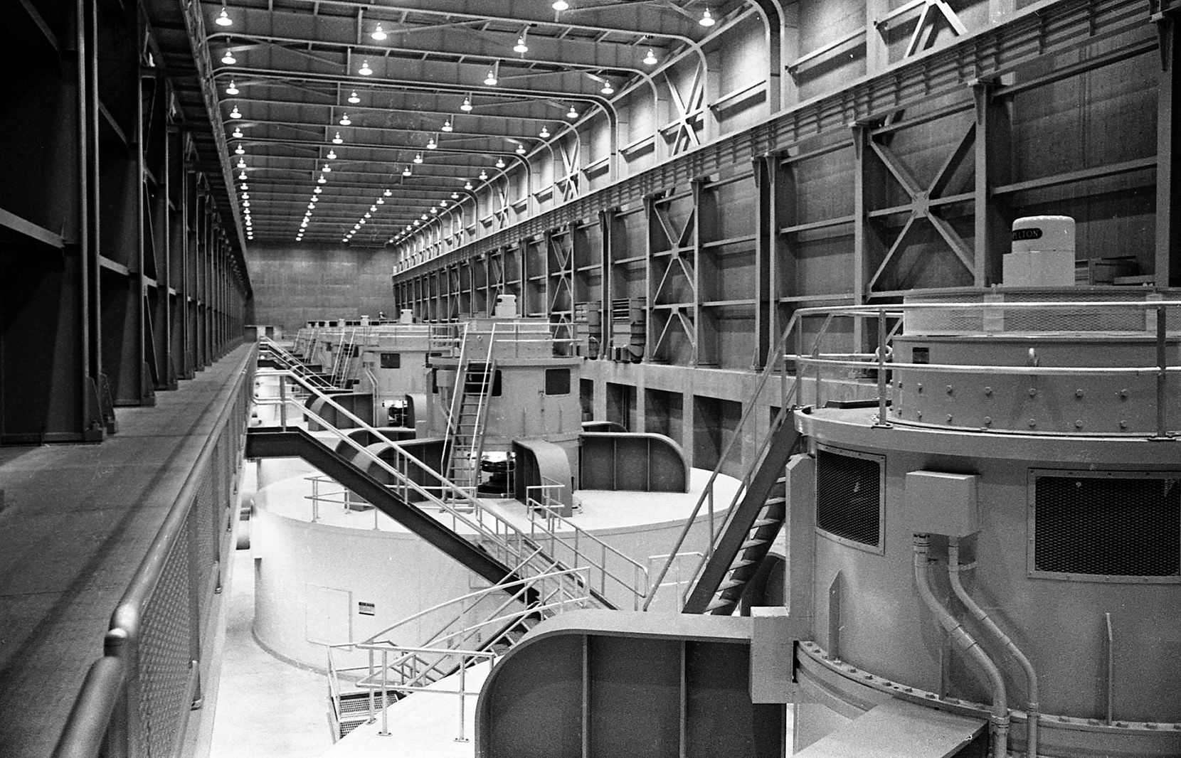
The turbine hall during the official dedication of Glen Canyon Dam near Page, Ariz. on Sept. 22, 1966. The first electricity was generated on September 4, 1964, with the power sent into the regional electric grid through a pair of long-distance transmission lines as far as Phoenix, Arizona and Farmington, New Mexico.[
Glen Canyon Dam
Updated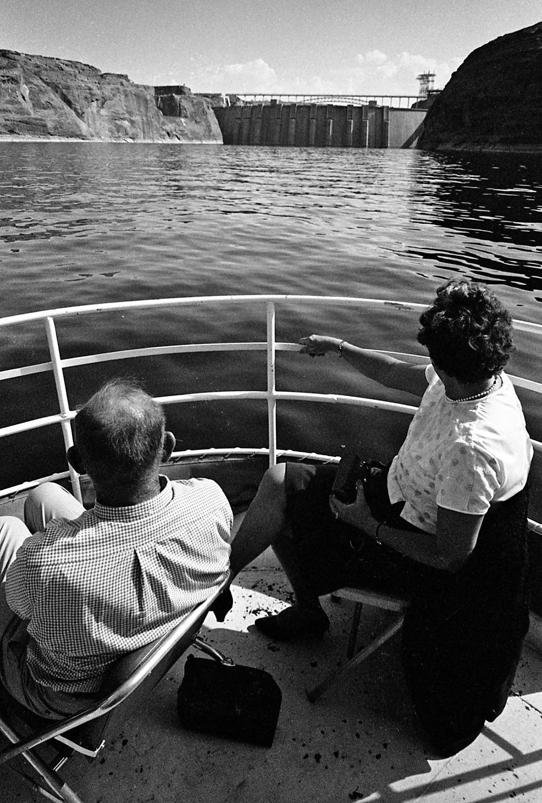
The eight penstocks that provide water for generation of electricity are revealed on the back of Glen Canyon Dam during the official dedication of Glen Canyon Dam near Page, Ariz. on Sept. 22, 1966.
Glen Canyon Dam
Updated
A man catches some sun during the official dedication of Glen Canyon Dam near Page, Ariz. on Sept. 22, 1966.
Glen Canyon Dam
Updated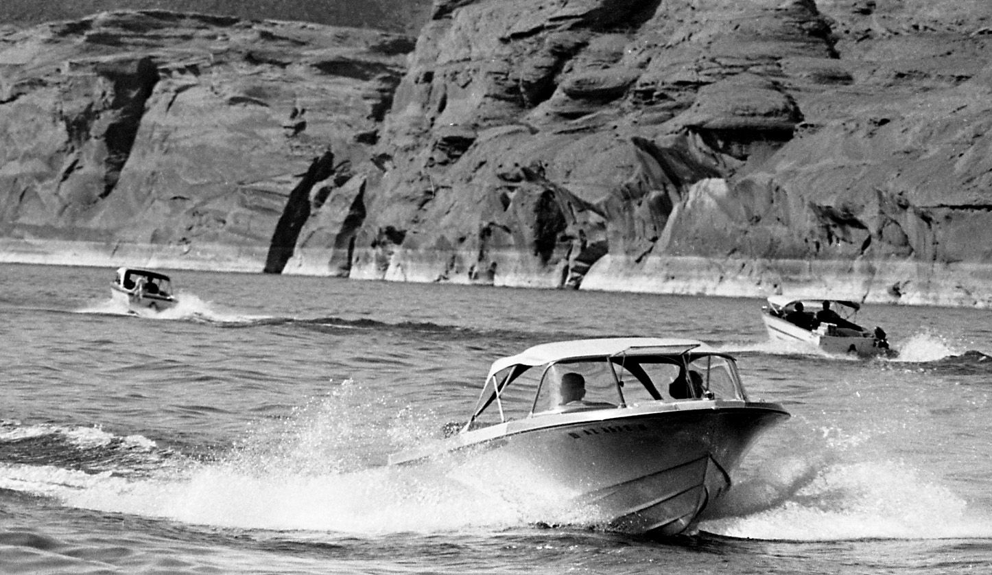
Boaters on Lake Powell during the official dedication of Glen Canyon Dam near Page, Ariz. on Sept. 22, 1966.
Glen Canyon Dam
Updated
Boaters on Lake Powell during the official dedication of Glen Canyon Dam near Page, Ariz. on Sept. 22, 1966.
Glen Canyon Dam
Updated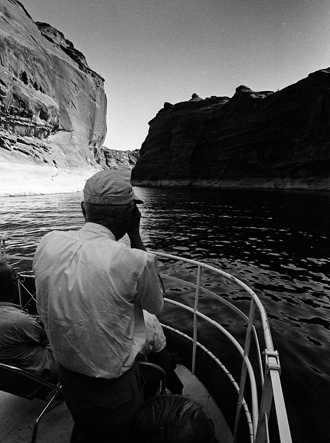
A guest photographs Arizona's newest lake during the official dedication of Glen Canyon Dam near Page, Ariz. on Sept. 22, 1966.
Glen Canyon Dam
Updated
Spectators watch the dignitaries from a distance during the official dedication of Glen Canyon Dam near Page, Ariz. on Sept. 22, 1966.
Glen Canyon Dam
Updated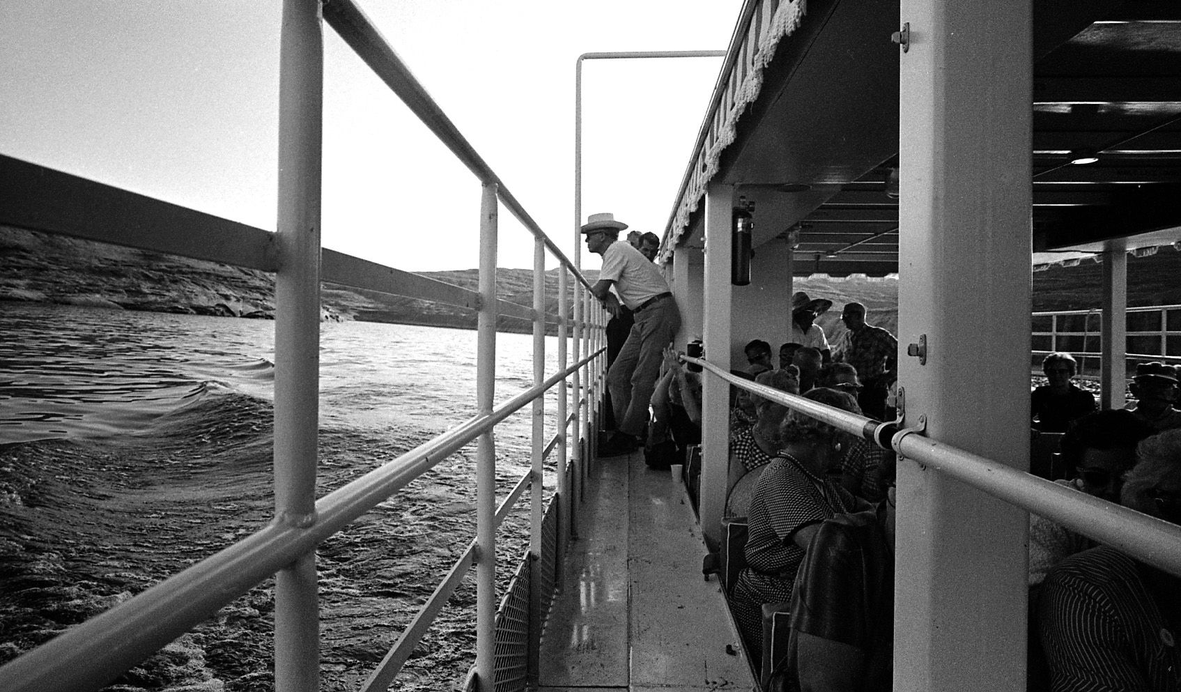
A boat ride on Lake Powell during the official dedication of Glen Canyon Dam near Page, Ariz. on Sept. 22, 1966.
Glen Canyon Dam
Updated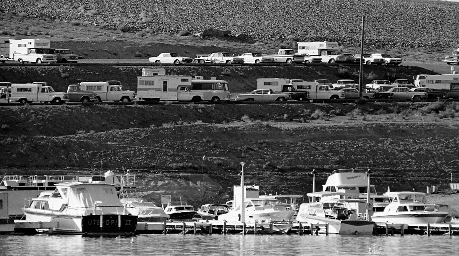
Wahweap Marina on Lake Powell during the official dedication of Glen Canyon Dam near Page, Ariz. on Sept. 22, 1966.
Glen Canyon Dam
Updated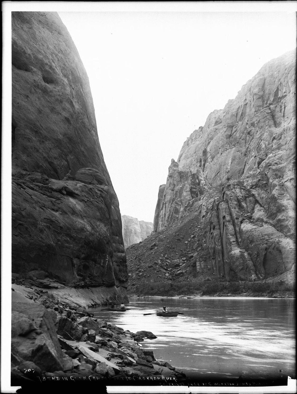
Photograph of a bend in Glen Canyon of the Colorado River, Grand Canyon, ca.1898. The towering nearly-vertical rocky canyon walls loom over the placid river. The canyon rim is visible in the distance. A rocky embankment forms the shore on one side of the river. Two men row small boats on the river.
Glen Canyon Dam
Updated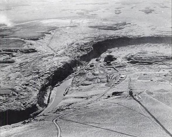
Glen Canyon damsite from the air in November 1957, prior to construction of the Glen Canyon Bridge
Glen Canyon Dam
Updated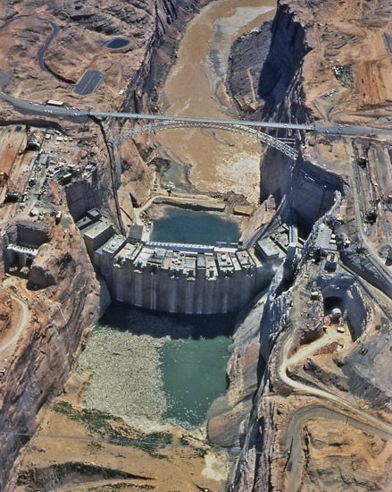
Aerial view of Glen Canyon Dam during construction - 1962
Glen Canyon Dam
Updated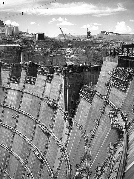
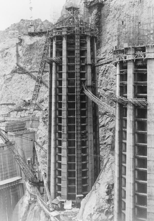
Construction of Glen Canyon Dam in 1963.
Glen Canyon Dam
Updated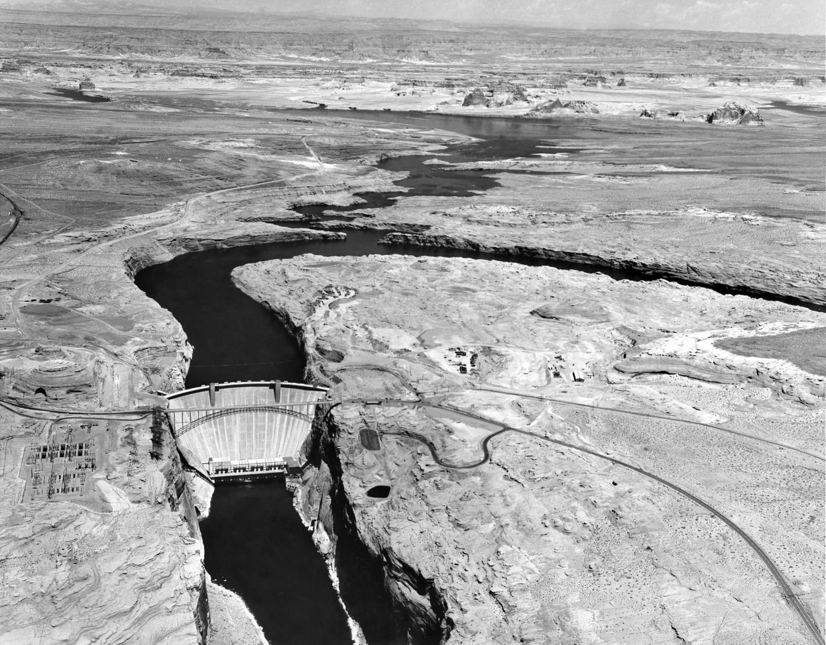
Lake Powell filling underway, 1965
Glen Canyon Dam, bridge, construction
Updated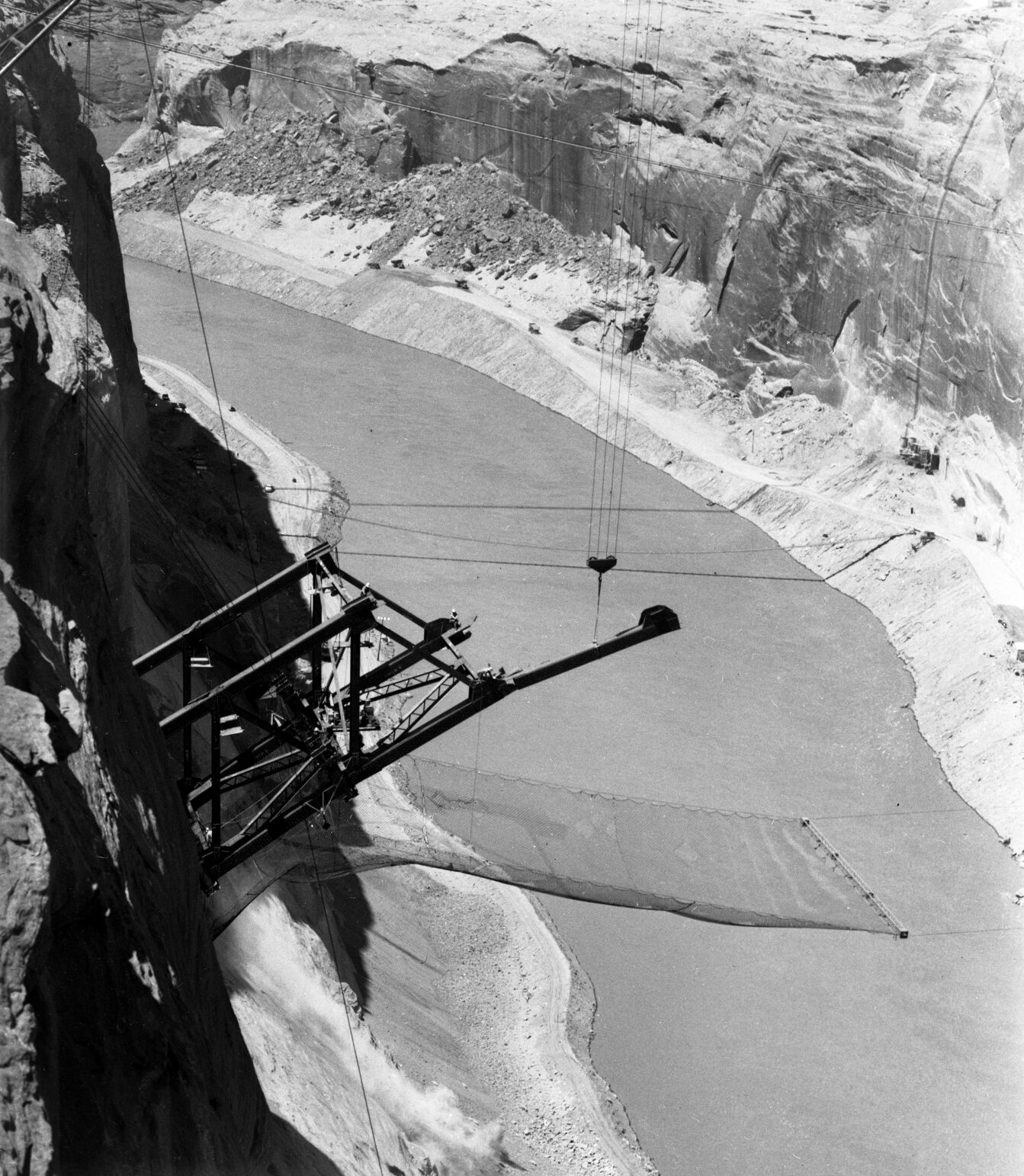
Steelworkers sit on the steel span for Glen Canyon bridge under construction high above the Colorado River in the late 1950s.
Glen Canyon Dam, bridge, construction
Updated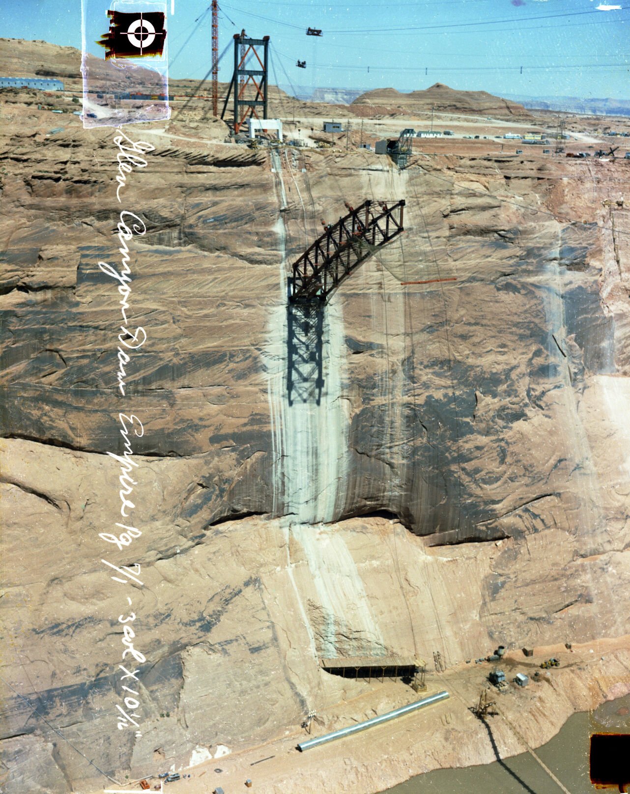
The bridge span emerges from the anchorage in the wall of Glen Canyon just west of the dam site under construction, late 1950s.
Glen Canyon Dam, bridge, construction
Updated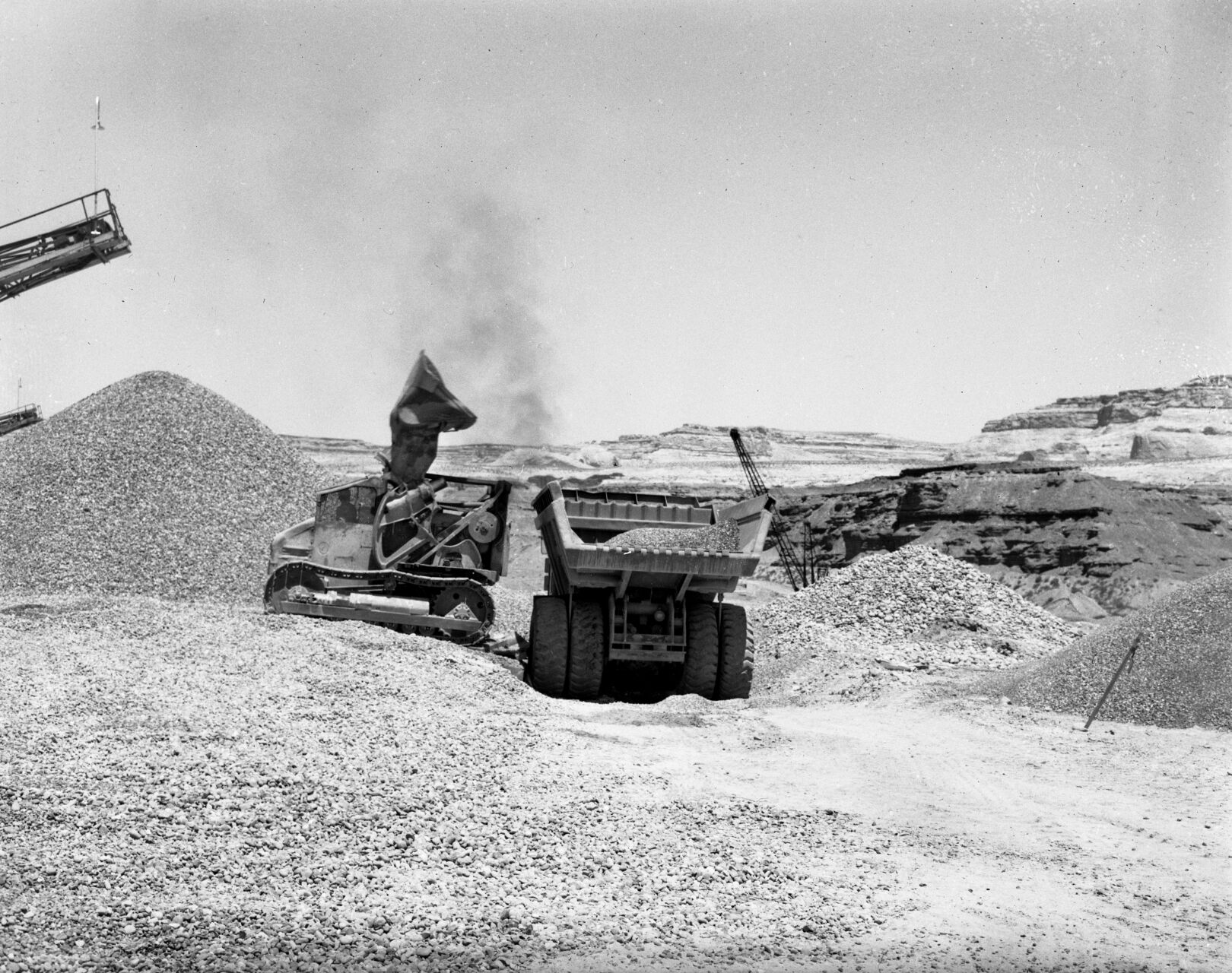
Heavy equipment moving rock at Glen Canyon Dam site, late 1950s.
Glen Canyon Dam, bridge, construction
Updated
Dozens of survey marks dot the wall of Glen Canyon at the site of the dam in the late 1950s.
Glen Canyon
Updated
Bend in Glen Canyon of the Colorado River, Grand Canyon, ca.1898. Photographer: George Wharton James
Photos: Construction of Hoover Dam on the Colorado River in the 1930s

This general view of Black Canyon on the Colorado River, looking upstream toward the site of Hoover Dam, shows a temporary steel suspension bridge in the foreground and portals of the 56-inch diversion tunnel bores which will carry the river water while the dam is under construction, March 12, 1932. The dam will be in Black Canyon, despite the fact that it is generally known as the Boulder Canyon Project. (AP Photo)

This photograph was made from the Nevada side of the river, and shows some of the blasting operations in progress, Aug. 24, 1932 in Nevada. Some idea of the difficulties of the operations may be gained from this view of the rock cliffs. (AP Photo)

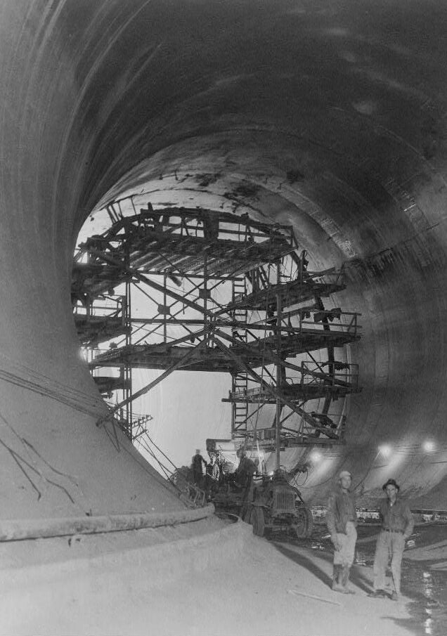
This view shows the interior of one of the tunnels through which the Colorado River will be diverted around the Hoover Dam site in Boulder City, Nev., April 18, 1932. The project is in the early stages of construction. (AP Photo)

Looking down on Hoover Dam site, the parapet is directly over the power plant site, and also part of the Nevada-Arizona highway which will traverse the dam, shown Aug. 24, 1932. Beyond this will be the greatest lake ever created by man. (AP Photo)

A lake covering 227 miles will form the 30,500,000 acre foot reservoir from Hoover Dam when completed. Elmer L. Chapman, junior reclamation service engineer, points to the hills which will be submerged after the completion of the project in Nevada, Aug. 24, 1932. The flat top lone mountain in the center of the photograph will be an island 14 feet above water. (AP Photo)

This is a downstream view of the Hoover Dam showing the immense concrete blocks rising from the bedrock of Black Canyon's floor, which will be the core of the dam, near Boulder City, Nev., Aug. 12, 1933. Concrete is being poured into the forms at the rate of about 6,000 cubic yards daily. (AP Photo)

Construction continues Jan. 9, 1932 as workers construct the retaining wall that gives support to the road leading over the top of Hoover Dam. Labor troubles were experienced during the huge engineering project on the Colorado River near Las Vegas, Nevada. (AP Photo)
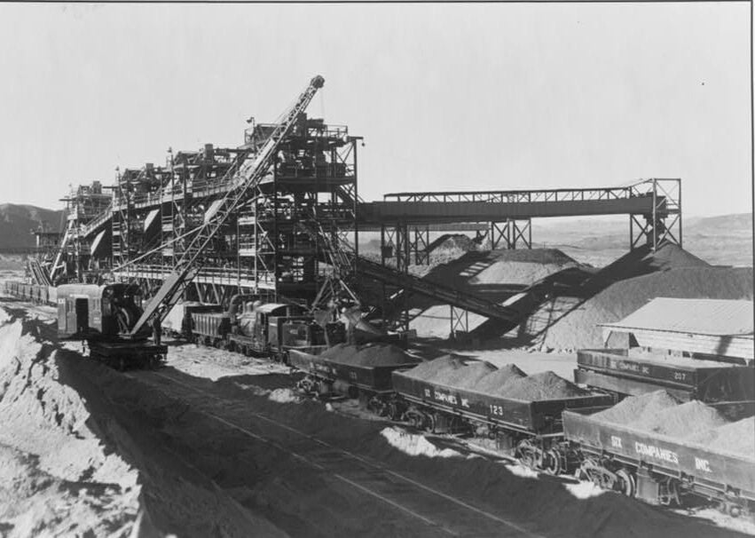
Gravel screening and washing plant in 1934. Glaha, Ben D., 1899-1970, photographer
Boulder Dam, (i.e. Hoover Dam) between Arizona and Nevada in 1933. Placing concrete in the sidewall of the Nevada spillway. A 2 cubic yard bottom-dump bucket is being handled by crane. Note the manner in which the panels are staggered
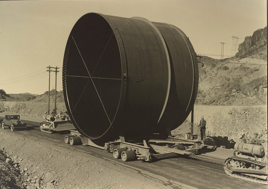
Penstock on trailer, 1934. Glaha, Ben D., 1899-1970, photographer
The Nevada intake towers at Boulder Dam in 1934. Glaha, Ben D., 1899-1970, photographer
Grouting concrete lining in 50' diameter diversion tunnel in 1934. Glaha, Ben D., 1899-1970, photographer

Construction of the Hoover Dam continues, a constant stream of large trucks dumping fifty tons of soil a minute, built an earth fill dam across the Colorado River, forcing its turbulent waters into two fifty-foot diversion tunnels on the Arizona canyon wall on Nov. 15, 1932. (AP Photo)

Inside of diversion tunnel no. 3, on the boulder dam project, showing concreting operations, July 9, 1934. The intersection of the inclined tunnel from the intake tower (above) with the present diversion which is being plugged. These tunnels will carry the 30-foot diameter steel penstocks for the power system. Photo by bureau of reclamation. (AP Photo)

This is an aerial view of one of the four intake towers of the Hoover Dam, Aug. 9, 1934. The towers, two on each side of the canyon upstream from the dam, will measure at 380 feet high. (AP Photo)

The Boulder Dam, Black Canyon of Colorado River, is nearing completion, this view showing 500 of its projected 730 feet above the canyon floor, Aug. 28, 1934. The federal reclamation service, directing the construction, says the dam, now 80 per center completed will be finished next April, a full year ahead of schedule. (AP Photo)

A view of the huge Boulder Dam operation from a high point on the Nevada rim of the Black Canyon, shown Sept. 11, 1934. The immensity of the project can be seen from this picture. (AP Photo)

Hoover Dam takes shape from the concrete columns in which it was poured (shot from cableway control tower downstream on Nevada rim, so looking upstream) in 1934.

The rarely-seen upstream face of Hoover Dam, May 1935

This is a view of the Hoover Dam from upstream as construction continues near Boulder City, Nev., Feb. 1, 1935. The crack in the upper center of the dam is a space left open for cooling and settling of the concrete and will be filled as work progresses. (AP Photo)

This aerial view shows a crest of the Hoover Dam, aka Boulder Dam, showing the highway leading across it on July 16, 1935. The road, soon to be opened to the public, will provide an easy route between Las Vegas, Nev., and Kingman, Arizona. The intake towers jut up on the other side of the dam in Boulder City, Nevada. (AP Photo)

Night view of Boulder Dam and Mead Lake taken from a plane United airlines-western air express shows the roadway over the dam top illuminated and the candles atop the intake towers casting their reflections on the water, Sept.22, 1936 in Boulder City, Nevada. (AP Photo)

Behind boulder dam, in the black canyon of the Colorado River, is the largest man-made lake in the world shown, June 11, 1938. Pressing against the barrier of concrete and steel are 20,000,000 acre-feet of water which, translated into gallons, is enough to provide 51,100 gallons for every person in the United States. This water is to be used to meet the needs of the power house at the toe of the dam, and to irrigate the thousands of acres of reclaimed desert downstream in Arizona and California. (AP Photo)

Meet the Champs. These six 82,500 kva generators in the Nevada wing of the power house at Boulder Dam are the biggest in the word, Feb.7, 1939 . Power produced at the dam by these generators and one in the Arizona wing, amounts to 130,000,000 kilowatt hours of energy each month which sells for ?290,000. The Bureau of Reclamation which built and operates the dam, received $3,297,289 in two years. Production at this time is approximately one-third of the ultimate capacity. (AP Photo)

Aerial view of Hoover (Boulder) Dam on the Colorado River, Dec. 11, 1948. (AP Photo)

This is Main Street in Boulder City, Nevada, Aug. 24, 1932, the model construction housing center for the workers on the huge Hoover Dam project. This city was constructed at a cost of $2,000,000. (AP Photo)

A three million pound gate of tunnel no. 4, shown above at left, was ready to close, Feb. 1, 1935, stopping flow of the Colorado River at the Boulder Dam, thus starting filling of a huge reservoir. The above photo taken just before the gate stated closing shows a coffer dam built across the entrance of tunnel no. 3, which has been diverting the river through the canyon walls and around the dam on the Arizona side. (AP Photo)

Spectators watch from bridge over spillway as Boulder Dam overflows for first time, August 6, 1941, and pours 15,000 cubic feet per minute from record level of Lake Mead into Colorado River behind the dam. Spillway leads into tunnel 50 feet in diameter and then 2200 feet to river level below where water bursts out in great jet. At Dam, Lake Mead had reached level of 590 feet and contained more than 10,000,000,000,000 of water. (AP Photo)

The mighty man-made falls of the Colorado River with the six outlets wide open in a night display. Since the start of generation of power here the dam has been a night-time Mecca for tourists in Los Angeles, Sept. 22, 1936. The transmission of power to Los Angeles will be started on October 9. (AP Photo)

The 115,000-vollite generator in the world?s biggest power plant, here at Boulder City, Sept. 29, 1936, where all is in readiness to start electricity over the world?s longest power transmission line ? 365 miles to Los Angeles. (AP Photo)

This magnificent man-made scenic favorite is Hoover Dam by night, May 11, 1953, one of this century?s outstanding triumphs of engineering and construction. At its foot is Lake Mead, the world?s largest man-made body of water on Popular with anglers and fans of boating, Lake Mead is fast becoming a favorite vacation playground. Gateway to the Hoover Dam ? Lake Mead recreational area is fabulous Las Vegas, Nevada on the main line of Union Pacific Railroad. AP Photo)

The mighty Hoover Dam impresses a young Swiss couple making their first tour of United States on their scooter, April 9, 1954 in Nevada. Natives of Zurich, Fred and Beatrice Troller were veteran scooter travelers in Europe before coming here. (AP Photo)

Boulder Dam?s mighty water intake towers, rising 395 feet into the air, are in picture of the gigantic power project shown, April 14, 1938. Through these towers flows the water which operates the huge generators in the powerhouse below the 727-foot dam. On the shores of the 110-mile long lake impounded, the government has established the boulder dam recreational area. Luxurious accommodations are available at Boulder City. New a regular airline stop. (AP Photo)

English: Tourists gather around one of the generators in the Nevada wing of the powerhouse of Boulder Dam (later Hoover Dam) to hear its operation explained.

Hoover Dam at Dusk, Sept. 20, 1950. (AP Photo)

This July 18, 2014 photo shows generators inside the Hoover Dam, located on the Colorado River, on the border between Arizona and Nevada. It's considered one of America's great civil engineering wonders. Located about a half-hour from Las Vegas, it's a top destination for visitors to the region. (AP Photo/John Marshall)

In this July 28, 2014 photo, lightning strikes over Lake Mead near Hoover Dam at the Lake Mead National Recreation Area in Arizona. On the left are the Arizona intake towers of Hoover Dam. The bathtub ring of light minerals shows the high water mark of the reservoir which has shrunk to its lowest point since it was first filled in the 1930s. (AP Photo/John Locher)

Low water levels in the Lake Mead reservoir and at the Hoover Dam show a "bath tub ring" on October 14, 2015. Water in the lake has continued to drop. (Irfan Khan/Los Angeles Times/TNS)

A boater gets an up-close view the "bathtub ring" that is visible at low water levels and is the result of the deposition of minerals on previously submerged surfaces while touring the front of Hoover Dam, which sits on the border of Nevada and Arizona, at Lake Mead, Nevada, June 28, 2021.

The intake towers that feed Hoover Dam’s power generators are almost fully exposed as the Lake Mead water level continues to decline in June, 2022.

