


As a gardener, you no doubt know that the most critical factors in your garden are your soil type, how much sun you get and precipitation. It can take a lot of observation and time to figure this out on a garden site. There are some online tools available, though, that can speed this task up a bit.
The following three tools will help you establish the sun’s path at your location, the patterns of precipitation you can expect based on historic records and the type of soil that is in your area. Naturally, these tools are not perfect but they are a great starting point, particularly if you have moved to a new location and are unfamiliar with your site.
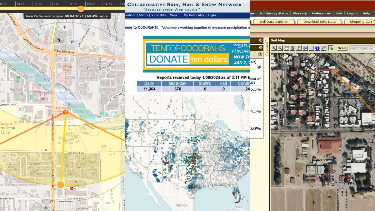
Figuring out your sun exposure with SunCalc
This tool is quite straightforward and easy to use. You simply put your address in the top left-hand box and your sun’s path will display for today’s date. The great thing about this tool is that you can put in other dates to see how the sun’s path will affect your garden during different times of the year.
You can also put in an object of a certain height (perhaps a tree you’re thinking about planting?) and the tool will calculate that object’s shadow at any date or time you ask it to. Take some time to play around with this tool, and it can help you plan where you put structures and tall trees in your yard, as well as help you figure out where to put plants with varying sunlight needs.
CoCoRaHS precipitation tool
This is the site of the Community Collaborative Rain, Hail and Snow network. It’s a network of volunteer citizen scientists that originated at Colorado State University in 1998. Volunteers measure precipitation and record it on the interactive CoCoRaHS website which is free to access and use.
Click on “Maps” at the top of the page, then on “Interactive” and zoom in to your area. At the top right you can specify a date range or you can click on “map options” and ask it to display (for example) the past month’s precipitation data. I find this particularly helpful, since it shows recent precipitation in various parts of town.
Another easy way to view the precipitation data is to click on “View Data” and then in the left hand column click on “Total Precip Summary”. There you can search by country, state and county and put in your date range. This will give you a table of the precipitation data from each station in the area you’ve designated.
There are lots of other data on the site, including downloadable reports for each registered volunteer weather station. If you are so inclined, you can participate in the data collection yourself. For more details, visit the CoCoRaHS “About us” page.
Getting soil info with the USDA Web Soil Survey
The Web Soil Survey displays data from nationwide soil surveys completed by soil scientists sponsored by the U.S. Department of Agriculture. To find out what the soil survey data is in your area, click on the big green button that says “Start WSS” on the WSS main page. A map of the U.S. will appear with a menu on the left hand side.
Expand the “Address” tab and type in your full address and then click “View.” Your neighborhood and house should appear. Now click on the little box that says “AOI”. This stands for “Area of interest” and allows you to draw a shape around the area you want to see the soil data for. Once you’ve drawn your box on the map, click on the “Soil map” tab. The soil data for the area of interest that you defined will appear in the left hand column.
If you encounter any issues, Watershed Management Group has a great short video that walks you through using the site.
This tool’s limitations are its scalability. It’s also good to keep in mind that urban soils are a grab bag – your site may have soil brought in by builders from another site, so the soil survey may not necessarily be accurate. I recommend supplementing the information you gather with soil testing at your site. It’s good to dig a couple of small test holes to determine whether you have caliche, clay, sand, rocky soil, and similar features. You can also perform a jar test on your soil to figure out what type of soil you have.
There is a lot more that goes into growing and maintaining plants than most people realize.

