


Our third La Niña weather pattern in three years seems almost certain, and one climate expert says that could be bad news for the already overtapped Colorado River.
In early September, the Climate Prediction Center for the National Atmospheric and Oceanic Administration forecast a 91% chance of a La Niña weather pattern dominating the Northern Hemisphere from September through November, and a 54% chance from January through March of 2023.
La Niña winters typically mean drier, warmer weather in the Southwest that can, although doesn’t always, spread as far north as Colorado’s southern Rockies, which would clearly drive down Colorado River flows.
The last two to three years in particular have seen fairly low to very low river flows in the basin, at the same time La Niña conditions were present.
Daniel Swain, a UCLA-based climate scientist, said he believes three straight La Niña years could spell trouble for the river in the upcoming fall and winter.
However, an official of the federal agency that makes forecasts for river flows into Lake Powell, a major Colorado River reservoir, said the agency hasn’t found a strong relationship between La Niña conditions and river flows into the lake. Powell stores water for future delivery to Lake Mead and, ultimately, to Arizona, California and Nevada in the river’s Lower Basin.
Flows depressed
Swain acknowledged there isn’t a “slam dunk” relationship between La Niña and river flows and runoff, But in looking at runoff totals over the past three years, “I would say yes,” that the La Niña conditions since 2020 have played a role in depressing flows and sending reservoirs plummeting to record low levels, he said.
This La Niña would be only the third time since 1950 that the Western U.S. and the Pacific Ocean have experienced three straight La Niña seasons since 1950, said Swain, of UCLA’s Institute for Environment and Sustainability.
During La Niñas, trade winds in the Pacific Ocean are stronger than usual, pushing more warm water toward Asia. Off the west coast of the Americas, upwelling increases, bringing cold, nutrient-rich water to the surface, says the National Oceanic and Atmospheric Administration. Those cold waters push the jet stream northward, bringing unusual warmth to the Southwest and across the southern U.S. and cooler, rainy and occasionally flooding weather to the Pacific Northwest.
This weather pattern typically results in lower than average precipitation in Southern California, Arizona and New Mexico, and sometimes also parts of Nevada, Utah and Colorado.
However, it also typically brings above average precipitation to the Pacific Northwest and northern Rockies, including the far northern reaches of the Colorado River system, Swain said. The La Nina-Colorado River flow relationship is weaker in that northern area, including Northwest Colorado and Southwest Wyoming, he said.
This is why La Niña’s overall signal for the Colorado Basin is somewhat weaker than one might expect. La Niña often results in much lower precipitation across the southern two-thirds of the basin, but doesn’t substantially decrease precipitation, or even increases it, across the northern portion of the basin, Swain said.
Studies show the presence of a La Niña or an El Nino event — the latter brings cool, wet winters to the Southwest and warmer, drier winters to the Pacific Northwest — explains perhaps 30-35% of flow variations on the Colorado River, especially in the lower and middle river basin, Swain said. Yet even that low percentage “is still the single strongest predictor of inter-annual (river flow) variability, as far as I am aware,” he said.
Different climates in region
The challenge in getting a clear statistical signal about La Nina’s impacts on the Colorado River is that the river integrates the “quite different climates” of the central and northern Rockies and the Desert Southwest over a vast region, making for opposing influences that vary as a function of latitude, he said.
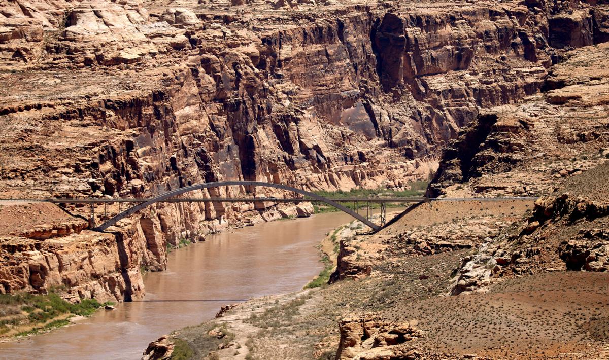
Runoff on the Colorado River into Lake Powell was very low during the past two La Niña seasons, federal statistics show.
In 2021, April to July runoff into Powell was 29% of the average spring-summer runoff that occurred from 1991 through 2020. Flows into the lake were 36% of average for the period October 2020 through September 2021 — a period that water officials typically refer to as a “water year.”
In 2022, April to July runoff into Powell was 59% of average, and the 2021-22 water year flow is forecast to be 63% of normal.
The center’s statistics are based on what it calls “unregulated inflow” into Powell, or the amount of water that would have flowed into that reservoir if there were no dams lying upstream of it — which isn’t the case.
Ashley Nielson, a hydrologist for the federal Colorado Basin River Forecast Center, said the agency has found that a low correlation exists between such inflows into Lake Powell and La Niña and El Niño years.
“Some La Niña years have produced near normal or above normal flows while others have seen much below normal flows as we have seen the last two years,” said Nielson, whose agency is part of the National Oceanic and Atmospheric Administration.
Swain acknowledged a difference exists between actual runoff in the river basin and flows into Lake Powell. The river basin’s overall flows are solely caused by climate conditions while flows into Powell are also triggered by direct human intervention, such as managing releases from dams upstream of Lake Powell, he said.
But he noted that the relationship between La Niña conditions and river flows strengthens when over two or three years. That means its impact on precipitation might be “stronger than the long-term average would otherwise suggest,” he said.
Long-term warming trend an issue
Replying, the forecast center’s Nielson said the agency has not done any work looking at the La Niña-runoff relationship over consecutive La Niña years. She didn’t disagree with any of Swain’s statements.
But she noted that many water experts across the basin agree with some of Swain’s more equivocal comments on this relationship. Those include his view that the La Niña effect on the basin’s northern reaches is weaker than it is elsewhere, that there isn’t a “slam dunk” relationship between La Niña and river flows, and that the basin’s immense size makes it hard to gauge a clear signal of the impacts.
Swain said the broader impacts of global climate change make this probable “Triple Dip” La Niña additional bad news for the Colorado River Basin.
In the past, La Niña brought cooler-than-average temperatures to much of the Southwest during winter. That would somewhat counteract the lower precipitation it brings, by allowing for decent snowpack accumulation.
“But today’s long-term warming trend has essentially zeroed out or even reversed this temperature effect — and La Niña years are now warmer than average most of the time,” leaving no ability for snowpack to mitigate the low precipitation overall, he said.
“Since it’s already warmer than the 20th century average essentially all of the time, which increases rates of evaporation and decreases snowpack, any factor that raises the odds of low precipitation across most of the Colorado Basin is not encouraging — to say the least,” he said.
“We could still get lucky, of course, but a third year of La Niña substantially decreases the odds of meaningful drought relief for at least another year.”

