


A surge of storms in late September couldn’t salvage Tucson’s “mediocre” 2019 monsoon, which wrapped up at an inch below normal.
An average Tucson monsoon, which runs from mid-June through Sept. 30, brings about 6 inches of rain.
As of Monday, just over 5 inches of rain were recorded at Tucson International Airport, according to the National Weather Service.
The season, while just below average, was nowhere close to being among the Top 10 driest monsoons ever recorded here, finishing as the 46th driest since 1895, according to NWS records.
This year’s highly anticipated monsoon brought little rainfall in June and July. August, which is typically the wettest month of the summer, brought in just over 1.5 inches of rain, falling 0.80 of an inch below normal.
Sitting at only 2.6 inches of rain at the end of August, climate experts were skeptical that September would be able to bring in enough storms to catch up to normal.
Even so, the last month of the monsoon brought just over 2.4 inches of rain, coming in at 1.16 inches above normal.
“I think we actually got lucky that the seasonal totals were only an inch below average for Tucson at the airport,” said University of Arizona climatologist Mike Crimmins. “We had a very wet September and actually a very wet couple of days last week in particular. There was some indication at the beginning of the season that the monsoon would show up later than usual and it did, which put us behind in July. August was also unusually slow with monsoon activity as well, but it isn’t readily clear why.”
September storms also brought several flash flood warnings and tornado warnings in areas of Pima County.
A tornado was confirmed to have touched down last week near Willcox, causing some damage.
The tropical storm season in the Eastern Pacific was slow to get started, but took off over the past six weeks.
Several of these storms that formed off the southern coast of Mexico curved up toward Tucson, helping to move a lot of tropical moisture this way over the past month, Crimmins said.
“Last week this tropical moisture interacted with an unusually strong low pressure system that eventually became cut off from the main storm track and brought us several days of showers and thunderstorms,” he said. “It was the perfect setup to bring days of cool, wet weather to Arizona and beneficial precipitation at the end of a mediocre monsoon season.”
The U.S. Drought Monitor showed abnormally dry conditions for most of the state this summer, bringing concerns that Arizona was headed for a short-term drought.
“We did see some expansion of short-term drought across much of Arizona because of the below-average precipitation in July and August,” Crimmins said. “I think the September precipitation has helped stabilize the short-term situation a bit. We still have some tropical activity to the south, which could help bring some more rain and relief to the region.”
Several communities in Northern Arizona, including Flagstaff, experienced the driest monsoon on record. Phoenix also experienced one of its driest monsoons on record.
Crimmins said the monsoon subtropical high had trouble staying in a favorable position near the Four Corners region for much of the summer, which impacted precipitation patterns across Arizona.
The weather service said showers and thunderstorms are possible later this week to the south and east of Tucson, but is expected to bring less than an inch of rain. This possible rain is courtesy of Tropical Depression Narda, which is making its way up the coast of Mexico.
Photos: Tucson's 2019 monsoon
Monsoon 2019
Updated
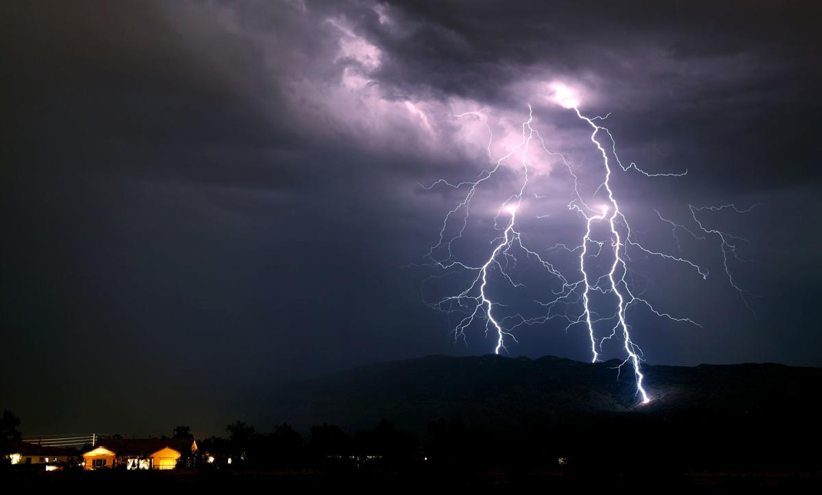
A lightning bolt strikes in the western part of the city, part of the second of two bands of monsoon storms to roll over the area, Tucson, Ariz., August 28, 2019.
Monsoon 2019
Updated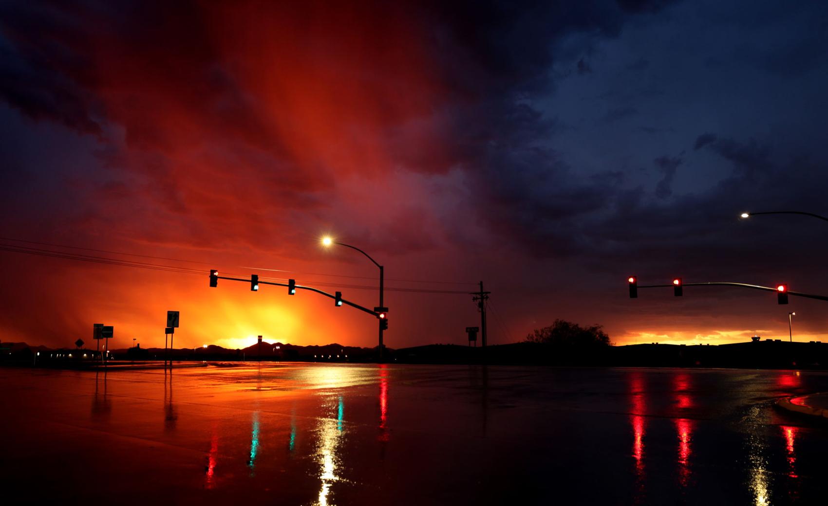
The sunset is reflected in the rain slicked intersection of Ajo Way and Valencia Rd., during the first of two bands of monsoon storms to roll over the area, Tucson, Ariz., August 28, 2019.
Monsoon 2019
Updated
Sunset over the construction project at the former La Placita Village, near Church and Broadway downtown Tucson, Ariz., August 16, 2019.
Monsoon 2019
Updated
A disabled car sits in the flooded wash at Copper and Wilson as the waters in the wash rise around it as monsoon finally delvers some rain, Tucson, Ariz., August 10, 2019.
Monsoon 2019
Updated
A bicyclist negotiates the overflow from a wash crossing Glenn at Wilson as the monsoon finally delvers some rain, Tucson, Ariz., August 10, 2019.
Monsoon 2019
Updated
Rural Metro Fire Department personnel watch over the flooded Julian Wash at Irvington after being dispatched for a swift water rescue as monsoon finally delvers some rain, Tucson, Ariz., August 10, 2019. Rescue ended up being not needed as the subject safely walked out of the wash on their own just as the RMFD arrived.
Monsoon 2019
Updated
In a monsoon haze, the sun sets behind a ridge just west of Greasewood near Starr Pass, Tucson, Ariz., August 8, 2019.
Monsoon 2019
Updated
Bank of America Plaza and One South Church, the former UniSource Energy Tower, catch the last of the day's colorful sunlight filtered through monsoon clouds, Tucson, Ariz., August 8, 2019.
Monsoon 2019
Updated
Sunset lights the clouds over the dozens of international flags flying behind The National Law Center for Inter-American Free Trade, 440 N Bonita Ave., Tucson, Ariz., August 8, 2019.
Monsoon 2019
Updated
Monsoon clouds make a big show over the valley, but fail to deliver on the promises of rain, Tucson, Ariz., August 7, 2019.
Monsoon over Sunnyside football
Updated
Sunnyside players get warmed up as a monsoon storm rolls in overhead during the Blue Devils' practice, Tucson, Ariz., August 6, 2019.
Monsoon
Updated
Monsoon storm clouds roll over the new control tower at Tucson International Airport, Tucson, Ariz., August 3, 2019.
Monsoon 2019
Updated
A patchy monsoon storm drops some heavy, but isolated rain, on the southeast side just after sunset, Tucson, Ariz., August 1, 2019.
Monsoon 2019
Updated
A patchy monsoon storm drops two lightning bolts on the southeast side, Tucson, Ariz., August 1, 2019.
Monsoon 2019
Updated
A patchy monsoon storm throws down a lightning bolt on the southeast side, Tucson, Ariz., August 1, 2019.
Monsoon 2019
Updated
A patchy monsoon storm throws down a snaky lightning bolt on the southeast side, Tucson, Ariz., August 1, 2019.
Monsoon 2019
Updated
A patchy monsoon storm throws down a lightning bolt on the southeast side, Tucson, Ariz., August 1, 2019.
Monsoon 2019
Updated
A biker pedal through the water running down Desert Ave. and flowing across Glenn in the aftermath of monsoon downpour, Tucson, Ariz., July 31, 2019.
Monsoon 2019
Updated
Tucson Fire Department personnel extricate a woman from a car pinned against the sidewalk safety railings at culvert overflowing Glenn Street at Wilson Street in Tucson, Ariz., July 31, 2019.
Monsoon 2019
Updated
A monsoon front rolls in over the city bringing brief, but heavy rain in Tucson, Ariz., July 31, 2019.
Monsoon
Updated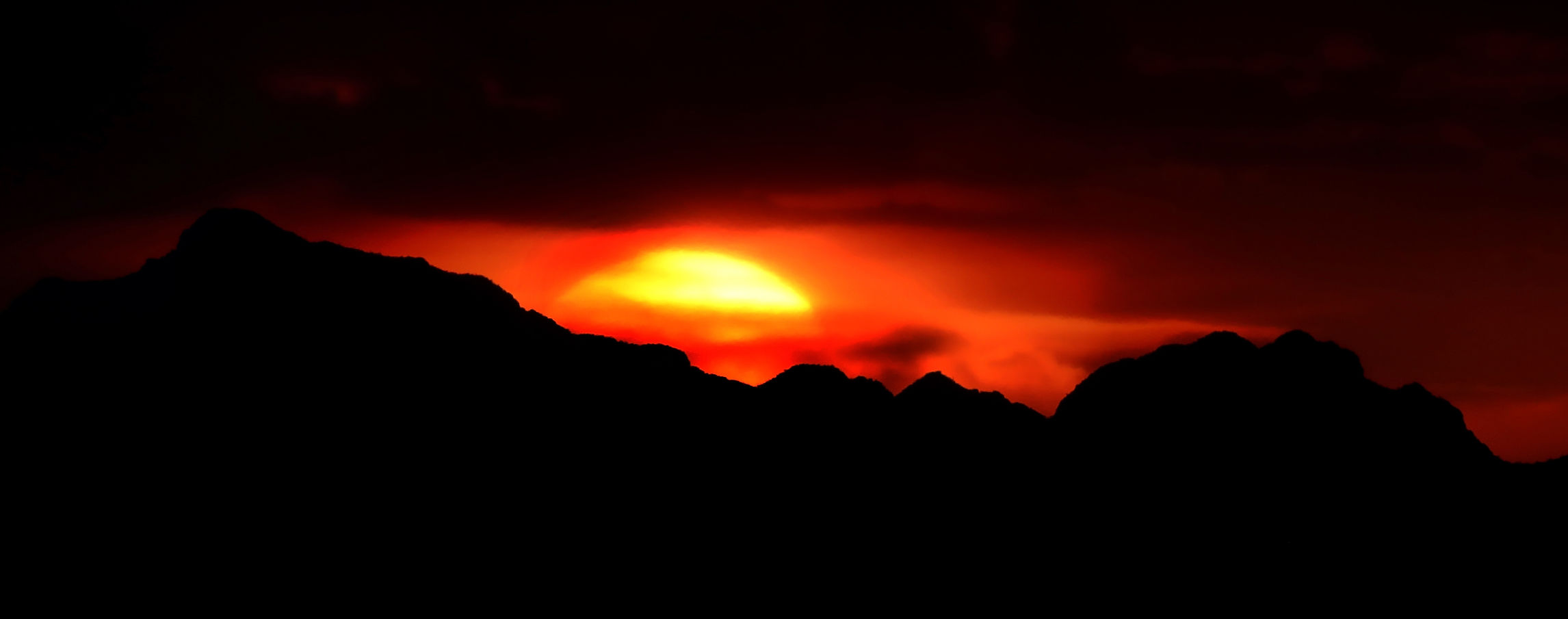
Monsoon sunset behind a ridge northwest of Kinney Rd., Tucson, Ariz., July 25, 2019.
Monsoon 2019
Updated
A biker heads east along Cushing St. near the Santa Cruz River under a monsoon sunset, Tucson, Ariz., July 24, 2019.
Monsoon 2019, bats take flight
Updated
A member of the crowd gets cell phone video of the nightly exodus of thousands of Mexican free-tailed bats from under the Campbell Ave. bridge over the Rillito River, Friday, July 19, 2019, Tucson, Ariz. Friday was Bats in Flight night at the bridge, and Pima County naturalists were on hand to answer questions and guide a few all-ages bat related activities. The next scheduled Bats in Flight is August 17, 6:30 - 8:30 p.m., it's free and no registration is needed.
Monsoon
Updated
A falcon rides the lines running along Speedway just east of Greasewood under a monsoon sunset, Wednesday, July 17, 2019, Tucson, Ariz.
Monsoon 2019
Updated
Lighting strikes straddle a ridge in the Rincon Mountains east of Tucson, looking east from the Agua Caliente Wash at Houghton Road on Sunday, July 14, 2019, Tucson, Ariz.
Monsoon 2019
Updated
A worker from Pearson's Signs helps to lower the PPEP Inc. sign down to the ground after high winds from Saturday's monsoon storm tipped the sign over at 901 E. Benson Highway on July 15, 2019. PPEP Inc., Portable, Practical Educational Preparation, is a non-profit that provides services to empower people living in rural areas through education, health, housing, counseling, employment, job training and many others.
Monsoon 2019
Updated
A monsoon storm, the first significant one of the season, crashes a few bolts down just before the gates opened for the Annual Bloom Night at Tohono Chul Park, July 13, 2019, Tucson, Ariz.
Monsoon 2019
Updated
Monsoon sunset behind downtown, Saturday, July 6, 2019, Tucson, Ariz.
Monsoon
Updated
The last bit of a monsoon storm breaks up in the sky just west of town after dropping a few sprinkles before fading away, Friday, July 5, 2019, Marana, Ariz.
Monsoon
Updated
A bolt of lightning appears to hit the high-rise at 5151 E. Broadway as a monsoon cell moves over the eastern part of town, Saturday, July 6, 2019, Tucson, Ariz.
Monsoon
Updated
Monsoon sunset behind downtown, Saturday, July 6, 2019, Tucson, Ariz.
Monsoon
Updated
Monsoon sunset throws light on the Union Pacific Railroad tracks running under Kino Parkway at Aviation Highway, Saturday, July 6, 2019, Tucson, Ariz.

