

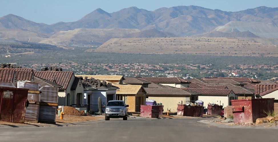


Literature promoting the SaddleBrooke Ranch development west of Oracle touts feature after feature — high Sonoran Desert terrain with beautiful mountain views, “multimillion-dollar country club amenities,” an 18-hole championship golf course and more.
The development, now roughly 1,000 homes strong with 5,600 total planned, also has delivered something not promoted — a falling water table.
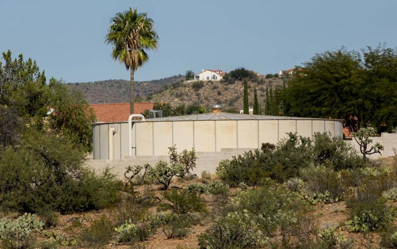
Since 2009, the water level has dropped 7.3 feet a year in one of two SaddleBrooke Ranch wells and 1.7 feet a year in the other, says the Arizona Water Co., a private utility serving the development.
This is one of many suburban developments surrounding Tucson where underground water tables are falling and are likely to fall much farther over the next century, state records show.
A prime cause is a 1993 state law that allowed continued groundwater pumping for new developments as long as the developer paid a three-county water district to replenish the aquifer elsewhere with Colorado River water from the Central Arizona Project canal.
One of that law’s purposes was to ensure that development could continue in areas such as SaddleBrooke Ranch, which lie miles from the CAP canal that runs west of the Tucson Mountains.
The law was pushed heavily by developers and builders, including Robson Communities, a Pinal County-based developer that is developing SaddleBrooke Ranch as well as the SaddleBrooke and Quail Creek projects in Southern Arizona.
At the same time, that law’s passage cleared the way, politically, for the state to approve separate rules intended to guarantee that no new development is built in Arizona’s urbanized counties without an assured, 100-year water supply.
The rules are aimed at carrying out Arizona’s pioneering 1980 Groundwater Management Act. It requires the Tucson, Phoenix and Prescott areas to balance pumping with recharge across their entire groundwater basins by 2025.
The entire state-run, Tucson-area water management area is on the edge of achieving balance between pumping and recharging because the city of Tucson has made heavy use of CAP water.
But water tables underneath fast-growing unincorporated suburbs are heading in the opposite direction:
- Groundwater levels are falling anywhere from 2 to 7 feet yearly in wells serving three private water companies that supply nearly 60 subdivisions belonging to the replenishment district in the Green Valley-Sahuarita area, company officials said.
- Groundwater levels under eight Tucson-area subdivisions, including SaddleBrooke Ranch, are forecast by the Arizona Department of Water Resources to drop to at least 625 feet in 100 years.
- Water levels in five are predicted to drop to at least 800 feet deep, records show. SaddleBrooke Ranch and SaddleBrooke lie in southern Pinal County, but are in the same state management area that governs water use in most of the Tucson area.
Under state law, water levels can fall 1,000 feet inside water management areas for Tucson and Phoenix and 1,100 feet in the Pinal County management area.
Hydrologists for the state water department made the forecasts around 15 to 20 years ago, as the department granted the developments certificates showing an assured 100-year supply.
The replenishment with CAP water is carried out in recharge basins along the Santa Cruz River and on Pima Mine Road, south of the Tucson city limits.
This practice of pumping one place and recharging elsewhere is “an artifact of the groundwater code,” says Arizona Department of Water Resources Director Tom Buschatzke.

SaddleBrooke Ranch is one of many suburban developments surrounding Tucson where underground water tables are likely to fall much lower over the next century.
Under that 1980 law, the responsibility for safe yield is considered to be basin-wide, across a broad geographic area, he said. Safe yield means balancing the amount of groundwater pumped with the amount that’s recharged back into the ground both through natural and artificial means.
The state law is intended to raise water levels in one area and lower them in another, Buschatzke said.
“It’s a problem we have discussed over the years, in terms of how to create a closer connection between where you pump the water and where you store the water,” Buschatzke said in a recent interview with KAET-TV.
In interviews with the Arizona Daily Star, three retired Tucson-area hydrologists, all with extensive experience analyzing water pumping impacts, expressed major concerns.
If water levels under these subdivisions decline as far as the state predicts, the many problems typically associated with over-pumping could occur there, the hydrologists said.
Those include subsidence, or the settling and compacting of the ground caused by excessive groundwater withdrawals that can trigger earth fissures.
Others are lower water quality, higher pumping costs and, at worst, the possibility that some aquifers might run out of water.
“The thing you have to remember is most of the water in this basin, we’re pumping water that’s 7- to 8,000 years old in many cases,” said Thomas Maddock, the retired head of the University of Arizona’s hydrology department.
“As soon as that water’s gone, we don’t have another ice age to reestablish it,” he warned.
It’s not an acceptable tradeoff to allow localized depletion of some aquifers while an entire basin balances pumping and recharge of groundwater, said Mike Carpenter, a retired U.S. Geological Survey hydrologist.
“If you draw the water level down in one of these areas, then the water is going to flow from other areas to fill in that which in essence becomes a hole,” Carpenter said.
In years to decades, that will eventually cause water-level declines, aquifer compaction, and subsidence in areas that would otherwise achieve safe yield, Carpenter said, concerns that are shared by Stanley Leake, another retired USGS hydrologist.
“It doesn’t seem square to me to draw the water table down here and recharge CAP water over there, wherever there is,” Carpenter said.

The Quail Creek community was granted assured water supply approvals by the state for more than 4,000 homes in the 1990s and early 2000s.
A fourth retired hydrologist, Don Pool, agreed that subsidence could become a concern in some heavily pumped areas, but said that maybe “they can trade water across the valley somehow” to alleviate problems like that in isolated areas.
“I don’t see it as a huge issue if the region is in safe yield” overall, said Pool, also formerly of the geological survey.
“You’re going to look at trouble”
The city of Tucson has averted major subsidence by halting most of its pumping in favor of importing CAP water.
But in suburban areas where heavy pumping continues, “I think some disasters are possible,” said Leake, adding the risks should be examined case by case.
In terms of sheer water availability, as levels approach 1,000 feet deep, “you’re going to look at trouble,” said Maddock.
Water quality issues would probably be the first problem because the deeper water is typically at higher temperatures, which can leach naturally occurring contaminants from surrounding rock.
Also, at deeper levels, “energy costs are pretty damn severe,” he said.
Below 500 feet, the water is also more likely to have higher fluoride levels, which can cause browning of teeth, said Carpenter.
As a well and its pumps approach 1,000 feet, you can get to the point where they can’t reach water because the well casing isn’t deep enough, he said.
You can reconfigure the well, but “then what do you do? Go down another 1,000 feet? There’s not a guarantee that you’ll get some water. You could run out of water,” Maddock said.

“Illinois did a better job with capturing rainfall for recharging aquifers than we do here,” says Chuck Stack, an environmental scientist.
Risk of earth fissures
Typically, areas of a groundwater basin most prone to subsidence have larger amounts of clay, the hydrologists said. Clay layers have finer-grained sediments than sands and gravels. That makes it harder to remove water from clay layers, but makes it easier for them to compact and settle when water is removed.
The Tucson basin’s heaviest clay concentrations — typically 60% to 80% — stretch along a belt-shaped band running from central Tucson south to the booming Sahuarita and Green Valley areas, a 1987 U.S.G.S. map shows. Clay concentrations of 40% to 60% are common immediately surrounding that belt. Heading north toward Catalina and SaddleBrooke, concentrations drop to the 20% 40% range.
“I’d say somewhere from 40% to 60% might be places that should be examined a little closer to see what the susceptibility to subsidence might be,” said Leake.
The 1987 report warned that subsidence in this area could someday get as bad as in the Eloy-Picacho area of Pinal County. There, heavy agricultural pumping has caused the ground to sink up to 20 feet and triggered earth fissures up to 2 miles long.
Rate of decline
Sam Sherrill, who lives in the SaddleBrooke subdivision south of SaddleBrooke Ranch in Pinal County, is concerned about the future of the water supply lying underneath.
Now 78, he moved to SaddleBrooke five years ago from Ohio after retiring as an associate professor at the University of Cincinnati’s School of Planning.
He started digging into his area’s water issues about a year ago, after he would ask people where “our water is coming from, and everywhere I asked, nobody knew.”
After hitting blind alleys, he recently found Arizona Department of Water Resources records for one private water-company well serving SaddleBrooke that shows it’s been falling about 1.5 feet a year since 1995.
To him, that’s no sign of impending crisis, since that well sits at 344 feet.
At that rate, water levels will only drop to 500 feet over 100 years.
But the rate of decline could increase, because Robson is now selling homes for a neighboring, 500-home development called the Preserve at SaddleBrooke.
In addition, a map recently circulated by officials associated with the SaddleBrooke Ranch project shows another, 3,534-acre “future potential expansion area” of lands surrounding the current development.
Sherrill said he’s concerned that the pumping and replenishment of water supplies by various agencies and companies is “a game of musical chairs. There are more and more people buying fewer chairs.”
He likens the practice of people buying subdivision lots for which pumped water will be replenished elsewhere to “a water insurance scheme, like buying insurance without knowing what the risk is.”

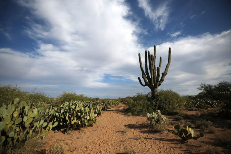
Natural desert was cleared for the Saddlebrooke Ranch golf course in 2005.
“Something’s not right”
Down in Quail Creek, which lies east of Green Valley along Old Nogales Highway, residents Chuck Stack and John Murphy also are concerned about falling water tables under their subdivision.
Quail Creek was granted assured water supply approvals by the state for more than 4,000 homes in the 1990s and early 2000s.
They know their subdivision will keep growing, since they see new building pad locations rising along Quail Crossing Road, the main drag through the red tile roofs, golf course and country club in their community.
And since the state law doesn’t require private water providers like theirs to report to the state how fast their water levels are falling each year, they’re concerned “something’s not right here,” Murphy said.
But Stack, who moved to Quail Creek from Aurora, Illinois, in early 2019, said he’s not concerned that the region will run out of water because as a certified environmental scientist, he believes lots of improvements can be made in water conservation.
“Illinois did a better job with capturing rainfall for recharging aquifers than we do here. Arizona is probably 20 years behind Illinois,” he said.
“Arizona is going to have to get its act together and do some aggressive work on rainwater harvesting and conservation,” he said.
“It takes money, but in the long term potable water is one of the most valuable resources in the Sonoran Desert. We should treat it that way.”

