

About 200,000 acres of Arizona grassland and forest have burned in 2014.
That may seem like a lot — 312.5 square miles — but it’s less than three one-thousandths of the state’s land mass, and a fifth of the acreage burned in the state’s record fire year in 2011.
It was “an unremarkable year” for fire in the Southwest, said Mary Zabinski of the Southwest Coordination Center in Albuquerque, where fire resources are marshalled and dispatched.
What’s remarkable is that Arizona and the Southwest escaped catastrophe in a year when the prolonged Western drought wreaked fiery havoc in California, Oregon and Washington.
What’s equally remarkable is that fire managers were able to use naturally occurring fires in Arizona for “resource benefit” on about 120,000 acres — in attempts to restore ecological balance to our overgrown forests and grasslands and create safety buffers for future fires.
How did we escape calamity?
In April, things looked ominous. A hot spring followed a dry winter after more than a decade of intermittent drought.
Early fires were burning in the Huachuca Mountains near Sierra Vista and on the San Carlos Apache reservation.
The state’s mountains had already shed their snowpack, which was less than half of the normal amount, and a series of fires broke out around Flagstaff on the Coconino National Forest.
Most jurisdictions announced restrictions on campfires a month earlier than usual.
Fire ecologist Don Falk, of the University of Arizona’s School of Natural Resources and the Environment, said in April that he was worried, but he noted that similar conditions had existed in 2013, when only 104,783 acres burned in Arizona.
Falk, who studies fire history in tree-ring scars, said he’s learned over the years that big fire years never occur when the winter is wet and the spring temperatures are cooler than normal, but “the converse is not always true. Severe weather conditions equal big fire seasons — sometimes,” Falk said.
“You can have the conditions, yet not have the triggering event. You can have hot, dry weather but it’s not particularly windy. Wind is a huge factor.”
Chuck Maxwell, a meteorologist with the Southwest Coordination Center in Albuquerque, coined the phrase “gravel-blowing wind” to explain the 2011 fire season, when more than 1 million acres burned in Arizona.
The wind didn’t blow hard for weeks at a time this year, he said. There was variability in the weather patterns that allowed for successful firefighting.
“In addition, we had some moisture events during fire season,” Maxwell said.
Heidi Schewel of the Coronado National Forest credited late-spring rains, a lack of sustained winds and the on-time arrival of monsoon moisture for creating a manageable situation.
Schewel said the early fire restrictions and growing awareness of fire threats, promulgated by the “one less spark” campaign, also helped.
In addition, she said, the forest merged its dispatching capability with the Arizona State Forestry Division and sent crews from the nearest available agency to new starts, regardless of land jurisdiction.
The Coronado has fought 36 fires of human origin this year and they were quickly snuffed, burning only 858 acres.
It recorded 25 lightning fires, which burned 13,153 acres.
Managing fires for benefits
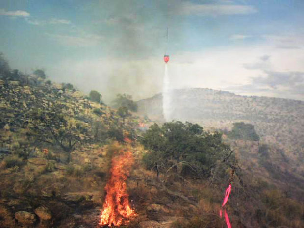
Almost all of the land burned — 13,057 acres — came from the Oak Fire in the Galiuro Mountains, which the Forest Service chose to manage for multiple benefits rather than risk putting firefighters into remote, rugged terrain.
“When we are managing fires, we are not ‘letting them burn,’” Schewel said. Fire managers need to be aware of values at risk — nearby homes or ranches, watersheds, historic and cultural assets, endangered or threatened species. They steer the fire to where it can have the biggest benefit, managing both its size and the severity of the burn.
The most dramatic example of managing, rather than fighting, a fire in Arizona this year was on the San Carlos Apache reservation, where two lightning-sparked blazes merged and burned for two months across more than 73,000 acres before being contained.
The Skunk Fire began as two lightning strikes on April 19 on the San Carlos Apache Reservation, north of Safford and east of Globe. Fire managers with the tribe and the U.S. Bureau of Indian Affairs decided to let it burn within a defined “box.”
“We’re trying to do this whenever we get the opportunity because it’s the only way to get large-scale fire back on the landscape,” said Dan Pitterle, the San Carlos tribal fire program manager.
Why do we want fire back on the landscape? The answer is familiar to most Westerners by now.
For decades, beginning in the early 1900s, fires were snuffed before they could get going. The resulting buildup of thick vegetation of all types led to a dangerous situation — too much fuel, now drying out in the drought.
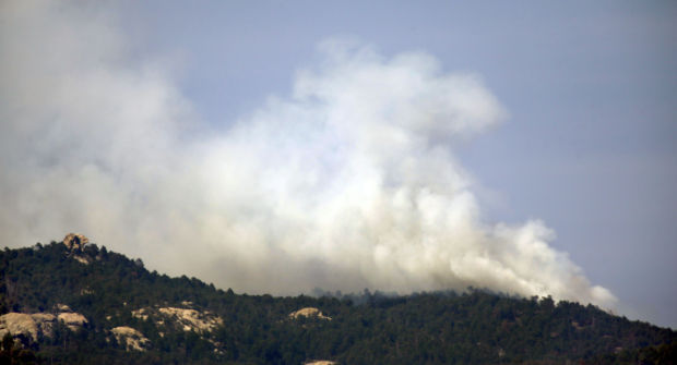
The Skunk Fire burned through brush and chaparral, choked with juniper and oak trees that had invaded the land over decades of fire suppression. In an essay for the “Wildfire Lessons Learned” website, fire historian Stephen Pyne called the terrain “metastasizing juniper woodlands.”
“A lot of that was grassland at one time,” Pitterle said. “If it goes up, we’re OK with that. All of that country needs to burn,” he said.
And burn it did. It escaped its “box and burn” perimeter a couple times. “We eventually caught it a long ways from where it started,” Pitterle said.
It burned 73,622 acres.
It was a good year, fire scientists say, for fires that will help correct decades of ecological imbalance. But choosing to manage, rather than suppress, a fire comes with risk.
“It’s the toughest decision a fire manager can make,” said Holly Krake, fire information officer for the Kaibab National Forest, “but the Forest Service and the Kaibab have made a strong commitment to not transfer risk to future generations.”
The Kaibab typically averages 11,000 acres a year in wildfires managed for resource benefits. This year, it has treated more than 28,000 acres.
In the Kaibab — 1.6 million acres of forest, prairies and forested peaks that flank both rims of the Grand Canyon — the arrival of monsoon moisture creates ideal conditions for using fire for beneficial purposes, Krake said.
The Sitgreaves complex of fires, now more than 11,000 acres, began with lightning strikes near Sitgreaves Mountain on the Williams district of the Kaibab on July 13. Sitgreaves Mountain hadn’t been allowed to burn since 1916. Nearly 100 years of dead-and-downed trees lay on the forest floor.
“The easier decision would have been to suppress them, because we could have put them out in a day or two as opposed to managing a fire for the next two weeks or a month,” said Krake.
But that wouldn’t have solved the problem. So far, the fire seems to have accomplished its role, she said. It burned on the ground through ponderosa stands, clearing vegetation and lower limbs. It burned hot in mixed conifer, killing some stands and sparing others, creating the “mosaic” that naturally occurs with frequent fire.
Full suppression fires
Even human-caused fires accomplished multiple objectives, though still classified “full suppression.”
“Every wildfire is an opportunity for resource benefit,” said Andi Thode, associate professor in the School of Forestry at Northern Arizona University.
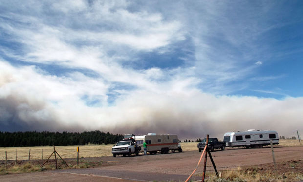
When the Slide Fire erupted in Oak Creek Canyon on May 20, there were many reasons for mounting an all-out attack.
The canyon sits between Sedona and the suburbs of Flagstaff, and is a premier camping/tourism area in the north country.
It is also rugged country, with vertical slopes and few features breaking the line of dried fuels on them.
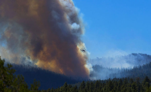
Don Muise, fire and aviation staff officer for the Coconino National Forest, said firefighter safety was his first concern. “We decided to back away from the main fire,” he said.
Muise and the interagency team brought in to fight the fire took advantage of previous thinning projects and prescribed burns between Oak Creek and Flagstaff.
They did backburns from those safer zones and dropped “ping-pong balls” of fire accelerant on ridge tops so fire would burn down slowly at night, instead of raging up the slopes in the hot afternoons.
Thode, who also heads up the Southwest Fire Science Consortium, lauded the approach.
“They drew a big box around the fire for safety reasons,” said Thode, and the results were similar to managed fires.
“People have begun to step back and do these burnouts with finesse.”

