


In the gloomiest long-term forecast yet for the drought-stricken Colorado River, a new study warns that lower river basin states including Arizona may have to slash their take from the river up to 40% by the 2050s to keep reservoirs from falling too low.
Such a cut would amount to about twice as much as the three Lower Basin states — Arizona, California and Nevada — agreed to absorb under the drought contingency plan they approved in early 2019.
Overall, the study warned that managing the river sustainably will require substantially larger cuts in use by Lower Basin states than currently envisioned, along with curbs on future diversions by Upper Basin states.
A massive rockslide in Horseshoe Bend not far from the Grand Canyon was captured on video by a hiker Friday.
While climate change’s impacts on the river have been repeatedly studied, this is the first study that seeks to pinpoint how warming temperatures would translate into reductions in water that river basin states could take over the long term.
Carrying out the study’s recommendations, under the most likely conditions of climate change, almost certainly would mean more supply curbs for the $4 billion Central Arizona Project.
The CAP is already slated to lose nearly half its total allocation under the worst case, shorter-term scenarios envisioned under the 2019 drought plan.
Tucson and Phoenix-area cities and tribes, along with Central Arizona farmers, all depend on the CAP for water for drinking or irrigation.
The study, written by 13 researchers, was posted online about a week ago, at a time the drying river is on the edge of its first major shortage.
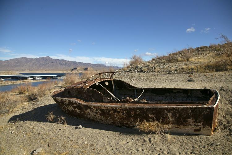
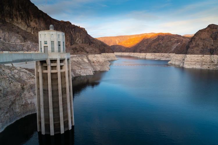
Federal forecasters predict Lake Mead will drop low enough to require cutbacks in water deliveries to Central Arizona farmers in 2022 due to river flow declines.
But exactly how much will be cut in long-term, future water deliveries is far from settled. The seven states are about to start renegotiating guidelines under which the river has been managed since 2007. Changes to the guidelines won’t take effect until 2026.
“Self-inflicted wounds”
In other forecasts, the study took a shot at longstanding plans by the four Upper Basin states — New Mexico, Colorado, Utah and Wyoming — to increase their take from the river under rights held from the 1922 Colorado River Compact.
The Upper Basin states’ forecasts of river diversions are unrealistic and would make it virtually impossible to maintain stable water supplies over an extended period, the study said.
“New demands in the era of climate change resulting in decreasing flows are the equivalent of self-inflicted wounds,” the study said.
Also, more, major Upper Basin diversions could drain both lakes Mead and Powell, dramatically reducing the amount of water available to serve people for drinking and irrigation and to generate electricity, the study said.
That would also result in the release of very warm water from Powell, compared to colder waters being released today. The Grand Canyon’s ecosystem downstream would be drastically changed, said Jack Schmidt, one of the study’s authors.
The study also warned that the current, downward trend in river flows will likely continue or worsen as temperatures keep rising.
That will lead to additional evapotranspiration — the absorption of atmospheric water supplies by plants — and aridification of the landscape, in which soils get drier and runoff keeps declining, the study said.
“Under this scenario, the basin will soon face a tipping point,” the study said.
“Huge, huge litigation” could be on the horizon
That could lead to frequent and possibly large violations of the Colorado River Compact in which Upper Basin states can’t meet their legal obligation to deliver the amount of water they’re required to deliver to Lower Basin states, the study said.
Then, Lower Basin states would put out a legal “compact call” demanding more water, arguing that the Upper Basin is violating terms of the 1922 Colorado River Compact.
“One of the lessons out of the paper is that we are in a very tentative, sensitive balance of supplies and demands right now,” said Brad Udall, a Colorado River State University water researcher who worked on the study.
“If demands increase or supplies decrease or some combination of the two happens, you could very likely see a compact call.”
Such a call would likely lead to “huge, huge litigation,” Udall said. “There’s a reasonable chance the Upper Basin would say ‘we don’t agree there is an obligation’ and they keep diverting.”
If such a call occurs, the worst case for the Upper Basin would be that all parties who started taking water from the river after the compact was signed would have to stop diverting, Udall said. That would include all major Upper Basin cities, including Denver.
“Humans will be forced to bend to will of nature”
The study also called for major changes in operations of Lake Mead and other reservoirs, and urged the river basin states to consider altering what’s known as the “Law of the River.”
That term describes a series of federal and state laws, regulations, U.S. Supreme Court decrees, compacts, a binational treaty, administrative agreements and various federal decisions that are used to manage the river and have long been seen as politically untouchable.
One key fix the study suggested would be to treat lakes Powell and Mead as a single reservoir when considering how much water is available in the river. That would entail combining the reservoirs’ water storage into a single figure to determine how much water should be released downstream for drinking and farming.
But the researchers warned that such changes, or another suggestion to drain either lake Powell or Mead to reduce total evaporation, won’t save enough water to fix the river’s problems.
Based on what it called “reasonable and probable” weather conditions due to climate change, “aggressive commitments to water conservation by both the Upper and Lower Basins will become critical, in the next 25 years,” to prop up lakes Mead and Powell at functional levels, it said.
“Dire situations require solutions far from historic norms. An increasingly limited and uncertain water supply should force water managers to confront an uncomfortable reality: the Colorado River system is overallocated and even existing allocations can no longer be guaranteed,” the study said.
“American society is on the path of a collision between nature and the structures and institutions of humankind. In the 20th century on the Colorado River, nature was bent to human will. Because we are now fully consuming its waters, and inflows are expected to decline, in the 21st century humans will be forced to bend to the will of nature,” the study said.
In a tweet last week, the study’s lead author, Oxford University’s Kevin Wheeler, said: “Question: What will it take to sustain the Colorado River? Answers: 1) Extraordinary demand management. 2) Extraordinary new thinking.”
“New abnormal” seen in river’s weather conditions
The study was conducted by researchers operating under Utah State University’s Center for Colorado River Studies. Its mission is to conduct studies that show how the river and its tributaries can be effectively managed, and this is its sixth study.
The new study relied on several known quantities.
First, it employed the same computer modeling system the U.S. Bureau of Reclamation has used to make forecasts for the river since the 1970s, said Wheeler. He’s an engineer and project manager who has worked in various roles on Colorado River issues for more than a decade.
Second, it considered the likelihood that the river’s weather conditions are entering a “new abnormal.” That means predictions of future climate conditions and runoff can’t be based on how those forces have behaved in the past.
Under a “new abnormal” scenario, the study said two outcomes could occur. Under one, runoff totals will match very dry conditions of 2000 to 2018, in which the river flows were 18% lower than those of the 20th century. Or, runoff could keep worsening, following the course predicted by Udall in a 2017 study he did with former University of Arizona climate scientist Jonathan Overpeck. They warned warming would lower river flows 20% to 30% by 2050 and 35% to 55% by 2100.
To determine how that scenario could affect the river, the new study used Udall and Overpeck’s prediction that continued warming could cause river flows to drop 6.5% for every 1-degree Celsius temperature increase. That’s the midpoint in a range of possible outcomes they forecast for lower river flows.
If either scenario happens and hydrologic conditions have truly shifted since 2000, “We need to plan as if this is all we’re going to get, this is what the implications are,” Wheeler said.
“Nobody could be absolutely certain. We could get a wet spell for sure,” Wheeler said. “But we believe that’s much less likely and that the recent conditions are much more representative of what’s likely to happen than flows of 100 years ago which were very wet.”
The study didn’t analyze a specific risk of any particular river flow shortfall or other problems, because it’s really hard to make such projections over an extended period.
But speaking specifically about a compact call, in which competing demands for the limited water would become dire, Udall said, “I can only say the risk is a lot higher than anyone should feel comfortable with.”
Buffer needed for electricity generation
When the study assumed conditions that have existed since 2000 would continue past the current time, its forecast was downbeat but not alarming.
If such conditions continue and the Upper Basin states take no more from the river than the 4 million acre-feet they’re now taking in an average year, the two reservoirs will hold 13 million acre-feet of water, the new study said. That compares to about 20 million acre-feet today.
If the Lower Basin states agree to the 40% cutback the study says may be needed, however, then the reservoirs would hold about 17 million acre-feet of water.
But if river flows keep decreasing as Overpeck and Udall have predicted, the reservoirs would keep losing about 250,000 acre-feet a year.
“Aggressive commitments to water conservation” would be needed in both basins just to keep 15 million acre-feet in the reservoirs, the study said.
The 15 million offers “a minimum level of water security,” Wheeler said. It would provide a buffer of 6.5 million acre-feet above what’s needed to keep producing power at Glen Canyon Dam and to let Las Vegas keep taking water out of Lake Mead, Wheeler said.
Said Udall: “Maybe the bottom line on this whole paper is that we need to prepare for the worst and hope for the best.”

