


The EPA is again clashing with the company proposing to build the $1.9 billion Rosemont Mine over how to compensate for its impacts on the land.
Hudbay Minerals Inc. is proposing its fifth plan since 2012 for land-saving and restoration work to compensate for its planned dredging and filling of washes on the mine site. The new plan, the most detailed by far at 859 pages, comes after earlier plans were rejected by federal agencies.
Hudbay says the plan, centering on a ranch in Santa Cruz County, will not only meet federal requirements for mitigation of environmental impacts, it will showcase how to do restoration work on arid land waterways.
But the Environmental Protection Agency, which has a veto power over a federal permit needed to build the mine, has sent highly critical comments on the plan to the Army Corps of Engineers.
Hudbay’s plan, published in September, is being reviewed by the Corps as it considers whether to issue a Clean Water Act permit, known as a 404 permit, that would be the last major approval needed for construction of the open-pit copper mine. The U.S. Forest Service signed off on the mine in June 2017. Under the Clean Water Act, applicants must have an approved mitigation plan to obtain permits.
The EPA blasts the plan by the Toronto-based company as environmentally ineffective and ecologically damaging. The Star obtained the EPA’s November 2017 comments through the federal Freedom of Information Act.
The agency’s stance isn’t new. During the Obama administration, a regional office of the EPA and its consultants wrote at least five letters and critical comments on Rosemont and its mitigation plans regarding the Corps permit. But the latest comments from the same office sharply contrast with the overall course President Trump’s EPA administrator, Scott Pruitt, has pursued. Pruitt has rolled back, or sought to eliminate, numerous past agency regulations and other actions in moves analysts see as pro-industry and pro-mining.
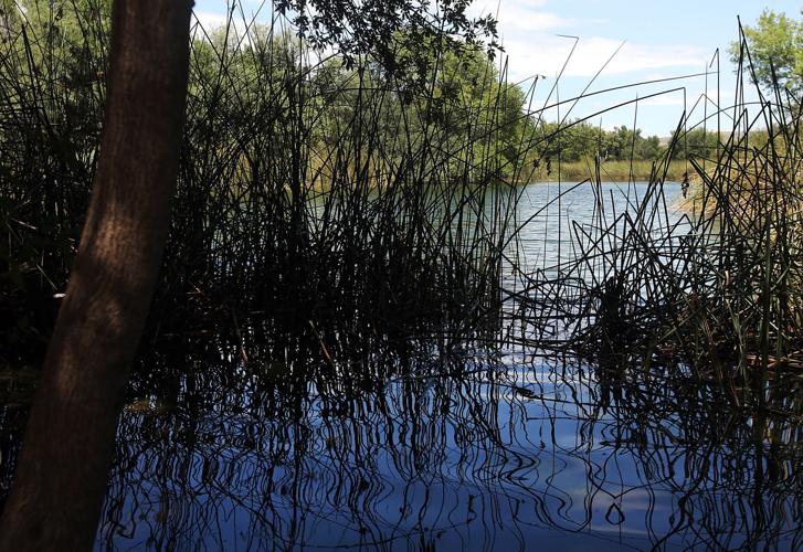
Hudbay’s new plan, like many earlier ones, centers on the Sonoita Creek Ranch, the company’s 1,580-acre parcel long used for farming and ranching. The ranch adjoins Arizona 82, between Sonoita and Patagonia in Santa Cruz County — about 12.5 miles south of the mine site in the Santa Rita Mountains in Pima County.
The plan would re-establish a natural stretch of Sonoita Creek through the ranch and move the entire channel several hundred feet. Hudbay says this work will reduce erosion and improve adjoining riparian habitat while carrying out goals of the Nature Conservancy. The conservancy runs a preserve along Sonoita Creek downstream of the ranch in Patagonia and favors reducing the creek’s man-made channelization, which dates to the 1940s.
This plan offers a “unique opportunity to return a major Santa Cruz River tributary to its historic floodplain,” Hudbay says.
Hudbay also proposes removing four livestock tanks from its mine site to free up stored water that would flow into neighboring Barrel and McCleary canyons that feed the ecologically valuable Davidson Canyon, and ultimately Cienega Creek.
NO WATERSHED HELP
In its 26 pages of comments, the EPA attacks the plan on many fronts, particularly the fact that Sonoita Creek Ranch lies outside the Cienega Creek watershed it says the mine will damage. No mitigation there is a serious deficiency and a crucial reason EPA has determined the mine will significantly degrade Cienega’s aquatic ecosystem, the agency said.
Both Sonoita and Cienega creeks feed the Santa Cruz River, but far apart. Sonoita Creek flows southwest before reaching the Santa Cruz south of Tubac. Cienega flows north and northwest into other tributaries feeding the Santa Cruz northwest of Tucson. The watersheds are separated by 125 miles, Pima County Administrator Chuck Huckelberry recently wrote the Corps.
“By any measure, the Cienega Creek watershed supports some of the most exceptional and unimpaired aquatic ecosystems remaining in the American Southwest; as a result of the (mine) project, this watershed will experience significant, permanent, unmitigated impacts to its aquatic environment,” the EPA commented.
“The mine will irreparably undo decades of public efforts to protect drinking-water supplies, biological resources and sensitive aquatic ecosystems within the Cienega Creek watershed.”
Asked by the Star to respond to the EPA’s criticisms, Hudbay sent a general statement: “The U.S. Army Corps of Engineers carefully set its requirements for mitigation associated with 404 permits. Rosemont continues to work with the Army Corps of Engineers to complete the package and satisfy those requirements.”
The company said the Sonoita Creek Ranch project, on land once slated for housing development, “is a unique opportunity to restore a system back to nature. We are proud of the project design, its scale, and the opportunity it affords for the Santa Cruz watershed.”
STREAM IMPACTS
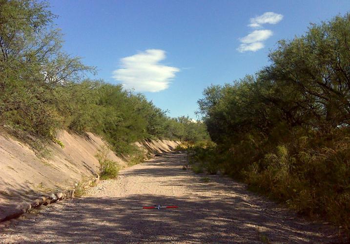
The mitigation would compensate for what the Corps says will be direct impacts from mine construction on 40 acres of federally regulated washes and indirect impacts on another 28 acres.
That translates to 18 linear miles of stream channel filled and dredged by the mine construction, fragmenting “an intact natural hydrologic landscape unit composed of hundreds of streams,” the EPA said in a November 2013 letter to the Corps.
Over the decades, Sonoita Creek has also been heavily altered through the ranch, the Hudbay mitigation plan says. In various sections, it’s been realigned, straightened and deepened along Arizona 82 to accommodate the highway, smaller roads, utilities, farms and ranches.
Its banks have been armored with rock and lined with berms to keep floodwaters from overrunning roads and farm fields. In some stretches, the once broad and shallow creek has been transformed into a deep flood-control channel.
Hudbay plans to restore two sections of creek, totaling nearly three miles, and to reconstruct four tributaries.
It would fill degraded creek sections and dig new channels several hundred feet away, moving the creek from the edge of the river valley along Arizona 82 into the valley center.
The company will haul soil dug out for the new channel to repositories alongside the creek bed. Three tributaries cut off from the creek bed by roads will be reconnected to it. The plan was designed by Water and Earth Technologies Inc., a consulting firm based in Fort Collins, Colorado.
Restored channel sections, rather than being armored with concrete or rock to prevent flood erosion, will be free to meander and migrate under the influence of flood flows, the design plan says.
These flows will overtop the restored creekbed more often and provide water to the floodplain, encouraging growth of riparian trees and shrubs. Flow speeds will be shaved, reducing erosion and promoting deposition of sediment into the stream.
Water will infiltrate the streambed more often, increasing recharge of the underground aquifer, which would trigger more plant growth, Hudbay says.
LACK OF BENEFITS SEEN
The EPA said much of this work lacks compelling ecological justification.
Its comments imply that some of the upstream area to be re-established is already in reasonably good shape and has stayed stable for more than 80 years.
Existing floodplain along that stretch of creek connects to high-quality, publicly owned grassland and woodlands through several other channels. Much of the abandoned farm field west of the creek is revegetating on its own and is expected to recover naturally as a mesquite bosque, EPA said.
Downstream in Lower Sonoita Creek, Hudbay would rehabilitate 12.1 acres of stream channel, in part to reduce erosion.
But the EPA said it’s “common knowledge” that such stream systems continually erode and move sediment downstream. Since the mitigation plan doesn’t identify the erosion’s underlying causes, there is great risk these measures won’t provide long-term ecological benefits, the agency said.
Plans to move creek sections and extend tributaries also lack environmental benefit, the EPA said.
Many similar streams flow at their floodplains’ edge, and the existing channel could be rehabilitated as is, the EPA said. Also, aerial photos show that a road isn’t blocking the tributaries’ water flow, as the plan contends, it said.
WILDLIFE CORRIDORS
The EPA said the plan also overstates benefits to wildlife.
The restoration work is supposed to promote safe wildlife passage from Las Cienegas National Conservation Area upstream to the Patagonia-Sonoita Creek Preserve downstream. Moving the channel from the highway will provide a safer wildlife corridor and reduce flooding risks to the highway, Hudbay said.
The plan contrasts the mine site and the Sonoita Creek area’s wildlife corridors, saying the mine site lies within a defined wildland block, a large, relatively unfragmented area with few or no human obstacles to wildlife movement. Riparian corridors, like those near Sonoita Creek, are unique in providing refuge for wildlife along disturbed areas.
But the EPA says corridors opened by the restoration won’t make up for what it calls critical wildlife corridors lost to mine construction in the Santa Ritas.
“We would agree that the existing wildlife corridors through Sonoita Creek Ranch constitute an important linkage and habitat for the passage of wildlife. However, we are incredulous by the attempt to denigrate the significance of the wildlife migration corridors at the mine project site simply by describing these lands as wildland blocks,” the EPA said.
Hudbay’s mine-site work “will irreversibly change” natural topography, fragment six corridors totaling 1,626 acres and disrupt wildlife movement, the EPA said.
“It is incongruous that the plan touts the importance of the ranch as providing wildlife linkages to the Santa Rita Mountains and Las Cienegas National Conservation area when these very areas will be disturbed and degraded by the mine project,” the EPA wrote.
MITIGATION HAS IMPACTS
Also, the plan doesn’t mitigate damages to at least 153 acres of stream channels, riparian areas and floodplain from the mitigation work itself, EPA said.
Just re-establishing the creek will require a massive undertaking to excavate, fill and recontour almost 300,000 cubic yards of soil, with heavy equipment compacting sensitive soils and disrupting topography, the EPA said.
Much of the existing floodplain is “high functioning, regionally rare sacaton grassland,” but the plan naively assumes riparian woodlands re-established by this work are more ecologically important than grasslands and woodlands that would disappear, the EPA said.

