


It looks like the Tucson area may be in for a rainy few days.
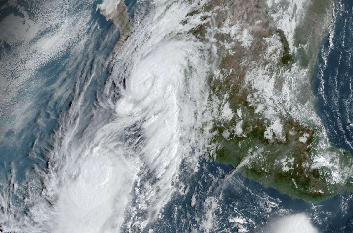
Hurricane Lorena was slated to bring moisture north into Southern Arizona over the weekend, while an upper weather disturbance moved south into the area. Combined, the two could make a wet Old Pueblo.
“We are expecting to see a good push of deep tropical moisture move into Southeastern Arizona from the south, some of which is associated with Lorena,” said Chris Rasmussen, meteorologist with the National Weather Service in Tucson, on Saturday afternoon. “But the main player is a strong upper-low diving down south through the Gulf of Alaska.”
“The upper-low is interacting with the moisture that’s moving northward,” Rasmussen said.
A very active period of weather is expected through Thursday, with Monday & Tuesday likely being the most dynamic of the four days. A threat of severe weather exists over parts of AZ Monday afternoon with locally heavy rains through Tuesday. #azwx pic.twitter.com/UalUjRT3Vb
— NWS Tucson (@NWSTucson) September 22, 2019
Showers were expected to hit Southern Arizona on Sunday, mainly affecting areas near the border.
The best chance for storms in the Tucson area is expected to begin Monday, potentially bringing heavy rain and strong winds through Wednesday or Thursday. On Monday afternoon, strong to severe thunderstorms could affect areas northwest of Tucson especially.
A flash flood watch is also in effect for Pinal County. The flash flood watch will expand into Pima County, including Tucson, at 6 p.m. Monday through 8 p.m. Tuesday.
Flood watches are in place when "when conditions are favorable for flooding," according to the weather service. "It does not mean flooding will occur, but it is possible."
Through the entirety of the storm period, Tucson is expected to tally in half an inch to 1.5 inches of rain in the valley and 2 to 3 inches in the mountains, Rasmussen said Saturday.

