


From its angled jawline to its upturned nose formed by the Colorado River, Arizona’s distinctive profile has been sculpted by centuries of ambition and conflict.
A new exhibit, set to open on Tuesday, May 28, at the Arizona History Museum in Tucson, explores the rich story of how the Grand Canyon State got its shape.
The exhibit was developed over the past year by curator Vanessa Fajardo, exhibits supervisor for the nonprofit Arizona Historical Society.
She said “Shaping Arizona” tells the story of “how Arizona’s border came to be and how that influences us now.”
The chronology covers every major era in the state’s development, from Spanish rule and Mexican independence to the territorial period ushered in by the Treaty of Guadalupe Hidalgo that ended the Mexican-American War.
There is also a display on how the lines drawn and the land claimed by faraway empires impacted the lives of Indigenous people, who thrived in what is now Arizona and Northern Mexico for centuries before the arrival of European colonists.
Elsewhere, there is a panel on Arizona’s most famous land transaction, the Gadsden Purchase, and another on a lesser-known boundary adjustment by Congress in 1867 that carved out a mostly empty, triangle-shaped slice of the Arizona Territory west of the Colorado River and gave it to the young state of Nevada.
The Silver State has certainly made the most of the extra patch of dirt at its southern tip, using it to lay claim to water from the Colorado, grab a share of the Hoover Dam project and build the world’s largest concentration of hotel rooms and craps tables in a place called Las Vegas.

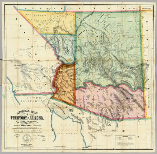
An 1864 map of Arizona shows the territory when it still included what is now the southern tip of Nevada.
“That change of the shape is super vital, not only to Nevada history but also to Arizona history,” Fajardo said.
“Shaping Arizona” is scheduled to run for about a year at the museum on Second Street, just west of the University of Arizona campus.
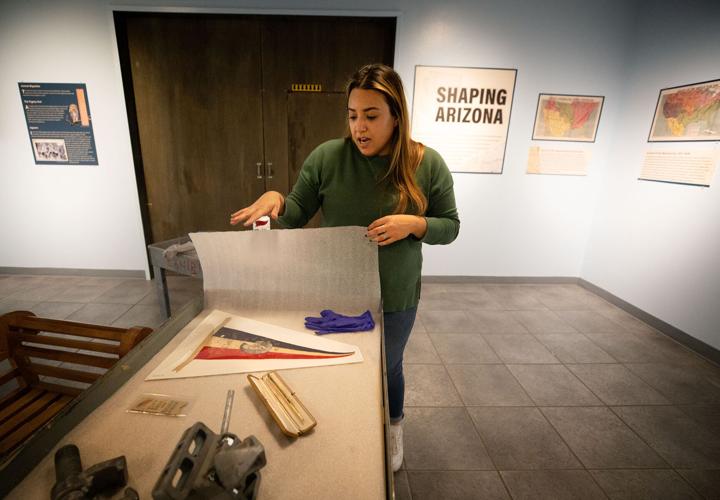
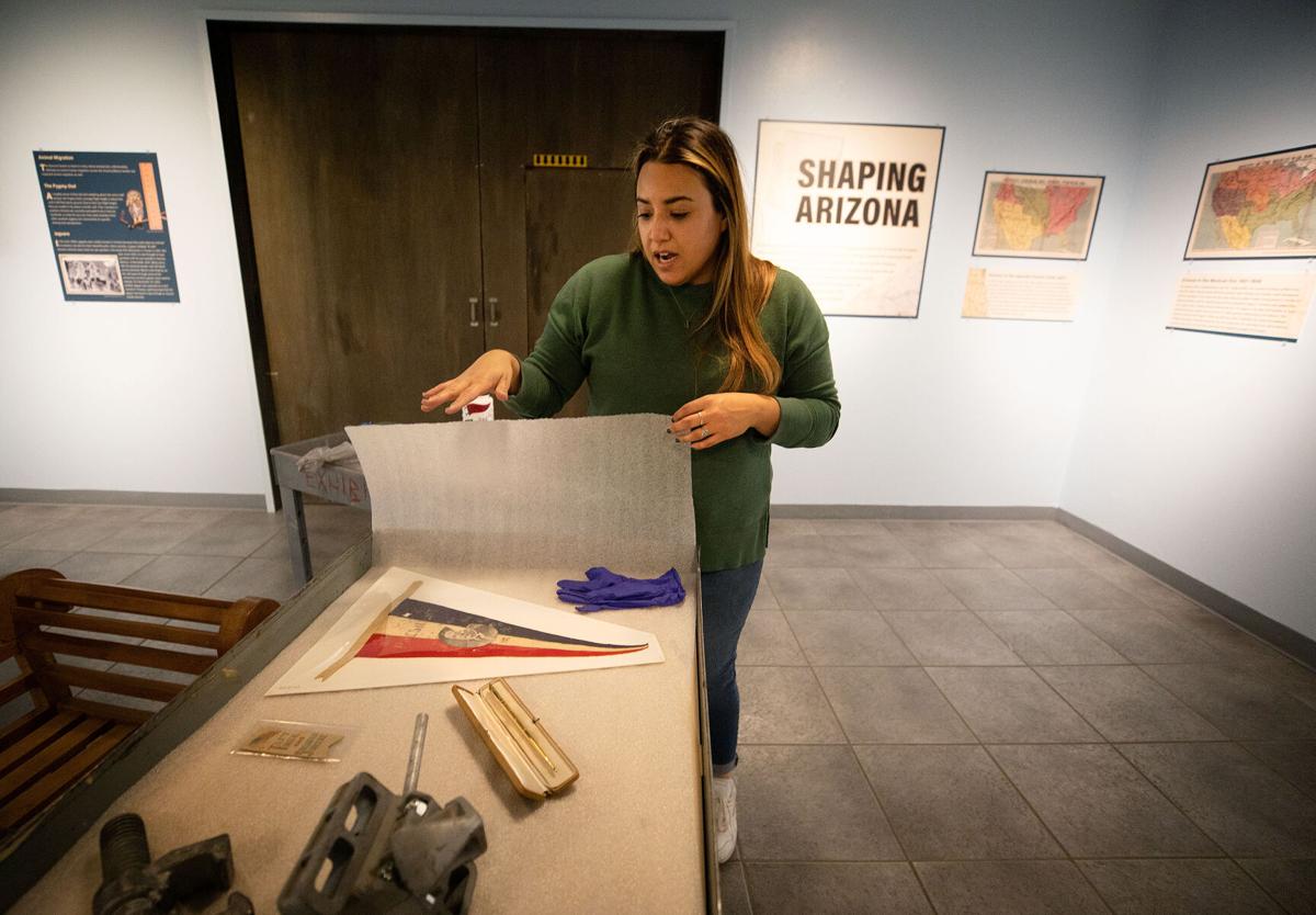
The exhibit is anchored by historic maps and photographs, with a few select artifacts thrown in.
Visitors can see the commemorative gold pen President William Howard Taft used to sign Arizona’s statehood proclamation on Feb. 14, 1912, and a political ribbon opposing an earlier proposal to jointly add Arizona and New Mexico to the Union as one giant state.
A pair of mannequins are dressed in the current uniform of the Border Patrol and a uniform worn in the early 1920s by federal immigration inspectors — also known as “mounted inspectors” — who rode the border before the patrol was established in 1924.

A photo from 1915 shows an American soldier and his Mexican counterpart standing on opposite sides of the international boundary in Douglas.
The 100th anniversary of the Border Patrol falls on May 28, the same day “Shaping Arizona” opens.
“That was kind of serendipitous,” Fajardo said.

The “Shaping Arizona" exhibit is set to open on May 28 at the Arizona History Museum, 949 E. Second St. The exhibit will showcase Arizona’s journey to statehood.
The newest pieces in the exhibit are metal clamps and bolts from former Gov. Doug Ducey’s short-lived shipping container border barrier, which stood for just a few months in 2022 and early 2023 and cost the state upwards of $200 million.
Also on display is the elaborate uniform cape of Mexican President Antonio Lopez de Santa Anna, who reluctantly agreed to the Gadsden Purchase in 1853 that brought Tucson, Tombstone and Yuma into the United States.
Fajardo said the rest of Santa Anna’s “very grand uniform” will be shown later this year at the Arizona Heritage Center, the historical society’s sister museum in Tempe, when a nearly identical version of “Shaping Arizona” opens there.
She said as far as she knows, this is the first time an exhibit has been staged at both museums at the same time.

A postcard shows the international boundary between Nogales, Arizona, and Nogales, Sonora, as it looked in the early 20th century.
The maps featured in “Shaping Arizona” are all reproductions, but some of the originals, including a 170-year-old map of the Gadsden Purchase, are preserved in the historical society’s archives in Tucson. Fajardo said anyone who wants to study one of those originals can do so by appointment.
One of her favorite items in the new exhibit is a photo from 1915 of an American soldier and his Mexican counterpart standing on opposite sides of the international boundary in Douglas. A crooked wooden fence post, barely taller than they are, is all that stands between them.
“Here’s this literal line in the sand,” Fajardo said. “I just like how simple it is.”
The University of Arizona Then and Now. Black and white photos from the Arizona Daily Star and Tucson Citizen archives paired with a color photo of the way the scene looks today. Produced by Rick Wiley / Arizona Daily Star

