


Water levels are falling in a series of monitoring wells connecting Fort Huachuca and the San Pedro River, leading an environmentalist to conclude that pumping by the fort and homeowners and businesses dependent on it are jeopardizing the long-imperiled river.
In a new report, longtime San Pedro crusader Robin Silver of the Tucson-based Center for Biological Diversity wrote that the well findings show a water level decline documented at the fort 20 years ago has now “undoubtedly” spread to the river itself.
Pumping at the fort or by individuals and businesses in the area whose livelihoods depend on the fort “is also undoubtedly jeopardizing the San Pedro River,” wrote Silver. He has been battling groundwater over-pumping along the river for more than 30 years and is a founder and board member of the center.
He also cited a 45% increase in water use at the fort from 2020 to 2024 in his report.
Silver’s conclusions were based in part on monitoring well data he obtained from the U.S. Geological Survey. It has measured well levels in that area for decades. He also relied on fort water production well data from the Arizona Department of Water Resources, and said those three wells were the only Fort Huachuca wells on the ADWR website.
He said he obtained the fort’s water use totals from the fort through the federal Freedom of Information Act.

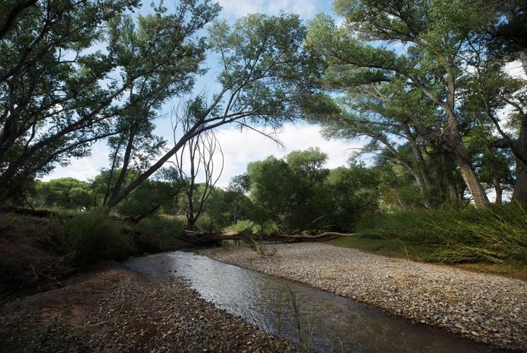
The San Pedro River. Water levels are falling in a series of monitoring wells connecting Fort Huachuca and the San Pedro, leading an environmentalist to conclude that pumping by the fort and homeowners and businesses dependent on it are jeopardizing the long-imperiled river.
This data represents one of many pieces of evidence Silver has cited over the years to back up his concerns about the fort’s impacts on the river — concerns also reflected in other formal studies by consultants, including one by a fort-hired consultant 15 years ago. Silver has sought, unsuccessfully to date, to force a downsizing of the fort’s workforce, to reduce its pumping pressure on the river.
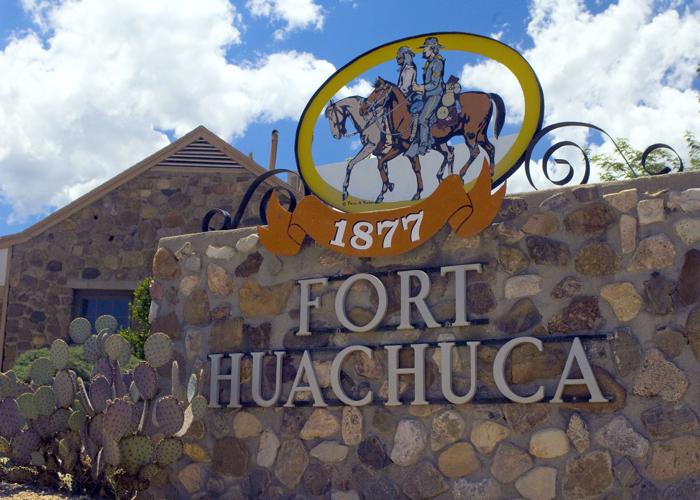
The fort, one of Southern Arizona’s largest employers, lies in the Upper San Pedro Basin about 75 miles southeast of Tucson. It is the mainstay of the economy of Sierra Vista, an adjoining city of about 44,400 people.
The river’s streamside riparian habitat — led by its cottonwoods and willows — and its overall ecology have long been prized by environmentalists and scientists. It is a national riparian conservation area, and The Nature Conservancy has called the San Pedro “one of the world’s last great places.”
Its water flows have been declining for years, and it’s been plagued by a deficit between pumping and natural recharge of rainwater into the aquifer, although that overdraft appears to have itself declined in recent years.
Most officials agree that over-pumping of the aquifer is a cause of declining river flows and threatens the San Pedro’s long-term survival. But there is widespread disagreement over Fort Huachuca’s role in the decline and over what authorities should do to arrest the groundwater overdraft.
Silver’s report comes as the Trump administration is ramping up Fort Huachuca’s role in its border enforcement.
It also comes as the fort and the U.S. Fish and Wildlife Service negotiate what would be the fifth federal biological opinion showing the fort complies with the U.S. Endangered Species Act. The previous opinions have been either thrown out due to lawsuits from the center or withdrawn by the federal agency voluntarily.
Reactions to report
Fort Huachuca declined to comment on Silver’s report, saying, “Fort Huachuca’s stewardship of our natural resources combined with our broad partnerships with stakeholders in the Upper San Pedro Basin, is a testament to our outstanding water conservation programs. We were not involved in the preparation of the report drafted by the Center for Biological Diversity and will not respond to its assertions.”

Fort Huachuca said: “Fort Huachuca’s stewardship of our natural resources combined with our broad partnerships with stakeholders in the Upper San Pedro Basin, is a testament to our outstanding water conservation programs. We were not involved in the preparation of the report drafted by the Center for Biological Diversity and will not respond to its assertions.”
A top USGS official in Arizona, Jamie Macy, declined to say in an interview with the Star on Friday whether he agrees with Silver’s conclusions about water level declines extending to the river. The agency must base any conclusions on its own independent analysis of the well data, said Macy, acting director and supervisory hydrologist for USGS’ Arizona Water Science Center.
Two retired USGS hydrologists, Robert MacNish and Bruce Gungle, told the Star they generally agreed with Silver’s conclusions. In particular, they cited a growing cone of depression of water levels under the fort and at the river.
A cone-shaped zone of depression in groundwater levels represents a reduction in water pressure in an aquifer, triggered by intense pumping and centered where the wells are pumping, said MacNish.
“When you have a cone of depression, it intercepts water headed for the river,” MacNish said. “We’re actually dealing with several cones of depression that are all packed into the same aquifer system.”
But Macy said, “At USGS, our standard practice, no matter what, if we do an analysis, is to do our own independent analysis, to make sure it’s up to USGS’ standard protocols.”
“We’ve been collecting data on the San Pedro for decades now. It is a vital resource and a finite resource. We’ve not been asked to do a thorough analysis, to look at declines in the San Pedro. (To do one), we will need to reach out to partners we work with, to ask if they’d like us to do an analysis like Robin Silver’s.”
But in his interview Friday afternoon, Macy also retracted two comments he had made in an email to the Star earlier that day disagreeing with and criticizing a portion of Silver’s report.
For one, he led the email by saying, “We do not agree that groundwater declines extend to the San Pedro River at this time.”
In a phone conversation afterward, he said, “I reread the email I sent to you. When I read it, I realized it’s not accurate (the statement about groundwater declines). I wanted you to have the most accurate story to give to the public.
“I guess I’m not sure I know what it means by declines reaching the river,” Macy said. “There are steady declines in all wells shown. I want that part of it to be clear. When I wrote that first sentence (in the email), it was taken out of context. That is not true.”
He also retracted a statement calling a particular finding of Silver’s misleading. It had to do with whether Silver’s report’s characterization of whether groundwater was moving towards or away from the river was accurate.
Macy said Silver’s analysis is mostly correct. But Silver’s statement in the report that “a negative gradient indicates groundwater flow away from the San Pedro River” is misleading, Macy said in his email. A gradient is a technical term indicating direction and strength of groundwater flow.
Macy said he originally thought Silver had said the gradients of flow were headed downward between all five monitoring wells he analyzed. But he later acknowledged that Silver was only referring to the gradient between two of the monitoring wells — which indeed has been negative since 1995.
Sierra Vista City Manager Chuck Potucek said he suspects that some water levels at wells at the fort are declining, but “I’m not going to attribute that to the presence of the fort. I don’t have the numbers.”
Potucek, along with other local, state and federal officials, have long been active in the Upper San Pedro Partnership, a group that has researched the river’s problems and carried out solutions, though less far-reaching than Silver’s calls for limits on growth and downsizing of the fort.
“We’ve used the USGS to do a number of different studies before. If the partnership wants to take a look at it, the USGS needs funding. If that’s something we need to do to verify things, we could just look for funding to get things done,” Potucek said.
Updates 2005 analysis
Silver prepared his new report as an update to a similar analysis done in 2005 by the Army Corps of Engineers.
The Corps report, published 20 years ago this month, said it was initiated because “groundwater levels are dropping in the Fort Huachuca/Sierra Vista area due to aquifer pumping. Over time, this potentially can have an appreciable effect on groundwater discharge to the San Pedro River.”

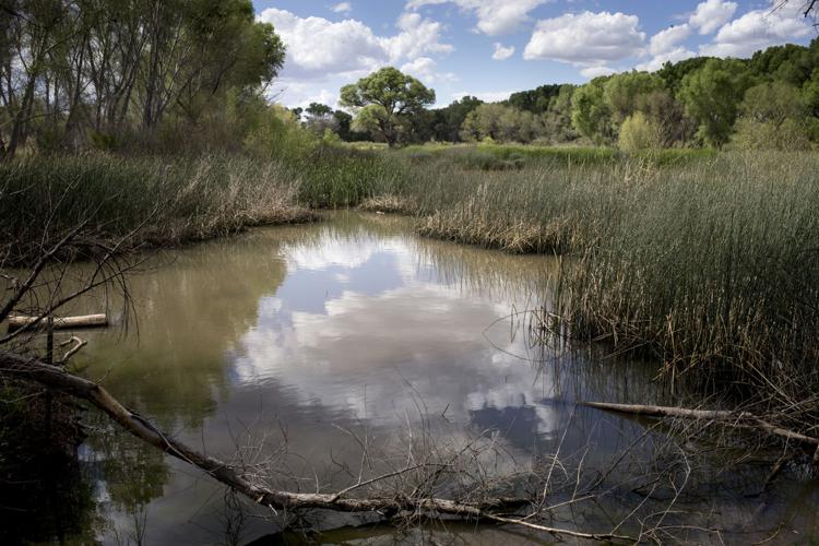
The Green Kingfisher Pond at San Pedro Riparian National Conservation Area near Sierra Vista. The river's streamside habitat and its overall ecology are prized by environmentalists and scientists. It is a national riparian conservation area, and The Nature Conservancy has called the San Pedro "one of the world's last great places."
The Corps had contracted with Fort Huachuca in April 1995 “to assist in the location, design, and construction of seven monitoring wells,” said the report from Corps hydrologic engineer Jon Fenske. The Corps began collecting data from the wells in April 1995.
The Corps report documented water level declines in four of these wells in a straight line from the fort — a line commonly called a transect by scientists — to the river from 1995 through 2004. The declines were steepest near the pumping centers of the fort and Sierra Vista and at their least near the river itself.
The other three wells weren’t in a direct line from the fort to the river, making their water levels less relevant.
Concluding, Fenske wrote, “From analysis of water-level data from 1995-2005, a clear trend has developed. The cone of depression in the Fort Huachuca area is growing, and measured water levels within 2 miles of the river have been declining.
“If groundwater development in the Fort Huachuca/Sierra Vista continues at present rates, water levels will continue to decline in the region. The extent to which this declining trend in groundwater levels currently extends to the San Pedro River itself is uncertain.
“This is dependent on the hydraulic conductivity of the geologic units located between the wells and the river, and the historical connection between the river and groundwater in this area.”
But it’s likely the water level decline did extend to the river, “resulting in a reduction of groundwater discharge to the river when compared to predevelopment conditions,” Fenske wrote.
Wells keep dropping
Silver’s report found that the monitoring wells’ water levels have kept falling since 2005, at different rates.
The two wells closest to the fort and Sierra Vista dropped 12 and 18 feet, respectively, from 2005 through 2025, the USGS data shows. The two wells closest to the river have fallen about 2 feet each since 2005, and the well at the river has dropped about 2.2 feet.
The gradient between each well was negative only between two wells farthest from the river. It was positive between all the others, indicating water is generally still flowing toward the river. But the gradient is also declining in intensity even when it’s positive, meaning that less water is reaching the river from the fort than before, Silver’s report said.
In addition, water levels in three other wells the fort pumps for water use on the base itself have also dropped — by 14.9 feet over the past 20 years, 9.9 feet over the past 30 years and 21.8 feet over the past 40 years, respectively, the fort’s data shows.
“Absolutely the cone of depression around the Fort Huachuca wells is increasing,” Silver said. “The proof is that along the transect line the entire aquifer is dropping. That’s what the monitoring wells show. Not only do they show that the aquifer under Fort Huachuca is dropping, but it’s now negatively affecting the river.”
He said that while current pumping clearly contributes to the well level declines, the bigger cause is a historic, cumulative groundwater pumping-recharge deficit between the fort’s pumping and recharge. It was estimated in 2010 at 300,000 acre-feet in a report from a fort consultant released by Silver in 2019 after a leak from a source he would not identify. That’s enough water to serve more than 1 million Tucson-area homes for a year, based on local water use rates.
MacNish disagreed with some of the technical points in Silver’s new report but added, “His bottom line statements, I agree with.
“All the pumping in the Sierra Vista sub-basin has reduced water pressure in the aquifer. Water levels in the aquifer have declined all over.”
He also agreed that the river’s future is today in jeopardy due to over-pumping.
“If all the pumping stopped today, the river could sill go dry and be dry for years before the system could recover and flow again,” said MacNish, who retired in 2001 after studying the San Pedro and other riparian issues for USGS and the University of Arizona. “If the pumping continues, the jeopardy is increasing.”
Sierra Vista manager Potucek said he doesn’t dispute that a cone of depression exists underneath Fort Huachuca’s aquifer, but said he’s not been convinced that the fort’s pumping is hurting the river.
“I’m not sure of the veracity of that report,” said Potucek about the internal 2010 report, without elaborating.
Silver’s new report, in blaming the fort for the river’s problems, “ignores what’s going on in Mexico,” he said. That’s where major questions exist about whether a big copper mine is drying up the river there.
He said it also ignores the impacts of drought and ignores the fact that population in the Sierra Vista area hasn’t grown much until border tensions caused the U.S. government to recently ratchet up their presence in the area.
And it’s ignored “a lot of good work done by people of good intentions to address these issues, which continues,” Potucek said.
That includes a number of human-driven recharge projects, led by the Sierra Vista Environmental Operations Park, where treated effluent is recharged near the river east of the city and near Highway 90. He also cited two other effluent and stormwater recharge projects in the area that are now being developed.
“Time will tell, right? We believe they will be beneficial. Will they counteract everything? I can’t see under the ground so I can’t say everything, but I believe they will be beneficial,” Potucek said.
The river's beaver population is hanging on almost 25 years after being reintroduced by wildlife officials.

