

(UPDATED 6:30 P.M.) — Tucson has tied a rain record with Tuesday being the eighth consecutive day that measurable rain has fallen at the Tucson airport, according to the National Weather Service.
The record, last set in 1972, could be broken Wednesday, the NWS said in a tweet. Officially, the airport received .08 of an inch of rain Tuesday.
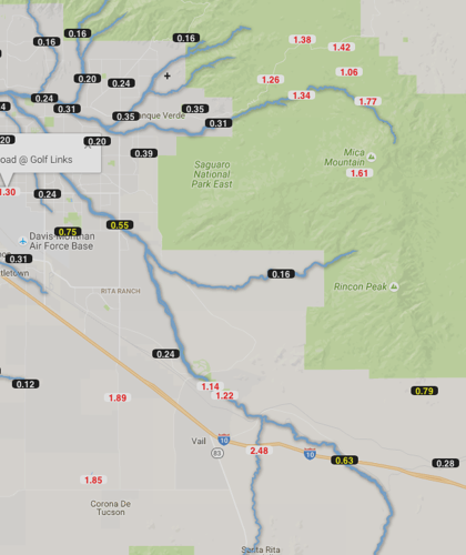
Much heavier rain was recorded on Tucson's east and southeast sides Tuesday.
Some rainfall totals for the day show the heaviest amounts east and southeast of Tucson.
Corona de Tucson southeast of Tucson received 1.85 inches of rain in a 24-hour period, according to the Pima County Regional Flood Control District rain gauges. Davidson Canyon, a little farthest southeast, received 2.5 inches as of 5 p.m.
The Manning Camp in the Rincon Mountain had 1.93 inches of rain, while areas in the Santa Catalina Mountains show totals upward of nearly 2 inches in some places.
In Tucson, heavy rain was recorded at Irvington Road and Pantano Road, with .80 of an inch shown on gauges, while .60 of an inch of rain was recorded at the Pantano Wash and South Houghton Road.
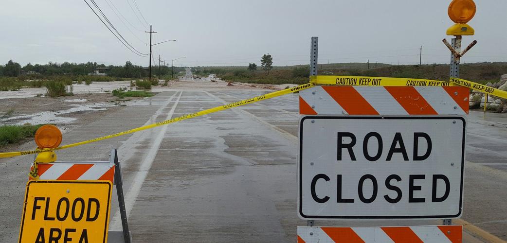
The NWS said a flash flood watch will remain in effect for Tucson and much of Southeastern Arizona through 5 a.m. Wednesday. Slow moving storms could return through the night and with the ground already saturated, heavy runoff could occur.
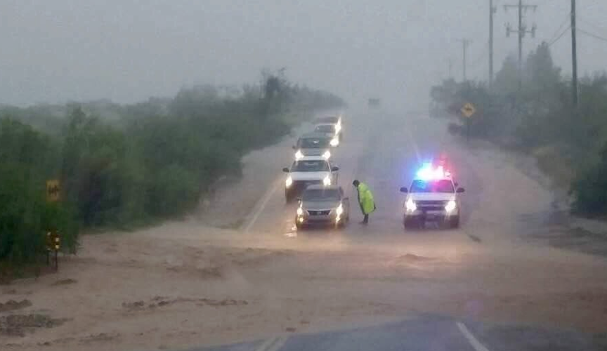
Earlier in the day, the Pima County Sheriff's Department ordered the Vail School District to evacuate students at Pantano and Andrada Polytechnic high schools as a preventative measure.
Vail schools reported on social media that there is a sinkhole near Andrada on Houghton Road and flooding north of the Pantano Wash. "We do not want students to get stuck at school," the Facebook post said.
Evacuated students were taken by bus to Cienega High School, where parents could pick their children up.
Here are some other road closures this evening in Pima County (courtesy of the Pima County Department of Transportation):
- Mission Rd north and south of Los Reales
- Old Nogales Highway South of Lumber Street
- Limberlost Rd at the Agua Caliente Wash
- El Tiro Road from Cocio Road west past Pump Station Road to end of pavement Westover Avenue between San Paulus Road and Valencia Road
- Westover from Valencia Rd to Drexel Rd
- Houghton Rd between Andrada Rd and Sahuarita Rd
- Soldier Trail at the Agua Caliente Wash
- Wentworth Road at Tanque Verde Creek
- Old Ajo Hwy between Ajo Highway and San Joaquin Road
- Avra Valley Road at the Brawley Wash east of Trico Rd
- Old Spanish Trail at the Rincon Creek
- Country Club Road at Dawson Road
- Tanque Verde LP Road at the Tanque Verde Creek
- Silverbell Road between El Camino Del Cerro and Ina Road
- Silverbell Road between Ina Road to El Camino Del Cerro
- Manville Rd btwn Avra Rd and Reservation Rd at the Brawley Wash
- Sandario Rd from Snyder Hill Rd to Desert Oasis Trail
- Redington Road at MP 3 the base of the road
- Snyder Hill Road at end of pavement to Desert Sunrise Trail
- San Joaquin Road between Ajo Highway and Bopp Road
- San Joaquin Rd between Old Ajo Way and Bopp Rd
- San Xavier Rd - east of Mission Rd at the Cemetery
- Los Reales Rd - west end of Rocking K Subdivision
- Santa Rita Rd from Dawson Rd north to Sahuarita Town Limits

