


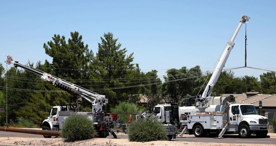


The intersection of West Ina and North Shannon roads was expected to be closed through the weekend as Tucson Electric Power repairs at least 14 downed power poles, the utility says.
“Repairs will also require the closure of Ina Road between Camino De La Tierra and Mona Lisa Road,” TEP spokesman Joseph Barrios said.
A dry microburst hit about 3:40 p.m. Friday, resulting in the downed power poles at Ina and Shannon, according to the National Weather Service.
The falling poles in turn knocked down traffic lights, the weather service says.
TEP expects some traffic restrictions will remain in place for about a week until repair work is completed.
At least 4,800 customers were temporarily left without power as a result of the storm, which damaged about two dozen power poles throughout the Tucson area, Barrios said.
The high temperature Friday in Tucson was 111 degrees, the hottest of the year so far.
It tied the daily record high for July 5 also set in 2018, the weather service says.
An excessive heat warning for the Tucson area has been extended through Tuesday evening as summertime temperatures reach nearly 110, the weather service said.
The heat warning is in effect for all but Santa Cruz and Cochise counties and the mountain zones of southeast Arizona, meteorologists at the weather service said. The warning could be extended if the weather conditions are ripe with moisture.
During this time frame, monsoon activity will be limited to mainly the Tucson area’s south and southeast sides, and across Santa Cruz and Cochise counties, the weather service said Saturday.
Sunday’s high temperature is predicted to reach 106 degrees with a mostly clear evening and a 77-degree low. Monday and Tuesday’s temperatures will nearly mirror Sunday’s forecast.
Monday’s high is expected to be 108 degrees, with a low of 78 degrees. Tuesday’s forecast mimics Monday, except for a slight chance of evening thunderstorms, according to the weather service.
As the high temperatures shift mid-to-late week, a more favorable moisture pattern returns to southeast Arizona. Residents could expect shower and thunderstorm chances to increase, as well as high temperatures to slowly decrease (but still remaining several degrees above normal levels), the forecast shows.
As a result of this heat, the National Oceanic and Atmospheric Administration is expanding the availability of a new experimental heat tool called HeatRisk. HeatRisk is a collaboration with the NWS and the Centers for Disease Control and Prevention. It provides information and guidance for those who are particularly vulnerable to heat and may need to take extra precautions for their health when the temperature rises.
The NWS said HeatRisk provides historical context for high-temperature forecasts, identifies how unusual the heat will be for any given time of year across a spatial area, and identifies temperatures that are expected to bring increased heat impacts over a 24-hour period, up to seven days in advance.
See what today's weather forecast looks like in Tucson.

