

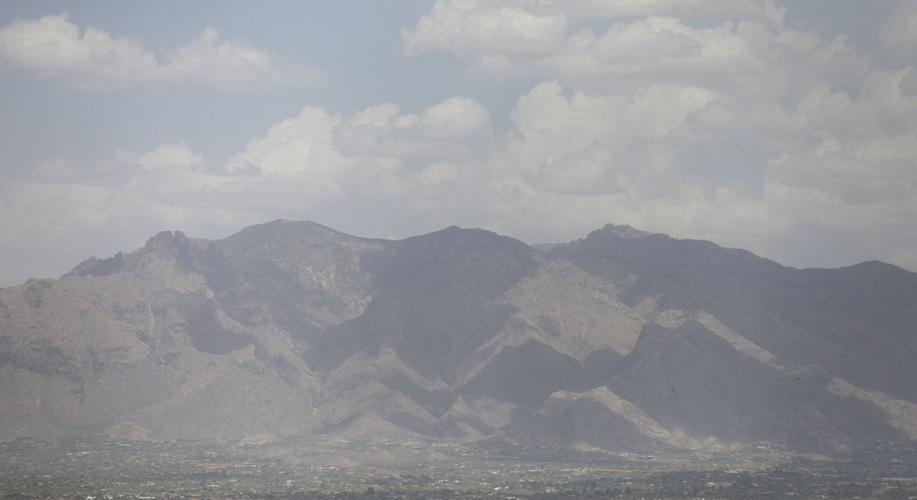

The longest day of the year was a hazy one in Tucson.
It also was hot, windy and stormy for some parts of the metro area.
A particularly huge haboob swept across west Texas and southern New Mexico before the dust storm settled over Tucson, leaving residents here wondering if the haze was due to storm clouds or smoke from a distant wildfire.
“That’s dust that’s up in the atmosphere,” said Julia Tetrault, a meteorologist with the National Weather Service in Tucson said Thursday morning. “It’s like that because there’s a nice temperature inversion, basically very stable air towards the surface is not allowing the atmosphere to completely mix out and let the particles just disperse like they probably would.”
See what today's weather forecast looks like in Tucson.
Haboobs occur when the wind created by nearby thunderstorms passes over warm dry land, picking up dirt and soil, according to National Weather Service meteorologists. These storms are more common in the spring and into the early summer, due to thunderstorm activity and cold weather systems.
“There was a cold front that surged down the plain yesterday through Texas into eastern New Mexico, and then that continued to progress through the Rio Grande Valley and across southern New Mexico, and then eventually into Arizona,” said Bryan Guyer, a meteorologist for the National Weather Service in Albuquerque, New Mexico. “This entire system produced widespread blowing dust across a large part of New Mexico into Arizona.”
What made this haboob particularly notable, said Jason Laney, a meteorologist for the National Weather Service in El Paso Texas, was its sheer size.
“This line of wind stretched for a solid 200 miles,” Laney said. “This was a long-lived and extremely large haboob.”
The dust storm was large enough to be visible on satellite as it traveled through the southwest, Guyer said.
“It’s been quite some time since I’ve seen one of this expanse,” he said.
According to both Guyer and Laney the storm and strong winds were responsible for a good deal of minor damage across the three states including downed tree limbs and several crashes due to low visibility.
The storm caused numerous car crashes Wednesday on Interstate 25 including a pileup with injuries near Algodones, between Albuquerque and Santa Fe, the Santa Fe New Mexican reported.
Guyer urged caution as dry, windy conditions persist across the southwest over the next few days.
“When folks do encounter blowing dust, they should pull off the roadway, and turn off their lights to put themselves in the safest environment possible,” he said.
Dust from the storm could also result in a temporary decline in air quality for the Tucson area, Natalie Shepp, Senior Program Manager for the Pima Department of Environmental Quality, said Thursday.
“When we look at dust levels, as far as air pollution, we’re looking at pm 10, which is the particulate matter size of 10 microns,” Shepp said. “We were at moderate levels this morning. They did kind of spike for a short time into the orange unhealthy level.”
Shepp said that gusty conditions following the storm may cause air quality levels to fluctuate for the near future.
“I would recommend that people utilize the Air Now website,” Shepp said. “Using the Air Now map will give them real time air quality data from our monitoring sites.”
“If the levels are in the unhealthy range, or if you’re a sensitive population and it’s in the yellow range, especially with the excessive heat warning too, we are generally just recommending for people to stay indoors if they can.”
Tucson reached a high temperature of 109 degrees Thursday along with wind gusts that reached up to 36 mph. And while no rain had been recorded Thursday afternoon at the airport, the official location for weather data here, some parts of the city had rain storms.

