


WASHINGTON — Warm Arctic waters and cold continental land will combine to stretch the dreaded polar vortex in a way that will send much of the United States a devastating dose of winter weather later this week, with swaths of painful subzero temperatures, heavy snow and powerline-toppling ice.
Meteorologists said the eastern two-thirds of the nation is threatened with a winter storm that could rival the damage of a major hurricane and has some origins in an Arctic that is warming from climate change. They warn the frigid weather is likely to stick around through the rest of January and into early February, meaning the snow and ice that accumulates will take a long time to melt.
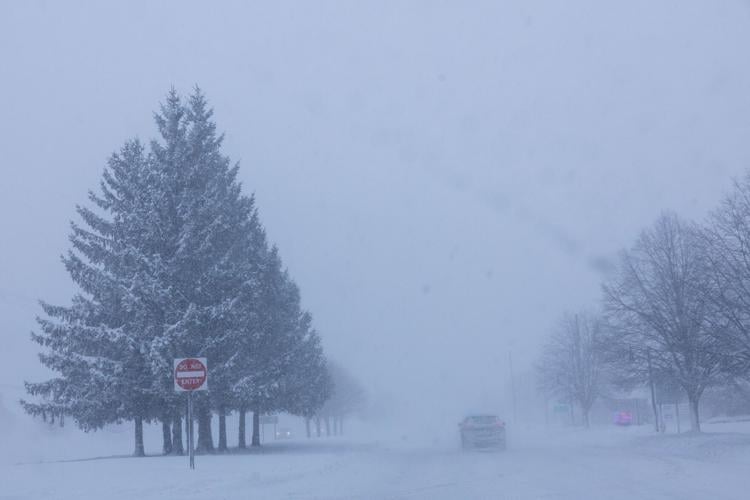
Forecasts have the storm, expected to start Friday, stretching from New Mexico to New England and across the Deep South. About 230 million people will face temperatures of 20 degrees or colder and about 150 million likely will be hit by snow and ice, with many Americans getting both, according to the National Weather Service.
"I think people are underestimating just how bad it's going to be," said former National Oceanic and Atmospheric Administration chief scientist Ryan Maue, now a private meteorologist.
The polar vortex, a patch of bitterly cold air that often stays penned up in northern Canada and Alaska, is being elongated by a wave in the upper atmosphere that goes back to a relatively ice-free part of the Arctic and snow-buried Siberia. As the bone-chilling temperatures sweep through the U.S., they'll meet with moisture from off California and the Gulf of Mexico to set up crippling ice and snow in many areas.
Origins of the system in a warming Arctic
The origins of the system began in the Arctic, where relatively warmer temperatures added energy to the polar vortex and helped push its cold air south.
"The atmosphere is aligned perfectly that the pattern is locked into this warm Arctic, cold continent," Maue said. "And it's not just here for us in North America, but the landmass of Eastern Europe to Siberia is also exceptionally cold. The whole hemisphere has gone into the deep freeze."
As far back as October 2025, changes in the Arctic and low sea ice set up conditions for the kind of stretched polar vortex that brings severe winter weather to the U.S., said winter weather expert Judah Cohen, an MIT research scientist. Heavy Siberian snowfall added to the push-and-pull of weather that warps the shape of the normally mostly circular air pattern. Those conditions "kind of loaded the dice a bit" for a stretching of the polar vortex, he said.
Cohen co-authored a July 2025 study that found more stretched polar vortex events linked to severe winter weather bursts in the central and eastern U.S. over the past decade. Cohen said part of the reason is that dramatically low sea ice in the Barents and Kara seas in the Arctic helps set up a pattern of waves that end up causing U.S. cold bursts. A warmer Arctic causes sea ice in that region to shrink faster than other places, studies found.
Arctic sea ice is at a record low extent for this time of year, according to the National Snow and Ice Data Center.
Where the winter blast will strike
The center of the stretched polar vortex will be somewhere above Duluth, Minnesota, by Friday morning, ushering in "long-lasting brutal cold," Maue said. Temperatures in the North and Midwest will get about as cold as possible, even down to minus 25 or 30 degrees Fahrenheit, Maue said. The average low temperature for the Lower 48 states will dance around 11 or 12 degrees on Saturday, Sunday and Monday, Maue said.
Two Great Lakes — Erie and Ontario — may freeze up, which would at least reduce the famed lake-effect snow a bit, Maue said.
National Weather Service meteorologist Zack Taylor of the national Weather Prediction Center said most areas east of the Rockies will be affected by bitter cold, snow or ice. Treacherous freezing rain could stretch from the southern plains through the mid-South and into the Carolinas, he said.
"We're looking at the potential for impactful ice accumulation," he said. "So the kind of ice accumulation that could cause significant or widespread power outages or potentially significant tree damage."
If you don't get ice, you could get "another significant swath of heavy snow," Taylor said. He said it was too early to predict how many inches will fall, but "significant snowfall accumulations" could hit "the Ozarks region, Tennessee and Ohio valleys, the central Appalachians, and then into the mid-Atlantic, and perhaps into the portions of the northeast."
Maue said in the mid-Atlantic around the nation's capital, there's a possibility that "you can get two blizzards on top of each other in the next 14 days."

