

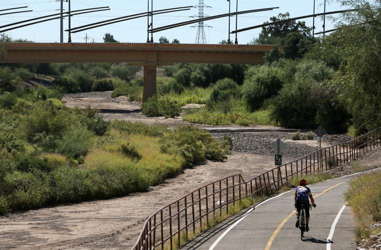
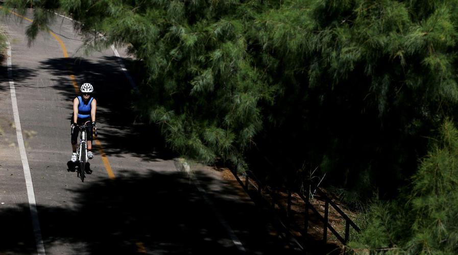


Tamarisk and mesquite trees, grasses and shrubs jut out 10 to 15 feet from both banks of the Santa Cruz River through downtown Tucson.
It’s a scenic view, conjuring memories of what the river looked like before groundwater pumping dried it up decades ago. But it’s also a flood risk, one that could be particularly hazardous this wet winter, a longtime University of Arizona flood expert says.
The Southwest is in the middle of a major El Niño event that has the potential to be the largest on record. While El Niño’s impacts vary around the world, in this region they typically mean wetter and often cooler late fall and winter weather than normal.
The threat of tropical storm flooding here from El Niño — which brought Tucson its record-setting 1983 flood — has passed with the changing of the seasons. But experts say there could still be flooding here from prolonged winter rains if that’s what El Niño brings, as happened during a weak El Niño period in 1993.
Over the decades soils and other sediment have built up across the entire river bottom. The trees growing along the river banks allow even more sediment to build up.
In some places the sediment and vegetation have grown almost as high as the soil cement-lined river banks. The result: The river has less room to carry water, raising the possibility of floodwaters overtopping the banks, says professor Victor Baker, who has been studying floods in Tucson and around the world for nearly 50 years.
If that happens, it would be the first time the Santa Cruz flooded in the downtown area at least since city officials installed a thick liner of soil cement along both banks back in the early 1980s. The soil-cement mixture has kept river waters from eroding the banks. But Baker worries that the now-artificial river can no longer handle the amount of flooding the soil cement cover was originally designed to carry.
“If the flood is large enough, it will spill out of the channel into adjacent areas,” said Baker, a professor of hydrology and water resources, and of geosciences.
Researchers worried
Baker’s interest in flooding on the river goes back to the 1980s, when he co-authored a National Academy of Sciences report that probed the causes of Tucson’s biggest flood on record, in 1983. His concern is backed up at least in part by a recent book on the Santa Cruz by three local experts in the river’s geology and hydrology.
“Requiem for the Santa Cruz” notes that during a 2005 flood, the river appeared to be close to the bottom of the Congress Street bridge deck — even though it was carrying barely one-fourth of the water the river channel was designed to carry. Its authors, geologist Raymond Turner and hydrologists Julio Betancourt and Robert Webb, have been studying the Santa Cruz and its hydrology and geology for decades.
Pima County flood control officials are now evaluating that area to determine whether vegetation needs to be removed to reduce flood risks. The county took over responsibility for maintaining the Santa Cruz from the city of Tucson in July 2014.
The county did wash maintenance along other sections of river following storms last fall. But vegetation removal through the downtown stretch of river “will be a large undertaking,” requiring federal permitting, analysis of existing topography and other work, says Suzanne Shields, director of the county’s Regional Flood Control District. The county doesn’t expect to get started on it before the current El Niño season ends, Shields said.
Shields is not worried about most of the other soil cemented washes, however. Most or all of them are designed to carry not just a 100-year flood, which has a 1 percent chance of happening in a given year, but a much rarer 500-year flood.
Many other major washes have had vegetation and sediment removal recently enough to prevent floodwaters from spilling over their banks, she said. In 2006, for instance, a 250-year flood hit the Rillito River on the city’s north side, but she said it generally stayed within the riverbanks and caused no damage.
But for several reasons including climate change, today’s 100- and 500-year flood levels could be different than they were in the past and could continue to change, says Baker and Phil Williams, a retired San Francisco civil engineering consultant who has written extensively about floods and and researched them for decades.
Most 100-year flood levels are based on the severity of past floods, says Williams. But because of climate change, that data may not be valid any more, he says. Other factors, Baker said, are changes in land cover — such as surface paving — that increase runoff, as well as the construction of storm sewer drains.
The county’s Shields didn’t totally disagree with them. “We try to build a system that’s resilient, but nobody can guarantee exactly what is going to happen,” she said. “You don’t know how a storm is going to hit. … You build these facilities and you can’t just walk away from them.”
FLoods act fast
Soil cement has been used here since the late 1970s, after major floods struck the Santa Cruz and Rillito rivers. It continued in 1982 when the city of Tucson put in a massive downtown flood control project in hopes it would allow development with little flood risk. The use of soil cement accelerated after a huge flood in October 1983 sent homes, trailers, condominiums and an office building into the Rillito and other washes when raging floodwaters undercut and ate away the riverbanks that held up the structures.
Since then, Pima County has lined about 80 miles of rivers and washes with soil cement, at a total cost of about $170 million. Soil cement lines parts or all of most major washes in the urban area including the Cañada del Oro, the Pantano and the Julian as well as the Rillito and Santa Cruz. They have become a symbol of better flood protection, and county officials from Administrator Chuck Huckelberry on down have taken pains to note that most flood damage since 1983 has struck homes and other structures built in older areas developed without soil cement protection.
Soil cement prevents floodwaters from eroding otherwise barren streambanks, which was the chief cause of flood damage here in the 1970s and ’80s. It also has allowed development at much greater levels than it otherwise would have.
Typically, for instance, Pima County requires developers to set buildings 500 feet back from an unprotected wash but only 100 feet back from a protected one.
Shields watched condos fall into the Rillito back in 1983, when as a lower-level county flood control staffer she went to that area to inspect the flood as it was roaring downriver. First, she saw cracks forming in the river, then saw banks starting to slough in and finally the condos fall in over 15 to 20 minutes.
“It was like watching something in slow motion,” she recalled recently.
The soil cement channels are designed with a safety factor known as “freeboard,” in which their level is raised 1ƒ to three feet to try to ensure that floodwaters never overtop them, she said. Most soil cement channels are designed to carry a 500-year flood, she said.
County officials conduct regular aerial surveys of the washes to monitor their elevation and check for sediment buildup, she said. That was done most recently in March.
“Big trouble here”
Reviews of the Rillito and the Cañada del Oro since then have found that there isn’t a major sediment buildup, she said. On the Pantano, the riverbed appears to be not rising but sinking, with parts of the channel having dropped 9 feet during 2006 alone.
But as Baker walked along the Santa Cruz through downtown last week, he noted that the flood control channel there was designed back in the 1980s for 45,000 cubic feet per second, then upgraded to handle 60,000 cubic feet of water per second. But in the same 2006 flood that created 200-year flood conditions in the Rillito, water almost completely filled the Santa Cruz even though it was only carrying 42,000 cubic feet per second, he said.
Sediment has built up all across the river channel, and trees have grown as high as 30 to 40 feet near the edges. The sediment is brought in every year by smaller flows that occur during normal storms. Now, with the channel constricted by sediment, trees and shrubs, “we don’t know for sure how much water it can carry, but it will be a lot less than what the channel was originally designed for,” Baker said. That raises the risk of water flooding over the edges, he said.
Baker also said he’s concerned about potential flood impacts on the Santa Cruz’s West Branch, a tributary that merges with the river north of Irvington Road and is choked with grasses and other vegetation. The West Branch is lined with homes close to the river on both sides.
“We have big trouble here,” he said.
The county removed some West Branch sediment in early 2015 and has since mowed and cleared vegetation there, Shields said. But “with these late summer into fall storms, I will have my staff go out and do maintenance.”
For many residents around the Southwest, the prospect of a big El Niño has seemed a lifesaver, offering hope for refilling drought-starved reservoirs and restoring some of the green to our desiccated desert. But for those living and working along the Santa Cruz, El Niño looms as a potential threat, whose odds of becoming reality won’t be known for months.

