

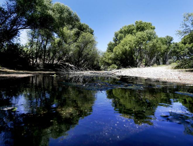

CASCABEL — The stretch of the San Pedro River that runs behind Anna Lands’ burnt adobe house is mostly dry, or wet only in shallow pools and patches. Some stretches are lined with fallen cottonwood trees killed by drought or knocked over by floods.
The San Pedro is one of the desert Southwest’s finest remaining examples of a streamside riparian area. But near Lands’ house this spring, only occasional stretches carry much water — and even then, it trickles slowly and often appears not to move.
The vast majority of the Middle San Pedro River runs like this during dry seasons. Particularly in dry times like now, it’s uncommon here to see gushing flows that are pervasive in the Upper San Pedro near Sierra Vista. Yet it’s the dry season when the river’s trees, frogs and fish need the “base” flows the most.
Over the past eight years, the Nature Conservancy has organized volunteer surveys of the Middle San Pedro — as part of a broader survey of the entire river — in June, the year’s driest month. In that time, no more than 22 percent of the entire, 32-mile-long Middle San Pedro carried water during the annual surveys.
Even on the conservancy-run Three Links Farm, the stream flows of which are the most reliable on the Middle San Pedro, only twice in the past eight years did the June surveyors find water on more than 38 percent of the stream. Sixteen percent carried water in the June 2014 survey. No more than 24 percent carried water in the past three years’ surveys.
Now Lands and many others who farm, ranch or simply dwell along this stretch of cottonwoods and willows are asking: What will become of the river once well pumps start whirring in a few years for a planned 28,000-home development in Benson?
The answer: Nobody knows, even as a Benson City Council vote nears on a preliminary plan for the Villages of Vigneto project along Arizona 90. The council will vote Monday, although the project already has legal zoning for 60,000 homes. The owners, Phoenix-based El Dorado Holdings, want to inscribe their new plan into law to ensure that all areas are developed consistently with roads, parks, open space and architecture.
“center of my universe”
It’s not clear when — or whether — the impacts on the river will be determined scientifically. Answers would come from the last leg of a three-part research project on the Middle San Pedro’s groundwater system, but there is no money to complete that project right now, says the U.S. Geological Survey, which produced the first two parts of the study with help from state financing.
That research could answer questions like whether groundwater flowing under the development site and the San Pedro River in the Benson area actually reaches the Middle San Pedro north of Benson. Without that knowledge, it’s not known if groundwater pumped for the Vigneto project will have any effect on the river.
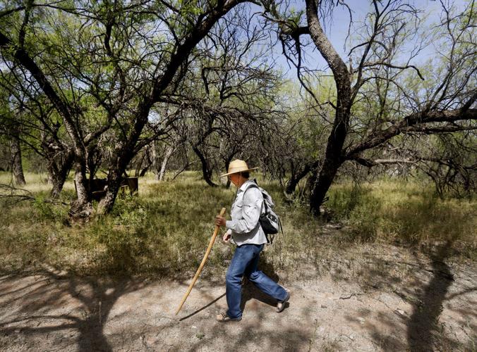
“It doesn’t matter which development it is — it’s really about the water,” said Lands, whose home lies 27 miles worth of paved and dirt roads north of Benson. “We know it’s not being replenished very well.”
Later, walking down a dry stretch, she added, “If they don’t know enough ... the city would be risking everything if they don’t hit the pause button.”
Jeff Cook, a Benson city councilman who generally supports the development, isn’t ready to pause. He says the development likely couldn’t be stopped even if he wanted to do that. That’s because of the zoning secured more than 20 years ago by the development’s previous owner, Ernie Graves, on the 12,000-acre site when it was called Whetstone Ranch.
“I don’t think we’re going to have the answers in two months or two years or even 10 years,” Cook said. “I think that we need to move forward and approve it, since this is only a preliminary plan. The final plan, with much more detail, we need to take a harder look at it.”
The final plan is due from El Dorado Holdings by the end of April.
About 75 mailboxes stand along Cascabel Road, a 15-minute walk through grasslands and mesquite flats from the cottonwood-dominated Middle San Pedro. Most residents are retired, says Lands, although about a half-dozen run cattle ranches or grow food, alfalfa, native grasses and other crops.
In one way or another, virtually everyone living here depends on the river, Lands said. Some, like Lands, pump drinking water from areas near the river, while others irrigate with wells fed by high groundwater.
“People will say it’s in the middle of nowhere and there’s nothing here,” Lands said as she approached the stream. “But for me and many others, it’s the center of my universe.”
Birds are among the biggest attractions along this stretch of river, just like at the Upper San Pedro near Sierra Vista. Both regions are known as globally important bird-migration areas.
An environmental report for the proposed SunZia power line to run through the area cited 307 bird species along the Lower and Middle San Pedro. That compares to 373 on the Upper San Pedro. For a time, the U.S. Fish and Wildlife Service considered creating a Lower San Pedro National Wildlife Refuge, but that idea has been on hold since November 2013.
One common breeding bird here is the endangered Southwestern willow flycatcher, for which surveyors found 114 total territories — exclusive breeding areas for a flycatcher pair — last year, says the wildlife service.
life thriving on farm
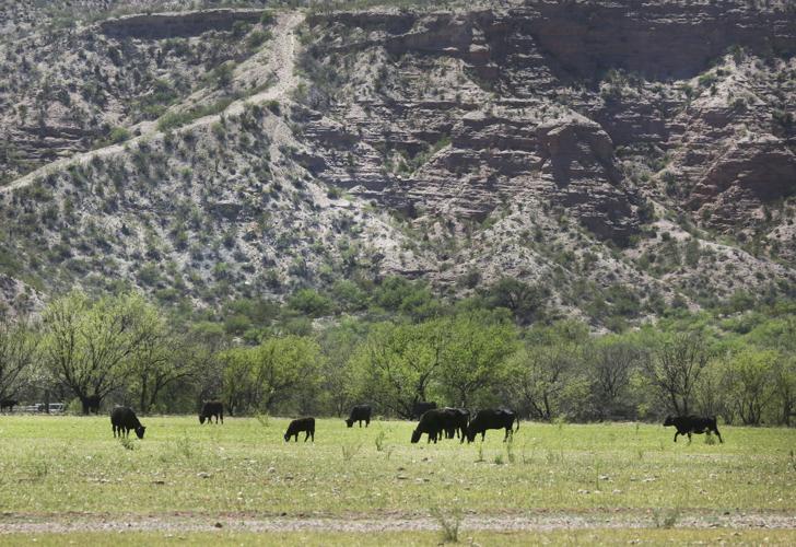
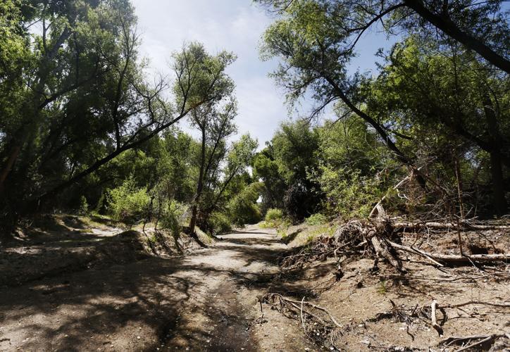
About 14 miles south of Lands’ home is the Nature Conservancy’s Three Links Farm, which the conservation group has managed since buying it in 2002. The farm covers 2,180 acres and spans about six river miles.
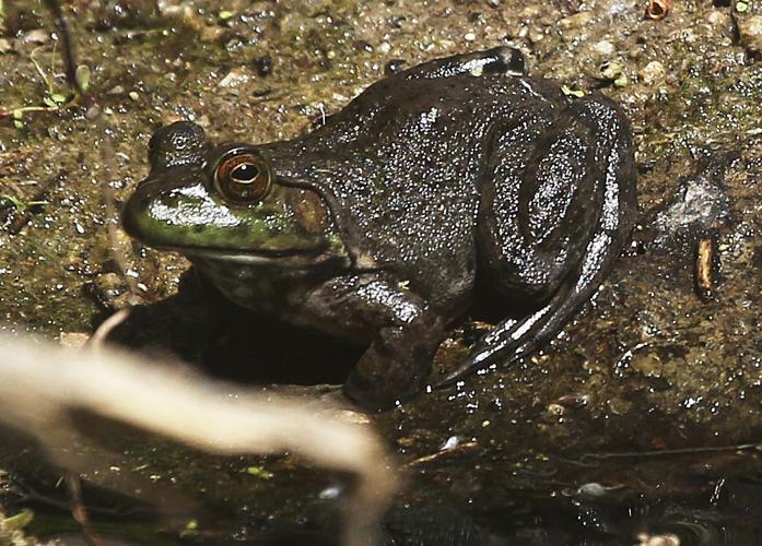
Here, running water is more common, although the river typically has far more dry than wet streambed in June. This year, water has run the entire six miles, thanks to the extreme storms triggered in September 2014 by Hurricane Odile. Water last Friday was running several feet wide and up to 2 feet deep, letting lowland leopard frog tadpoles and longfin dace swirl around.
The conservancy bought the land with the idea of retiring 90 percent of the groundwater pumping used to grow alfalfa. It split the land into five parcels and sold off three after putting conservation easements on all parcels so they won’t be developed.
Now, the conservancy says, the trees are healthier and bird counts are higher. Surveyors for the U.S. Bureau of Reclamation found 54 individual willow flycatchers on Three Links in 2014, compared to 12 in 2004.
Holly Richter and Barbara Clark of the conservancy pointed to a prime example of the river’s health: tiny cottonwood seedlings whose green leaves and red stems jutted from the ground. These grow only in areas with very moist soil, high groundwater tables, lots of sunshine and no competing plants, they said.
Five feet away, the ground rose higher and the dirt was bare, noted Richter, the conservancy’s Arizona conservation director. But she added that it’s not possible to know without computer modeling how much the river benefited from the pumps’ removal.
further study crucial
The conservancy started looking at the groundwater system here back in 2005.
By drilling 15 wells, constructing maps showing the altitudes of groundwater contours and slopes, and mapping well records and soils, conservancy researchers estimated that more than 3,500 acre feet of water a year flowed underground through Three Links.
The researchers concluded that a substantial amount flowed downstream to the aquifer under Three Links from the Benson area in the Upper San Pedro Basin. Chemical analyses, for instance, showed the same groundwater chemistry in both places. Flood flows, mountain runoff and groundwater recharge from neighboring mountains were ruled out as major sources for Three Links groundwater.
The conclusion, released as the since-abandoned Whetstone Ranch development project was being planned, was that increasing groundwater pumping in the Benson area could reduce groundwater flows into the Lower San Pedro Basin, threatening the river’s future.
The complex computer modeling needed for this basin has already been used to try to shore up the declining Upper San Pedro that’s threatened by Sierra Vista-area groundwater pumping, she said.
Five years ago, the USGS published the first of three planned, detailed reports on this region’s aquifer. It detailed geologic features, including impervious bedrock, coarse sands and gravels that readily carry groundwater and finer grained materials from which groundwater is harder to pump.
This year, perhaps this month, the survey will release the second report, this one establishing a water budget: how much groundwater is pumped, and how much natural runoff and artificial recharge sources such as treated wastewater go back into the aquifer.
The third study could be the most crucial — showing how groundwater flows in the aquifer in the Benson area and into Cascabel. This study includes creation of a computer model to simulate how changes in groundwater flow would resonate through the aquifer — so if more groundwater is pumped, what would happen up above.
Without this model, researchers won’t know the impacts of pumping on the river, said Jesse Dickinson, a USGS hydrologist in Tucson. Without money, however, this report won’t be done.

