


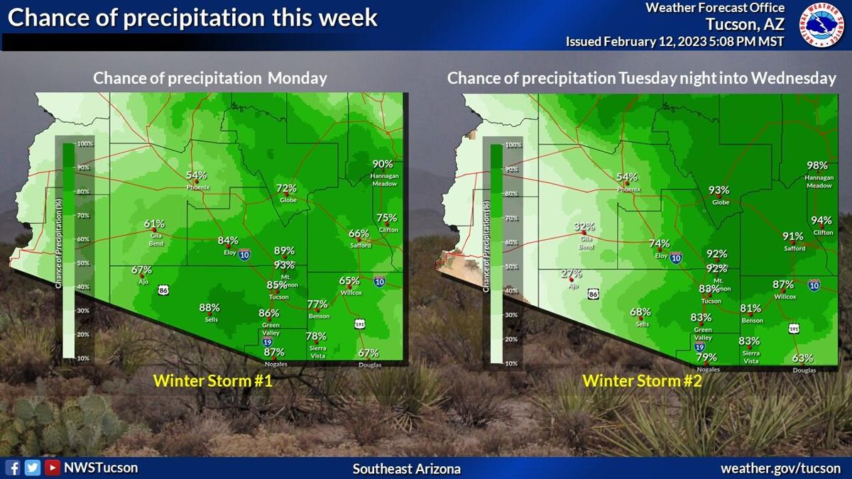
Expect a pair of winter storms will bring unsettled weather to Tucson and southeast Arizona this week.
The first storm will move through the area Monday bring a high chance of rain to valley areas and snow to the mountains, the National Weather Service in Tucson says.
The high Monday should be about 53 degrees.
The second storm will be "stronger and colder," the agency says.
It will move into the area late Tuesday into Wednesday.
It is expected to bring strong winds Tuesday afternoon and Tuesday night, especially over the mountains, near Sierra Vista and maybe around Oracle, north of Tucson, the NWS says.
Rain also expected Tuesday night into Wednesday morning.
Snow levels should start near 6,000 feet, lowering to about 2,500 feet by Wednesday morning.
Tuesday's high temperature should be about 63 degrees and drop to about 50 degrees on Wednesday.
Do you know when our hottest day was, or our coldest? What was our wettest year? Take this quiz and find out.

