

This story was created by #ThisIsTucson and underwritten by Jack Furrier Tire & Auto Care, with 50 percent off road trip services. Thanks for supporting the local businesses that support us!
Is your New Year's resolution to do more hiking? Or maybe you just wanna get off the couch and take a pretty drive toward some Wilderness (with a capital "W.") Well This is Tucson has got you covered. Here are five hiking destinations we've hit over the past year while doing our Arizona Road Trip series.
These destination trails exemplify the beauty of Southern Arizona and are fit for every skill level.
Aside from the stunning Chiricahua Mountains, most of these destinations are within an hour from Tucson. We've included hikes in all elevations, from low desert to the piny forests of Mount Lemmon. Inexperienced hikers can do most of the trails on this list. But watch out for Picacho Peak, that one's a doozy. Happy hiking!
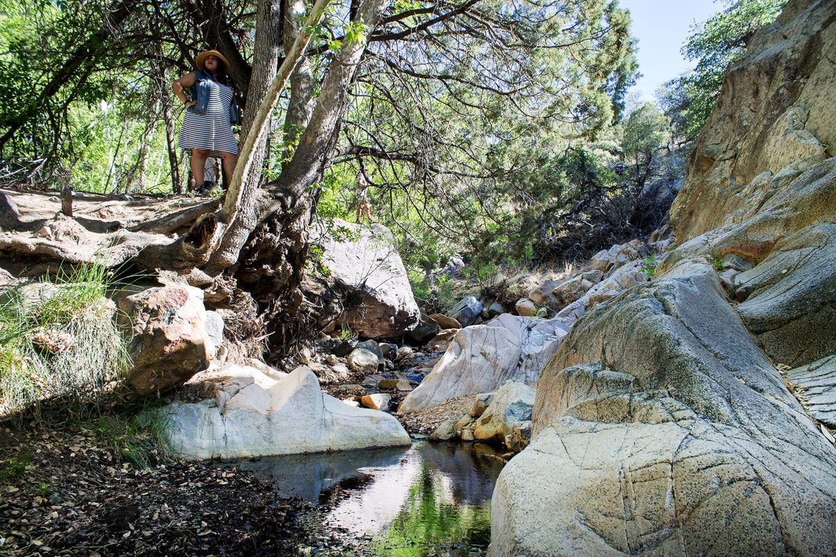
Madera Canyon

Forty miles south of Tucson, Madera Canyon is a great day trip for those looking for a quick change of scenery. Its sky island status transports you from the desert grasslands at the base of the Santa Rita Mountains, to a lush wooded paradise filled with an array of different plants and wildlife. One of the more popular hikes here is the 1.3 mile Proctor Road Nature Trail at the base of the canyon, which takes you past a secret waterfall and the historic White House Ruin, which was Madera Canyon’s first settlement in the late 1800s.
We also walked a bit of the 5.3 mile Madera Canyon Nature Trail, which took us up into the canyon for some spectacular vistas. More experienced hikers will definitely enjoy the 10.8+ mile hike up to Mount Wrightson, one of the highest peaks in Southern Arizona.
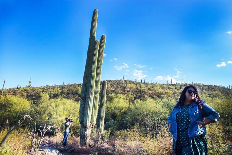
Robles Pass at Tucson Mountain Park

Samantha hiking the Bittersweet/Sunset Loop trail in the Robles Pass area.
Not far from the Mission San Xavier del Bac lies the vast network of desert hiking trails known as Tucson Mountain Park. Just take Mission Road north to Ajo Way and head west till you see the tall saguaros. We visited Robles Pass, a 16-mile trail system located on the outskirts of the park and a 15-minute drive from the mission.
This hike begins in a west-side neighborhood, but takes you out into the desert for some sweet vistas and lots of saguaro cactus. The Bittersweet Sunset Loop Trail may straddle the road, but manages to give you a tranquil feeling and in the mist of suburbia. Try to spot the crested saguaro.
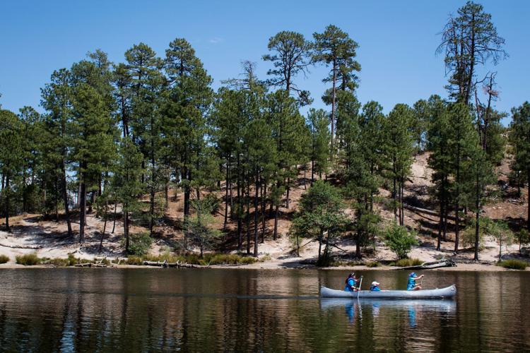
Mount Lemmon

Rose Canyon Lake is a popular fishing and canoeing destination located 7,000 feet up on Mount Lemmon.
With average temps 20 to 30 degrees cooler than the Tucson valley below, Mount Lemmon transforms itself to a snowy wonderland during the winter months.
The small community of Summerhaven near the top of the mountain has several restaurants and businesses including a cookie cabin and a popular lunch joint called the Sawmill Run, where you can enjoy a ½ pound burger and local Dragoon IPA. Work off your lunch by playing in some snow at Marshall Gulch or take a hike on a nearby trail. The Meadow Trail is a sure bet for beginning hikers, a relatively flat two miles with scenic views of pine-topped vistas.
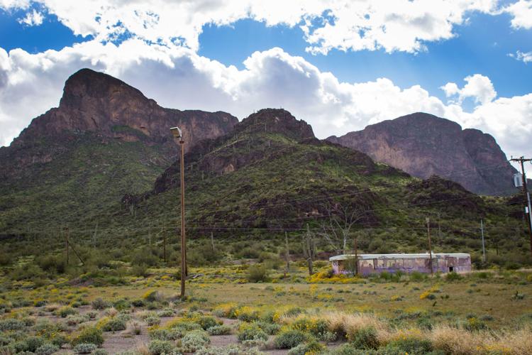
Picacho Peak

View of Picacho Peak from the road.
Picacho Peak has been a Southwestern landmark for centuries. It was home to the Hohokam from around 750 to 1450 AD, according to Arizona State Parks and Trails, and also hosted an array of travelers including Spanish Conquistadors and the Mormon Battalion.
There are a number of trails you can take around the park, but if you want to get to the top, you can take either the Sunset Vista Trail (which begins at the back of the peak) or the Barrett Loop Trail (at the front). Both will lead to the Hunter Trail, a steep 1.6-mile trail that takes you to the summit using steel cables that are hammered into the rock.
This hike is for serious inquiries only. The trail is labeled as “difficult,” and one Phoenix New Times writer even described it as a “Hell Hike.” If you can make it to the top, the 365-views of the desert are extremely rewarding.
The Chiricahuas

Sights from the Chiricahuas
Thirty seven miles southeast of Willcox, Chiricahua National Monument is often called the “Wonderland of Rocks.” A giant volcanic eruption 27 million years ago sent ash and molten debris flying into the earth. All of this hot stuff eventually transformed into rhyolite and eroded away into the incredible rock formations we see today.
There are plenty of places to hike and explore at the Chiricahuas, but our pick for a quick trek is the Echo Canyon Loop Trail. The trailhead is located near the top of the eight-mile scenic drive into the monument. If you keep right, about a half mile into your hike you’ll come across the Echo Canyon Grottoes where you can actually walk inside some of the rock formations. The views are also pretty spectacular during this hike, so be sure to bring a camera.
There are no entrance fees to get into the monument and camping is $20 per night. Find information on campsite reservations here. Pro tip: Get gas before you make the trip. There are no gas stations along the way or near the Chiricahuas.

Before you head down the road, take your car to Jack Furrier Tire & Auto Care to get it Road Trip Ready with 50 percent off services that will get you where you need to go. Click here for more info or call 520-547-5005. With 14 locations around Tucson, you'll find one near you.