


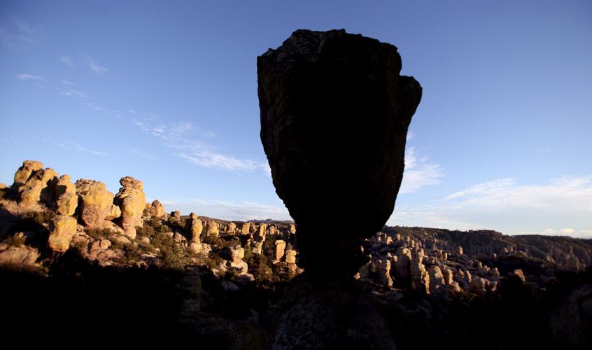


Chiricahua National Monument in Southeastern Arizona was once the home of Apaches, and they had their own name for the place: “Land of the Standing-Up Rocks.”
Take one look at the monument’s landscape and you’re likely to agree that they came up with a pretty good name.
The National Park Service site, tucked away in the Chiricahua Mountains southeast of Willcox, is a wonderland of standing-up rocks: pinnacles, spires, sheer stone columns and other rock formations.
“Chiricahua National Monument is truly a hidden gem among the public lands administered by the National Park Service,” says Allen Etheridge, superintendent of the monument. “In some ways it has not yet been ‘discovered’ despite it being close to large population centers such as Tucson.
“Only about 46,000 people visit Chiricahua annually, so often when you are there you may have a trail to yourself,” Etheridge said.
Meanwhile, Chiricahua’s reputation as a hidden gem has inspired a coalition of Southern Arizona residents and communities to campaign for having the monument redesignated as a national park. U.S Rep. Martha McSally, a Republican representing Arizona’s Second Congressional District, agrees with the idea, and on Sept. 27 she introduced legislation in Congress that would redesignate the site as Chiricahua National Park.
ORIGIN OF ROCKS
The story behind the rocks isn’t completely understood, but scientists trace the history to a volcanic eruption about 27 million years ago.
The eruption spread ash over a vast area, and the ash particles fused together to form a type of rock known as rhyolite.
Uplifting and other geologic forces later created joints and cracks in the rocks. Then, over the eons, the erosive forces of water, wind and ice slowly sculpted the rock into the formations seen today.
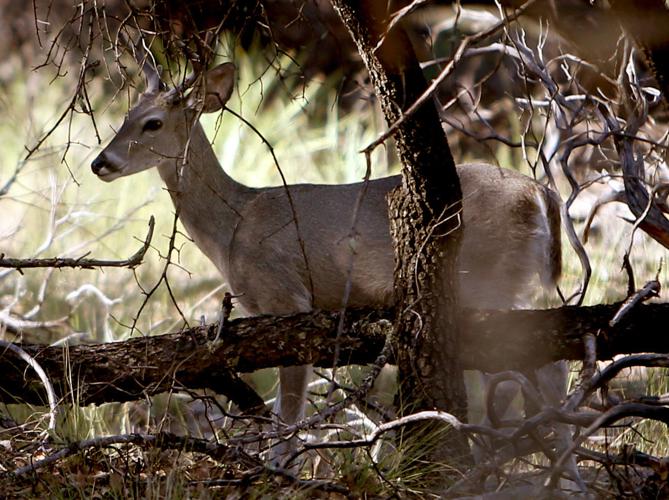
CRITTERS
Superintendent Etheridge says the monument also provides excellent habitat for wildlife, with 86 percent of its land set aside as federally designated wilderness.
“Chiricahua hosts an abundance of wildlife such as black bear, mountain lions, deer, coatimundi, wild turkeys, javelina, ring tails, and much more,” he says. “Plus, there are over 20 miles of great hiking trails and a small campground in which reservations can be made.”
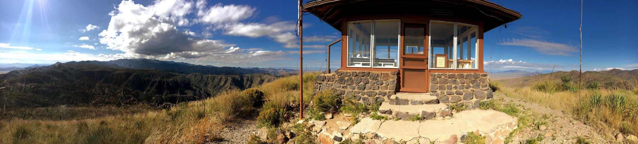
GET A VIEW
A drive on the monument’s eight-mile Bonita Canyon Drive provides a good overview of the dramatic lithic landscape.
The route takes visitors through spectacular, crane-your-neck vertical scenery with seemingly endless variations on the rock-formation theme.
The drive ends at vista-rich Massai Point where options range from simply taking in the panoramic views to taking a hike into the rocky landscape.
One trail worth a try is the 3.3-mile Echo Canyon Loop. Made up of segments of three connected trails, the loop route leads hikers into the heart of the monument’s ahhh-inspiring scenery.
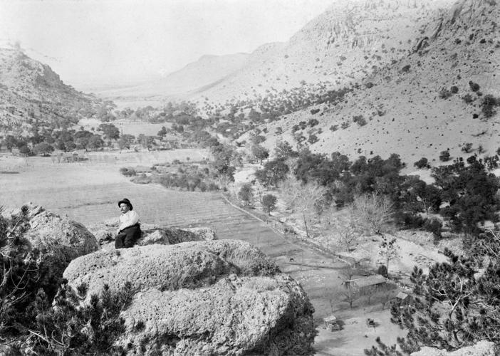
FARAWAY RANCH
The historic Faraway Ranch site, a short distance off the road between the monument entrance and visitor center, offers a glimpse of life in the area long before the monument was established in 1924.
Beginning as a simple homestead in the late 1880s, the ranch dwelling was expanded from a cabin to the much larger building visitors see today.
GET TO CHIRICAHUA
From Tucson, drive east on Interstate 10 to Willcox and proceed southeast on Arizona 186 to a junction with Arizona 181. Turn east at this junction and drive four miles to the monument entrance.

