


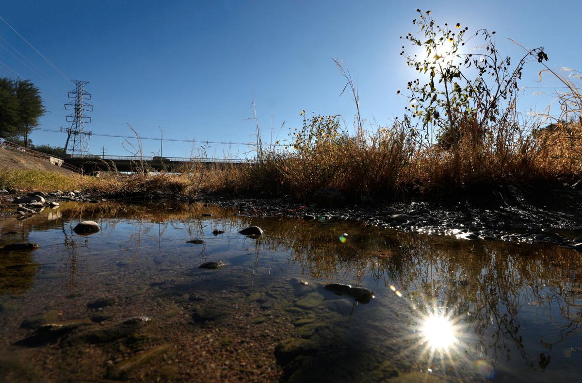
Prolonged droughts can kill rivers, but Tucson’s current dry spell has actually helped the Santa Cruz River flow farther north than it had been.
Reclaimed water discharged into the river by Tucson Water’s Heritage Project is now flowing well north of Speedway. Three months ago, it was stopping between Congress Street and St. Mary’s Road, almost a mile south of where it flows now.
But after an up-and-down series of effluent releases into the river, Tucson Water isn’t putting more water there than before. The river flows farther now because dry weather has made it harder for the water to seep into the aquifer, thus prolonging its flow for longer distances, utility officials say.
There are two stretches of the Santa Cruz River in Tucson where you're likely to see water. One is just south of downtown and the other is near Crossroads at Silverbell District Park in Marana. Both flow along stretches of the Loop thanks to the release of reclaimed water, or effluent by Tucson Water last summer.
For this, credit the bright green algae that populates much of the river now.
“It’s called soil clogging and is fairly common,” Tucson Water spokesman Fernando Molina said of the algae’s impact on the river’s flow.
Algae forms because the lack of rainfall allows for very little scouring of the riverbed by storm runoff, Molina said.
“Scouring” refers to the force of heavy flows of water moving the top layers of sediments, removing algae, and opening up pore spaces.
So algae forms naturally in the river channel. It clogs pores in the riverbed through which the reclaimed water normally seeps into the aquifer, Molina said.
Now the water runs farther, even though the utility is still releasing the same 800 gallons per minute of reclaimed water that it has been since September.
While the northern half of the wet section of river doesn’t contain any visible algae, algae is often found in sediments below the water, Molina said.
This algae-clogging effect has been documented nationally in a number of studies, and some scholars have characterized it as a problem for artificial recharge projects such as the one Tucson Water is conducting on the Santa Cruz.
But once more rainfall returns to the Tucson area, and “once we have some scouring of the channel taking place and the algae is removed,” the water should seep more quickly into the aquifer and not flow as far on the surface, Molina said.
In September, the city slashed releases into the Santa Cruz to their current level from 1,900 gallons per minute. It was done to prevent the aquifer from recharging so fast and so high as to potentially undercut a downtown-area landfill west of the river, which had been a concern off and on for months.
Before that cutback, the river water was flowing to about halfway between Speedway and Grant Road.
The utility started discharging reclaimed water into the river just north of 29t Street in late June 2019.
Besides the algae formation, the river also flows farther now because the weather is cooler and evaporation rates are lower, Molina said. Plus, notches that were installed in concrete during channel renovation work last spring are keeping the water centered in the channel, he said.
Historically, the Santa Cruz used to flow north of Tucson to as far as Red Rock in Pinal County, but now turns dry in northern Pima County.
30+ historic photos of the Santa Cruz River through Tucson
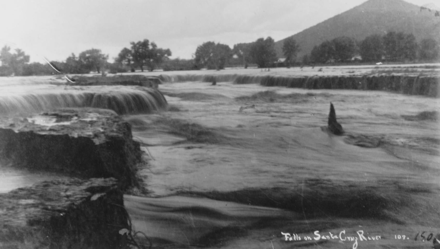
Waterfalls on the Santa Cruz River in 1889 near Sentinel Peak in Tucson.

Girls in Santa Cruz River,1889-1890.
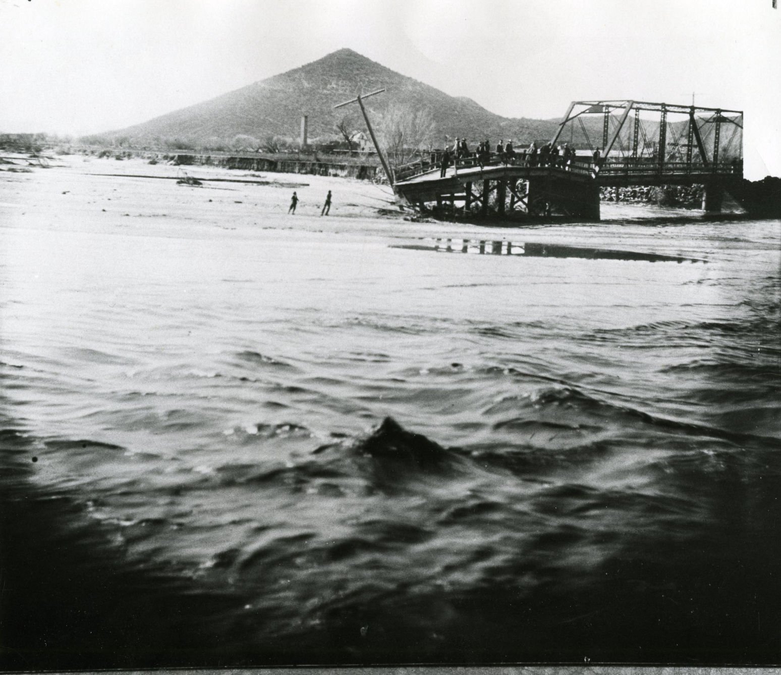
A bridge over the Santa Cruz River near Sentinel Peak in Tucson washed out during flooding in 1915.
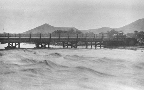
Santa Cruz River at St. Mary's Road bridge in 1931.
The Santa Cruz River flows north as seen from Sentinel Peak in Tucson in the early 1900's.
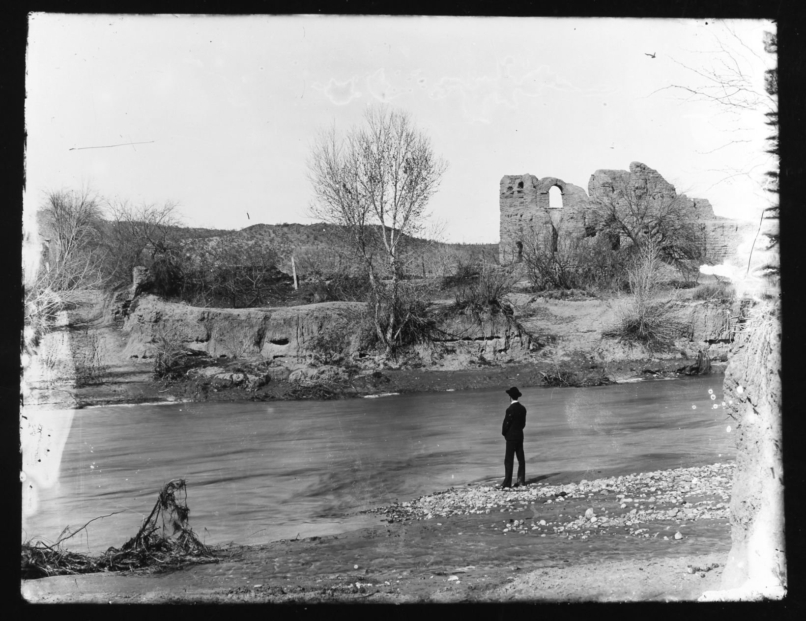
El Convento along the Santa Cruz River, ca. 1910.
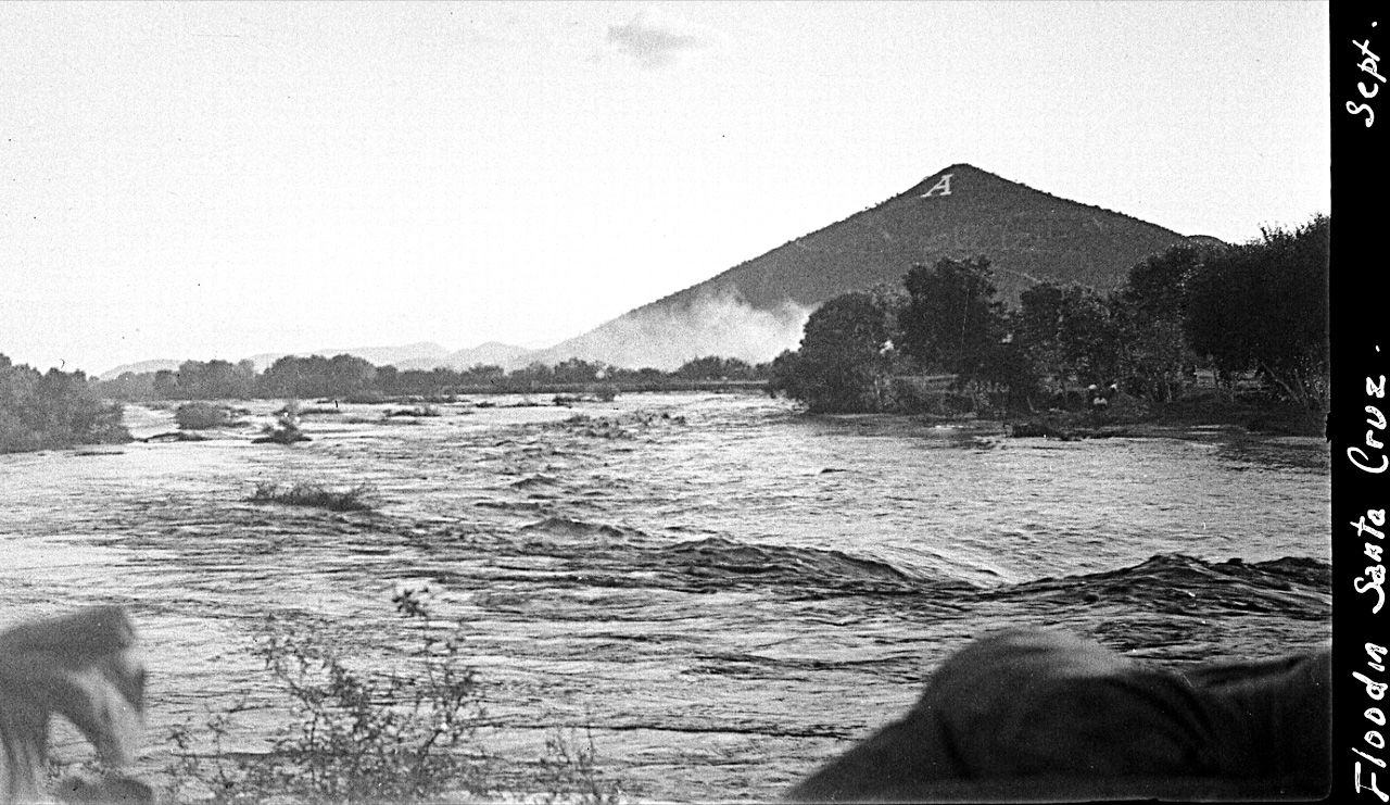
Flooding of the Santa Cruz River, Tucson, in September, 1926, from “Letters from Tucson, 1925-1927” by Ethel Stiffler.
Flooding of the Santa Cruz River, Tucson, in September, 1926, from “Letters from Tucson, 1925-1927” by Ethel Stiffler.

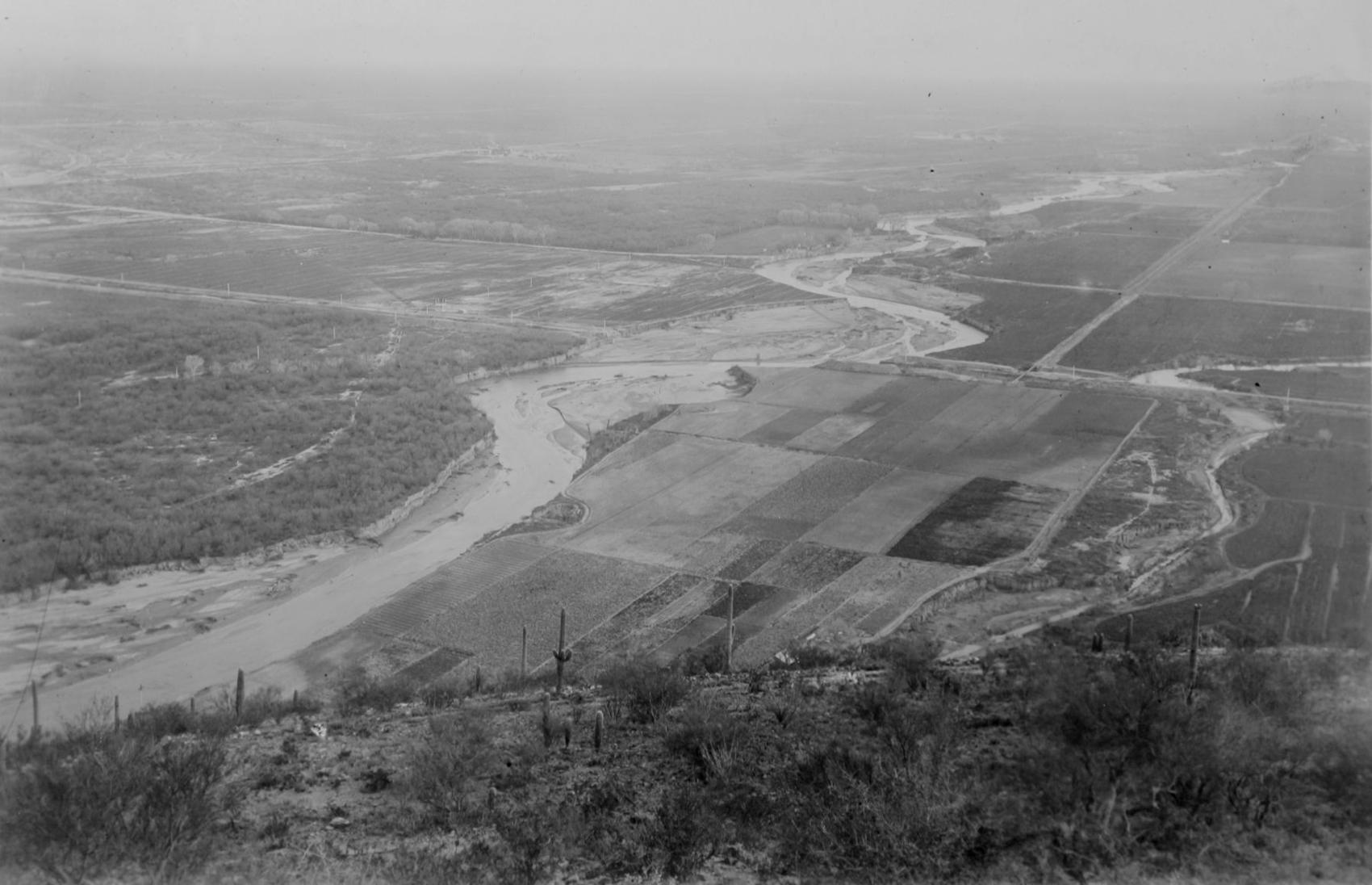
Aerial view of the Santa Cruz River as it winds its way through Pima County north of Cortaro Road in 1953. The county was considering a bridge at several locations, but had to contend with the ever-changing course of the river.

The Tucson Citizen wrote in 1970, "The Santa Cruz River is a garbage dump" and "even marijuana grows in it." City leaders were pushing to upgrade and beautify the channel. The U.S. Army Corps of Engineers was studying the possibility.
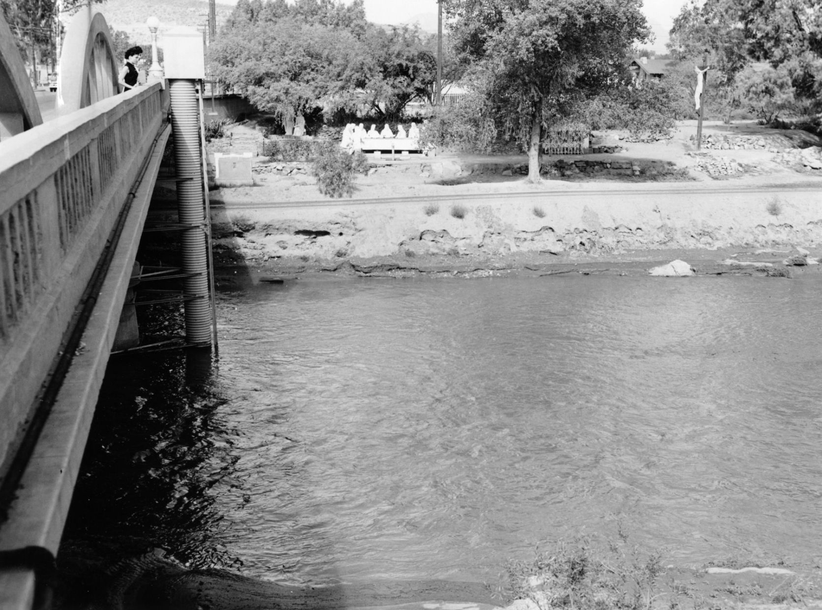
The Santa Cruz River flowing under the Congress Street bridge in August, 1952. The Garden of Gesthemane is in the background.
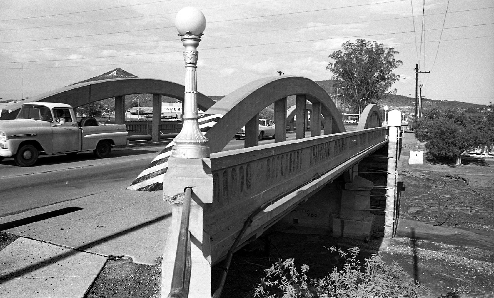
By July 24, 1970 the old bridge on West Congress over the Santa Cruz River had to go and be replaced by a new bridge.

By July 24, 1970 the figures from Felix Lucero's Last Supper had been on the west side of the Santa Cruz River for more than 20 years. City authorities had decided to leave it in place while a new bridge on West Congress Street was to be replaced.
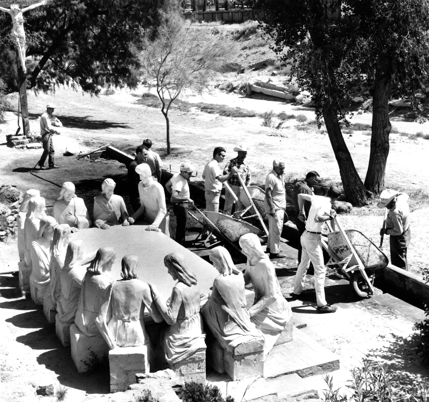
Volunteers from the Tucson Jaycees and Junior Chamber of Commerce finish restoration of the statues and grounds of the Garden of Gethsemane along the Santa Cruz River in May, 1964. The statues were ravaged by vandals and weather. The city parks and recreation department worked with the volunteers. Artist Felix Lucero began sculpture project in 1938 and finished it nine years later.

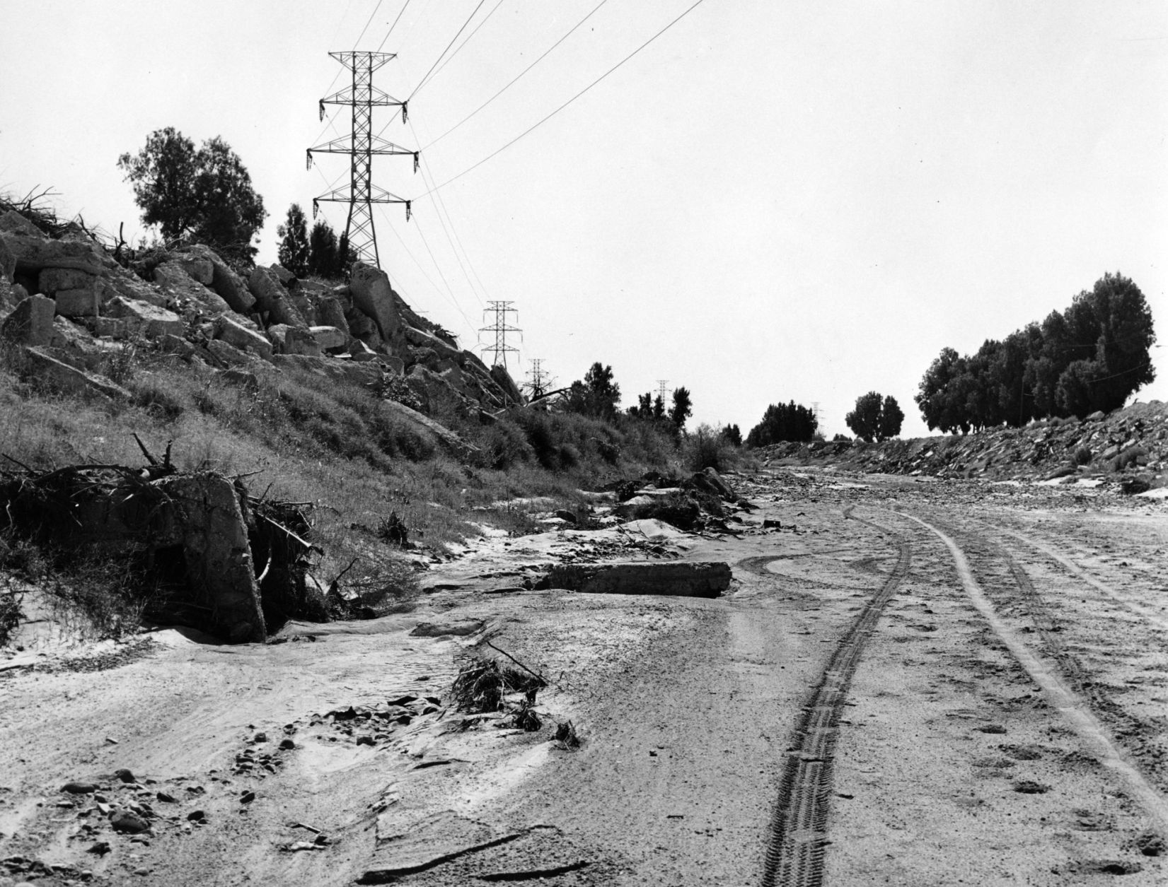
Drought in June, 1974, turned the Santa Cruz riverbed into crunchy chunks of dried mud.

The Santa Cruz River flowing under Silverlake Road in August, 1970.

Children play in the Santa Cruz River near Speedway Blvd in August, 1970.
The Santa Cruz riverbed at Congress Street in November, 1967.

After years of waiting, crews began clearing debris and channeling the Santa Cruz River in November, 1977, and constructing what would become a 14-mile river park. The Speedway Blvd. bridge is in the background.

After years of waiting, crews began clearing debris and channeling the Santa Cruz River in November, 1977, and constructing what would become a 14-mile river park.

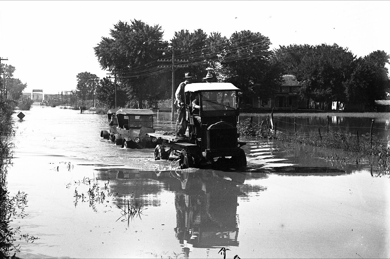
The Santa Cruz River looks peaceful flowing underneath Speedway Road after days of flooding in October, 1977.

Adalberto Ballesteros rides along the Santa Cruz River west of downtown Tucson in 1980.

The Santa Cruz River looking north from Valencia Road in July, 1974.

Junked cars and trash spill into the Santa Cruz River, looking south, just south of Grant Road in July, 1974.

Road graders scrape the Santa Cruz River channel between Speedway and Grant roads during bank stabilization construction in May, 1991.
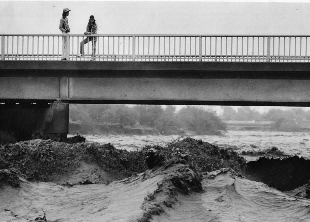
Water surges in the Santa Cruz River at the St. Mary’s Road bridge on Oct. 2, 1983.

Flooding in Marana after the Santa Cruz River overflowed its banks in Oct. 1983.

A bridge on the Santa Cruz River northwest of Tucson washed out during flooding in October 1983.

Residents watch the surging Santa Cruz River rush past West St. Mary's Road on January 19, 1993.

Tucson firefighters are standing by and waiting for two kids floating in the Santa Cruz River on some type of object during flooding in July, 1996.

As the Tucson Modern Streetcar rumbles across the Luis G. Gutierrez Bridge, water flows bank to bank along the Santa Cruz River after a morning monsoon storm on July 15, 2014.

Johnny Dearmore skips a rock in the Santa Cruz River as reclaimed water is released into the channel at 29th Street as part of the Santa Cruz River Heritage Project on June 24, 2019. The release of effluent is the city’s first effort to restore a fraction of the river’s flow since groundwater pumping dried it up in the 1940s.

The Santa Cruz River flows Friday morning July 23, 2021 after an overnight monsoon storm passed over in Tucson, Ariz.

Betsy Grube, center, with Arizona Game and Fish Department, releases longfin dace fish into the Santa Cruz River at Starr Pass Boulevard on March 23, 2022, as Mark Hart, right, takes a video and Michael Bogan, a professor in aquatic ecology at the University of Arizona, picks up more fish to release. The 600 fish were captured from Cienega Creek in Vail.

