


The Santa Cruz River on Tucson’s northwest side will take on a reddish hue Tuesday when UA and federal researchers launch an experiment to learn about sunlight’s effects on “trace chemicals” in the water.
At about 6:45 a.m. Tuesday, University of Arizona and U.S. Geological Survey researchers will release a couple of gallons of what they say is a nontoxic dye called rhodamine WT, diluted with stream water, into the river on the north side of the Ina Road ridge, near the Tres Rios Water Reclamation Facility.
As the water flows north toward Marana, the dye could become visible as far away as the Trico Road Bridge, 17.5 miles north of Ina Road.
The reddish color should last for a couple days, most likely turning a diluted pink before dissipating, said Joseph Cuffari, a program manager for the Pima County Regional Flood Control District, which manages rivers and washes.
Federal and University of Arizona researchers added red dye to the Santa Cruz River on Tuesday morning as part of a study looking into sunlight's effect on chemicals and other materials in the water. The non-toxic dye was put in the river near West Ina Road and is expected to travel downstream towards Marana over the next few days.
“The dye should be quite visible in the river initially, perhaps dramatically so, and will fade as it moves and disperses going downstream,” said Eric Shepp, Flood Control District deputy director, adding that the researchers don’t yet know how far along the river the dye will remain visible.
To check the impacts of sunlight, researchers will conduct separate tests later for concentrations of personal care products, pharmaceuticals and other chemical compounds in the water, Cuffari said.
The river water at that site is mostly treated effluent from two Pima County sewage treatment plants.
“You can never fully clean the water — you clean it to the best of your abilities,” said Cuffari. “Everything is 99.9% effective. They want to look at the last 1%.”
“The key takeaway: Does sunlight alter chemical compounds?” he added.
Since river water flows at different speeds in different locations, the use of the dye will let researchers ensure they’re collecting samples of the same sections of water as it moves downstream.
By taking samples at specific locations, researchers hope to be able to measure sunlight’s cumulative impact, as to whether it either destroys or chemically alters organic materials in water. That research will be done separately, in later laboratory experiments in which researchers will collect water samples at specific intervals downstream to measure sunlight’s impacts, flood control officials said.
Researchers will collect samples until about Friday.
The data could be useful for researchers around the country looking at water quality treatment efforts for effluent, Cuffari said.
The USGS requested the project to support its research. “The county and the flood control district are okay with USGS performing this work, but it is their work,” Shepp said.
30+ historic photos of the Santa Cruz River through Tucson
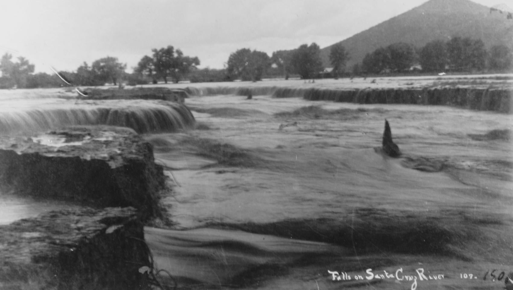
Waterfalls on the Santa Cruz River in 1889 near Sentinel Peak in Tucson.

Girls in Santa Cruz River,1889-1890.
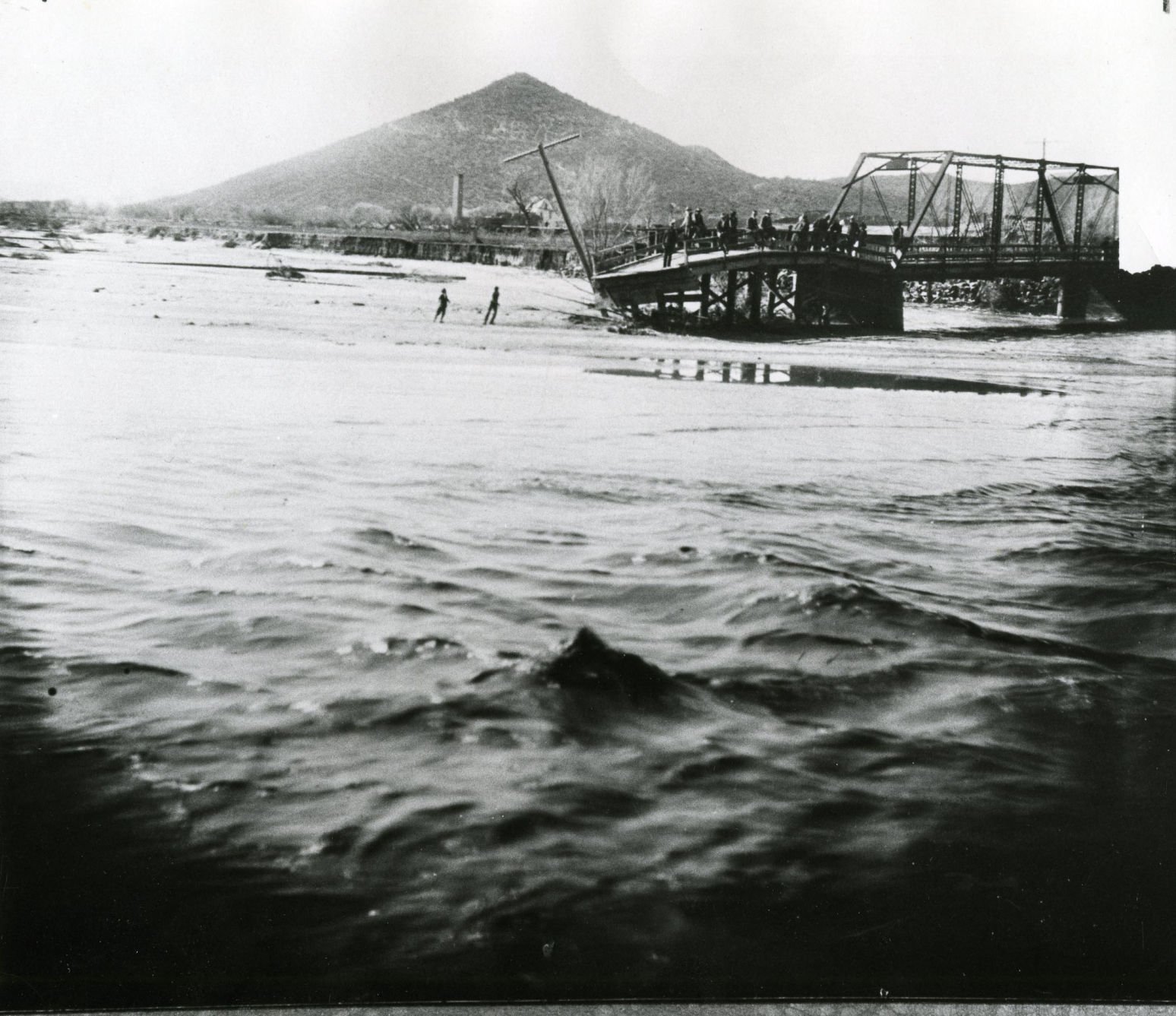
A bridge over the Santa Cruz River near Sentinel Peak in Tucson washed out during flooding in 1915.
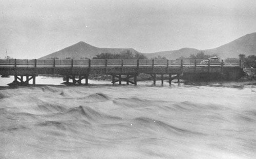
Santa Cruz River at St. Mary's Road bridge in 1931.
The Santa Cruz River flows north as seen from Sentinel Peak in Tucson in the early 1900's.
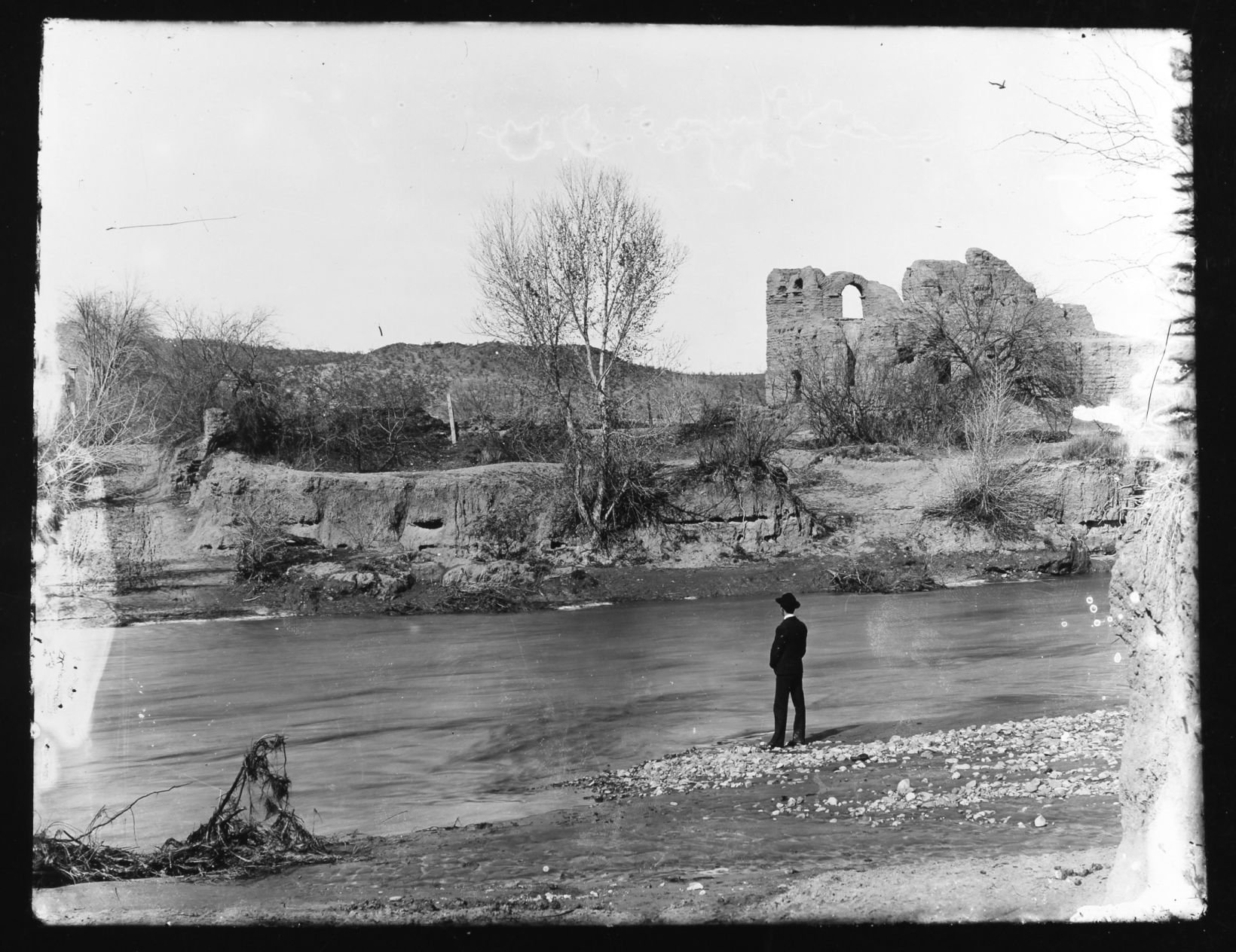
El Convento along the Santa Cruz River, ca. 1910.
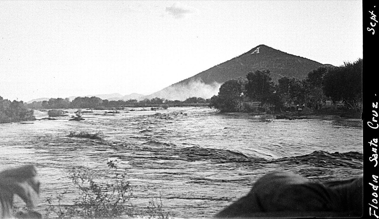
Flooding of the Santa Cruz River, Tucson, in September, 1926, from “Letters from Tucson, 1925-1927” by Ethel Stiffler.
Flooding of the Santa Cruz River, Tucson, in September, 1926, from “Letters from Tucson, 1925-1927” by Ethel Stiffler.

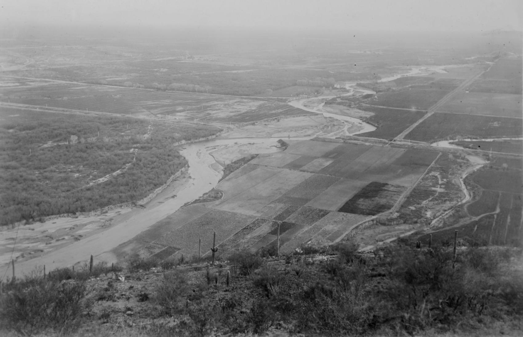
Aerial view of the Santa Cruz River as it winds its way through Pima County north of Cortaro Road in 1953. The county was considering a bridge at several locations, but had to contend with the ever-changing course of the river.

The Tucson Citizen wrote in 1970, "The Santa Cruz River is a garbage dump" and "even marijuana grows in it." City leaders were pushing to upgrade and beautify the channel. The U.S. Army Corps of Engineers was studying the possibility.
The Santa Cruz River flowing under the Congress Street bridge in August, 1952. The Garden of Gesthemane is in the background.
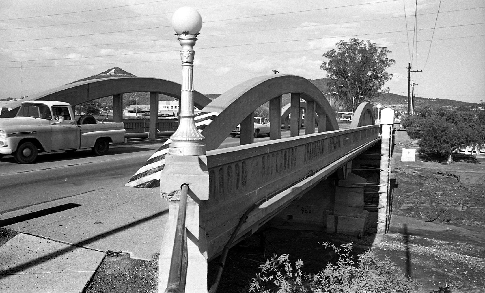
By July 24, 1970 the old bridge on West Congress over the Santa Cruz River had to go and be replaced by a new bridge.

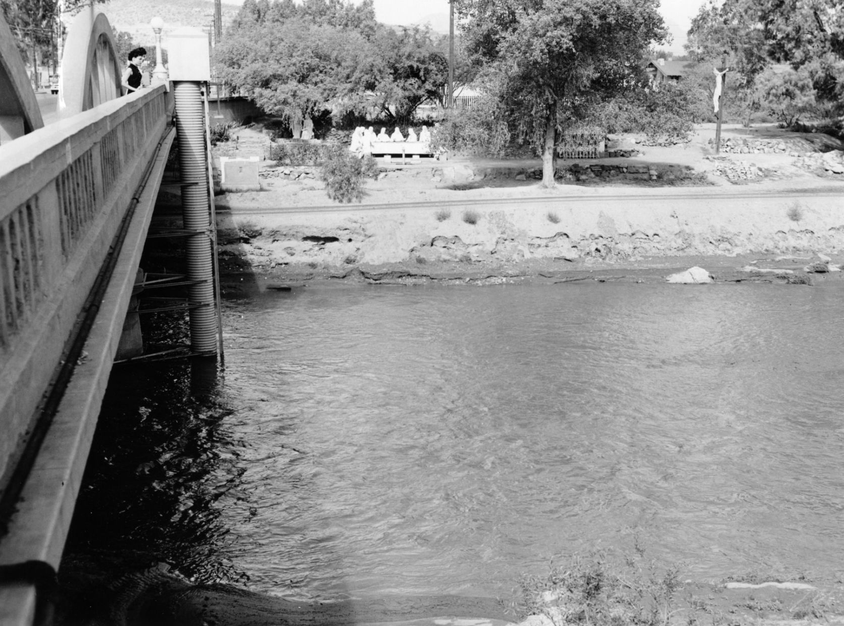
By July 24, 1970 the figures from Felix Lucero's Last Supper had been on the west side of the Santa Cruz River for more than 20 years. City authorities had decided to leave it in place while a new bridge on West Congress Street was to be replaced.
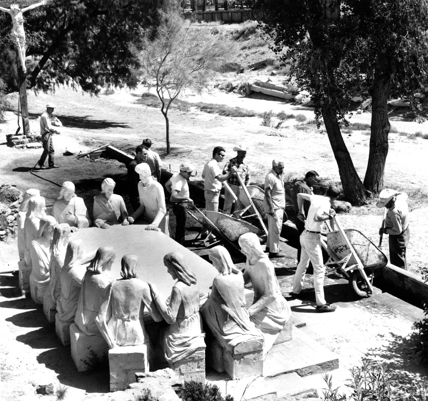
Volunteers from the Tucson Jaycees and Junior Chamber of Commerce finish restoration of the statues and grounds of the Garden of Gethsemane along the Santa Cruz River in May, 1964. The statues were ravaged by vandals and weather. The city parks and recreation department worked with the volunteers. Artist Felix Lucero began sculpture project in 1938 and finished it nine years later.

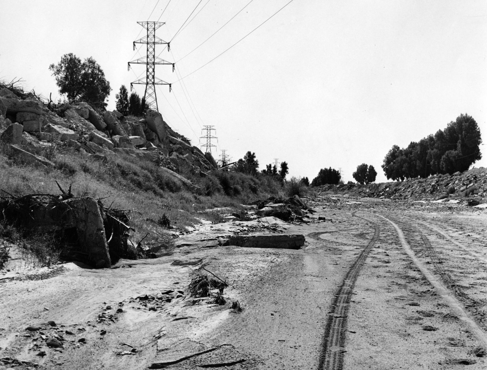
Drought in June, 1974, turned the Santa Cruz riverbed into crunchy chunks of dried mud.

The Santa Cruz River flowing under Silverlake Road in August, 1970.

Children play in the Santa Cruz River near Speedway Blvd in August, 1970.
The Santa Cruz riverbed at Congress Street in November, 1967.

After years of waiting, crews began clearing debris and channeling the Santa Cruz River in November, 1977, and constructing what would become a 14-mile river park. The Speedway Blvd. bridge is in the background.

After years of waiting, crews began clearing debris and channeling the Santa Cruz River in November, 1977, and constructing what would become a 14-mile river park.

The Santa Cruz River looks peaceful flowing underneath Speedway Road after days of flooding in October, 1977.

Adalberto Ballesteros rides along the Santa Cruz River west of downtown Tucson in 1980.

The Santa Cruz River looking north from Valencia Road in July, 1974.

Junked cars and trash spill into the Santa Cruz River, looking south, just south of Grant Road in July, 1974.

Road graders scrape the Santa Cruz River channel between Speedway and Grant roads during bank stabilization construction in May, 1991.
Water surges in the Santa Cruz River at the St. Mary’s Road bridge on Oct. 2, 1983.

Flooding in Marana after the Santa Cruz River overflowed its banks in Oct. 1983.

A bridge on the Santa Cruz River northwest of Tucson washed out during flooding in October 1983.

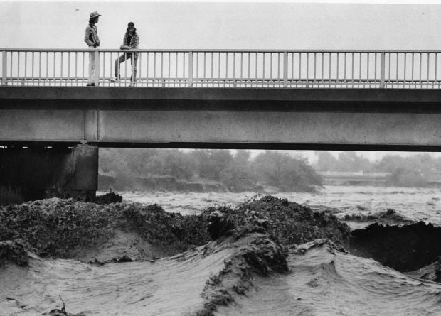
Residents watch the surging Santa Cruz River rush past West St. Mary's Road on January 19, 1993.

Tucson firefighters are standing by and waiting for two kids floating in the Santa Cruz River on some type of object during flooding in July, 1996.

As the Tucson Modern Streetcar rumbles across the Luis G. Gutierrez Bridge, water flows bank to bank along the Santa Cruz River after a morning monsoon storm on July 15, 2014.

Johnny Dearmore skips a rock in the Santa Cruz River as reclaimed water is released into the channel at 29th Street as part of the Santa Cruz River Heritage Project on June 24, 2019. The release of effluent is the city’s first effort to restore a fraction of the river’s flow since groundwater pumping dried it up in the 1940s.

The Santa Cruz River flows Friday morning July 23, 2021 after an overnight monsoon storm passed over in Tucson, Ariz.

Betsy Grube, center, with Arizona Game and Fish Department, releases longfin dace fish into the Santa Cruz River at Starr Pass Boulevard on March 23, 2022, as Mark Hart, right, takes a video and Michael Bogan, a professor in aquatic ecology at the University of Arizona, picks up more fish to release. The 600 fish were captured from Cienega Creek in Vail.

