


When the power went out in Jackie Gonzalez’s Rio Rico home one weekday earlier this month, the mother of two packed up the kids and drove an hour north on Interstate 19 to West Irvington Road.
Five years ago, she would have waited it out at the nearest Walmart.
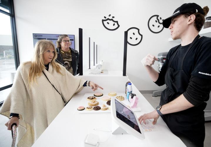
On this weekday, she and the kids hung out at Crumbl Cookies, one of several eateries that have opened at The Landing, off I-19 and West Irvington Road.
Since breaking ground in 2017, The Landing across the street from Tucson Spectrum mall is fast becoming the hottest entertainment destination in Tucson.
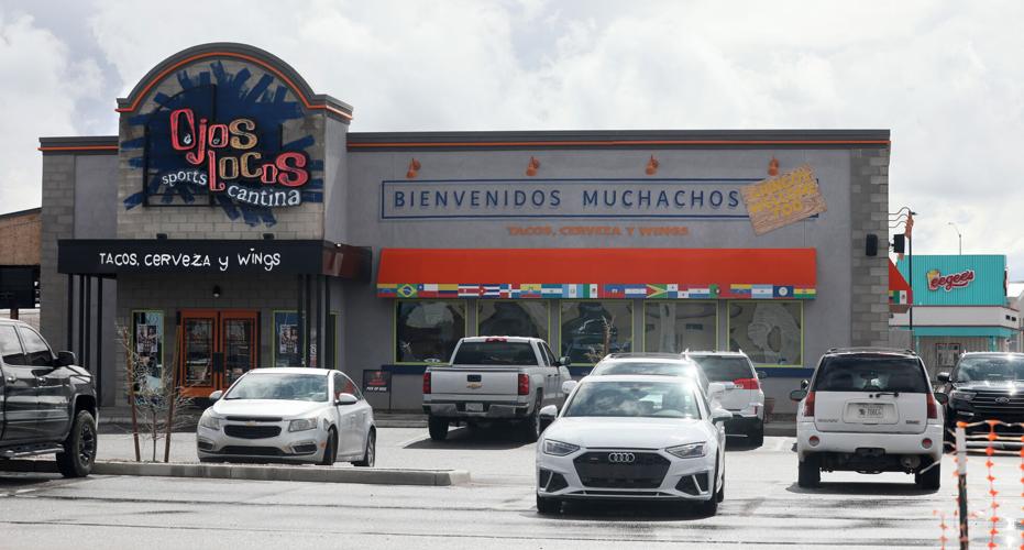
The 65-acre mixed-use center from Tucson developers Bourne Cos. is home to popular family-friendly chains including In-N-Out Burger, Crumbl Cookies, Chick-fil-A and Red Robin, as well as the more adult-leaning Ojos Locos Sports Cantina.
This week, the center gets perhaps its biggest entertainment tenant, Main Event, a 50,000-square-foot bowling alley, arcade and family event center that opens on Wednesday, March 1.
“There’s a ton of people over here,” said Matt Rudder, the franchisee for Tucson’s three Crumbl locations. “The demographics are awesome. There are tons of high schools. There are tons of involvement. And then, especially right here (at The Landing), there’s so much going on and this was the place that we needed to be.”

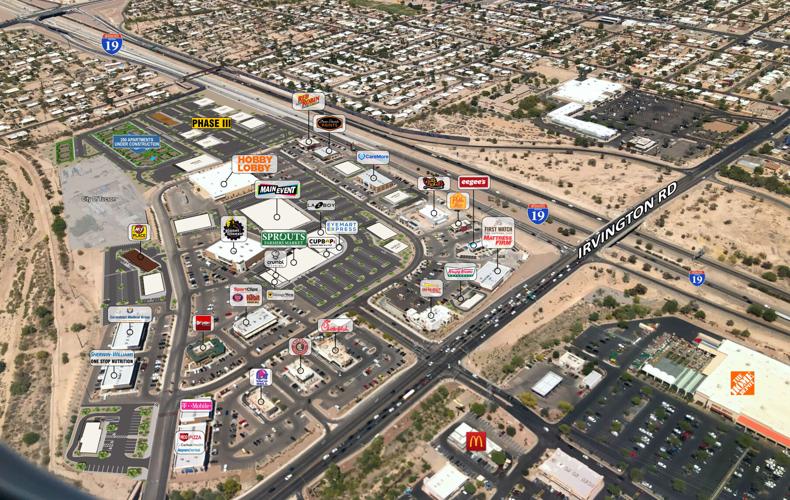
This aerial image of The Landing at Irvington Road and I-19 shows existing businesses and those planned and under construction.
“The area is ripe for expansion,” said Dillon Walker, marketing strategist for the project developer Bourn Cos. “Our actual focus on The Landing is reflected in some of our branding work that we’ve done and trying to attract the right mixes on the premises.”
Walker said the project’s proximity to Mexico also played a role in Bourn’s plans for The Landing as a magnet for destination travelers from Mexico. Bourne estimates 2.7 million Mexican travelers visit The Landing each year.
But the project in one of Tucson’s opportunity zones — areas designed to spur economic development through tax incentives offered to investors — also serves a need to the surrounding largely Hispanic south-side community.
In addition to The Landing, the Interstate 19-Irvington Road corridor is home to several big box stores including Target, Ross Dress For Less and Home Depot, as well as smaller national retail stores occupying 1 million square feet of retail space in the 122-acre Tucson Spectrum mall.
Harkins Tucson Spectrum 18, from the Scottsdale-based behemoth that operates movie theaters in Colorado, California, Oklahoma and throughout Arizona, also is a big draw for the area, saving south-side residents the cross-town drive to either Tucson Mall or Park Place.

The Landing, a 65-acre mixed-use center from Tucson developers Bourne Cos., is home to popular family-friendly chains including In-N-Out Burger, Crumbl Cookies, Chick-fil-A and Red Robin, as well as the more adult-leaning Ojos Locos Sports Cantina.
“I actually had several employees that were from this side of town that were working at my other locations, and they wanted to transfer to their home stores,” said Crumbl’s Rudder. “So, I would even say a lot of my employees are from around this area.”
The Landing has prompted infrastructure improvements along I-19, including the construction a year or so ago of the Irvington Road overpass and widening to ease access to the Spectrum and surrounding businesses, Walker said. The state added a third right-turn lane off the interstate onto westbound Irvington to ease anticipated traffic from a hotel and apartments planned at The Landing.
“That’s allowed for more traffic to get through. It’s probably promoted a little bit more traffic, but you can tell that there’s a lot of emphasis being focused on that particular area,” Walker said. “I just think there’s still a lot of development to be done. I think that if you look, there’s so many homes being built on the southwest side.”
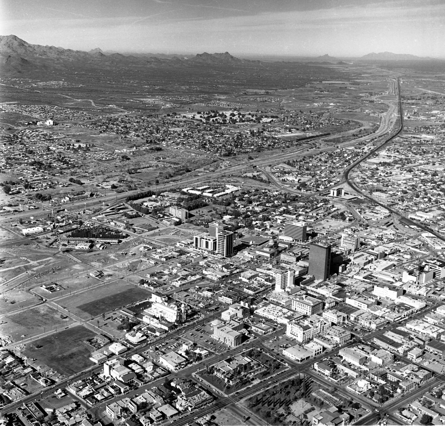
Aerial photos of Tucson in 1968

Looking north from Arroyo Chico, still more or less an open pit, where it crossed S. Cherry Ave. (lower right) in this aerial photo of Tucson in December, 1968. At that time, Cherry was a popular thoroughfare, extending from 29th Street through the University of Arizona campus and past Speedway Blvd. It was cut into pieces with the expansion of Arizona Stadium, the Arroyo Chico flood control project, and the Kino Parkway extension.

The clean, straight University of Arizona Mall splits the campus in two in this aerial photo looking west from Tucson Blvd. in December, 1968. The 100-foot-tall Meinel Optcal Sciences Building is under construction on open land cleared for more expansion, in the left side of the photo.

Looking east at the West University neighborhood and the University of Arizona Campus, center, from roughly Stone Ave. in this aerial photo of Tucson in December, 1968. 6th Avenue is at the very bottom. Catalina Park is lower left.

Sahuaro High School, which opened for students in August, 1968, in the center surrounded by new subdivisions in this aerial photo southwest across Tucson in December, 1968. The one swath of open desert across the street from the high school did not stay that way for long.

Downtown Tucson with "A" Mountain and Tumamoc Hill in the distance in this aerial photo of Tucson in December, 1968. Homes and businesses in the old barrio have been razed to make way for the TCC and Symphony Hall, left. The Southern Pacific RR hospital (now Evo DeConcini U.S. District Courthouse) is in the center of the photo. The Pima County Administration building is nearly complete, but construction on the Superior Court building has not begun. Stone Avenue, at bottom, still has the large department stores – Penney's, Jacome's, Steinfeld's. But their existence was doomed by El Con Mall a few miles to the east.

Rolling Hills Golf Course and new houses around it along a two-lane (and partly dirt) Golf Links Road in this aerial photo of Tucson in December, 1968. St. Augustine Catholic High School sits on the right side in the large open plot just above the golf course. The "V" building – the only structure on the Southside of Golf Links, is still there. It's the New Life Wesleyan Church.

22nd Street stretches east from Houghton Road in Tucson in this aerial photo of Tucson in December, 1968. In the center, Old Spanish Trail crosses 22nd Street, then Harrison Road. The land surrounding that intersection is now paved over with myriad retail businesses. At least two of the homes in the foreground are still there, surrounded by packed subdivisions.

The new Interstate 10 loops through South Tucson in this aerial photo looking southeast in December, 1968. In the distance, the new interstate hooks right and connects back to Benson Highway – the old US 80. Southgate Shopping Center and the new, concrete-lined Julian Wash are at right. The black line at left is the El Paso and Southwestern RR tracks, then still in use.

And rising from the desert is the De Anza Drive-In theatre on Alvernon Way, south of 22nd Street, in this aerial photo of Tucson in December, 1968. To the left, across Alvernon and barely visible, is the Magic Carpet Slide. In the background, the Bermuda grass at Randolph golf course at Reid Park has gone dormant for the winter.
The shades of the future mesh with Tucson's past in this aerial photo of downtown Tucson in December, 1968. The new Interstate 10 is largely complete, with bridged crossings over Tucson streets. The bulldozed barrio is obvious (at left), but there are still remnants of Tucson's architectural pride: The Carnegie Library (foreground center) is beautiful, the majestic Hotel Santa Rita to its right, and several modest, quirky hotels, theaters and brick buildings with character.

Broadway Road looking west from Swan Road, Tucson, in 1968. The wide Venice Stravenue is the street visible in foreground. The Midstar Plaza is at left. The mid-rise office building at 4400 E. Broadway is under construction, just above the plaza in the photo.
The 1880 home saved from urban renewal 50 years ago is in need of repair.

