


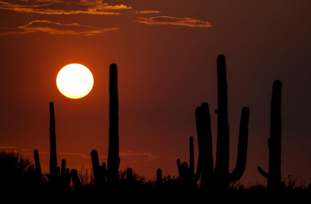
Brutal summer weather didn’t let up in September, with record-breaking heat and record-tying drought pounding Tucson simultaneously.
Tucson’s hottest September on record marked the third straight month of record-breaking temperatures here.
It was accompanied by record-tying September rainfall of zero at Tucson International Airport, the National Weather Service said.
Just on Tuesday this week, the city broke another dubious record — for the most 100-degree or hotter days in a single year.
In addition, Tucson had its second worst monsoon season on record. It ended on Wednesday, Sept. 30, only one-hundredth of an inch wetter than the driest monsoon season on record, back in 1924.
The entire June 15-Sept. 30 monsoon season was also the warmest on record, preliminary findings show, the weather service said.
In all, 10 daily and monthly temperature records were broken or tied in September. From May through September, a total of 60 temperature records were broken or tied, weather service reports show.
“As a Tucsonan, this was the most miserable monsoon I’ve ever weathered and I’ve been here almost 20 years,” said Michael Crimmins, a University of Arizona environmental sciences professor and climate scientist.
Normally, the Southwest’s summer heat is tempered by the monsoon’s cloudy and rainy afternoons from mid-June to mid-to-late September, he said. This year, the monsoon never really materialized, allowing the sun’s energy to push up temperatures.
That aggravated a heat wave already driven by long-term climate change, Crimmins said.
“That’s that perfect storm of creating record hot summer temperatures,” he said.
The Tucson Fire Department said multiple agencies were responding to a swift water call along the Rillito River north of Tucson Mall on Thursday morning. The Northwest Fire District and Green Valley Fire District said they were also responding to several swift water rescues. More weather updates: http://tucne.ws/1fgo
Metro area in extreme drought
Statewide, the drought is widespread enough that nearly 70% of Arizona was locked in extreme drought as of Tuesday, says the U.S. Department of Agriculture’s most recent weekly Drought Monitor report, released Thursday morning.
The extreme drought area now covers all of the Tucson metro area except for a few suburban residents living near Saguaro National Park-West, said Brad Rippey, an Agriculture Department meteorologist in Washington, D.C. During extreme drought conditions, native plants can be stressed, wildlife will come into urban areas from the wild in search of food and water and livestock often don't have adequate water.
Nearly 94% of Arizona is experiencing at least severe drought conditions, the Drought Monitor says. The entire state is under some form of drought conditions, ranging from moderate to extreme, Rippey said. The percentage of the state in various stages of drought conditions has been increasing markedly in recent weeks. This week, unlike last week, about 3.37% of the state -- in the Phoenix area and Pinal County -- are suffering exceptional drought, during which desert plants can die and natural lakes, ponds and streams can dry up.
Also, at least 40% of the state has been blanketed with extreme drought since Aug. 25, the Drought Monitor says. Flagstaff and Phoenix had their record and near-record dry monsoon seasons, respectively, the Weather Service said.
Zip, zilch, nada rainfall
The specifics on Tucson’s September records and near-records:
- The zero rainfall matches the September 1953 total — the only other totally dry September since records started being kept here in 1895. The airport got a trace of rain on Aug. 30; its last measurable rainfall was .11 of an inch on Aug. 29.
- This monsoon season got 1.6 inches of rainfall. The driest monsoon season on record got 1.59 inches back in 1924.
- September’s average temperature was 86 degrees, more than a degree above the previous record of 84.9 degrees set in 2018. The average September temperature, covering the period 1981-2010, has been 81.6 degrees.
- Tuesday, Wednesday and Thursday of this week, Tucson got its 99th, 100th and 101st 100-degree days of 2020, breaking the previous record of 99 100-degree days in 1994. That record could be beaten more decisively over the next few days, because the weather service says there’s a chance of at least 100-degree readings every day through Monday, Oct. 5. Going back to 1895, the average number of 100-degree days in a year is 62.
No cloud cover to hold temperatures down
Much of the attention on Tucson’s searing summer heat focuses on the urban heat island effect, which typically pushes up nighttime temperatures more than daytime temperatures. The heat island effect is caused by continued development that covers the urban area with concrete, asphalt and other hardened surfaces that absorb the sun’s daytime heat and reflect it back to the atmosphere by night.
This September, however, the monthly daytime average high temperature of 99.1 degrees spiked nearly a full degree more above normal than did the average low temperature of 72.3 degrees.
This summer’s “nonsoon” deserves the credit for this phenomenon, UA’s Crimmins said.
“The impact of no monsoon is that when it’s humid out during monsoons, you tend to see overnight temperatures stay warmer,” but that didn’t happen this season, he said.
By contrast, during the day, monsoons and their accompanying cloud cover tend to hold temperatures down, he added. Our often cloudless days during this bad monsoon season didn’t allow that to happen.
Climate change in the background
At the same time, overall, “You couldn’t get to these levels of temperatures without that added boost of climate change in the background,” Crimmins said.
He said no single factor kept monsoon storms from advancing north into Arizona from northern Mexico and the Gulf of Mexico where they usually originate.
What’s known is that normally, the high pressure mass of very hot air that hangs over Arizona and much of New Mexico through June is pushed northward in favor of a subtropical air mass that brings in summer storms, he said.
“There is a deep, soupy air mass to the south, and a subtropical ridge drives that air mass into the U.S.,” Crimmins said. “Well, that air mass never really made it that far north this year.
“We saw that procession (of the air mass) in July. Then it advanced a bit, then stalled in early August. It’s usually at its peak by the beginning of August, but it started to retreat then. You are now at the descending limb of the monsoon season.”
So much for autumn
Looking ahead, the weather service predicts more of the same dry heat in the immediate future. No rain is likely and temperatures will be well above normal for Tucson at least until early next week.
For the longer term, the National Oceanic and Atmospheric Administration, the weather service’s parent agency, predicts better than normal chances of above normal temperatures and below normal precipitation for the entire Southwest.
This precipitation pattern, at least, is common during La Niña winter seasons, in which shifting ocean currents and air masses push the jet stream further north. Then, the Southwest gets drier and often warmer weather than normal and the Pacific Northwest is wetter than normal.
The La Niña conditions have already built up in the Pacific this year, NOAA officials say.

