


November ended up slightly cooler and a bit drier than normal for Tucson, despite what the National Weather Service described as a “roller coaster ride” with four intervals where high temperatures were near 80 degrees.
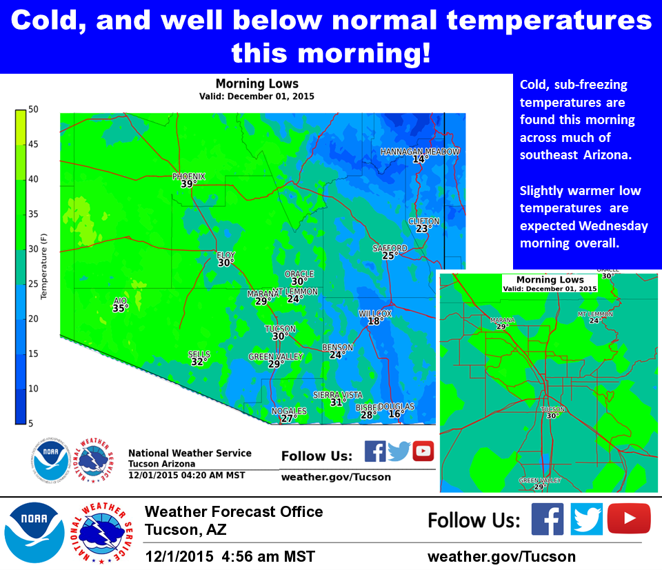
We flirted with freezing a couple times between those warm periods but did not record our first 32-degree reading of the season until Sunday. The temperature then dropped to 30 degrees Monday morning.
Our extremes for the month were that 30-degree reading Monday and a high of 84 on Nov. 2.
Forecasters still expect a wetter than normal winter, courtesy of the warm waters of the Pacific Ocean, where a full-blown El Niño weather pattern should send storms our way routinely.
That usually occurs in the latter part of the winter, said National Weather Service meteorologist Ken Drozd, but could happen earlier this year.
The average November temperature was 59.1, just 0.7 degrees below normal. Rainfall was a scant 0.16 inches, which is 0.41 inches below the average.
For the year, precipitation and temperatures are well above normal, according to the monthly climate report compiled by NWS meteorologist John Glueck.
The average temperature to date is 73.9 degrees, just half a degree behind 2014, which is the warmest year on record.
Rainwise, we’ve already collected 12.95 inches in the official gauge at Tucson International Airport, making it the 20th-wettest January-through-November period on record.
After a chilly Wednesday, Dec. 2, morning, the low temperatures will yield to warmer weather for the rest of the week, with highs in the 70s and lows in the upper 30s to 40.

