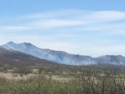
Fall and early winter rains relieved drought conditions in the Southwest, but also grew a lot of grasses that have “cured” in the abnormal heat and deficient rain of the last couple months.
“I’ve been at the fire station 17 years, and I haven’t seen it look as bad as it does right now,” said Oracle Fire Chief Larry Southard.
Southard said the oak/manzanita grasslands of his district on the north side of the Santa Catalina Mountains are knee-high, contiguous and thick.
His department responded to three brush fires in February, a month that is normally pretty slow, he said.
Regionally, the fire danger is normal, according to a fire season prediction from the Southwest Coordination Center in Albuquerque, which manages wildland fire resources for New Mexico, Arizona and West Texas.
Exceptions to that prediction are in western Arizona and the southern portions of Arizona and New Mexico, where the same rains that relieved drought “create loading and continuity of fine fuels.” Those conditions point to above-normal fire danger, especially “when winds and available fine fuels align,” according to a March 11 report from the center’s predictive services.
Wind and fuel aligned last week to spread the Baker Canyon Fire in a remote area of southeastern Arizona at the New Mexico line. The fire, which began about 28 miles northeast of Douglas, is still burning on land managed by the U.S. Bureau of Land Management, Arizona State Land and the Coronado National Forest. It has burned across 7,050 acres of brush and grasses.
One home and six outbuildings are threatened by the fire, which has crossed into New Mexico and is about 15 percent contained.
The U.S. Forest Service has already battled 11 fires this year on more than 8,000 acres of grassland in the Coronado National Forest, said spokeswoman Heidi Schewel.
She noted that the last fire of 2015 was on Dec. 26 and the first fire of 2016 broke out on Jan. 16. “The new normal on the Coronado National Forest is that fire season is year-round,” Schewel said.
The Coronado manages land on or adjacent to Southern Arizona’s Sky Island mountain ranges, where fire danger in late spring and early summer is greatest in the high-altitude conifer forests. Now, those areas are still moist from winter precipitation and snow patches remain in the highest elevations, said Schewel.
In the grasslands, the danger is now. “There are abundant fuels that have cured out at lower elevations,” Schewel said.
This time of year, fires are usually assumed to be human-caused. Only one of the 11 fires on the Coronado this year was naturally caused — a lightning strike during an unusual winter thunderstorm.
In Oracle, all three February fires were of human origin, Southard said. Two were along roads where dragging tow chains, tire blowouts and discarded cigarettes are the usual culprits. The other fire resulted from backyard disposal of warm fireplace ashes, said Southard.
In addition to the usual warnings about responsibly tending campfires and cooking fires, officials are again promoting a “one less spark” campaign to prevent fires from starting.
“Use situational awareness,” said Schewel. There are no restrictions in place at the moment, but on a dry, windy day in the grasslands, fires can start easily with a dragging tow chain or even a lawn mower blade hitting a rock, she said.
After two months of temperatures well above normal and negligible rainfall, the grasslands are primed to burn.


