The mineral potential of the Roskruge Mountains, 20 miles west of Tucson at the southern end of what is now Ironwood Forest National Monument, resulted in limited mining success.
The Roskruge range covers around 30 square miles of landmass consisting of low and rounded hills with elevations ranging from 2,500 to over 4,000 feet, including Martina Mountain, the highest point in the range.
George J. Roskruge, the range’s namesake, was a Pima County surveyor who was credited with having surveyed the Russellville Townsite at the Johnson Mining Camp and other prominent mining localities in Southeastern Arizona.
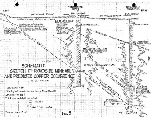
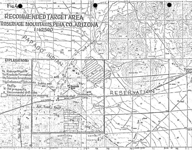
The Roadside Mine, also known as the St. Francis Mine, 35 miles west-southwest from Tucson and 3 miles north of Coyote Mountain, on what is now the Tohono O’odham Reservation, was a low-grade copper deposit developed in the 1880s. Composed of interbedded clastic sediments and andesitic volcanics formed over 65 million years ago, it is perhaps the most well-known mine in the Roskruge range and the Coyote mining district.
A prospector made the initial discovery in 1880 and informed Epes Randolph, a prominent mining investor and affiliate of the Southern Pacific Railway in Tucson, who promptly invested in its operation with the finances of Collins P. Huntington. Comprised of 41 unpatented mining claims encompassing 847 acres, the mining camp was most active in the early 20th century, providing supplies and water to local travelers between Tucson and Ajo.

Sketch of Roadside Mine Property. Courtesy of Arizona Geological Survey
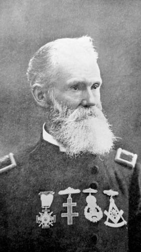
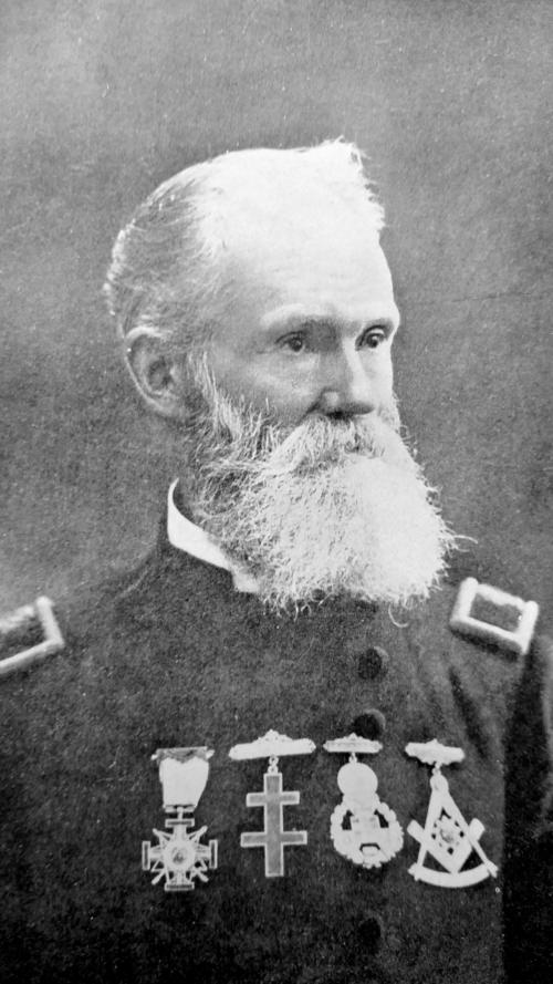
Mining engineer Courtney De Kalb, along with the widow of financier Huntington, further developed the property in 1912. By 1924, the principal shaft was developed at 800 feet in depth prior to the mine’s closing.
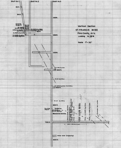
Despite an overall negative economic mineralization prognosis, De Kalb remained positive that he was close to reaching the sulfide zone within several hundred feet. He noted rock containing multiple small fractures filled with pyrite, chalcopyrite and chalcocite at several feet below the 800 level. These sulfides, occurring as veinlets up to 2 millimeters wide, indicated a high concentration of copper.
During the operation, he estimated that he blocked out 40,000 tons of ore containing 3 percent copper and 9 ounces of silver and 0.03 ounces of gold per ton.
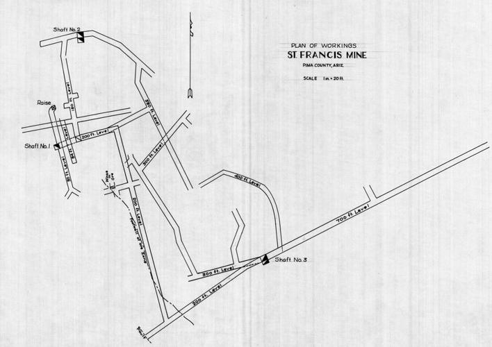
There were estimated intermittent copper ore shipments through 1917 totaling 10,000 tons from the workings including three shafts consisting of 2,640 feet of drifts, crosscuts and raises. The Roadside Mine is documented as having produced small quantities of the rare lead copper bismuth sulfide mineral aikinite. It is associated with deposits of gold and galena.
Bernabe C. Bricter, a local prospector, was noted for having shipped $80 worth of ore from the Roskruge Mountains around 1913. The Papago Chief Mine just south in the Baboquivari Mountains was notable for a high shipment of copper ore to the Douglas smelter around the same time.
In 1956, Edwin A. Stone located multiple mining claims, 65 total, within an elliptical area defined by a broken rim of andesite hills after acquiring quit-claim deeds from the DeKalb’s widow establishing the Roadside Mines Co. Yet the mine never reached a stage of production.

Map depicting the Roadside Mine in relation to prominent geologic & geographic figures.
Other mining ventures in the Roskruge Mountains did not fare better. In the mid-1950s, the Roskruge Mountains were the subject of interest by Mexco (Mineral Exploration Co.) composed of Allen Rugg, Elmer “Ben” Bell and Ernest Hicks, who originally located two groups of claims, Magnetite Group and Badger Group, on property 6 miles north of Robles Junction on the Ajo-Tucson highway, State Route 86.
The company conducted a series of diamond-drill tests at depths exceeding 200 feet in an alluvial-covered area with outcrops of metamorphosed limestone, shales and gray felsitic rock.
Mineral discoveries included oxidized coppers, limonite in quartz, magnetite, epidote and skarn. Other minerals included copper sulfides, pyrite, galena wulfenite, vanadinite and pyromorphite. But overall, the core samples lacked economic value.
Among other mining interests, the Heinrichs Geoexploration Co. was also involved with landowner negotiations and land investigation of mineral and surface rights in the Roskruge Mountains.
John W. Donaldson owned 5,000 acres of land, half of which was deemed to hold mineral potential and the other half used for water access, a mill site and tailings pile. The estimated value was between $2 million to $5 million. However, an 18-month free lease on the property granted by Donaldson apparently failed to produce significant finds .

Mineralization documented in relation to three shafts of St. Francis Mine.

Workings of St. Francis Mine
Since the late 1970s, there have not been concerted attempts to develop the mineral potential of the Roskruge Mountains.


