


As our temperatures hung around 110 degrees much of the past week, a new study finds Tucson is well over 7 degrees hotter than if a city with pavement and other heat-radiating development hadn't been built.
Extreme heat is the U.S.'s deadliest weather-related hazard, the nonprofit research group Climate Central said in releasing the analysis Wednesday. The ambitious study sought to compare the impacts of urban heat islands in Tucson, Phoenix and 63 other U.S. cities.
As part of that comparison, the study concluded sprawling Sunbelt cities including Tucson and Phoenix suffer proportionally less from the urban heat island effect than skyscraper-laden New York and San Francisco — even though it's much hotter overall in Arizona. A prominent University of Arizona researcher on extreme heat said, however, that it would be wrong to conclude more sprawl will solve our heat island problems.
During extreme heat events, Climate Central said, the urban heat island effect can worsen heat stress and related illness for millions, put vulnerable populations at risk, and lead to higher energy bills and strained power grids during spikes in cooling demand.
The heat island effect is hardly a novel concept. In research dating back to the 1940s, the effect of buildings, roads and sidewalks has been shown to boost temperatures, sometimes dramatically, by absorbing and radiating back the sun's heat.
Climate Central's research sought to pinpoint these impacts on a neighborhood scale, focusing on tiny U.S. census blocks hosting as few as 600 residents as well as in larger census tracts covering one or more entire neighborhoods.
Tucson had an overall heat island score of 7.65, meaning its temperatures are 7.65 degrees hotter on average because of all the pavement, buildings, sidewalks and other development.
But the heat island impact is much worse in some of Tucson's areas with less green space and more pavement, Climate Central found:

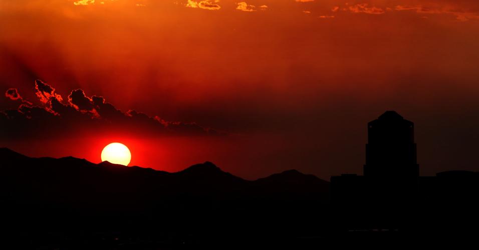
The monsoon clouds break up just before the sun sets on Tucson after a recent monsoon storm. It is 7 degrees hotter in the city now than the surrounding desert, a new study says.
— About 365,000 Tucsonans, out of 542,000 residents in all neighborhoods studied, live in areas in which the temperature is at least 8 degrees hotter due to the heat island effect.
— About 65,000 Tucsonans live in neighborhoods in which the temperature is at least 9 degrees hotter because of heat island impacts, topped by four midtown and east-side census tracts with heat island index scores of 9.5.
Sprawl vs. density
This may be small comfort to shade-starved Tucsonans, but the analysis also finds that in calculating the urban heat island effect, the urban sprawl that many planners and environmentalists revile for its leapfrog development and wildlife habitat destruction fares better than high-density infill development with tall buildings.
"Particularly in cities that are still growing, you tend to see more low-rise development and often less population density," Climate Central spokesman Peter Girard said. "You frequently see wider streets and grid layouts rather than narrow streets like you see in Boston. The narrower streets and the taller buildings impede airflow and contribute to a more intense heat island effect, he said.
But that reality is tempered by concerns about heat island impacts from large expanses of pavement and the lack of green space in many sprawling suburbs, experts say, which even those at Climate Central acknowledge.
Ladd Keith, a University of Arizona expert in extreme heat, warns that elected officials and planners will take the wrong lesson from the new analysis if they decide "sprawl is the answer" to the heat island effect.
Effect is worst in NYC
Even Tucson's insufferable heat still put it fifth from the bottom in the analysis' Urban Heat Island Index scores. Bigger and more sprawling Phoenix and Las Vegas stood at the very bottom of the index rankings compiled by the Princeton, New Jersey-based research group.
The 65 cities hold about 50 million people, accounting for 15% of the total U.S. population, Climate Central said. About 68% of those 50 million people live in cities with an urban heat island index rating of at least 8.
The U.S.' most populous city, New York, ranked highest by far with a 9.65 score, compared to 7.41 for Phoenix and 7.42 for Las Vegas. San Francisco's tall buildings and narrow streets gave it the second highest score of 9.14, even though it's much cooler than Southwestern cities.
Some New York City neighborhoods are as much as 12 degrees hotter due to urban-amplified heat, Girard told the Arizona Daily Star.
"New York has by far the largest portion of 'compact high rise' (development) … which is highly correlated with the reflectivity of surfaces," said Jen Brady, a Climate Central senior data analyst. "Roadways, buildings, and even large open paved spaces like parking lots or abandoned buildings contribute to this."
Density does play a role, basically because humans produce heat with transportation and residual heat from buildings, Brady said.
The analysis mapped each city to show how different land use and growth patterns influence the location of hot spots, "whether concentrated in a dense urban core or sprawling across a vast area."
While Tucson, Phoenix and Las Vegas are on the low end of the group's heat island index, "this still means you are seeing 7 or 8 degrees of additional heat on top of what you would expect, because of the built environment," Girard said.
Methods disputed
Climate Central's approach drew criticism, however, from three University of Arizona and Arizona State University scientists who specialize in extreme heat research. They're leading a separate, federally financed $25 million study to track heat impacts across the state's urban corridor.
One of them, ASU researcher David Sailor, says Climate Central's methods led it to put some of Phoenix's hotspots in the wrong locations.
"I think use of the urban heat island as a metric oftentimes is misleading and of only modest value in trying to understand extreme heat and its impacts and how we mitigate them in cities," said Sailor, director of ASU's School of Geographical Sciences and Urban Planning.
Strictly speaking, the heat island effect's magnitude is simply a measure of how much warmer a city is compared with unbuilt rural surroundings, he said. Also, the strength of the heat island effect varies considerably at different times and during different seasons, he said.
Suppose Portland, Oregon has a bigger heat island effect than Phoenix — "does that mean heat in Portland is a bigger problem than in Phoenix, which is much hotter?" Sailor said.
It's more useful to understand absolute weather conditions that people are exposed to and directly affect their lives, he said — such as maximum and minimum air temperatures and humidity.
But Sailor added, "I want to emphasize that these sorts of studies are important. What they have done for Phoenix and Tucson is better than nothing."
By focusing on urban "hot spots", such studies seek to pinpoint temperature variations within a city and which populations in a city are at risk from extreme heat, so officials can intervene to help them.
While this isn't a bad study, the danger in such studies is "taking the wrong lesson … (that) sprawl is the answer to this. It's the complete wrong answer," UA's Keith said.
"Sprawl requires a lot of roadway infrastructure. Gasoline-powered autos contribute to the urban heat island. Some of our coolest places are our densest places, that have a lot of shade and a lot of vegetation," said Keith, an associate professor in UA's School of Landscape Architecture and Planning
The Star asked Climate Central about the fact that lower heat island ratings for sprawling cities goes against what many planners see as smart growth — infill of existing developed areas. Girard replied that other factors may outweigh building heights in contributing to the heat island effect.
They include the kind of building and roofing materials used, street widths and layouts, he said.

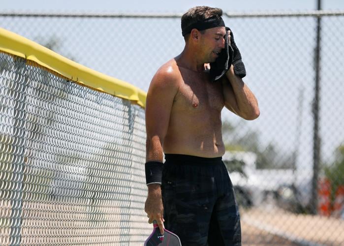
Allan Mendelesberg wipes his brow in between points while playing pickleball against his business partner on their lunch hour at Himmel Park in Tucson, Ariz. on July 9. Tucson is under an excessive heat warning through Wednesday evening.
"When there is sprawl it is probably more likely to be broken up with some green space at some point," observed Climate Central data analyst Brady. "However, we like to remind people that an overdeveloped suburban area that does not include sufficient green space will be hotter as well."
Biggest factors
The three biggest factors that influence a city's urban heat island index are as follows, says Climate Central:
1. Albedo, the fraction of incoming solar radiation reflected by a surface. Hard, dark surfaces such as roads, buildings and parking lots have low albedo, meaning they easily absorb sunlight and radiate it back as heat.
2. Percentage of green space, since plants help cool the air. Plants can help reduce peak summer temperatures by 2°F to 9°F in urban areas.
3. Population density. Extra heat comes from human activities, including transportation, industrial facilities, and the cooling of buildings. During a heat wave, air conditioning can add 20% more heat to the outside air.
Areas high on the new heat island index have characteristics that amplify heat, potentially increasing local temperatures, Climate Central says.
The degree to which each of these characteristics appear in a city is factored into the urban heat island index to estimate their combined capacity to increase temperatures.
Research for this analysis lasted three years, Girard said.
To calculate each city's heat island index, Climate Central examined land cover and building patterns in a manner laid out in an earlier study that classified areas of a city by 17 different local climate zones, based on general land cover, building structures and overall human activity.
Then they applied a peer reviewed methodology to calculate an area's potential to amplify heat.
Because these calculations are based heavily on a city's physical environment rather than observed temperatures on a given day, the urban heat island index value is applicable to any temperature, daytime or nighttime, Climate Central's Girard said. That's different from the traditional scientific view that the urban heat island effect is felt most strongly at night.
But the urban heat island's potential to expose people to temperatures that increase health risks is greatest during extreme heat events, so the impact is most dangerous around daily highs, he said.
Raw desert's heat
To illustrate where he thought Climate Central got things wrong, ASU researcher Sailor pointed to an area far north of Phoenix on Climate Central's heat island map that was shown to have an index reading of 5.5.
But that area is mostly vacant, save for the growing suburban community of Anthem that occupies a fairly small percentage of the entire area shown, Sailor said.
"It’s desert. Nobody lives here. It’s open desert that they say is 5.5 degrees warmer than something," Sailor said. "My question is, what are they using for the baseline? What are they using as a control?"
He says Climate Central's index readings can be affected by the different kinds of unbuilt landscapes surrounding different cities.
Atlanta, Philadelphia and New York City, for instance, are surrounded by forest and farmland, whereas much of the developed Phoenix area is surrounded by raw desert. In the daytime, the desert around Phoenix can even be hotter than in the city, which could alter Phoenix's heat island index score.
"If your rural area is a forest, of course a city will be hotter. A forest is generally going to be cooler, with more soil moisture and evapotranspiration from the plants," he said.
Much of Phoenix itself is also an oasis, which can also lower its heat island index rating.
"We flood irrigate, we artificially plant trees and lawns and we have golf courses," Sailor said.
But the Climate Central study doesn't use areas surrounding a city as baselines, according to its spokesman Girard.
Its analysis calculates the degree to which the built environment in a specific location is capable of increasing temperatures, rather than the relative difference between locations, he said.
"You could frame it as a comparison to a theoretical state in the same place, if the built environment didn't exist," he said.
if a New York City (census) tract were identical in its development to a Phoenix tract, "they'd have the same scores," Girard said.
But when Sailor compared some of Climate Central's heat island hot spots with actual temperature measurements ASU researches have made in the same neighborhoods, "some of their hottest areas are, in actuality, relatively cool neighborhoods," he contends.
"On the flip side, some of the neighborhoods that we have measured to be among the hotter neighborhoods in the city, appear to be relatively cool or average in their map," Sailor said.
Another ASU researcher, professor Matei Georgescu, went so far as to raise concerns about research methods used in the underlying study that Climate Central cited as its basic methodology for calculating heat island indexes.
That paper proposes a new index aimed at quantifying the hazard of the "absolute maximum" heat island intensity in urban areas during the summer, Georgescu noted.
But the heat island effect varies at different times of the day, and the study appears to have no indication how long or at what times this maximum intensity occurs, he told the Star.
"The community, and in general all practitioners, are interested in urban overheating" during particular portions of the day, in part to more effectively manage energy delivery for air conditioning during peak demand hours, he said.
Yet other parts of that study's analysis relied on average maximum daily summertime temperatures, and Georgescu asked, "Why merely average summer temperature, given obvious day to day variability, and this variability will vary from place to place, especially for coastal versus landlocked urban environments?" he said.
UA involved in upcoming study
Sailor acknowledged, however, that urban heat island measurements can be useful to understand temperature variations within a city.
"Then, you can start asking questions about why (one neighborhood is hotter) and start looking for solutions," he said.
But the bigger focus should be on excessive urban heat in general, he said.
That's the subject of the federally financed, $25 million research project that the three UA and ASU researchers are working on in Phoenix and Tucson as well as other urban areas of Arizona. The project is being coordinated by those universities and Northern Arizona University in Flagstaff.
Last month in Tucson, researchers surveyed the city in mobile observatories to assess neighborhood level climate and heat impacts. High-tech trucks belonging to Brookhaven National Laboratory are partnering with UA and ASU researchers to study the Southwest's extreme heat. The trucks were taking temperature and air pollution readings on a neighborhood scale, while driving across Tucson.
Similar mobile observations have been made for the project this summer in the Phoenix area.
"We ran a dozen cars with these instruments, along with two mobile observatories," such as those used in Tucson, over 24-hour periods, said ASU's Sailor.
This study, expected to last five years, should start producing data for Tucson as early as this December, Keith told the Star.
Climate Central's Girard acknowledged that its analysis can't replace UA's and ASU's "on the ground" research.
Sailor is right that Climate Central's approach "can miss nuances that local observations reveal," Girard said.
The ASU researcher is also correct in saying extreme heat represents a bigger threat to Arizona residents than those in cooler cities, even in cities with higher urban heat island index ratings than Phoenix and Tucson, he said.
Ideally, Climate Central's analysis "helps to identify neighborhoods where the built environment can amplify heat, to help city officials and planners investigate further. Collecting local data, like the ASU project does, is likely essential to confirm impacts and recommend solutions," Girard said.
Get your morning recap of today's local news and read the full stories here: tucne.ws/morning

