


It’s no secret that winters in the Southwest are usually mild, but Tucson has been riding an exceptional heat wave this winter.

A bicyclist takes advantage of a clear and warm early evening for a ride along the Rillito River Park paths near North Craycroft Road.
Average monthly highs have hovered around the mid- to upper-80s since November. The last week of February could be more of the same, courtesy of a strong ridge, said Kevin Strongman, a meteorologist with the National Weather Service in Tucson.
The high-pressure ridge — the result of a jet stream — is pushing precipitation and cloud cover to the north, Strongman said.
Without the cloud cover, he said, heat from the sun is beating down on Tucson and driving up surface temperatures.
La Niña has been coming into play, he said.
This “stronger than normal ridge,” Strongman said, is more “pronounced” than a typical February. A ridge like this one, he said, doesn’t usually make its way to Tucson until March or April.
February’s average high temperature (to date) eclipsed the normal average by about nine degrees, reaching 77.2 degrees as of Friday.
That temperature also sets a record for the average maximum temperature for February to date.
For this time of the year, “fire weather is exceptionally threatening,” Strongman said, urging area residents to be vigilant with fire prevention.

Wildflowers bloom Friday along East Speedway. Sunny and mild days after expected through the weekend.
He said Tucson has “above normal chances” for an exceptionally hot summer.
In the meantime, highs are forecast to remain in the 70s until Monday, with a high of 74 degrees Saturday, 79 Sunday and 83 Monday. Lows will be in the low to mid-40s.
The expected high on Tuesday: 86.
Photos: Monsoon 2024 in Tucson

Drivers make their way east on St. Mary’s Road as a monsoon storm with heavy rain and hail rolls over the west side of Tucson, Ariz. on August 21, 2024.

Several bolts strike near Corona De Tucson from one of series of monsoon cells that peppered the area with wind, rain and lots of lightning around Tucson, Ariz., August 16, 2024.
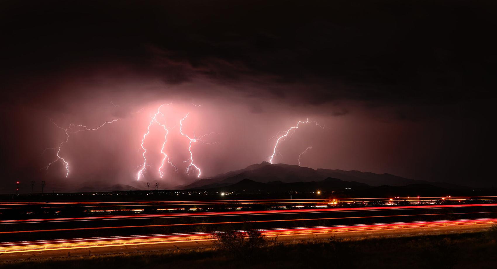
Several bolts strike the southern reaches of the Rincon Mountains as traffic from I-10 speeds below one of a series of monsoon cells that peppered the area with lightning, wind and rain around Tucson, Ariz., August 16, 2024.

Lightning from a small cell strikes just west of Rita Road as a series of monsoon storms skirted Tucson, Ariz., August 16, 2024.

Lightning hammers the Rincon Mountains east of Vail, Ariz., and north of I-10 from a monsoon storms that moved slowly northwest outside Tucson, Ariz., August 16, 2024.

A barrage of bolts strikes in the extreme southern foothills of the Rincon Mountains east of Vail, Ariz., as a monsoon cell rolls alongside the traffic on I-10, August 16, 2024.

An isolated monsoon cell drops a lightning bolt just west of Rita Road as several bands of storms peppered the area with lightning, wind and rain around Tucson, Ariz., August 16, 2024.

The Rincon Mountains absorb several lightning strikes from a monsoon storm cell that slowly rolled to the east of Vail, Ariz., August 16, 2024.

The Santa Cruz river flows with water underneath the Congress Street bridge after a monsoon storm rolled over Tucson on August 8, 2024.

Tucson Electric Power crews continue repairing fallen power lines from Thursday’s monsoon storm, West Speedway Boulevard, Tucson, Ariz., Aug. 10, 2024.

A driver makes their way through deep water near Tyndall Ave and 22nd Street after a monsoon storm rolled over Tucson, Ariz. on August 8, 2024.

A couple of people walk with umbrellas along Congress Street after a monsoon storm rolled over Tucson on August 8, 2024.
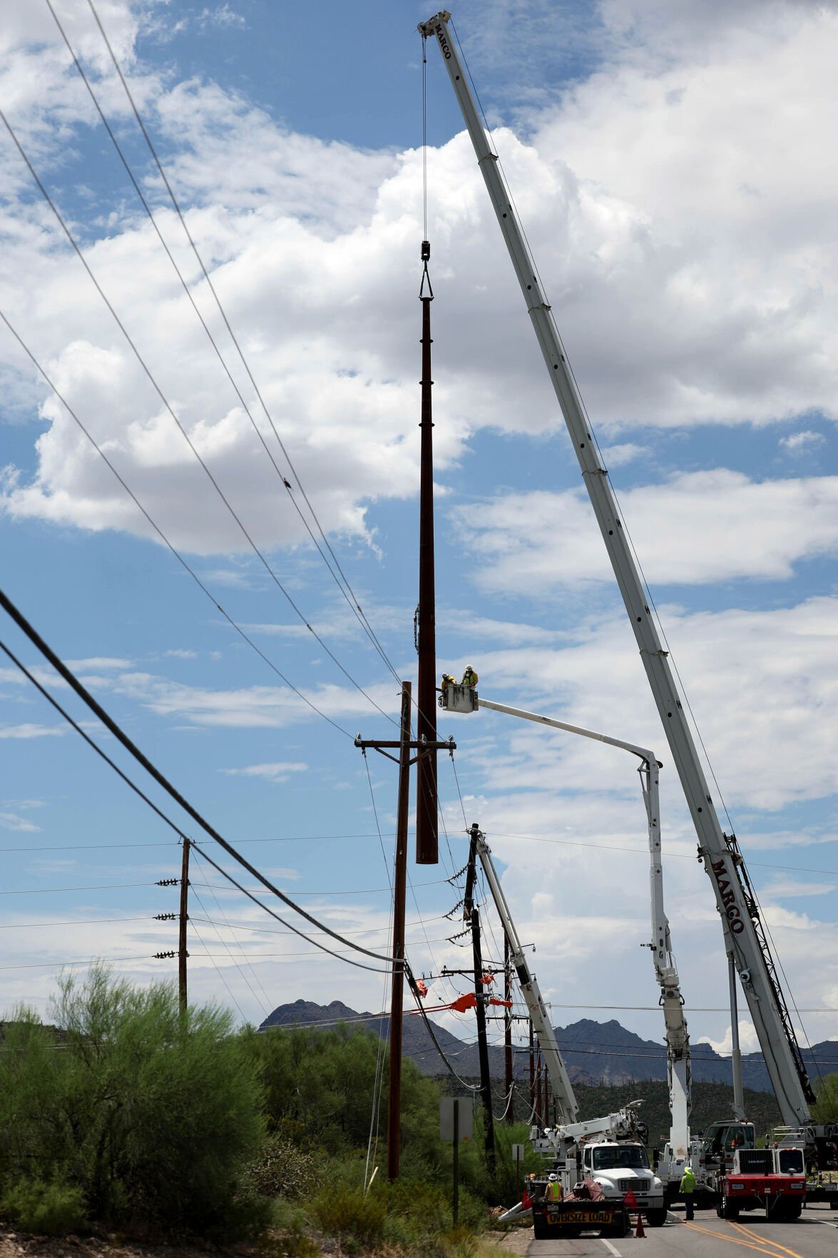
Tucson Electric Power crews continue repairing fallen power lines from Thursday’s monsoon storm, West Speedway Boulevard, Tucson, Ariz., Aug. 10, 2024. Air gusts reaching 70 mph took down trees and power poles on both the east and west sides of Tucson Thursday evening.

Tucson Electric Power deploys crews to fix fallen power line along West Speedway Boulevard, Tucson, Ariz., Aug. 8, 2024.

A collection of power lines in the road after a monsoon hit the West side of Tucson on Thursday afternoon, West Speedway Boulevard, Tucson, Ariz., Aug. 8, 2024.

Tucson Electric Power deploys crews to fix fallen power lines after a monsoon hit the West side of Tucson, West Speedway Boulevard, Tucson, Ariz., Aug. 8, 2024.

Tucson Electric Power deploys crews to fix fallen power lines after a monsoon hit the West side of Tucson, West Speedway Boulevard, Tucson, Ariz., Aug. 8, 2024.

A man runs for cover as intense winds and storm showers pass through Downtown Tucson on Thurs. afternoon, East Toole Avenue, Tucson, Ariz., Aug. 8, 2024.

A woman uses an umbrella to keep rain showers away during a late afternoon walk, West Speedway Boulevard, Tucson, Ariz., Aug. 8, 2024.

The sun sets behind the Tucson Mountains and a few ragged monsoon clouds, Tucson, Ariz., July 26, 2024.

A driver sits in a flooded out vehicle in the middle of Country Club Road just south of Ft. Lowell Road in the midst of a monsoon storm,Tucson, Ariz., July 25, 2024. Several vehicles stalled out in the waist high runoff on Country Club at Presidio Road in the midst of a monsoon rain. Emergency personnel were scrambling for a couple of hours to calls throughout the city.

A Tucson Fire Department member reacts to another vehicle venturing into the heavily flooded intersection of Country Club Road and Presidio Road already filled with stalled and flooded vehicles in the midst of a monsoon storm,Tucson, Ariz., July 25, 2024.

Tucson Fire Department personnel check an empty vehicle for passengers while responding to the call of several stranded vehicles on Country Club Road at Presidio Road in the midst of a monsoon storm,Tucson, Ariz., July 25, 2024.

Tucson Fire Department personnel help a passenger out of a flooded vehicle on Country Club Road at Presidio Road, one of the half dozen vehicles disabled in the flooding from a monsoon storm,Tucson, Ariz., July 25, 2024.

A car drifts to a halt as it floods out trying to cross the water rushing over Ft. Lowell Road at Christmas Avenue in the midst of a monsoon storm,Tucson, Ariz., July 25, 2024.

A flooded car sits empty in the middle of Ft. Lowell Road at Christmas Avenue, one of at least four vehicles to stall out in the runoff rushing through the area in the midst of a monsoon storm,Tucson, Ariz., July 25, 2024.

A pair of pedestrians slog their way through the floodwaters rushing down Christmas Avenue across Ft. Lowell Road in the midst of a monsoon storm,Tucson, Ariz., July 25, 2024.

Clouds from a late afternoon monsoon storm swirl over One South Church and downtown Tucson, Ariz., July 20, 2024. The storm brought gusty winds, some dust, a little rain and sporadic lightning. Rain chances remain good for the rest of the weekend.

A bolt of cloud lightning stretches over the skies above Tucson, Ariz., during one of the first widespread monsoon storms of the season, July 18, 2024.The cell brought rain, dust and wind over a large part of the valley.

A bolt of lightning comes to earth south of the Pima Community College West Campus as a widespread monsoon storm sweeps through much of Tucson, Ariz., July 18, 2024.

An arc of lightning strikes near the western foot of Tumamoc hill south of the Pima Community College Campus as a monsoon storm slowly rolls over Tucson, Ariz., July 18, 2024.
A long, thin finger of lightning strikes a hill in the southwest part of Tucson, Ariz., as wide monsoon storms dumps a little rain over the area, July 18, 2024.

A bolt of lightning strikes around downtown Tucson as winds pick up to 12 mph, West Speedway Boulevard, Tucson, Ariz., July 18, 2024.

Lightning strikes around the southeastern reaches of the Rincon Mountains as a monsoon storm runs up the San Pedro River valley east of Tucson, Ariz., July 17, 2024.

A bicyclist heads west on the Maclovio Barraza Parkway bridge over 6th Avenue into a monsoon sunset, Tucson, Ariz., July 17, 2024. The storms have taken a break on the past few days, but chances of rain returning increase heading into the weekend.

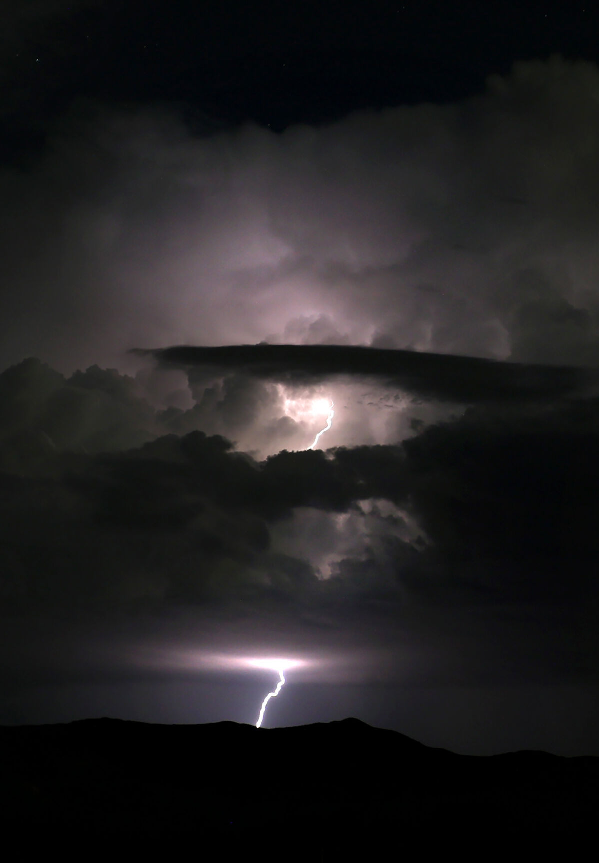
Lighting from a monsoon storm over the San Pedro River Valley and the southeastern reaches of the Rincon Mountains, Tucson, Ariz., July 17, 2024.
One of multiple lighting strikes from a storm hitting the southeastern parts of the Rincon Mountains and San Pedro River valley east of Tucson, Ariz., July 17, 2024.

Lightning strikes around the Tucson Mountains as winds pick up to 12 mph, West Speedway Boulevard, Tucson, Ariz., July 18, 2024.

A skateboarder makes his way west on Maclovio Barraza Parkway past the Sunlink Operations & Maintenance building during a monsoon sunset over Tucson, Ariz., July 17, 2024. The monsoon weather calmed down since Sunday’s microburst, but storms are likely to return in a few days.

The side of the building at AutoZone Auto Parts, 935 West Prince Road, blew over during a monsoon storm early Sunday night. A large complex of storms with high winds and many microbursts left extremely widespread damage in Tucson. Photo taken July 15, 2024.

Crews from Sturgeon Electric work on an electricity pole along Orange Grove Road on Monday morning July 15, 2024. A large complex of storms with high winds and many microbursts left extremely widespread damage in Tucson early Sunday evening. Thousands of Tucson Electric Company customers were without power.

A crew from Northwest Landscaping clean up debris from several trees that fell down on the University of Arizona campus Monday morning July 15, 2024. A monsoon storm brought strong winds and many microbursts in Tucson early Sunday evening leaving widespread damage.

A worker from Northwest Landscaping stomps down tree debris in the bed of a truck as a crew cleans up a tree that fell down on the University of Arizona campus Monday morning July 15, 2024. A monsoon storm brought strong winds and many microbursts in Tucson early Sunday evening leaving widespread damage.
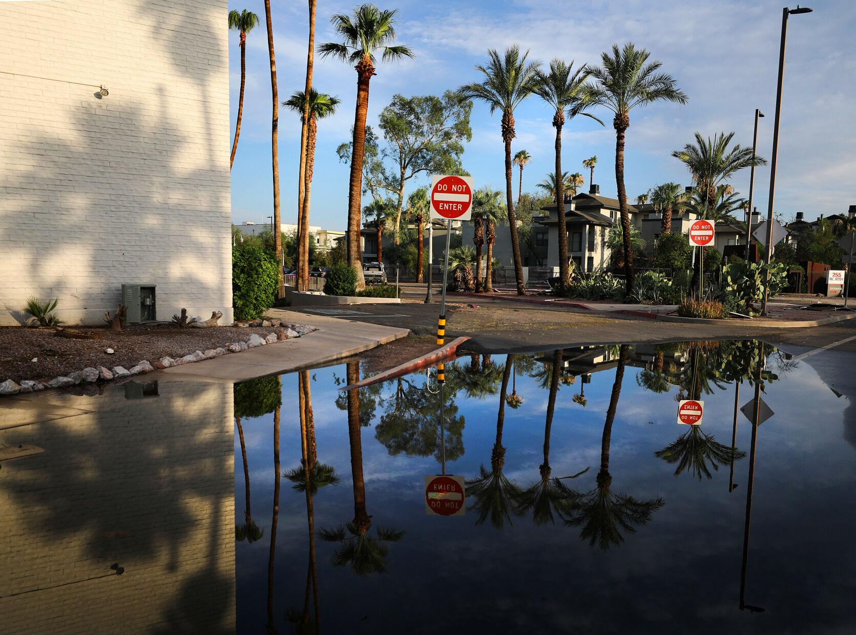
A pool of water shows reflections along North Granada Ave. on Monday morning July 15, 2024, after a large complex of storms with high winds and many microbursts left extremely widespread damage in Tucson early Sunday evening.

A worker from BrightView Landscape Services stands by a downed tree that fell over two cars parked along North Sixth Avenue at East Fifth Street after a monsoon storm brought strong winds and many microbursts in Tucson early Sunday evening.

A worker from BrightView Landscape Services tosses a branch onto a pile of tree debris along North Sixth Avenue at East Fifth Street after a monsoon storm brought strong winds and many microbursts in Tucson early Sunday evening. Photo taken Monday morning July 15, 2024.

A saguaro lays on the ground at North Oracle Road and Ventura Street in Tucson, Ariz. after a monsoon storm brought high winds and many microbursts early Sunday evening. Photo taken July 15, 2024.

The overhead cover at the Circle K along Congress Street and the I-10 Frontage Road is blown down Monday morning July 15, 2024 after a large complex of storms with high winds and many microbursts left extremely widespread damage in Tucson early Sunday evening.

Debris lays along West Congress Street on Monday morning July 15, 2024, after a large complex of storms with high winds and many microbursts left extremely widespread damage in Tucson early Sunday evening.

A pool of water shows reflections along North Granada Ave. on Monday morning July 15, 2024, after a large complex of storms with high winds and many microbursts left extremely widespread damage in Tucson early Sunday evening.

Cars maneuver around a downed tree along North Granada Ave. on Monday morning July 15, 2024, after a large complex of storms with high winds and many microbursts left extremely widespread damage in Tucson early Sunday evening.
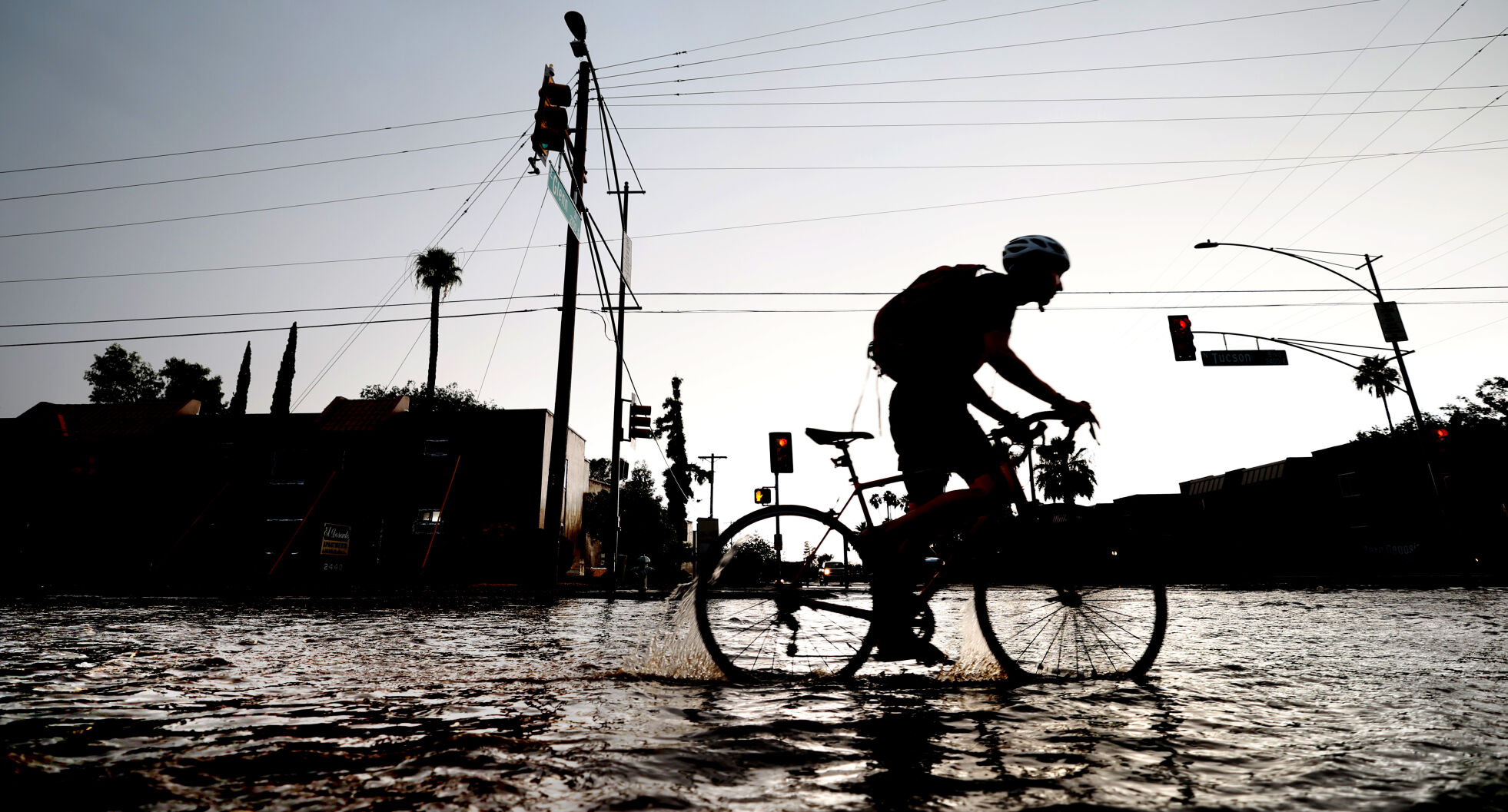
A biker fords the flooded intersection of Glenn Street and Tucson Boulevard as a monsoon storm drops a lot of rain in a little time over mid-town Tucson, Ariz., July 11, 2024. Rain, wind and lighting accompanied several bands of storms that rolled over the area just before sunset.

A car dives along the stream of water flowing through the middle of Warehouse Avenue reflecting the light from sunset following a monsoon storm doused several parts of Tucson, Ariz., July 11, 2024.

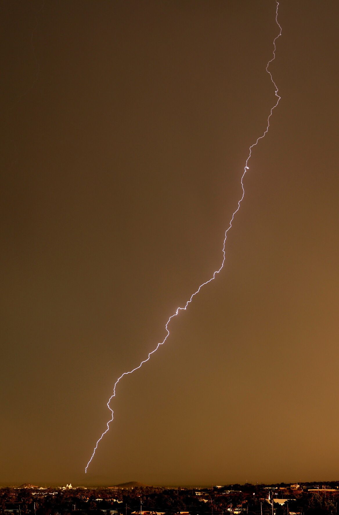
A bolt of lightning hits in midtown as the northern cell of a monsoon storm rolls through the area, Tucson, Ariz., July 11, 2024.

The monsoon clouds break up to the west just before the sun sets on a storm sweeping through, Tucson, Ariz., July 11, 2024.

A Tucson, Ariz., Police Department cruiser sends up rooster tails of run-off water as it heads down Tucson Avenue under lights and siren during a monsoon storm July 11, 2024.

Southern Arizona skies are painted red following storm showers rolled through Tucson on late Thursday afternoon, July 12, 2024.

Tucson Electric Power has crews working along West Ina and North Shannon Road to clear all monsoon damage, West Ina Road, Tucson, Ariz., July 6, 2024. The intersection of West Ina and North Shannon Road is expected to be closed through the weekend as Tucson Electric Power repairs at least 14 downed power poles, the utility says.

Tucson Electric Power has crews working along West Ina and North Shannon Road to clear all monsoon damage, West Ina Road, Tucson, Ariz., July 6, 2024. The intersection of West Ina and North Shannon Road is expected to be closed through the weekend as Tucson Electric Power repairs at least 14 downed power poles, the utility says.

Tucson Electric Power has crews working along West Ina and North Shannon Road to clear all monsoon damage, West Ina Road, Tucson, Ariz., July 6, 2024. The intersection of West Ina and North Shannon Road is expected to be closed through the weekend as Tucson Electric Power repairs at least 14 downed power poles, the utility says.
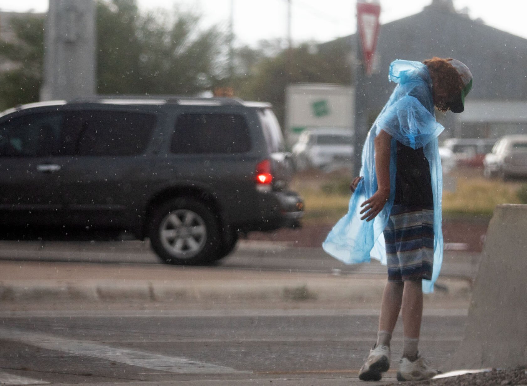
A man puts on rain poncho as he stands at St. Mary’s Road and the I-10 Frontage road as a monsoon storm rolls over the west side of Tucson on June 28, 2024.

An isolated storm cell drops rain over the far northeast part of the valley just as sun sets on a day of scattered monsoon action around Tucson, Ariz., June 27, 2024. Rain and wind landed over the area mostly in the area around the Rincon Mountains

People get photos of the sunset over Windy Point Vista along Catalina Highway following a day-long rain in the Santa Catalina Mountains, Ariz., June 22, 2024.

A couple walk down Sabino Canyon Park on a rainy day in Summerhaven, Ariz., June 22, 2024.
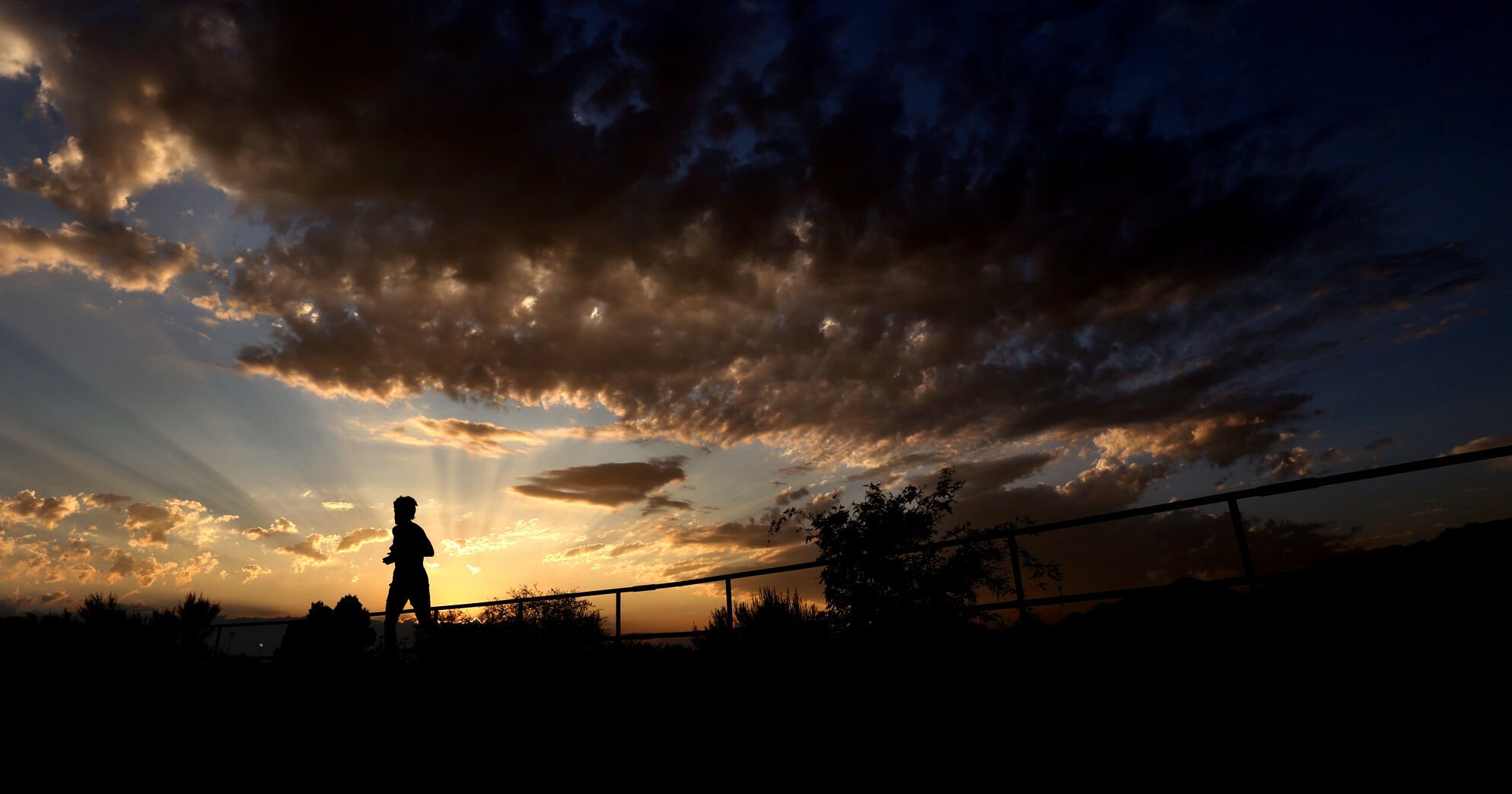
As the sun sets on a triple digit day, a runner makes his way along the south bank paths on the Rillito River Park near Columbus Boulevard, June 13, 2024, Tucson, Ariz.

A hiker and her dog walk through Saguaro National Park East near the Broadway Trailhead under a very early monsoon sky, Tucson, Ariz., June 20, 2024. The wind, dust, sprinkles and a few bolts of dry lightning were the first real stirrings of this year’s monsoon, which officially began five days ago on the June 15,.

Virginia Garcia, who lives in the Magee-La Cholla area of Northwest Tucson, submitted this photograph from her front-door camera of a cloud she says destroyed half her roof during the monsoon storm Sunday night, July 14, 2024.

