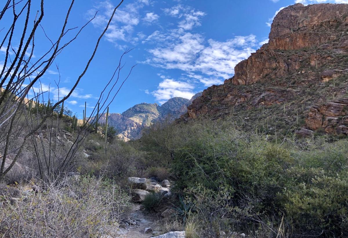
There are so many hiking trails to explore in and around Tucson. But having so many options also makes it kinda hard to decide where to go, especially for the casual weekend hiker.

Veronica and Johanna, your helpful hikers, explore the Pima Canyon Trail.
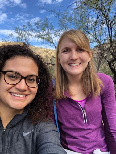
That's where we come in. (Hi!) Johanna is an occasional weekend hiker who thinks all hikes should end in water. Veronica is a newbie hiker who refers to the outdoors as "the nature", but is excitedly discovering a little about Tucson and a lot about herself one trail at a time!
We'll hike some of these trails and tell you what they're really like. We'll tell you how hard a trail is, if it's kid-friendly or too creepy to do alone, where to park and what the bathrooms and water situation is like. Happy trails!
Golden leaves, a hidden waterfall and sweeping city views.
Pima Canyon Trail has it all.
We hit the trail on Tuesday morning with heart, excited to explore the wonders of Pima Canyon, which is part of Coronado National Forest.
We scrambled up rocks, marveled at splashes of fall color and paused in awe at the sound of wind fluttering through tree leaves. Wonder, yes. We definitely found that.
We can see why this is such a popular place to spend a few hours outdoors.
How to get there
It's pretty easy to find the Iris Dewhirst Pima Canyon Trailhead which is as far east on Magee Road as you can go. From Oracle Road head east on Magee and keep driving straight into the parking lot. You can also head north on First Avenue until it becomes Christie Road and follow that up to Magee Road and turn right. The trailhead can be found on Google maps here.
About the trail

The first stretch of the trail is bordered by private property on both sides, so stay on the path.
We hiked about 4 miles one way on this trail, making for almost 8 total miles of hiking. This was a pretty significant distance for both of us. Luckily, the trail is beautiful, well-marked and not totally grueling, so we enjoyed the whole 8 miles.
The trail begins pretty flat and easy and is bordered by private property for the first stretch, so make sure you stay on the path. Not long after we began hiking, we crossed under a heavily graffitied bridge.

Graffiti bridge
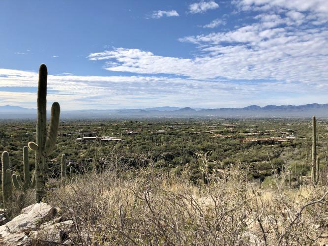
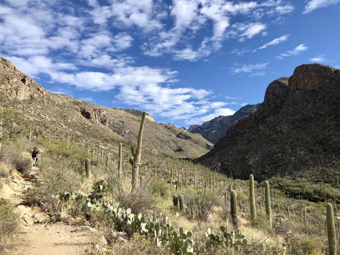
The first series of hills we hit almost felt like the hardest, as we clambered up the rocky incline. The reward is that the view gets increasingly better as you climb. Facing the mountain, you'll see a forest of saguaros. City-side, all of Tucson sprawls out before you. You can see downtown, the 'A' on Sentinel Peak and roads criss-crossing the city. It took us 20 to 30 minutes to get here from the trailhead and we were walking at a very leisurely pace.

This view rewards you as you climb higher on the trail.
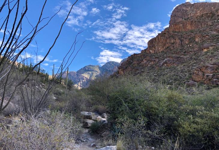
From here, the trail heads into the canyon, hugging the mountain and eventually winding alongside a mostly dry (at least that day) wash.

Heading into the canyon.
After our first hour or so of hiking we came upon an ENORMOUS boulder that is begging to be climbed. Depending how much rain and snow melt the area receives you could find water here, but we didn't. Instead, we climbed the boulder, took a water break and admired the desert around us.

Taking a break to admire the views along the Pima Canyon Trail.
If you're just looking for a short Saturday morning hike, this would be a great place to turn around.
But not us.
We wanted to find a wildlife dam we read about that's supposedly 3.2 miles from the trailhead, and although we failed to find it, the trail rewarded us in other ways. (If you HAVE found the dam, please email us your pictures. After all that work, we'd like to see it 😆).
About 30 minutes after we left the mega boulder, we stumbled into a patch of autumn, with yellow-leafed cottonwood trees presiding over the river bed.

Take in those golden leaves!
Later, we discovered a hidden waterfall trickling down a cliffside. We suspect it's the product of last weekend's rain.

We suspect this small waterfall is a result of our weekend rain.
Much of the trail followed the Pima Wash, crossing it occasionally. Because of that, the path was relatively flat, though rocky in some points. The canyon creek may flow after heavy rainfall or mountain snow, so use discretion depending on when you go.
We turned around after about 4 miles when the trail became a little steeper and trickier to follow.
We both loved this hike because of the variety of things to see.
How hard is it?

In the canyon
Hiking websites rate this trail moderate to difficult. As beginners it felt challenging but manageable. The trail was mostly flat, although there were a few inclines and rocky stretches. For us, 8 miles round trip was a long hike, but not too rigorous and you could adjust this hike to suit your time and ability.
The best bits
Johanna: When we caught our first glimpse of fall colors, my heart leapt. When we found ourself beneath a small grove, I had to stop to take it in — especially the sound of the wind in the leaves, which I thought was water at first. I told Veronica that this was Narnia-level magic.

"Narnia-level magic" on the Pima Canyon Trail.
I also loved the tiny waterfall because: 1. It felt like a secret treasure and 2. How do you live here and not love water in the desert?
Although you get panoramic views of the city and the canyon, this hike is mostly through the desert, so I loved those unexpected finds you'd see somewhere with real seasons.
Veronica: The tiny waterfall was one of my favorite parts of the trail, there is something incredibly soothing about the sound of water cascading down the rock face.
Johanna led most of the way up the trail, so my favorite experience was hearing how excited she was at each new thing we encountered (moss, fall colors on the cottonwood trees, rocks!) Nature is pretty darn magical.
Does it feel safe to go alone?

The trail begins relatively flat, though there are lots of rocks, so watch your step.
We hiked this trail on a Tuesday morning and encountered multiple people throughout the hike, but we'd recommend taking a friend, especially if you want to hike as far as we did. Even though the trailhead is close to major roads, the trail into the canyon starts to feel remote the farther in you go. Plus, we had a hard time getting cell service at certain points on the hike, so better to take a buddy.
Family call
Veronica: I started the hike saying "there's no way I'd bring my 7-year-old on this trail" and ended the hike being passed by what looked like a 7-year-old girl and her family on our way out. While this hike isn't impossible for kiddos, it will likely require extra care and time to navigate it. There were some really easy, flat patches of trail but also some parts with slippery and loose rocks and some elevation climbs. This hike is not stroller friendly.
Facilities

The parking lot at the Pima Canyon Trail trailhead has drinking fountains but no bathrooms.
You can fill up your water bottle at a water fountain at the trailhead. Signage there mentions bringing along a shovel "for sanitation" so that tells you what kind of bathroom facilities exist on this trail and the parking lot: none.
Parking
There's a decent-size parking lot just off Magee Road and parking is free. Follow the signs. However, this trail is very popular during fall and winter and the 50-car lot is known to fill up on the weekend.
Other helpful tips
The trail is open dawn to dusk and dogs are not allowed.
The start of the trail is flanked on both sides by private property, so be sure to stay on the trail at all times.
As with any hike make sure you:
• Take plenty of water and snacks
• Wear sun protection (sunscreen and/or hat)
• Tell someone where you're going
• Stay on the trail
• Listen to your body and know your limits (it's OK to turn around at any point on your journey, even on a loop)
• Be safe when you encounter flowing water on your hike
• Enjoy the nature


