


Editor's note: This story was originally published in 2022 and updated in 2025.
Sentinel Peak is special to Tucson.
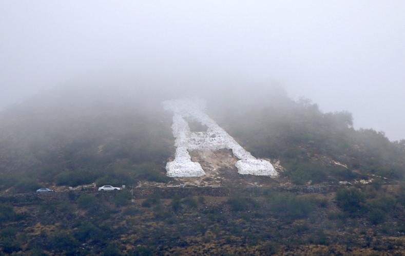
The west-side mountain, often dubbed “A” Mountain thanks to the giant letter “A” on its east side, offers 360-degree views of the city.
The base is considered Tucson’s birthplace, and the mountain itself is often the backdrop for Fourth of July fireworks. Its stone “A” was created by University of Arizona students in 1915 and finished in 1916.
In the beginning of the COVID-19 pandemic, the “A” was painted blue. Over the years, it’s been painted red for the #RedForEd movement, green for St. Patrick’s Day, and red, white and blue following the Sept. 11 terror attacks.
It’s been lit with flares to kick off the UA’s homecoming celebrations. It’s even been painted yellow as a prank by Arizona State University students.
Whether you’re hiking, bicycling or driving, consider this your guide to visiting Tucson’s very special “A” Mountain and its cityscape views.
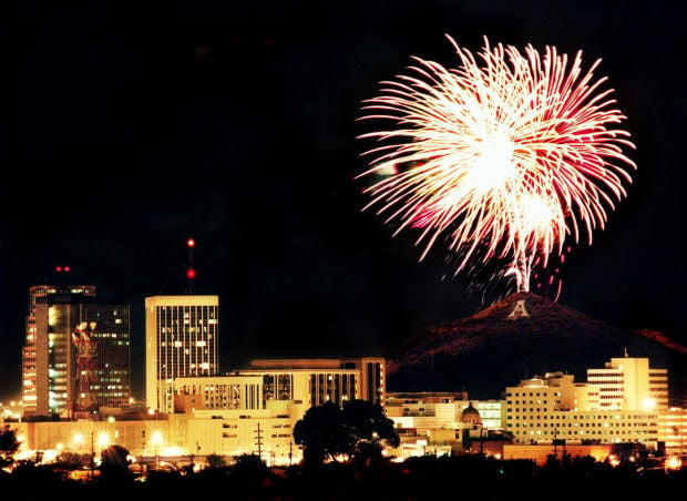
Fourth of July fireworks display from “A” Mountain.
Getting there
Sentinel Peak Park, or “A” Mountain, is located on Tucson’s west side at 1001 S. Sentinel Peak Road. It’s open from sunrise to sunset daily, though there are restrictions for cars, according to the city.
Cars are not allowed at all on Mondays, but are allowed these days and times:
- 2 p.m. to sunset Tuesday-Thursday
- 11 a.m. to sunset Friday-Sunday

The rivalry between the UA and ASU has been around for a longgggg time, both on and off the football field.
History
Sentinel Peak and the Santa Cruz River below have histories that date back thousands of years, with the area’s first inhabitants growing crops at the mountain’s base, according to Visit Tucson. Eventually, the Hohokam and the Tohono O'odham established villages in the area, according to this story.
The village at the base of Tumamoc and Sentinel Peak was called “S-cuk Son” — meaning “foot of the black,” a reference to the dark volcanic rock on the mountains, according to Mission Garden's historian Diana Hadley and community outreach coordinator Kendall Kroesen in 2019.
According to the City of Tucson, the settlement was pronounced as “Tuk-Son” when Spaniards arrived.
A sign at Sentinel Peak says the mountain was once the subject of development proposals including a water reservoir and the location for a hotel accessible by a tram. It was ultimately deemed a public park, but not before years of litigation that led to the U.S. Department of the Interior deciding in the late 1920s that the mountain belonged to Tucson.

A brilliant sunset competes with the annual Lighting of A Mountain party on top of the Main Gate Garage at the University of Arizona in Tucson, on Oct. 21, 2018.
Driving
If you’re looking to drive up the mountain, you can follow Congress Street west until you see Cuesta Avenue — make a left there. You’ll see a lower parking lot on your right when a sign for the park appears. If you continue driving beyond that parking lot, the roadway will take you up the mountain.
Along that road, you’ll loop around the mountain, its “A” and a multitude of city views, before getting to the upper parking lot, where you can park for free.
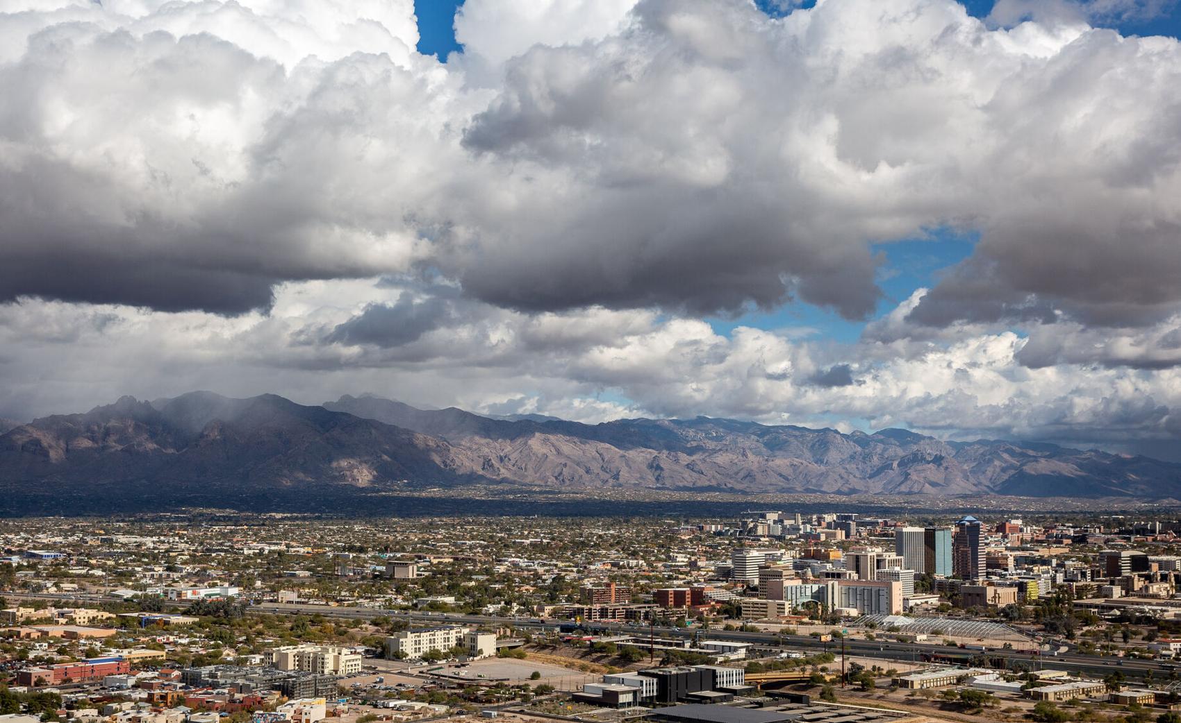
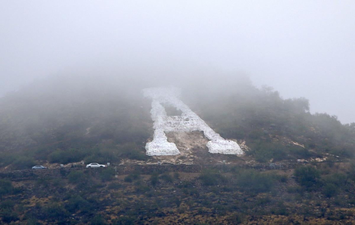
Tucson from Sentinel Peak as clouds roll through Pima County on Dec. 29, 2020.
Hiking
If you so choose, you can park in the lower parking lot and hike the Gilbert Escandón Jiménez trail, named after Jiménez who helped maintain the peak’s trails for more than 70 years.
You can find the trailhead in the southwest corner of the lower parking lot. The uphill hike itself won’t take you to the peak and will instead take you to an upper section of the road. Some hikers choose to turn around, or continue along the side of the road to the mountain's summit, though beware of cars.
The Arizona Daily Star says the trek is about 2½ miles roundtrip.
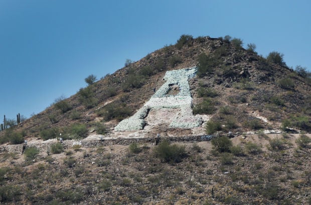
The views of and around Sentinel Peak, otherwise known as "A" Mountain on April 10, 2013. The coloring of the "A" has changed over time, ranging from black to green and the patriotic red, white and blue scheme.
Alternatively, you can park in the upper parking lot and choose from a handful of much shorter hikes to reach the 2,897-foot peak.
There’s Mission View Trail, which is a mostly smooth walkway with little noticeable elevation gain. It takes you along the south side of the mountain and ends with a sideview of the “A.” There’s also Sentinel Summit Trail, which is far more steep and very rocky, ending with a view right above the “A.”
Other trails include Sentinel Trail and South Sentinel Trail, both of which end with side views of the “A.” All of the trails are less than a mile long and some of them connect.
Whichever hike you choose, you’ll get beautiful views of our purple mountains and the city below.

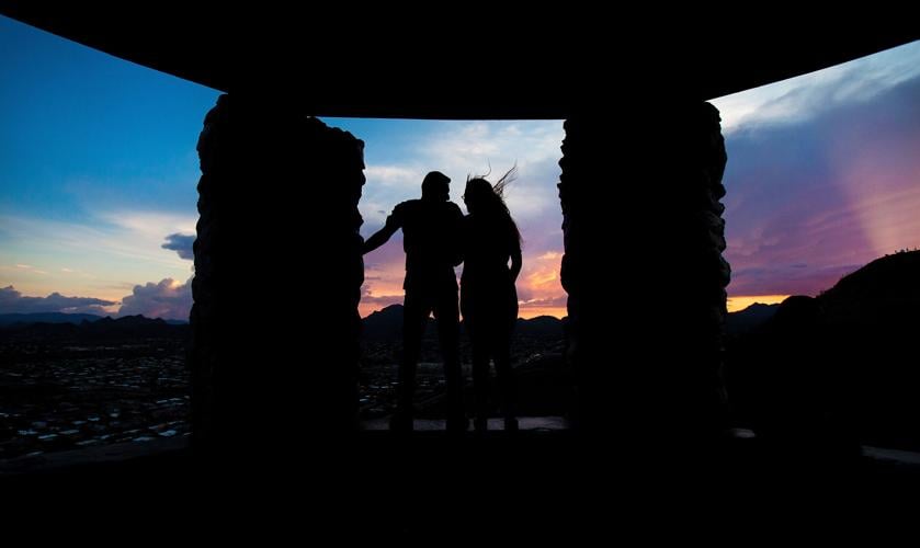
A young couple takes in monsoonal cloud sunset over the Tucson Mountains as they endure gusty updrafts at a lookout on Sentinel Peak on July 18, 2018, in Tucson, Ariz.
Other things to note
There are a few ramada areas along “A” Mountain, in addition to a couple picnic tables and benches. West of the upper parking lot, there’s an old stone shelter, perfect for sunset views.
Dogs are allowed, but they must be on a leash at all times. Clean up their poop! Also important to note: There are some tiny shards of broken glass in areas along the mountain.
A list of things not allowed: Glass containers, drones except in designated areas, fireworks and littering.
And if you choose to hike, remember, safety first! Bring water, protect yourself from the sun and check the weather beforehand. See more tips here.

