


In April 1972, the Avra Valley’s Hunter Subdivision No. 2 — owned by Lee J. Hurst and utilizing the Cella, Barr, Evans and Associates engineering firm — was recorded with Pima County along with its street names.
The theme for the streets was a continuation of the subdivision just south of it called El Tirador Estates (The Shooter Estates), whose streets were named mostly for historic firearms.
Hunter Subdivision No. 2’s streets include:
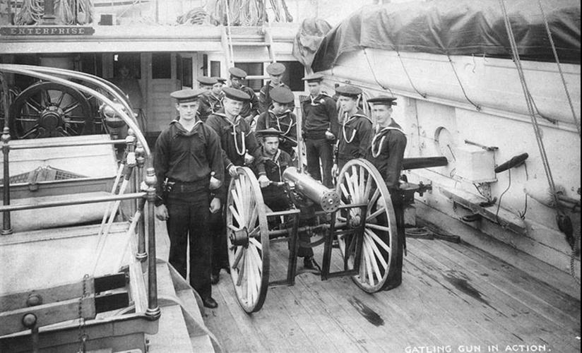
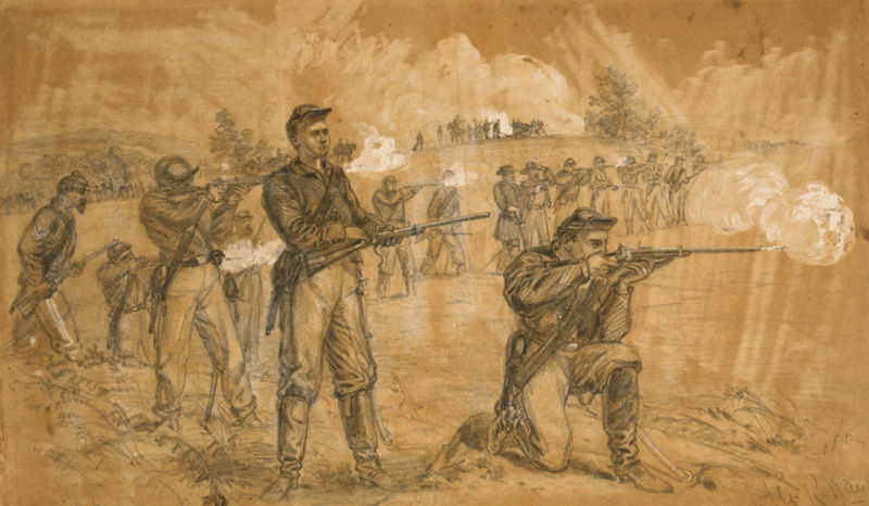
Gatling Road: During the U.S. Civil War, Dr. Richard J. Gatling, a physician and inventor, created the first working version of the machine gun called the Gatling gun, which he patented in 1862. Gatling divided his loyalties during the War Between the States. While attempting to sell firearms to the Union Army, he was an active member of the Order of American Knights, a covert group — most of whose members lived in the North — of Confederate sympathizers and saboteurs.
The weapon he invented was a hand-driven, multi-barreled machine gun that revolved around a central axis and originally had six barrels that fired at 350 rounds per minute. This gun was first used by Gen. Benjamin F Butler of the Union Army at the siege of Petersburg, Virginia, in 1864-1865. But the unreliability of its early models, among other factors, led to it being redesigned with 10 barrels and firing at 400 rounds per minute, and it wasn’t adopted by the U.S. Army until 1866. The Colt Armory in Hartford, Connecticut made the production model.
This gun has been featured in films including “The Magnificent 7” and “The Last Samurai.”
The Downtown Links Project in Tucson will be a 4-lane road that parallels the Union Pacific Railroad and connects Barraza-Aviation Parkway at Broadway Road to Interstate 10 via St. Mary's Road. The expected completion date is early 2023. Video by: Mamta Popat / Arizona Daily Star (2020)
Starr Road: Ebenezer T. “Eben” Starr was born in 1816 in Middletown, Connecticut. He was the son of Nathan S. Starr, Jr. and grandson of Nathan S. Starr, Sr. The senior had a sword company in the late 1700s and received government contracts for sabers and swords, and after the junior joined in, it became N. S. Starr & Son, a gun and sword company. In 1823, the company received a government contract for rifles and produced its most well-known firearm, the Nathan Starr Model 1817 flintlock rifle.
Ebenezer T. Starr had his own business called the Starr Arms Co. with offices on Broadway in New York City, and factories in Yonkers, Binghamton and Morrisania, New York. He produced revolvers such as the Starr Model 1858 Navy and Starr Model 1858 Army Double Action, and also single-shot and 4-shot Derringer pistols. He is best known for his Starr Percussion Carbine, utilized by the Union Army during the Civil War.
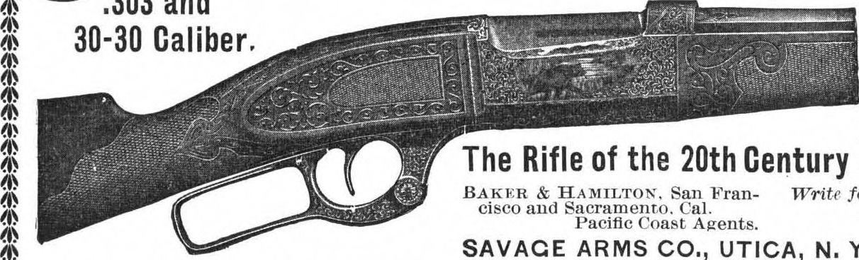
Savage Road: Arthur W. Savage was born in Jamaica but arrived in the United States as a boy, attending school in Baltimore, Maryland and later finishing his education in England and becoming a world traveler.
In the mid-1890s, Savage founded the Savage Repeating Arms Co. in Utica, New York — although the first guns introduced by the business were manufactured by Marlin Firearms Co., such as the Savage Model 1895. By the following year, and until 1897, the company sold ammunition.
Around this time, a new corporation called Savage Arms Co. was formed, with eight main stockholders, and a factory was established.
During the 1910s, Savage Arms Co. either bought or merged with the Driggs Seabury-Ordnance Co. and produced firearms for military use during World War I. Around 1920, the company merged with Stevens Arms Co. of Chicopee Falls, Massachusetts.
In 1938, Arthur W. Savage was found deceased in San Diego, California, from a bullet wound. A pistol was by his side. The same year, Savage Arms Co. accepted a contract to produce the .45 caliber Thompson submachine gun.
The year after World War II ended, the Utica plant closed and all operations were carried out at the Stevens plant. In 1960, all production was relocated to Westfield, Massachusetts, where the company is currently located.
Two firearms the company is noted for are the Savage Model 1899, later called the Savage Model 99; and the Savage Model 110.
Weatherby Road: Roy Weatherby began his enterprise in 1945 as Weatherby’s Sporting Goods, a small store, just 25 feet by 70 feet, in Atascadero, California, but it would grow into something much bigger.
Weatherby not only enjoyed designing guns but also cartridges. He would test his new projectiles in an underground 100-yard shooting range under his store and his targets would vary from soaked Los Angeles phone books to bullet-proof glass, with many of his calibers being able to penetrate the so-called bullet-proof glass.
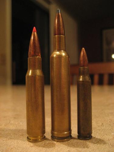
There are many cartridges stamped with the Weatherby name, the majority being magnum cartridges used in big game hunting or hardened targets.
He also designed high quality rifles, particularly the Weatherby Mark V bolt-action rifle, which came in different calibers and barrel lengths and were originally manufactured in Germany, with some made in Italy, but later manufacturing moved to Japan. Other models were the Weatherby Mark XXII and the Weatherby Crown Custom.
It’s interesting to note that John Wayne, the legendary cowboy actor, often appeared in Weatherby advertisements. He was also given, by Roy Weatherby himself, a custom Weatherby rifle, which he very much prized.
Sharps Road: Christian Sharps was born about 1811 in New Jersey. He had a common school education and was then apprenticed in the machinist trade. He is thought to have figured out his invention of a breech-loading firearm in the Daniel Nippes Armory on Mill Creek, near Philadelphia, Pennnsylvania.
At some point after his apprenticeship, Sharps worked for noted gunmaker John Hall at the Harpers Ferry Armory in Virginia (now West Virginia).
In 1849, he was residing in Washington, D.C., possibly to get a U.S. government contract for his patented basic breechloading firearms system. The following year, his patented breech-loading musket was tested by the U.S. Marine Corps, which gave it rave reviews, leading to government contracts.
In 1851, he set up his business called Sharps Rifle Manufacturing Co. in Hartford, Connecticut. He provided the technical advice and marketed the firearms while his partners, Robbins and Lawrence of Vermont, manufactured the guns, among them the Sharps 1852 Saddle Ring Carbine.
In 1853, R.S. Lawrence of Robbins and Lawrence arrived in Hartford to build and manage an arms manufacturing plant for Sharps’ stockholders, based on the Sharps patents. Christian Sharps received royalties on each gun made.
In 1853, Sharps cut connections with the Sharps Rifle Manufacturing Co. in Hartford, moved to Philadelphia and set up C. Sharps & Co. He then started on a course of creating a breech-loading single pistol. Four years later it was recorded that C. Sharps & Co. was comprised of Sharps in association with Nathan H. Bolles and Ira B. Eddy.
By this point, they had constructed a brick building that housed the machinery related to firearm production. The business produced Sharps breech-loading, self-priming pistols and Sharps rifles.
In 1862, C. Sharps & Co. formed a partnership with William Hankins, known as Sharps & Hankins, and began making firearms for the Civil War. It produced the Sharps & Hankins Model 1862 Carbine among other weapons for the Union Army. Sharps & Hankins is believed to have existed until 1872.
Christian Sharps died in Vernon, Connecticut, on March 13, 1874. His original firm Sharps Rifle Manufacturing Co. was sold and reorganized as the Sharps Rifle Co.in Bridgeport, Connecticut, and operated until 1881. A company bearing the name Sharps Rifle Co. exists today in Wyoming, although it’s not believed to be the same company.
Some of the well-known Sharps firearms include the Sharps Model 1853 Sporting Rifle and the Sharps Model 1874 Military Rifle.
A look back at Tucson-area streets:
Photos: A look back at Tucson-area streets
Broadway Road, Williams Addition, 1958
Recently paved and improved Broadway Road in Tucson looking east to Craycroft Road (just beyond the Union 76 gas station at left), where the Broadway pavement ended in 1958. At right, is the natural desert of the Williams Addition, an innovative 160-acre development with only 22 homes on large lots. Developer Lew McGinnis bought all but two of the homes by 1980. It is now Williams Centre.
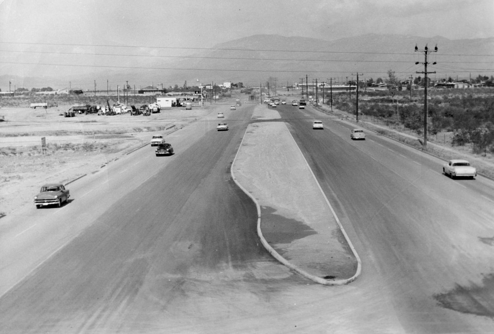
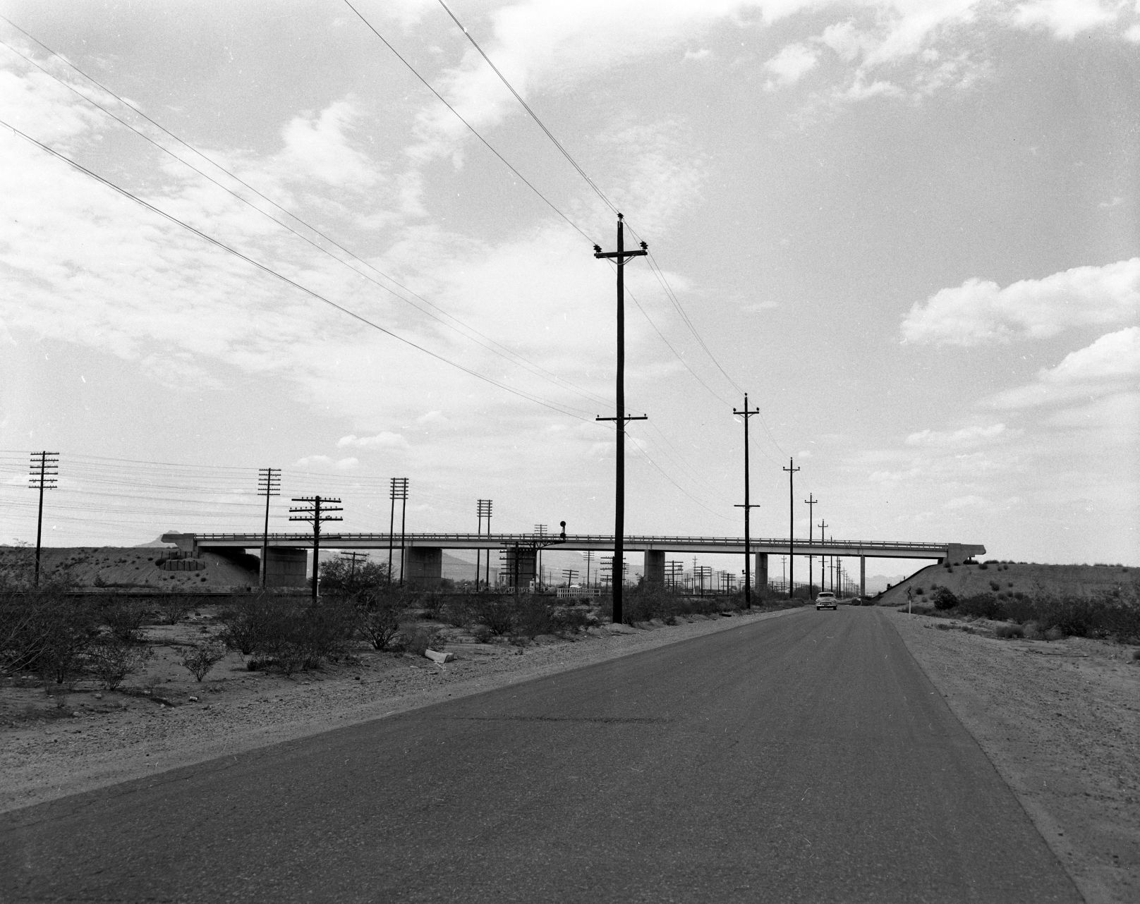
Interstate 10, 1960
Interstate 10 under construction at St Mary's Road in Tucson, ca. 1960.
Cherry Avenue, 1972

Arizona Stadium is off in the distance looking south along North Cherry Avenue on February 9, 1972. At the time the UA was proposing an addition to its football stadium adding another 10,600 seats to the east side of the structure that would involve permanently closing Cherry Avenue. It was also considering a 3,600-unit parking lot, all of which could cost around $11 million.
Speedway Blvd., 1950

Speedway Blvd. looking east from County Club Road, Tucson, in 1950. The controversial "hump" down the middle of the road separated opposing lanes of traffic. It was removed in 1957.
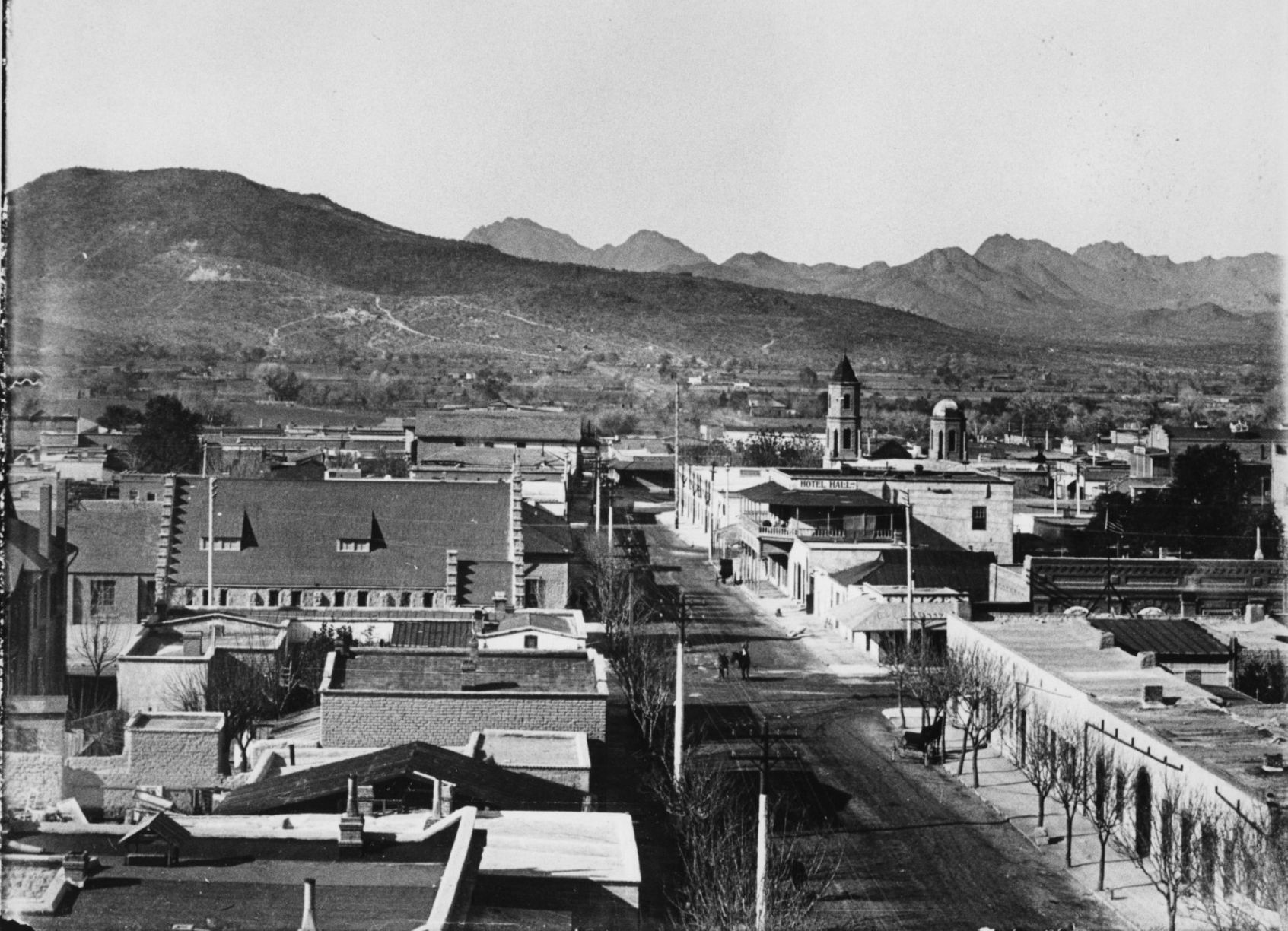
Court Street, 1900

Court Street in Tucson, c. 1900. City Hall is on the left (with flagpole) and San Augustin church is the peaked roof in distance at the end of the street. The building in the left foreground was used for the first mixed school taught by Miss Wakefield( later Mrs. Fish) and Miss Bolton.
Congress Street, 1933
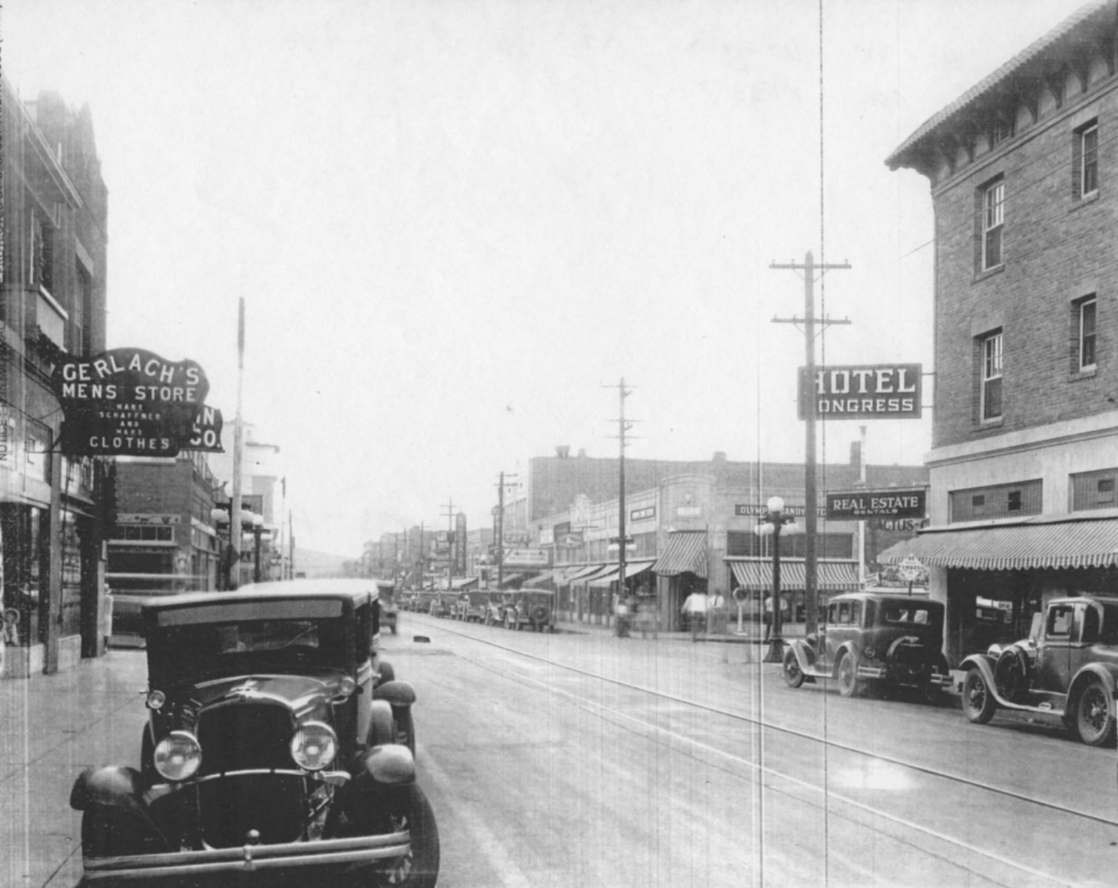
Congress Street, looking west from 4th Avenue, Tucson, ca. 1933. Hotel Congress is at left. Today, Caffe Luce and One North Fifth Lofts have replaced the shops just beyond the Hotel Congress sign on the corner of 5th Ave. and Congress.
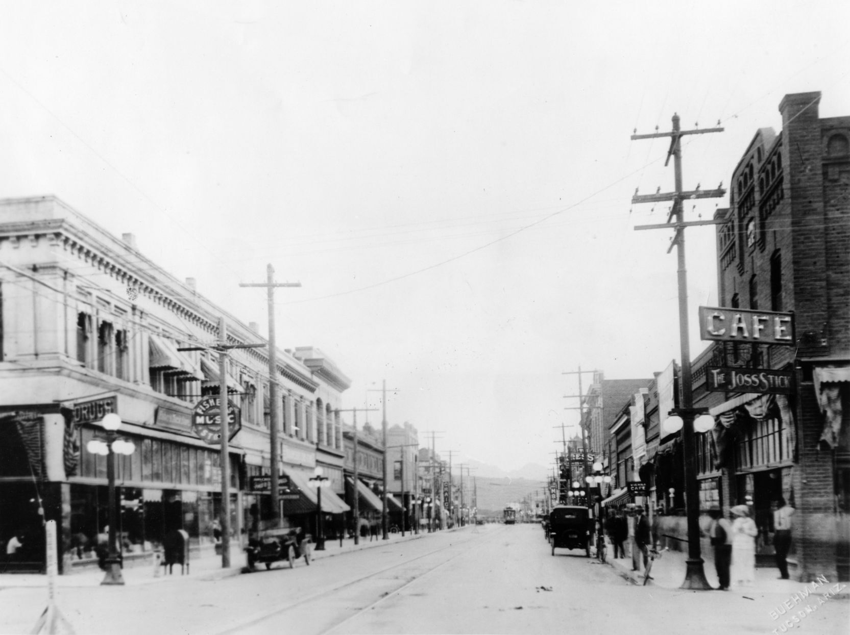
Broadway Road, 1900s
Undated photo looking west on Broadway Road from the Santa Rita Hotel in Tucson. The cross street with man on horseback is Stone Ave. Photo likely from the early 1900s, since the Santa Rita was finished in 1904.
Congress St., 1920
Congress Street in Tucson, looking west from 6th Avenue in 1920.
Park Avenue, 1952
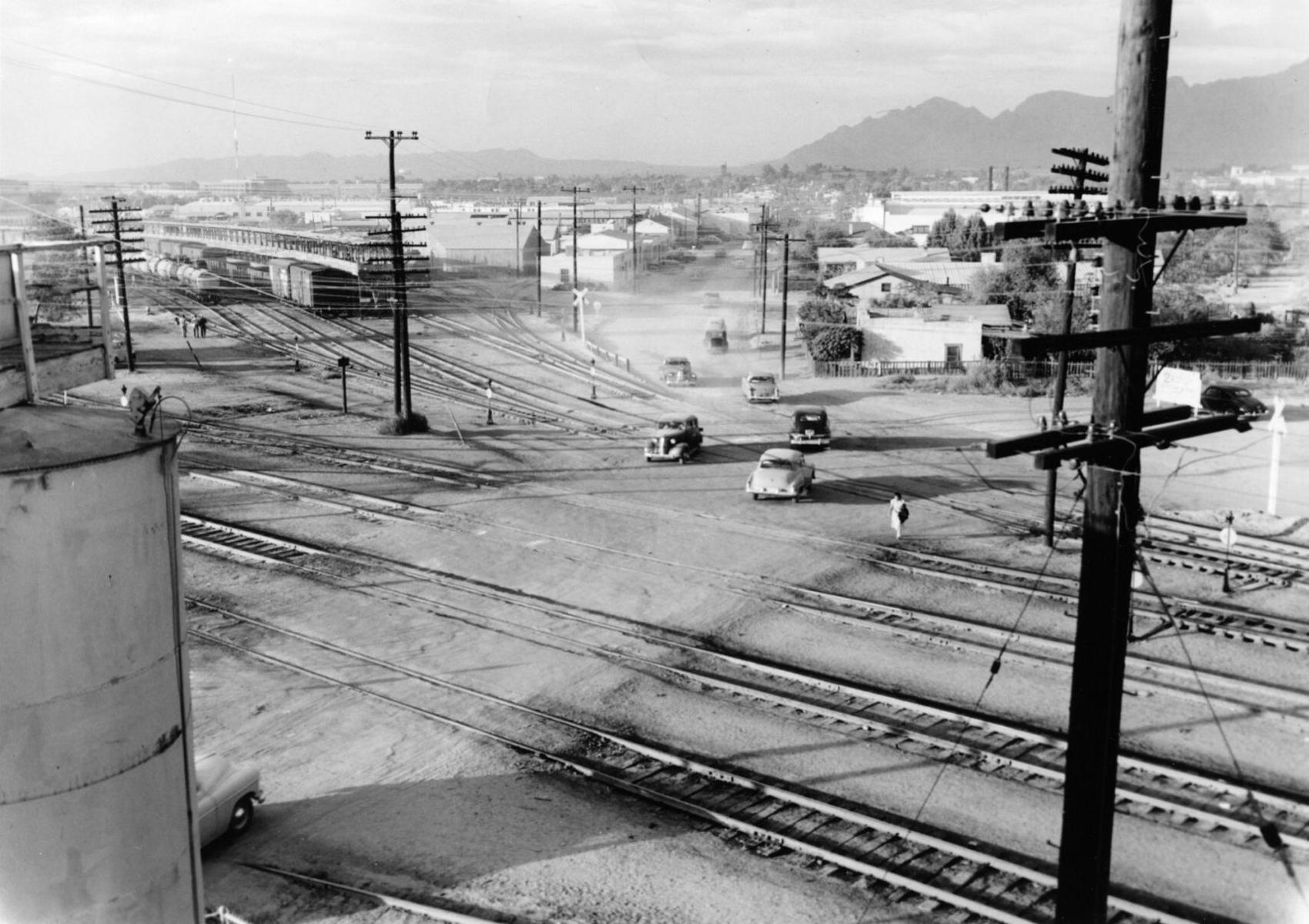
Definitely not a safe place to walk: Park Avenue at the Southern Pacific RR tracks in 1952, looking north into the Lost Barrio in Tucson. Park now crosses under the railroad tracks and links with Euclid Ave.
Electric street cars
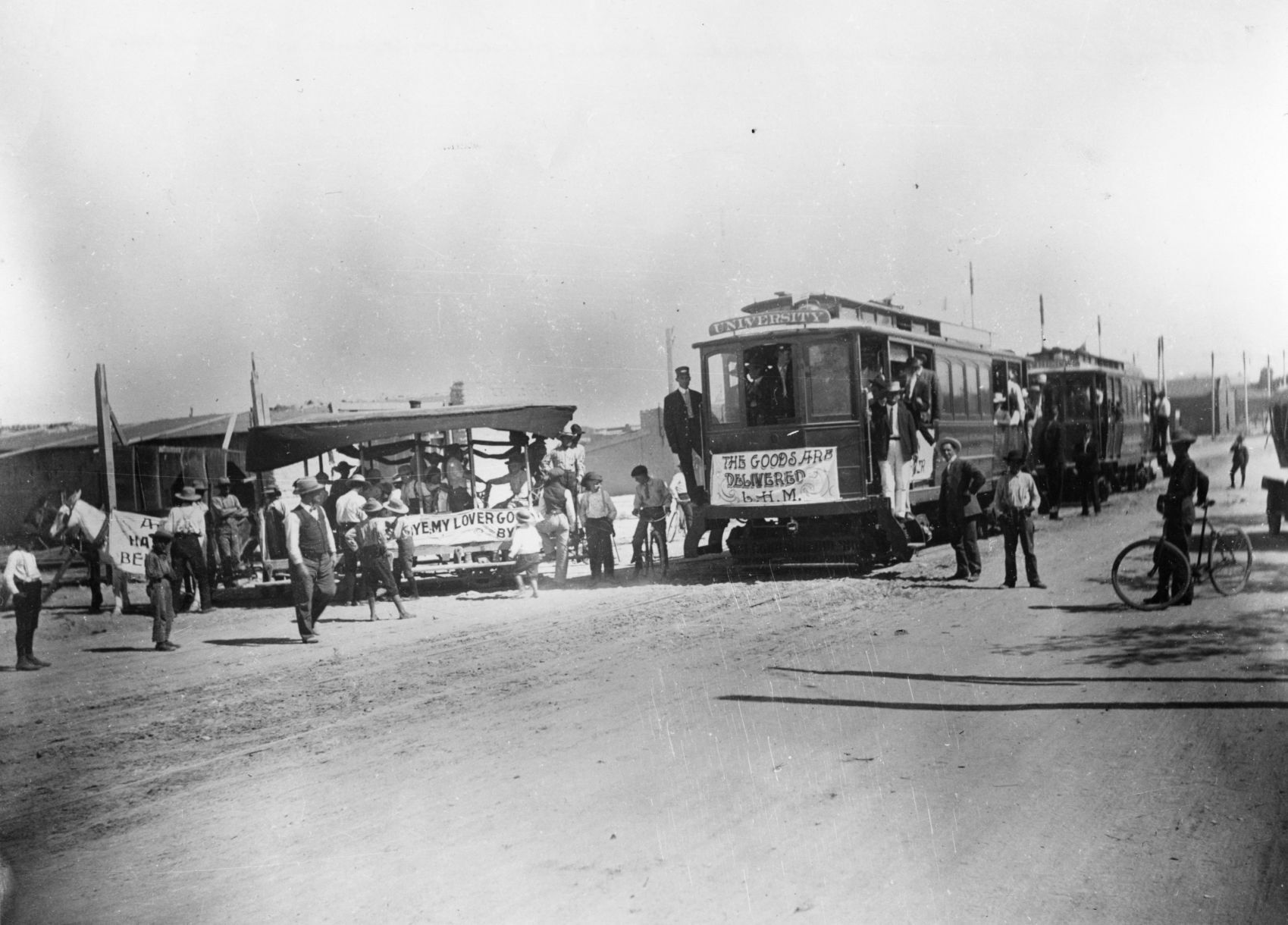
Electric street cars replaced horse-drawn street cars in Tucson, 1906.
Toole Ave., 1958
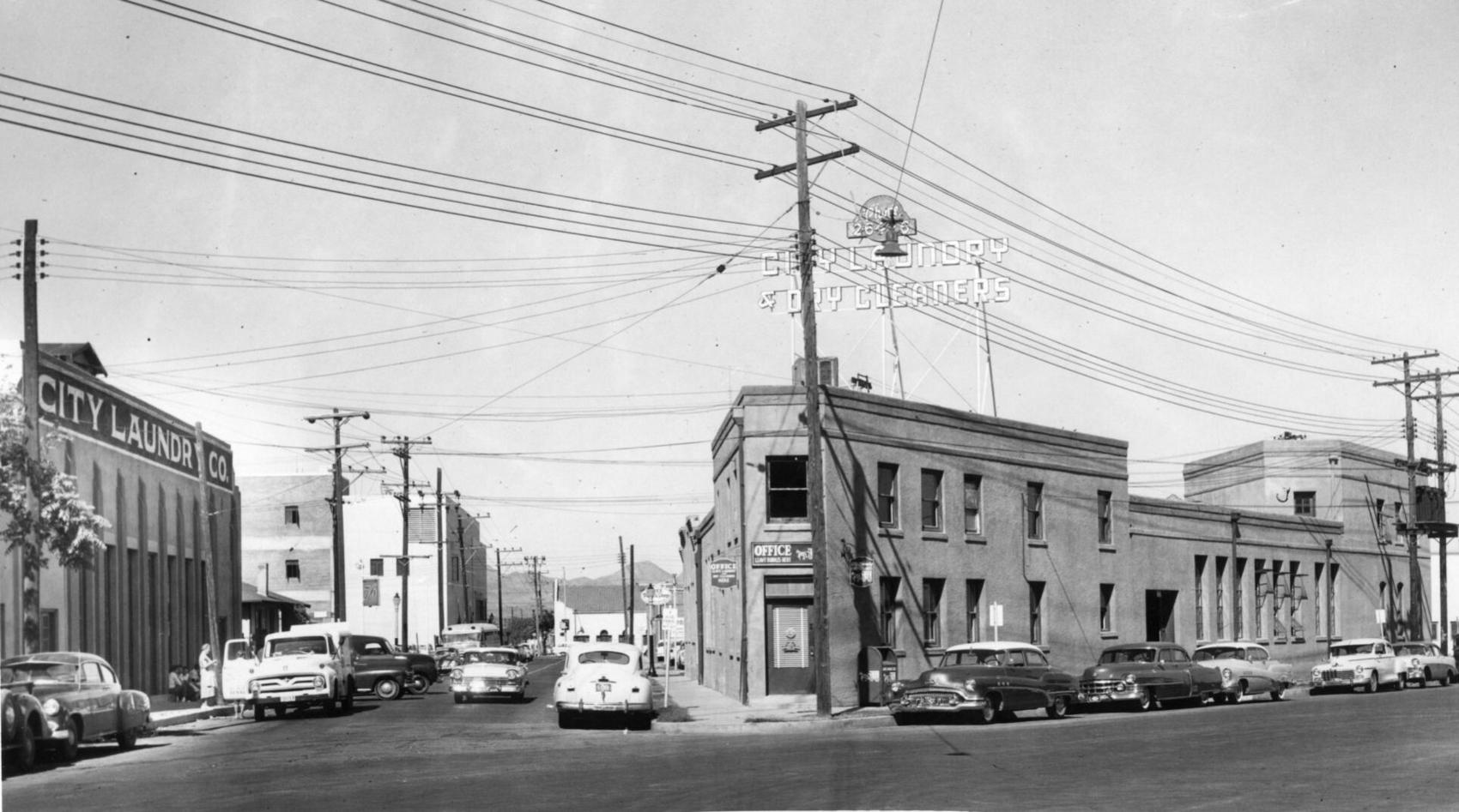
City Laundry Co. of Tucson occupied the historic building at right, at 79 E. Toole Ave., since 1915. Prior to 1915, it was a brewery. It was one the oldest buildings in downtown Tucson. The building at left fronting Council Street was built by City Laundry in 1928 and ultimately became the main plant. Both buildings were demolished in 1958 to make way for a parking lot.
Stone Ave., 1971
Updated
The lights of businesses on Stone Avenue in downtown Tucson, looking south from Ventura Street in July, 1971.
22nd Street, 1962

Traffic tie-ups like this one in June, 1962, happened several times a day on 22nd Street at the Southern Pacific Railroad tracks in Tucson. Most of the motorists in this picture had to wait 10 minutes for the two-train switching operation. An overpass solved the problem in 1965.
Benson Highway, 1972
This stretch of the Benson highway near South Palo Verde Road was bypassed after Interstate 10 was opened in 1969. It was just another string of businesses along the road that struggled to survive on August 14, 1972. The four-mile stretch was once a vital thoroughfare before the interstate system was created.
Church Ave, 1966

Greyhound bus depot, left, was located on the northwest corner of Broadway Boulevard and Church Avenue around February 1966.
Campbell Ave., 1960

Gridlocked traffic on Glenn Street, east of Campbell Avenue as thousands of people attended the opening of the new $2 million Campbell Plaza Shopping Center on April 7, 1960. Originally, the parking facilities was designed to handle 850 vehicles but it was overflowing for the event. The plaza is situated on 18 acres and has 18 tenants.
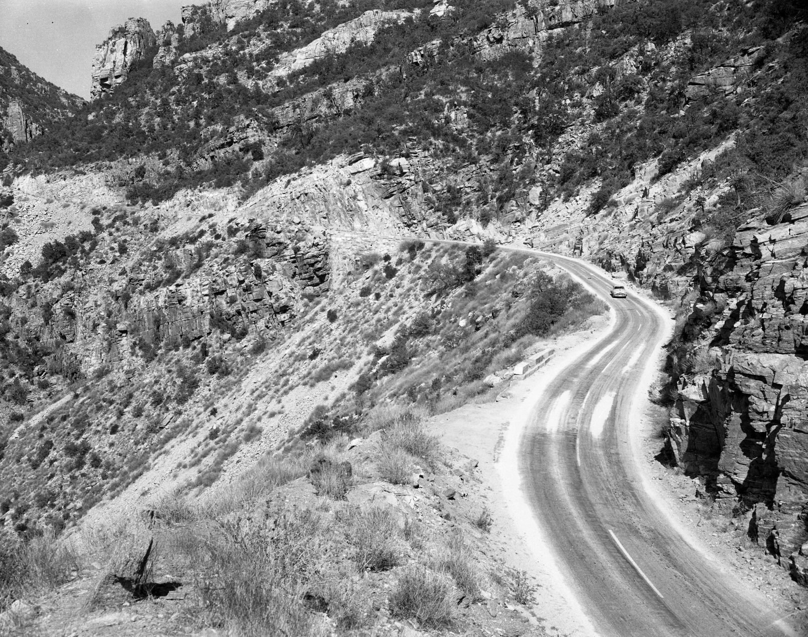
Interstate 19, 1964

Looking south on the Nogales Interstate Highway (now I-19) at the Ajo Way overpass on July 20, 1964.
Meyer Avenue, 1966

Street scene of South Meyer Avenue looking south from West Congress Street on June 26, 1966. All the buildings were demolished as part of the city's urban renewal project in the 1960s and 70s.
Cortaro Road, 1978

Cortaro General Store on the northwest corner of Cortaro Road and I-10 in December, 1978.
Congress St., 1967

A man crosses East Congress Street at Arizona Avenue as this portion up to Fifth Avenue was falling on hard times with only one small shop still in business on May 3, 1967.
Stone Avenue, 1955
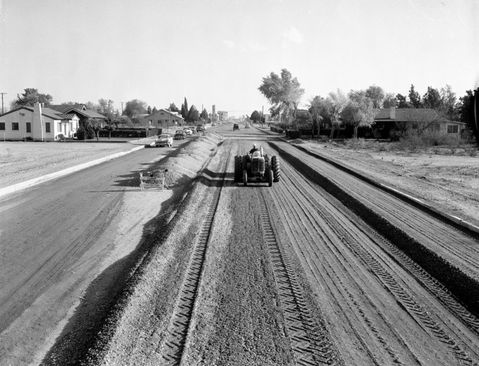
The Stone Avenue widening project between Drachman and Lester streets in April, 1955. A Pioneer Constructors pneumatic roller is used to compact the gravel base for an 80-foot roadway. The four-block project cost $37,500.
US 84A in Tucson, 1954

Westbound SR84A (now I-10) at Congress Street in 1954. In 1948, the Arizona State Highway Department approved the Tucson Controlled Access Highway, a bypass around downtown Tucson. It was named State Route 84A, and connected Benson Highway (US 80) with the Casa Grande Highway (US 84). By 1961, it was reconstructed as Interstate 10.
Grant Road, 1962
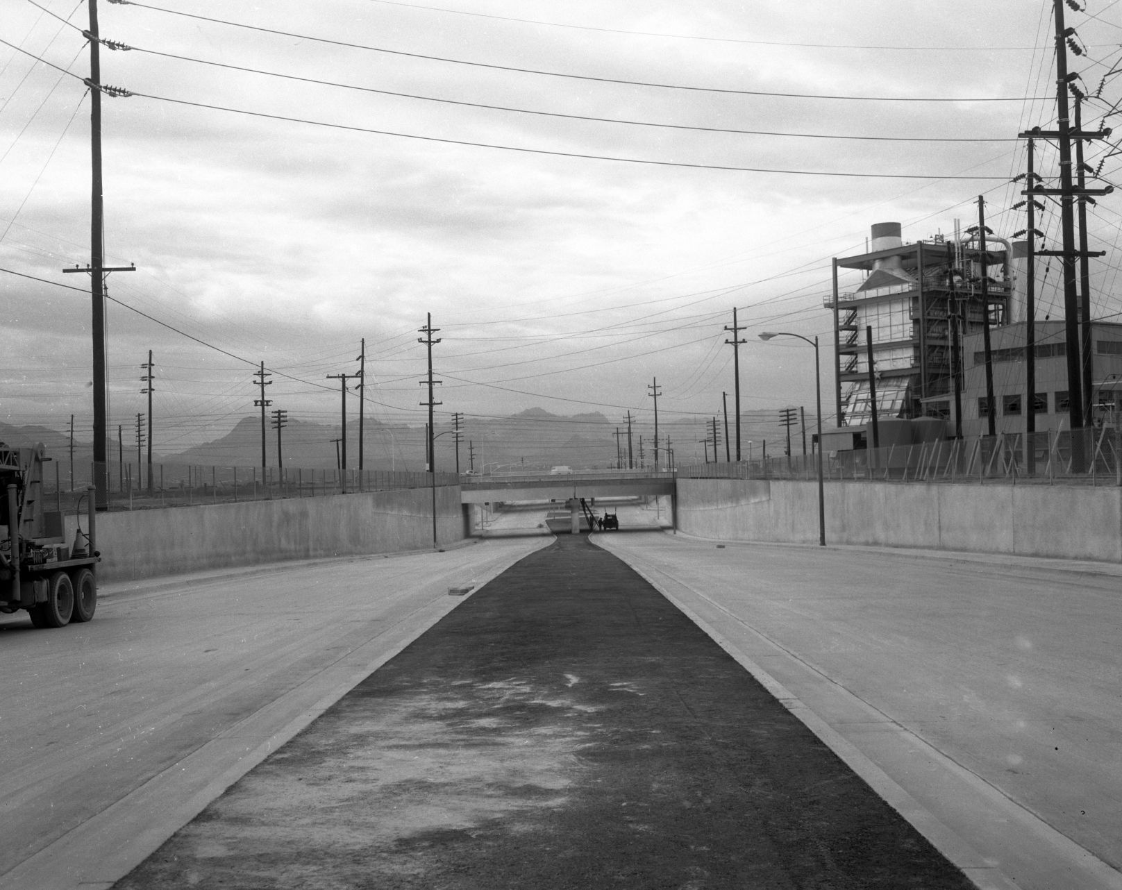
The new Grant Road underpass at the Southern Pacific RR in December, 1962, as seen looking west on Grant Road east of the tracks and Interstate 10. The Tucson Gas and Electric generating station (no longer there) is at right.
Grant Road, 1966

Grant Road, looking west at Campbell Ave. in 1966.
Old Nogales Highway, 1966
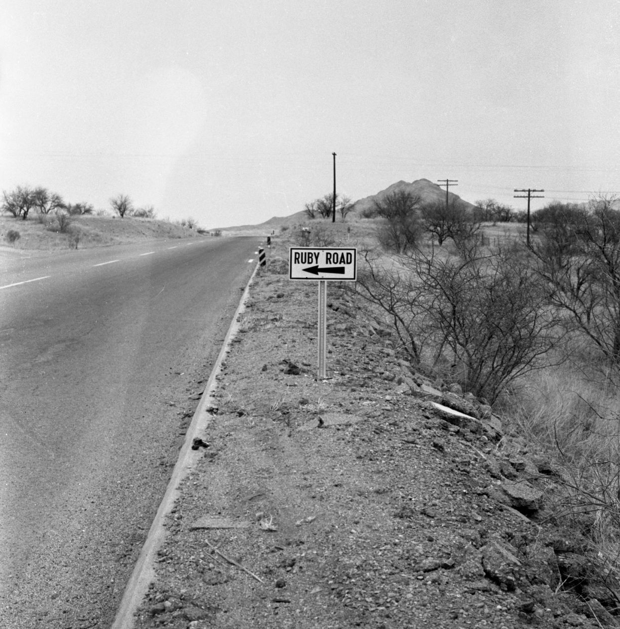
Old Nogales Highway near Ruby Road in July, 1956.
Oracle Road, 1925

This is a 1925 photo of the All Auto Camp on 2650 N Oracle Rd at Jacinto which featured casitas with the names of a state on the buildings. T
Oracle Road, 1950

This is a 1950 photo of the North Oracle Road bridge where it originally crossed over the Rillito River, west of the current bridge.
Oracle Road, 1979

Area in 1979 along North Oracle Road near the entrance of the Oracle Road Self Storage at 4700 N Oracle Rd near the Rillito River which would now be north of the Tucson Mall. There is no apparent record of the Superior Automatic and Self Service Car Wash.
Oracle Road, 1975

Oracle Road, looking south from Suffolk Drive, in March, 1975. Then, it was a four-lane state highway on Pima County land. It was annexed by Oro Valley more than 30 years later.
36th St., 1956
The Palo Verde Overpass south of Tucson (Southern Pacific RR tracks), looking East on 36th Street, in 1956.
Interstate 10, 1966
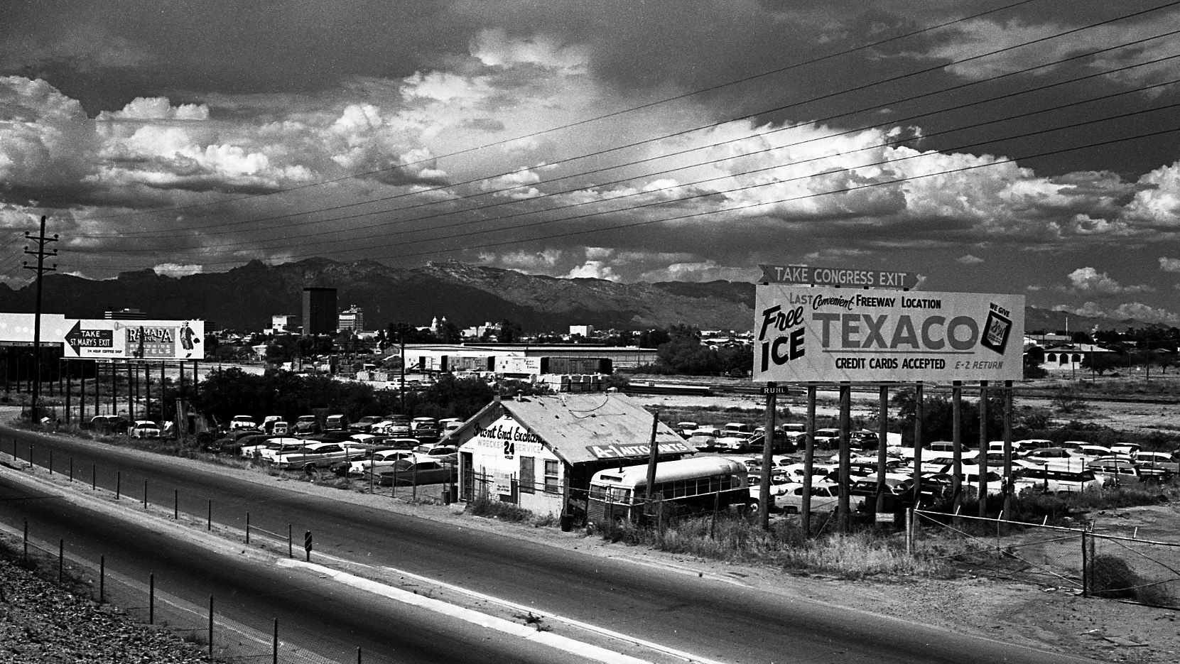
Large billboards used to line the area along Interstate 10 (South Freeway) between West 22nd and West Congress Streets on May 5, 1966.
Catalina Highway, 1967

Snow clogs the Catalina Highway to Mt. Lemmon at 5,400 feet elevation on Feb. 18, 1967. Rock slides up ahead kept motorists from going further.
Speedway Blvd., 1968

The new Gil's Chevron Service Station at 203 E Speedway on the northeast corner at North Sixth Avenue was open for business in March 1968. The photo is looking toward the southeast.
Catalina Highway, 1955
The Mt. Lemmon Highway on May 18, 1955.
Tanque Verde Road, 1950s

In this undated photo taken in the late 1950s, the Tanque Verde Bridge over the Pantano Wash was allowing traffic to make its way toward the northeast side of town.
Craycroft and I-10, 1966

The TTT Truck Terminal at Craycroft Road and Benson Highway in Tucson in June, 1966. It's a mile east of the original, built in 1954.
Congress St., 1980

Congress Street in Tucson, looking east from the Chase Bank building at Stone Ave. in August, 1980.
Silverbell Road, 1975

Silverbell Road and Scenic Drive in Marana, looking south-southwest in 1975.
Interstate 10, 1962

Interstate 10 (referred to as the "Tucson freeway" in newspapers at the time) under construction at Speedway Blvd. in the early 1960s. By Summer 1962, completed freeway sections allowed travelers to go from Prince Road to 6th Ave. The non-stop trip to Phoenix as still a few years away.
Alvernon Way, 1982

This is a July 2, 1982 photo of flooding along a Tucson street. Might be North Alvernon Way near Glenn Street.
6th Ave, 1960s

The Tucson Fire Department's Station No. 1 was once on the 100 block of South Sixth Avenue, across the street from the Pueblo Hotel and Apartments in the late 1960s. The fire station had been on the site from as early as 1909 and was next door to the Tucson Stables, which had a livery and sold feed for horses. The historic Santa Rita Hotel rises up behind the fire station. The entire block is now the Tucson Electric Power headquarters.
Ruthrauff Road, 1975

Shown in 1975, owboys drive 250 cattle down a frontage road near Ruthrauff Road in Tucson toward the finish line of "The Last Cattle Drive," a 350-mile journey that began in Willcox. The drive ended at the Nelson Livestock Aucions yard, 455 N. Highway Drive. The cattle was sold with proceeds going to the Muscular Dystrophy Assosciation.
Main Ave., 1969
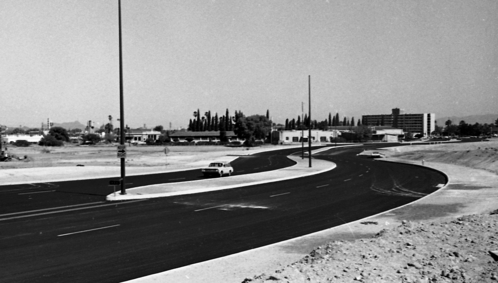
The newly aligned South Main Ave swerved its way along a barren stretch of landscape on May 9, 1969. Note the Redondo Towers in the background.
Congress St., 1970

Traffic along West Congress Street near the Santa Cruz River moves along on July 24, 1970. City authorities had decided to replace the bridge starting in the fall.

