


Because there are so many hiking trails to explore in and around Tucson, in 2019, #ThisIsTucson's staff set out to find some of the best trails around the city — especially for the casual weekend hiker.
We hike the trails and tell you what they're really like. We note how hard a trail is, if it's kid-friendly or too creepy to do alone and what the bathroom and water situation is like.
With a new decade nearly upon us, maybe you're resolving to spend some more time outside. Us too. We'll see you out there.
Esperero Trail in Sabino Canyon

There are so many hiking trails to explore in and around Tucson.
Esperero is a 10-mile out-and-back hike into the Pusch Ridge Wilderness but you can turn off at Rattlesnake Trail and make a much smaller loop. It starts at the Cactus Picnic Area.
Our plan was to take Esperero Trail about 1.5 miles and then head back for a total of 3 miles. But we decided to explore and ended up hiking about 4.5 miles. Go here for our complete story about the trail.
Douglas Spring Trail

My intention was to get to Bridal Wreath Falls in the Rincon Mountains via the Douglas Spring Trail at the east end of Speedway
The Douglas Spring Trail is a 16.6-mile out-and-back trail inside Saguaro National Park East, but you can turn around wherever you want to make it shorter. It connects with other trails such as Three Tank, Carrillo and Wildhorse.
A popular end point of this hike is Bridal Wreath Falls, which ends up being a 5.6-mile round trip. To get there, stay left on the Douglas Spring Trail until you see a trail marker telling you to turn right for the falls. Go here for our complete story about the trail.
Canyon Loop Trail in Catalina State Park

There are so many hiking trails to explore in and around Tucson.
The Canyon Loop Trail is a 2.3-mile loop through the foothills that begins and ends at the trailhead parking lot.
There are two spots you can start the hike, one closest to the parking lot, and the other is left of that where the road loops. We took the one on the right, which goes counterclockwise around. There's a beautiful mosaic wall and sunscreen stations at the entrance.
There are lots of trails connecting to this one, making it easy to explore. Some are marked as unofficial trails, but are clearly used. We took a couple of these for different views and were not disappointed.
When all was said and done we hiked about 3.5 miles. Go here for our complete story about the trail.
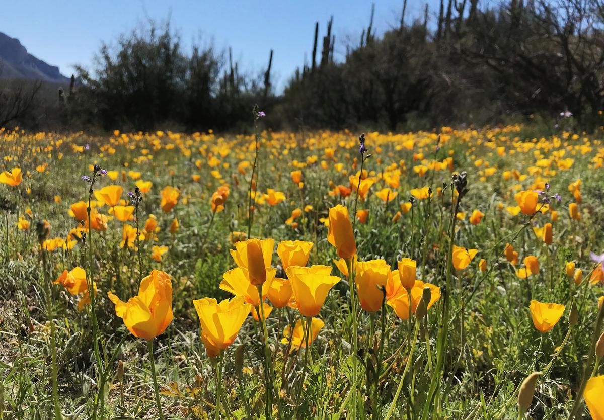
Yetman Trail to the stone house

I had heard about the Bowen Homestead, AKA stone house, for years but had never been there.
The trek to the stone house is about 2 miles round trip on the Yetman Trail in the Tucson Mountains, west of downtown. We accessed it from the Camino de Oeste trailhead off Speedway.
You can make it a much longer hike if you do the whole trail, which is about 12 miles out-and-back.
The route takes you through a canyon where you're surrounded by majestic saguaros, prickly pear cactus and yellow brittlebush flowers (in the spring). The sides of the mountains are painted with splashes of yellow, orange and green. It was breathtaking.
While you're hiking, even though it's not far, you might start to wonder where the house actually is, but be assured you can't miss it. Go here for our complete story about the trail.
Sycamore Reservoir Trail
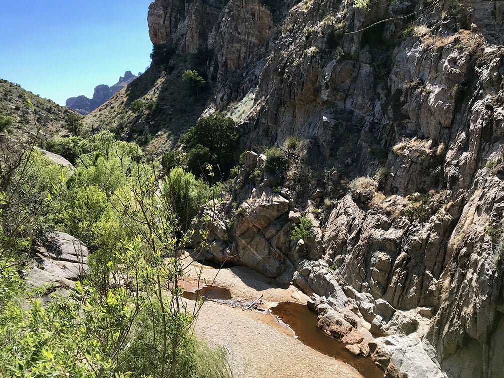
When I set out to hike the Sycamore Reservoir Trail on Mt. Lemmon earlier this week, I didn't expect to find magic. But this trail definitely put a spell on me.
The hike to the Mount Lemmon reservoir and back from the parking lot outside the Gordon Hirabayashi Campground was about 6.5 miles. So give yourself about three hours.
At the back side of the recreation site you'll see an Arizona Trail sign and an indicator letting you know the Sycamore Trail is to your right. Your final destination is a dam and riparian area to explore. It's magic. Go here for our complete story about the trail.
Picture Rocks petroglyphs

You'll find yourself peering up at a mound of rocks with more than 140 petroglyphs.
This amazing display of ancient rock art is showcased near the Redemptorist Renewal Center, 7101 W. Picture Rocks Road, in northwest Tucson.
After just a short (and we mean short!) walk from the parking lot, you'll find yourself peering up at a mound of rocks with more than 140 petroglyphs carved by the Hohokam, likely between the years 800 and 1300. You can continue further into the wash for a more lengthy walk and connect with other trails in Saguaro National Park west. Go here for our complete story about the petrogylphs.
Pima Canyon Trail

We scrambled up rocks, marveled at splashes of fall color and paused in awe at the sound of wind fluttering through tree leaves.
We hiked about 4 miles one way on this trail, making for almost 8 total miles of hiking. This was a pretty significant distance for both of us. Luckily, the trail is beautiful, well-marked and not totally grueling, so we enjoyed the whole 8 miles.
The trail was mostly flat, although there were a few inclines and rocky stretches. For us, 8 miles round trip was a long hike, but not too rigorous and you could adjust this hike to suit your time and ability. Go here for our complete story about the trail.